Category:Norden, Greater Manchester
Jump to navigation
Jump to search
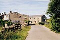
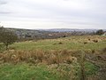
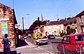
English: Norden is a village within the Metropolitan Borough of Rochdale, in Greater Manchester, England. It is situated on the western edge of the town of Rochdale.
village in United Kingdom  Eglwys Sant Paul, Norden | |||||
| Upload media | |||||
| Instance of | |||||
|---|---|---|---|---|---|
| Location | Rochdale, Greater Manchester, North West England, England | ||||
 | |||||
Subcategories
This category has the following 6 subcategories, out of 6 total.
A
- Ashworth Fold (10 F)
K
- Knowl Hill, Rochdale (12 F)
N
- Norden War Memorial (5 F)
P
- St Paul's church, Norden (4 F)
S
Media in category "Norden, Greater Manchester"
The following 177 files are in this category, out of 177 total.
-
 784 to 768 Edenfield Road, Norden - geograph.org.uk - 2698226.jpg 4,000 × 2,248; 1.33 MB
-
 865 Edenfield Road, Norden - geograph.org.uk - 2698209.jpg 4,000 × 2,248; 1.07 MB
-
 A bend in Ashworth Lane - geograph.org.uk - 2053232.jpg 3,872 × 2,485; 3.47 MB
-
 A stile in a poor state - geograph.org.uk - 2053202.jpg 3,872 × 2,480; 4.09 MB
-
 A woodland ford - geograph.org.uk - 2053215.jpg 3,872 × 2,592; 5.52 MB
-
 A680 Edenfield Road at Elmsfield Avenue - geograph.org.uk - 6820104.jpg 1,024 × 725; 183 KB
-
 Approach Road to Red Lumb - geograph.org.uk - 214068.jpg 640 × 430; 103 KB
-
 Ashbourne Street - geograph.org.uk - 1954661.jpg 800 × 600; 145 KB
-
 Ashworth Hall - geograph.org.uk - 3937536.jpg 3,853 × 2,082; 1.49 MB
-
 Ashworth Moor - geograph.org.uk - 1770819.jpg 2,816 × 2,112; 1,016 KB
-
 Ashworth Moor Water Treatment Works - geograph.org.uk - 4556615.jpg 1,600 × 1,200; 584 KB
-
 Ashworth Road in Winter - geograph.org.uk - 4762733.jpg 3,264 × 2,448; 2.92 MB
-
 Ashworth Valley - geograph.org.uk - 1770884.jpg 2,816 × 2,112; 1,020 KB
-
 Bagslate Moor - geograph.org.uk - 4069132.jpg 2,560 × 1,920; 2.49 MB
-
 Baitings Mill Cottage - geograph.org.uk - 1770798.jpg 2,816 × 2,112; 1.11 MB
-
 Baitings Mill, Norden - geograph.org.uk - 1164487.jpg 640 × 419; 67 KB
-
 Baitings Mill, Norden - geograph.org.uk - 1182711.jpg 414 × 640; 48 KB
-
 Baitings Mill, Norden - geograph.org.uk - 1182719.jpg 640 × 417; 91 KB
-
 Black Pit Chimney - geograph.org.uk - 1948399.jpg 600 × 800; 86 KB
-
 Black Pits Mill Chimney - geograph.org.uk - 2122682.jpg 480 × 640; 54 KB
-
 Black Pits Mill Chimney - geograph.org.uk - 2122743.jpg 480 × 640; 63 KB
-
 Black Pits Mill Chimney, Detail - geograph.org.uk - 2122737.jpg 481 × 640; 60 KB
-
 Blackpits Chimney - geograph.org.uk - 2221455.jpg 600 × 800; 274 KB
-
 Blackpits Chimney - geograph.org.uk - 2221495.jpg 600 × 800; 291 KB
-
 Blackpits Chimney - geograph.org.uk - 2221499.jpg 600 × 800; 203 KB
-
 Blackpits Road - geograph.org.uk - 1948323.jpg 600 × 800; 177 KB
-
 Blackpits Road - geograph.org.uk - 1948369.jpg 600 × 800; 111 KB
-
 Bottom of Rooley Moor - geograph.org.uk - 1767298.jpg 2,816 × 2,112; 1.92 MB
-
 Bridge Inn - geograph.org.uk - 1223826.jpg 640 × 392; 48 KB
-
 Buttercup fields sloping down to Red Lumb Mill - geograph.org.uk - 1876038.jpg 3,872 × 2,433; 4.41 MB
-
 Caldershaw Road, Rochdale - geograph.org.uk - 5921254.jpg 640 × 480; 72 KB
-
 Cattle Grid - geograph.org.uk - 1767214.jpg 2,816 × 2,112; 1.06 MB
-
 Cattle grid near Seddons Farm - geograph.org.uk - 2053248.jpg 3,872 × 2,508; 4.13 MB
-
 Clearing - geograph.org.uk - 2221347.jpg 800 × 600; 384 KB
-
 Coalbank Lower Bridge, Norden - geograph.org.uk - 354462.jpg 393 × 640; 105 KB
-
 Cobbled Road from Norden - geograph.org.uk - 2221343.jpg 800 × 600; 405 KB
-
 Cobbled Track to Blackpits - geograph.org.uk - 2221363.jpg 800 × 600; 410 KB
-

-
 Copped Hill, Ashworth, Lancashire - geograph.org.uk - 2786477.jpg 1,024 × 768; 139 KB
-
 Doctor Dam and the chimney - geograph.org.uk - 6035144.jpg 5,152 × 3,864; 7.21 MB
-

-
 Doctor Dam on a winter's day - geograph.org.uk - 864427.jpg 640 × 480; 46 KB
-

-

-
 Doldrum Farm - geograph.org.uk - 1767275.jpg 2,816 × 2,112; 1.02 MB
-
 Duckworth Farm - geograph.org.uk - 1770891.jpg 2,816 × 2,112; 968 KB
-
 East Knowles Farm - geograph.org.uk - 1876110.jpg 3,872 × 2,452; 4.3 MB
-
 Edenfield Rd jct Ashbourne St, Norden - geograph.org.uk - 354459.jpg 640 × 410; 87 KB
-
 Edenfield Road - geograph.org.uk - 1705469.jpg 1,024 × 768; 268 KB
-
 Edenfield Road junction with Bagslate Moor Road - geograph.org.uk - 1671583.jpg 1,024 × 768; 185 KB
-
 Fallen wind turbine by Mount Etna near Rochdale - geograph.org.uk - 6326955.jpg 5,184 × 2,920; 5.61 MB
-
 Farm track - geograph.org.uk - 1659960.jpg 640 × 480; 87 KB
-
 Field view - panoramio.jpg 1,280 × 960; 487 KB
-
 Filling Station, Edenfield Road - geograph.org.uk - 1671571.jpg 1,024 × 768; 108 KB
-
 Footbridge over Mill Croft Brook - geograph.org.uk - 2122708.jpg 640 × 480; 210 KB
-

-
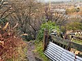
 Footpath Steps - geograph.org.uk - 2221355.jpg 800 × 600; 395 KB
-
 Footpath, near Blackpit Mill - geograph.org.uk - 2122668.jpg 480 × 640; 111 KB
-

-
 Greater Manchester from Hunger Hill - geograph.org.uk - 4594260.jpg 1,632 × 918; 302 KB
-
 Greenbooth Road, Norden - geograph.org.uk - 2715051.jpg 640 × 480; 147 KB
-
 Hind Clough and Top o'th Royd Farms - geograph.org.uk - 1705525.jpg 1,024 × 768; 279 KB
-
 Horse and Farrier - geograph.org.uk - 1954673.jpg 900 × 600; 165 KB
-
 Horse grazing near Wolstenholme Fold - geograph.org.uk - 2053186.jpg 3,872 × 2,489; 3.87 MB
-
 Hunger Hill trig point - geograph.org.uk - 4556081.jpg 1,600 × 1,200; 514 KB
-

-

-

-

-

-
 Keepers Cottage - geograph.org.uk - 3546011.jpg 1,548 × 1,116; 508 KB
-
 Lancashire, Ashworth Road - geograph.org.uk - 2679868.jpg 3,264 × 2,448; 4.02 MB
-

-

-
 Mary, Baitings Mill - geograph.org.uk - 1170181.jpg 416 × 640; 89 KB
-
 Mill Croft Brook - geograph.org.uk - 2122712.jpg 640 × 480; 219 KB
-
 Motor bike track to Hunger Hill - geograph.org.uk - 4556100.jpg 1,600 × 1,200; 642 KB
-
 Naden Wood (1) - geograph.org.uk - 6046033.jpg 5,152 × 3,864; 7.34 MB
-
 Naden Wood (2) - geograph.org.uk - 6046039.jpg 1,024 × 768; 356 KB
-
 Naden Wood (3) - geograph.org.uk - 6046042.jpg 5,152 × 3,864; 7.07 MB
-

-

-
 Norden Co-op - geograph.org.uk - 1954665.jpg 900 × 600; 142 KB
-
 Norden Cricket Club - Front Entrance - geograph.org.uk - 2427306.jpg 1,600 × 1,200; 299 KB
-
 Norden Cricket Club - Side Entrance - geograph.org.uk - 2427302.jpg 1,600 × 1,200; 532 KB
-
 Norden Cricket Club pavillion.jpg 1,600 × 1,200; 265 KB
-
 Norden Methodist Church - geograph.org.uk - 1671555.jpg 1,024 × 768; 139 KB
-
 Norden Methodist Church - geograph.org.uk - 3054690.jpg 3,872 × 2,592; 3.7 MB
-
 Norden Methodist Church - geograph.org.uk - 448077.jpg 640 × 426; 131 KB
-
 Norden Methodist Church - geograph.org.uk - 5921669.jpg 640 × 493; 80 KB
-
 Norden Post Office - geograph.org.uk - 1954664.jpg 800 × 600; 154 KB
-
 Norden Post Office - geograph.org.uk - 5921680.jpg 640 × 465; 77 KB
-
 Norden Road - geograph.org.uk - 5921245.jpg 640 × 480; 89 KB
-
 Norden URC - geograph.org.uk - 1954669.jpg 900 × 600; 163 KB
-
 NTL Mobile Phone Mast, Whittaker Moss - geograph.org.uk - 1672332.jpg 768 × 1,024; 152 KB
-
 Nutters Restaurant - geograph.org.uk - 1705345.jpg 1,024 × 768; 210 KB
-
 Old Delph Road - geograph.org.uk - 1954676.jpg 800 × 600; 152 KB
-

-
 Old Toll House, Norden (geograph 6114846).jpg 640 × 436; 238 KB
-
 Pack Horse Track Behind Blackpits Road - geograph.org.uk - 2221378.jpg 800 × 600; 388 KB
-
 Pack Horse Track Towards Blackpits - geograph.org.uk - 2221369.jpg 600 × 800; 416 KB
-
 Path from Whittaker Moss to Norden Village - geograph.org.uk - 2221307.jpg 1,280 × 960; 993 KB
-

-

-

-
 Path round the edge of the estate - geograph.org.uk - 2053167.jpg 3,872 × 2,494; 4.85 MB
-
 Piles of wood dumped by Ashworth Lane - geograph.org.uk - 2053222.jpg 3,872 × 2,485; 3.66 MB
-
 Pylons over a grassy hill - geograph.org.uk - 2053212.jpg 3,872 × 2,592; 2.38 MB
-
 Rear view of Knowl Farm - geograph.org.uk - 1876071.jpg 3,671 × 2,447; 3.39 MB
-
 Reservoir north of Hunger Hill - geograph.org.uk - 4556096.jpg 1,600 × 1,200; 642 KB
-
 Road to Greengate Hill - geograph.org.uk - 816580.jpg 640 × 480; 180 KB
-
 Rowan Close, Rochdale - geograph.org.uk - 2786485.jpg 1,024 × 768; 157 KB
-
 Ruin at Naden Dean - geograph.org.uk - 301470.jpg 640 × 481; 67 KB
-
 School Lane - geograph.org.uk - 1770910.jpg 2,816 × 2,112; 1.41 MB
-
 School Lane, Norden - geograph.org.uk - 354465.jpg 640 × 480; 102 KB
-
 Scott House - geograph.org.uk - 3937534.jpg 3,318 × 1,923; 1.17 MB
-

-
 Shepherd Mill Bridge, Norden - geograph.org.uk - 1660001.jpg 640 × 480; 99 KB
-
 Sidholme Farm - geograph.org.uk - 3940029.jpg 3,751 × 2,434; 2 MB
-
 Sign for the Bridge Inn, Norden - geograph.org.uk - 5921685.jpg 485 × 640; 68 KB
-
 Sign for the Brown Cow, Norden - geograph.org.uk - 5921683.jpg 475 × 640; 66 KB
-
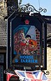 Sign for the Horse ^ Farrier, Norden - geograph.org.uk - 5921679.jpg 403 × 640; 77 KB
-
 Sign for the Norden Arms ^ Eatery - geograph.org.uk - 5921672.jpg 492 × 640; 48 KB
-
 Sign for the Turf Tavern, Rochdale - geograph.org.uk - 5921259.jpg 582 × 640; 68 KB
-
 Sign for the White Lion, Norden - geograph.org.uk - 5921693.jpg 387 × 640; 82 KB
-
 St. James' Sunday School - geograph.org.uk - 850585.jpg 640 × 438; 136 KB
-
 Stone terraces on Edenfield Road, Norden - geograph.org.uk - 2698296.jpg 4,000 × 2,248; 1.05 MB
-
 Terraced cottages at the bottom of Old Delph Road - geograph.org.uk - 3054698.jpg 3,872 × 2,592; 4.33 MB
-
 Terraced housing on Norden Road - geograph.org.uk - 5921242.jpg 640 × 525; 79 KB
-
 The beer garden at the White Lion - geograph.org.uk - 3032264.jpg 800 × 600; 198 KB
-
 The Blue Ball on Edenfield Road - geograph.org.uk - 3032232.jpg 800 × 600; 113 KB
-
 The Blue Ball on Edenfield Road - geograph.org.uk - 3032236.jpg 800 × 600; 157 KB
-
 The Blue Ball, Norden - geograph.org.uk - 3054694.jpg 3,872 × 2,592; 3.41 MB
-
 The Bridge Inn, Norden - geograph.org.uk - 3032368.jpg 800 × 600; 136 KB
-
 The Bridge Inn, Norden - geograph.org.uk - 5921684.jpg 640 × 540; 91 KB
-
 The Brown Cow, Norden - geograph.org.uk - 5921682.jpg 640 × 508; 85 KB
-
 The car park at the White Lion - geograph.org.uk - 3032284.jpg 800 × 600; 95 KB
-
 The Grapes on Norden Road - geograph.org.uk - 3032212.jpg 800 × 600; 78 KB
-
 The Grapes on Norden Road - geograph.org.uk - 3032215.jpg 600 × 800; 92 KB
-
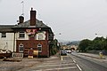
 The Horse & Farrier, Norden - geograph.org.uk - 3036425.jpg 800 × 600; 106 KB
-
 The Horse & Farrier, Norden - geograph.org.uk - 5921678.jpg 640 × 556; 89 KB
-
 The Norden Arms ^ Eatery - geograph.org.uk - 5921670.jpg 640 × 451; 61 KB
-
 The site of a barbecue - geograph.org.uk - 2053229.jpg 3,872 × 2,592; 4.78 MB
-
 The Star Inn - Edenfield Road - geograph.org.uk - 4793386.jpg 3,561 × 2,546; 1.68 MB
-
 The Turf Tavern, Norden - geograph.org.uk - 3032380.jpg 800 × 600; 111 KB
-
 The Turf Tavern, Norden - geograph.org.uk - 3032386.jpg 800 × 600; 105 KB
-
 The Turf Tavern, Norden - geograph.org.uk - 3032390.jpg 800 × 600; 89 KB
-
 The White Lion on Edenfield Road - geograph.org.uk - 3032250.jpg 800 × 600; 99 KB
-
 The White Lion on Edenfield Road - geograph.org.uk - 3032255.jpg 600 × 800; 125 KB
-
 The White Lion on Edenfield Road - geograph.org.uk - 3032260.jpg 800 × 600; 103 KB
-
 The White Lion on Edenfield Road - geograph.org.uk - 3036454.jpg 800 × 600; 106 KB
-
 The White Lion, Norden - geograph.org.uk - 5921691.jpg 640 × 529; 80 KB
-
 These cows were inquisitive and lively - geograph.org.uk - 1876150.jpg 3,872 × 2,457; 3.68 MB
-
 To Knowl Hill - geograph.org.uk - 6035173.jpg 5,152 × 3,864; 7.5 MB
-
 Track - geograph.org.uk - 1954656.jpg 800 × 600; 184 KB
-
 Track to Black Dad - geograph.org.uk - 2053235.jpg 3,872 × 2,494; 3.93 MB
-
 Track to Turnshaw Hill - geograph.org.uk - 1878182.jpg 3,634 × 2,447; 2.87 MB
-
 War memorial garden, Norden - geograph.org.uk - 3054703.jpg 3,872 × 2,592; 3.98 MB
-
 White Lion - geograph.org.uk - 1770790.jpg 2,748 × 2,061; 1.03 MB
-
 White Lion public house at Norden - geograph.org.uk - 4556624.jpg 1,600 × 1,200; 576 KB
-
 Whittaker Moss - geograph.org.uk - 1672321.jpg 1,024 × 768; 366 KB
-
 Whittaker Moss - geograph.org.uk - 1672327.jpg 1,024 × 768; 362 KB
-
 Woodhouse Fold Farm - geograph.org.uk - 1760253.jpg 2,816 × 2,112; 976 KB
-
 Woodhouse Lane - geograph.org.uk - 1760254.jpg 2,816 × 2,112; 1.63 MB
-
 Woodhouse Lane - geograph.org.uk - 1761382.jpg 2,816 × 2,112; 1.26 MB
-
 Woodhouse lane - geograph.org.uk - 1761447.jpg 2,816 × 2,112; 1.39 MB
-
 Woodhouse Lane - geograph.org.uk - 1761461.jpg 2,816 × 2,112; 1.03 MB
-
 Woodhouse Lane - geograph.org.uk - 3940024.jpg 3,767 × 2,413; 1.59 MB
-
 Woodhouse Lane - geograph.org.uk - 3940027.jpg 3,888 × 2,592; 2.31 MB
-
 Woodhouse Lane - geograph.org.uk - 3940028.jpg 3,849 × 2,473; 1.36 MB
-
 Woodhouse Lane 55 years on - geograph.org.uk - 1707737.jpg 1,024 × 768; 224 KB
-
 Woodhouse Lane, Norden - geograph.org.uk - 1760252.jpg 2,816 × 2,112; 1.65 MB
-
-
 Derelict Cottages - geograph.org.uk - 483283.jpg 640 × 480; 102 KB
-
 Knowl Moor's eastern flank - geograph.org.uk - 124455.jpg 640 × 479; 127 KB
-
 Moorland - geograph.org.uk - 216549.jpg 640 × 420; 78 KB
-
 Norden United Reformed Church - geograph.org.uk - 448075.jpg 640 × 426; 136 KB


_-_geograph.org.uk_-_6046033.jpg)
_-_geograph.org.uk_-_6046039.jpg)
_-_geograph.org.uk_-_6046042.jpg)


.jpg)
.jpg)


