Category:Noord Deurningen
Jump to navigation
Jump to search
| Object location | | View all coordinates using: OpenStreetMap |
|---|
human settlement in the Netherlands   | |||||
| Upload media | |||||
| Instance of | |||||
|---|---|---|---|---|---|
| Location | Dinkelland, Overijssel, Netherlands | ||||
 | |||||
Subcategories
This category has the following 4 subcategories, out of 4 total.
D
L
- Lubberdinksweg 15, Denekamp (21 F)
R
- Rammelbeekweg 16, Denekamp (17 F)
S
- Sint Nicolaasstichting, Denekamp (11 F)
Media in category "Noord Deurningen"
The following 43 files are in this category, out of 43 total.
-
-

-
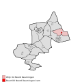
 Map - NL - Dinkelland - Wijk 04 Noord Deurningen.svg 625 × 575; 18 KB
-
 Map NL - Dinkelland - Noord Deurningen.png 800 × 600; 11 KB
-
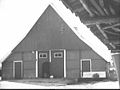
 "Zwiep", aanzicht - Noord Deurningen - 20168835 - RCE.jpg 1,200 × 795; 209 KB
-
 "Zwiep", aanzicht - Noord Deurningen - 20168836 - RCE.jpg 1,200 × 798; 301 KB
-
 "Zwiep", aanzicht - Noord Deurningen - 20168837 - RCE.jpg 1,200 × 798; 330 KB
-
 100, aanzicht - Noord Deurningen - 20168838 - RCE.jpg 1,200 × 788; 146 KB
-
 Achter- en zijgevel - Noord Deurningen - 20482486 - RCE.jpg 1,200 × 900; 181 KB
-
 Achtergevel - Noord Deurningen - 20477997 - RCE.jpg 1,200 × 900; 133 KB
-
 Achtergevel - Noord Deurningen - 20478000 - RCE.jpg 1,200 × 900; 168 KB
-
 Achtergevel - Noord Deurningen - 20480706 - RCE.jpg 1,200 × 900; 110 KB
-
 De Cloese Klöpkeshoes binnenaanzicht.jpg 3,072 × 4,080; 3.53 MB
-
 De Cloese Klöpkeshoes binnenin.jpg 4,080 × 3,072; 3.36 MB
-
 De Cloese Klöpkeshoes buitenaanzicht met gevelteken.jpg 3,072 × 4,080; 4.4 MB
-
 De Cloese Klöpkeshoes buitenaanzicht.jpg 3,072 × 4,080; 5.54 MB
-
 De Cloese Klöpkeshoes gevelteken.jpg 3,072 × 4,080; 4.51 MB
-
 De Cloese Klöpkeshoes infohoek binnen.jpg 3,072 × 4,080; 4.06 MB
-
 De Cloese Klöpkeshoes kappeletje van binnen.jpg 4,080 × 3,072; 3.37 MB
-
 De Cloese Klöpkeshoes kei.jpg 3,072 × 4,080; 6.61 MB
-
 De Cloese Klöpkeshoes klok.jpg 3,072 × 4,080; 6.2 MB
-
 De Cloese Klöpkeshoes stoel binnen.jpg 3,072 × 4,080; 4.07 MB
-
 De Cloese Klöpkeshoes uitleg.jpg 4,080 × 3,072; 3.68 MB
-
 De Cloese Klöpkeshoes vooraanzicht huisje.jpg 3,072 × 4,080; 6.3 MB
-
 De Cloese Klöpkeshoes vooraanzicht.jpg 3,072 × 4,080; 6.06 MB
-
 Gevels (voorheen nummer 15) - Noord Deurningen - 20168827 - RCE.jpg 1,200 × 787; 245 KB
-
 Gevels (voorheen nummer 15) - Noord Deurningen - 20353927 - RCE.jpg 1,200 × 788; 216 KB
-

-
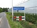 Kombord Noord Deurningen.jpg 800 × 600; 382 KB
-
 Kopgevel 'klopkeshoes' waskamer - Noord Deurningen - 20460355 - RCE.jpg 1,200 × 900; 179 KB
-
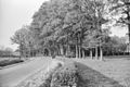
 Landschap met eiken bij Noord Deurningen, RP-P-OB-25.025.jpg 2,812 × 3,960; 1.38 MB
-
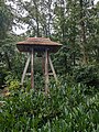
 Noord Deurningen Klokkenstoel.JPG 2,288 × 1,712; 2.33 MB
-
 Overzicht van de achtergevel - Noord Deurningen - 20450524 - RCE.jpg 1,200 × 897; 308 KB
-

-
 Overzicht van de voorzijde - Noord Deurningen - 20450523 - RCE.jpg 1,200 × 885; 304 KB
-

-

-
 Voorgevel - Noord Deurningen - 20460353 - RCE.jpg 1,200 × 900; 209 KB
-

-

-
 Zij- en achtergevel - Noord Deurningen - 20477999 - RCE.jpg 1,200 × 900; 154 KB
-

-
 Zij- en kopgevel aanbouw - Noord Deurningen - 20460354 - RCE.jpg 1,200 × 900; 181 KB


_-_Noord_Deurningen_-_20168827_-_RCE.jpg)
_-_Noord_Deurningen_-_20353927_-_RCE.jpg)


