Category:No entry road signs in England
Jump to navigation
Jump to search
Subcategories
This category has the following 3 subcategories, out of 3 total.
L
Media in category "No entry road signs in England"
The following 103 files are in this category, out of 103 total.
-
 Car park exit, Fairmead Road, High Beach, Epping Forest, Essex England.jpg 3,000 × 2,000; 5.85 MB
-
 Carfax to Market Square in Horsham, West Sussex, England 01.jpg 4,435 × 2,957; 10.52 MB
-
 Carfax to Market Square in Horsham, West Sussex, England 02.jpg 4,315 × 3,236; 10.64 MB
-

-
 A38 and Haywards Lane - geograph.org.uk - 1365835.jpg 640 × 365; 61 KB
-
 Albion Rd - geograph.org.uk - 4299204.jpg 640 × 430; 75 KB
-
 Andrew Street - Leeds Road - geograph.org.uk - 3705929.jpg 480 × 640; 73 KB
-
 Anti-second home sticker, St Ives, Cornwall, July 2023.jpg 3,024 × 4,032; 2.73 MB
-
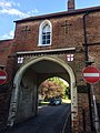
 Arch Leading to Rose Hill - geograph.org.uk - 108529.jpg 480 × 640; 173 KB
-
 Avebury Avenue - geograph.org.uk - 1541089.jpg 640 × 430; 151 KB
-
 Bath Claverton Street - First 53814 (WX05RUA).JPG 1,366 × 820; 557 KB
-
 Belmont Road - geograph.org.uk - 2659627.jpg 640 × 480; 78 KB
-
 Berkeley Street, Gloucester - geograph.org.uk - 2536517.jpg 640 × 480; 105 KB
-
 Beulah Rd - geograph.org.uk - 3966122.jpg 640 × 430; 83 KB
-
 Beulah Rd - geograph.org.uk - 4508132.jpg 640 × 426; 84 KB
-
 Blackpool United Hebrew Synagogue 2.JPG 2,976 × 3,968; 6.3 MB
-
 Blackpool United Hebrew Synagogue 254.jpg 2,560 × 1,920; 1.25 MB
-
 Blackpool United Hebrew Synagogue 3.jpg 3,968 × 2,976; 6.26 MB
-
 Broad St - geograph.org.uk - 5929684.jpg 1,024 × 681; 145 KB
-
 Bull Inn, Sheep Street - geograph.org.uk - 2565623.jpg 2,560 × 1,920; 2.17 MB
-
 Bury St - geograph.org.uk - 2049133.jpg 640 × 430; 145 KB
-
 Butter Hill Dorking.jpg 2,448 × 3,264; 2.35 MB
-
 Calverley St - geograph.org.uk - 4324201.jpg 640 × 430; 71 KB
-
 Cecil Road, Rochester - geograph.org.uk - 1359776.jpg 640 × 480; 87 KB
-
 Chalk Lane - geograph.org.uk - 2791644.jpg 2,592 × 1,936; 2.25 MB
-
 Charles St - geograph.org.uk - 5929681.jpg 1,024 × 681; 141 KB
-

-
 Clacton-on-Sea, Wellesley Road - geograph.org.uk - 3847987.jpg 640 × 480; 253 KB
-
 Commercial Rd - geograph.org.uk - 5996229.jpg 1,024 × 681; 150 KB
-
 Coney Street, York - geograph.org.uk - 407873.jpg 480 × 640; 72 KB
-
 Cook, Wey Hill - geograph.org.uk - 2078730.jpg 640 × 430; 132 KB
-
 Courthouse St - geograph.org.uk - 5255685.jpg 640 × 426; 65 KB
-
 Definitely no entry - geograph.org.uk - 2889336.jpg 1,704 × 2,304; 1.71 MB
-
 Dewsbury Bus Station - geograph.org.uk - 518798.jpg 640 × 480; 82 KB
-
 Dover, Dolphin Lane-Russell Street - geograph.org.uk - 2846532.jpg 3,648 × 2,736; 3.78 MB
-
 Dover, Dolphin Lane-Russell Street - geograph.org.uk - 2846535.jpg 3,648 × 2,736; 3.54 MB
-
 Drayton Road - geograph.org.uk - 769904.jpg 640 × 480; 79 KB
-
 Edgar Road, Margate - geograph.org.uk - 4581309.jpg 2,272 × 1,704; 918 KB
-
 Embankment Road - Plymouth Citybus 569 (WA69CYP).JPG 1,366 × 1,024; 479 KB
-
 Exeter, UK - panoramio (4).jpg 2,136 × 3,216; 902 KB
-
 Exit to the private road, White Rock - geograph.org.uk - 1351387.jpg 640 × 430; 78 KB
-
 Falmouth High Street - Cornish Ferries PJ02PZY.jpg 1,024 × 768; 444 KB
-
 Filey Bus Station - geograph.org.uk - 342065.jpg 640 × 480; 55 KB
-
 Friday Street, Henley on Thames - geograph.org.uk - 3665566.jpg 2,048 × 1,536; 1.57 MB
-
 Grosvenor Rd - geograph.org.uk - 1177570.jpg 640 × 430; 70 KB
-
 Grosvenor Rd - geograph.org.uk - 3970293.jpg 640 × 430; 76 KB
-
 Guildhall Street, Canterbury - geograph.org.uk - 2810641.jpg 4,320 × 3,240; 4.1 MB
-
 High Street - geograph.org.uk - 4314111.jpg 1,024 × 683; 180 KB
-

-
 Kew Street - geograph.org.uk - 2541264.jpg 640 × 480; 79 KB
-
 Lady crossing Drayton Road - geograph.org.uk - 769916.jpg 640 × 480; 71 KB
-
 Lansdowne St - geograph.org.uk - 3670512.jpg 640 × 430; 68 KB
-
 Lime Hill Rd - geograph.org.uk - 1124946.jpg 640 × 430; 78 KB
-
 Livery Street, Birmingham - geograph.org.uk - 4102681.jpg 3,488 × 2,616; 2.17 MB
-

-
 Looking north up St Pirans Avenue - geograph.org.uk - 859738.jpg 640 × 480; 59 KB
-

-
 Manchester Road guided busway, Bradford - geograph.org.uk - 37262.jpg 640 × 480; 151 KB
-
 Matlock Bath from the bus - geograph.org.uk - 1130147.jpg 640 × 480; 99 KB
-
 McDonald's Carpark - geograph.org.uk - 2582691.jpg 800 × 531; 89 KB
-
 2022 at Meldon Viaduct station - from the Granite Way.JPG 1,366 × 910; 660 KB
-
 Monks Way - geograph.org.uk - 1157176.jpg 640 × 428; 206 KB
-
 Montpelier Road - geograph.org.uk - 2674407.jpg 480 × 640; 91 KB
-
 Mount Edgcumbe Rd - geograph.org.uk - 5666720.jpg 640 × 426; 81 KB
-
 Mount Edgecumbe Rd - geograph.org.uk - 5314434.jpg 640 × 426; 80 KB
-
 Mount Edgecumbe Rd - geograph.org.uk - 5708116.jpg 640 × 426; 82 KB
-
 Nares St - geograph.org.uk - 1899683.jpg 640 × 430; 130 KB
-
 No entry - geograph.org.uk - 3991232.jpg 640 × 430; 78 KB
-
 No entry ahead - geograph.org.uk - 2929948.jpg 640 × 430; 68 KB
-
 No entry into Pusey Street, Oxford-geograph-3006430-by-nick-macneill.jpg 800 × 600; 109 KB
-
 No entry sign with googly eyes, Penzance, March 2021.jpg 3,024 × 4,032; 2.2 MB
-

-

-
 No entry to Silverdale Rd - geograph.org.uk - 2729853.jpg 640 × 430; 66 KB
-
 No entry, St George's Rd - geograph.org.uk - 3648450.jpg 640 × 430; 63 KB
-
 No Entry^ Lime Hill Rd - geograph.org.uk - 1287639.jpg 640 × 430; 85 KB
-
 No entry^ Springwell Rd - geograph.org.uk - 1315863.jpg 640 × 430; 67 KB
-
 North Holmes Rd - geograph.org.uk - 2643100.jpg 640 × 430; 92 KB
-
 North Walls - geograph.org.uk - 664860.jpg 468 × 640; 71 KB
-
 North Walls, Chichester - geograph.org.uk - 92229.jpg 640 × 603; 198 KB
-
 Northward view along St Nicholas Road, West Hill, Brighton (June 2010).JPG 1,900 × 2,500; 982 KB
-
 Plymouth Street at its junction with Drove Road, Swindon - geograph.org.uk - 1726410.jpg 1,600 × 1,200; 523 KB
-
 Popes Lane - geograph.org.uk - 175074.jpg 640 × 480; 345 KB
-
 Salisbury Station - geograph.org.uk - 4094409.jpg 1,024 × 680; 252 KB
-

-
 Shepherds Lane, Beaconsfield - geograph.org.uk - 988611.jpg 640 × 480; 78 KB
-
 Silverdale Rd - geograph.org.uk - 4281462.jpg 640 × 430; 78 KB
-
 Silverdale Rd - geograph.org.uk - 4409554.jpg 640 × 426; 78 KB
-
 Smeeds, Smart, Signs Shop in Bank Street, Herne Bay - geograph.org.uk - 2472975.jpg 4,000 × 3,000; 3.57 MB
-
 South Place view northwest from junction with Willson Street 01.jpg 3,648 × 2,736; 3.34 MB
-
 St John's Rd - geograph.org.uk - 3653630.jpg 640 × 430; 69 KB
-
 St Phillip's Street, Cheltenham - geograph.org.uk - 3249699.jpg 640 × 541; 76 KB
-
 Stop sign in Claremont Road - geograph.org.uk - 1171373.jpg 480 × 640; 99 KB
-
 The Castle, Dover - geograph.org.uk - 1587118.jpg 640 × 427; 60 KB
-
 The Grand - geograph.org.uk - 4739381.jpg 640 × 426; 89 KB
-
 To Let, Lime Hill Rd - geograph.org.uk - 1186835.jpg 640 × 430; 83 KB
-

-
 Watling Street View - geograph.org.uk - 1448850.jpg 480 × 640; 73 KB
-
 Welwyn Garden City, Longlands Road - geograph.org.uk - 1029899.jpg 640 × 480; 111 KB
-
 Welwyn Garden City, Longlands Road - geograph.org.uk - 874023.jpg 640 × 480; 92 KB
-
 Wentworth St - geograph.org.uk - 5929690.jpg 1,024 × 681; 172 KB
-
 Wentworth Street - geograph.org.uk - 1116650.jpg 471 × 640; 83 KB
-
 Wild Street, Derby - geograph.org.uk - 1704093.jpg 1,600 × 1,200; 197 KB


_-_flow_splitting_of_traffic_on_the_exit_slip_road_at_Marton_-_geograph.org.uk_-_1595548.jpg)


.JPG)


.JPG)
.jpg)


.JPG)


