Category:Nitshill
Jump to navigation
Jump to search
district in Glasgow City, Scotland, UK .jpg) | |||||
| Upload media | |||||
| Instance of | |||||
|---|---|---|---|---|---|
| Location |
| ||||
 | |||||
Media in category "Nitshill"
The following 73 files are in this category, out of 73 total.
-
 A726 Nitshill Road (geograph 5896850).jpg 1,600 × 984; 286 KB
-
 Beautiful nitshill tunnel.jpg 2,824 × 2,118; 2.2 MB
-
 Dark skies over South Nitshill (geograph 4887514).jpg 3,504 × 2,336; 4.22 MB
-
 Dove Street, Nitshill - geograph.org.uk - 1319279.jpg 640 × 480; 107 KB
-

-
 Faskin Road, Hurlet (geograph 6261370).jpg 1,024 × 768; 223 KB
-
 Flats on Pinmore Street (geograph 5662652).jpg 1,600 × 1,111; 351 KB
-
 Footpath under the Salterland Viaduct (geograph 4948819).jpg 3,504 × 2,336; 5.11 MB
-
 Former Househill Parks Depot (geograph 3956541).jpg 640 × 480; 91 KB
-
 Glasgow Museums Resource Centre - geograph.org.uk - 1083515.jpg 640 × 366; 45 KB
-
 Glasgow Museums Resource Centre - geograph.org.uk - 1224788.jpg 640 × 481; 51 KB
-
 Glasgow wards 2017 no03 Greater Pollok.png 2,000 × 2,040; 504 KB
-
 Gowanbank Primary School (geograph 5896902).jpg 1,600 × 1,066; 294 KB
-
 Hanover Close, 8 Dove Street (geograph 5897084).jpg 1,600 × 1,119; 435 KB
-
 Heading for the spawning grounds - geograph.org.uk - 1543875.jpg 640 × 480; 100 KB
-
 High Rise Block, Priesthill (geograph 2848331).jpg 2,694 × 2,505; 3.87 MB
-
 High rise flats on Nitshill Road (geograph 5665447).jpg 1,499 × 1,278; 310 KB
-
 High rise flats on Nitshill Road - geograph.org.uk - 5749268.jpg 1,201 × 1,600; 339 KB
-
 House and boat (geograph 6060432).jpg 1,600 × 1,090; 302 KB
-
 Househill Park, Hurlet - geograph.org.uk - 1319319.jpg 640 × 480; 127 KB
-
 Househill Parks Depot - geograph.org.uk - 156745.jpg 640 × 480; 168 KB
-
 Houses on Whiteacres Road (geograph 5749324).jpg 1,600 × 1,033; 273 KB
-
 Houses on Willowford Road (geograph 5259781).jpg 1,600 × 1,067; 357 KB
-
 Houses, Kinarvie Road (geograph 4682003).jpg 800 × 600; 416 KB
-
 Houses, South Nitshill (geograph 6032549).jpg 1,600 × 989; 473 KB
-
 Leverngrove Court from Nitshill Road - geograph.org.uk - 1318774.jpg 640 × 480; 107 KB
-
 Looking down the steps (geograph 5748995).jpg 1,175 × 1,600; 390 KB
-
 Map of Renfrewshire Sheet 012, Ordnance Survey, 1863-1864.jpg 10,706 × 7,173; 15.2 MB
-
 Map of Renfrewshire Sheet 012, Ordnance Survey, 1863-1864.tiff 10,706 × 7,173; 219.71 MB
-
 Memorial to the Nitshill Mining Disaster - geograph.org.uk - 1319269.jpg 640 × 480; 190 KB
-
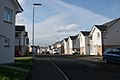
 New houses, Drumbeg Drive (geograph 5975887).jpg 1,600 × 920; 277 KB
-
 New houses, Drumbeg Drive (geograph 5975891).jpg 1,600 × 1,025; 272 KB
-
 New houses, Nitshill (geograph 5171002).jpg 1,600 × 1,067; 214 KB
-
 New houses, Roughmussel (geograph 4947046).jpg 3,504 × 2,336; 3.83 MB
-
 Nia Roo (geograph 3575635).jpg 3,941 × 2,689; 1.36 MB
-
 Nia Roo - geograph.org.uk - 1319218.jpg 640 × 480; 118 KB
-
 Nitshill Depot - geograph-2352976.jpg 1,024 × 683; 128 KB
-
 Nitshill mining disaster memorial plaque.jpg 4,080 × 3,072; 5.77 MB
-
 Nitshill Road (geograph 3414185).jpg 640 × 480; 285 KB
-
 Nitshill War Memorial (geograph 6264223).jpg 1,600 × 1,067; 302 KB
-
 Parkhouse (geograph 5259753).jpg 1,600 × 1,067; 474 KB
-
 Parkmanor Avenue (geograph 5098666).jpg 800 × 600; 147 KB
-
 Properties on Nitshill Road (geograph 5896911).jpg 1,600 × 985; 280 KB
-
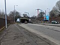
 Railway bridge over the A726, Nitshill Road (geograph 5308326).jpg 1,600 × 1,067; 429 KB
-
 Rear of houses on Weensmoor Road (geograph 5171053).jpg 1,600 × 866; 203 KB
-
 Recent housing, South Nitshill (geograph 5749280).jpg 1,600 × 1,200; 403 KB
-
 Roundabout on Parkhouse Road (geograph 6264276).jpg 1,024 × 683; 144 KB
-
 Shops at Nitshill (geograph 5665458).jpg 1,600 × 1,200; 258 KB
-
 Shops on Craigbank Drive (geograph 5896868).jpg 1,600 × 1,058; 276 KB
-

-
 Sky Dragon (geograph 5750156).jpg 1,600 × 1,122; 440 KB
-
 South Nitshill (geograph 2848340).jpg 3,748 × 2,811; 6.22 MB
-
 St Bernards Catholic Church (geograph 5750174).jpg 1,600 × 1,107; 345 KB
-
 St Bernards Church, Nitshill (geograph 5171009).jpg 1,600 × 1,077; 462 KB
-
 St Bernards Primary School (geograph 5627939).jpg 1,600 × 936; 227 KB
-
 Stairs to South Nitshill - geograph.org.uk - 1319233.jpg 640 × 480; 98 KB
-
 Steps to Whithope Road - geograph.org.uk - 4563599.jpg 2,048 × 1,536; 977 KB
-
 The Cavendish - geograph.org.uk - 1319291.jpg 640 × 480; 113 KB
-
 The Hurlet - geograph.org.uk - 23138.jpg 640 × 480; 123 KB
-

-
 The rear of St Bernard's Catholic Church - geograph.org.uk - 5749320.jpg 1,600 × 1,108; 411 KB
-
 Toby Carvery, Hurlet (geograph 4088322).jpg 5,184 × 3,456; 7.23 MB
-
 Tower Block UK photo glw-30 (Nitshill 1983).jpg 2,613 × 1,729; 668 KB
-
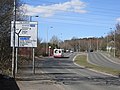
 Traffic on Parkhouse Road - geograph.org.uk - 1319194.jpg 640 × 480; 111 KB
-

-
 View from Whitehaugh Road (geograph 5749026).jpg 1,600 × 907; 268 KB
-
 War memorial, Nitshill (geograph 5974288).jpg 1,600 × 1,256; 670 KB
-
 Waste ground beside Nitshill Station (geograph 5308307).jpg 1,600 × 1,067; 359 KB
-
 Weensmoor Road (geograph 5685987).jpg 1,600 × 1,021; 247 KB
-
 Whitehaugh Road (geograph 5749048).jpg 1,600 × 941; 266 KB
-
 Whithope Terrace (geograph 5685997).jpg 1,600 × 891; 191 KB
-
 Willowford Place, Nitshill (geograph 5171038).jpg 1,600 × 916; 196 KB
-
 Willowford Road - geograph.org.uk - 4563514.jpg 1,834 × 1,258; 620 KB
.jpg)

.jpg)


.jpg)
.jpg)
.jpg)
.jpg)


.jpg)
.jpg)

.jpg)
.jpg)

.jpg)


.jpg)
.jpg)
.jpg)
.jpg)

.jpg)


.jpg)
.jpg)
.jpg)
.jpg)
.jpg)


.jpg)
.jpg)
.jpg)
.jpg)
.jpg)
.jpg)
.jpg)
.jpg)
.jpg)
.jpg)

.jpg)
.jpg)
.jpg)
.jpg)
.jpg)


.jpg)
.jpg)


.jpg)
.jpg)
.jpg)
.jpg)
.jpg)
.jpg)
.jpg)
