Category:Night in East Sussex
Jump to navigation
Jump to search
Ceremonial counties of England: Bedfordshire · Berkshire · Buckinghamshire · Cambridgeshire · Cheshire · Cornwall · Cumbria · Derbyshire · Devon · Dorset · Durham · East Riding of Yorkshire · East Sussex · Essex · Gloucestershire · Greater London · Greater Manchester · Hampshire · Herefordshire · Hertfordshire · Isle of Wight · Kent · Lancashire · Leicestershire · Lincolnshire · Merseyside · Norfolk · North Yorkshire · Northamptonshire · Northumberland · Nottinghamshire · Oxfordshire · Rutland · Shropshire · Somerset · South Yorkshire · Staffordshire · Suffolk · Surrey · Tyne and Wear · Warwickshire · West Midlands · West Sussex · West Yorkshire · Wiltshire · Worcestershire
City-counties: Bristol · City of London
Former historic counties:
Other former counties:
City-counties: Bristol · City of London
Former historic counties:
Other former counties:
Subcategories
This category has the following 4 subcategories, out of 4 total.
B
- Night in Battle, East Sussex (1 F)
- Buses in Brighton at night (12 F)
H
- Night in Hastings (5 F)
Media in category "Night in East Sussex"
The following 91 files are in this category, out of 91 total.
-
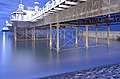 Beneath the Pier (Long Moonlit Exposure).jpg 2,922 × 1,916; 2.92 MB
-
 Bexhill Coastline at Night (aerial).jpg 4,000 × 3,000; 1.52 MB
-
 Bexhill railway station - geograph.org.uk - 84918.jpg 640 × 480; 91 KB
-
 Bonfire night with Firework (6507032309).jpg 3,872 × 2,592; 8.56 MB
-
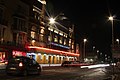
 Brighton MMB 56 The Boutique.jpg 3,942 × 2,964; 2.86 MB
-
 Brighton pier smt.jpg 1,024 × 683; 94 KB
-
 Castle Street - geograph.org.uk - 2654055.jpg 640 × 480; 95 KB
-
 Church of St. Mary the Virgin - geograph.org.uk - 2312137.jpg 640 × 480; 49 KB
-
 Church Passage, Hastings Old Town - geograph.org.uk - 1075244.jpg 640 × 480; 75 KB
-
 Cinque Ports Street - geograph.org.uk - 1740391.jpg 640 × 430; 128 KB
-
 Cornwallis Terrace - geograph.org.uk - 2693103.jpg 640 × 480; 79 KB
-
 Crown and Anchor, Eastbourne - geograph.org.uk - 2735500.jpg 640 × 480; 81 KB
-
 De La Warr Pavillion Night (4242501710).jpg 1,402 × 2,118; 2.36 MB
-
 East Beach Street - geograph.org.uk - 2216522.jpg 640 × 320; 54 KB
-
 East Beach Street at night - geograph.org.uk - 2712439.jpg 640 × 480; 62 KB
-
 East Parade at night - geograph.org.uk - 2291813.jpg 640 × 427; 71 KB
-
 Eastbourne bandstand - geograph.org.uk - 5052200.jpg 4,608 × 3,456; 3.37 MB
-
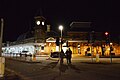 Eastbourne Station - geograph.org.uk - 4962604.jpg 640 × 426; 50 KB
-
 Eastbourne Station - geograph.org.uk - 4962605.jpg 640 × 426; 66 KB
-
 Eversfield Place, St.Leonards on sea.. (6331619981).jpg 1,630 × 2,256; 525 KB
-
 George Street - geograph.org.uk - 2823109.jpg 640 × 427; 45 KB
-
 George Street at night (geograph 6703147).jpg 3,024 × 3,024; 2.95 MB
-
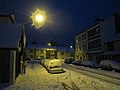
 George Street in snow at night - geograph.org.uk - 2181194.jpg 640 × 480; 74 KB
-
 George Street, Hastings at Night - geograph.org.uk - 1224288.jpg 640 × 480; 109 KB
-
 Goldstone Retail Park - geograph.org.uk - 1657118.jpg 640 × 477; 88 KB
-
 Hastings Arms, Hastings - geograph.org.uk - 2295083.jpg 640 × 480; 55 KB
-
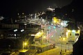
 Hastings Old Town at Night - geograph.org.uk - 50091.jpg 640 × 480; 76 KB
-
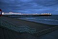
 Hastings Seafront Night.jpg 2,016 × 1,512; 846 KB
-
 Hastings Seafrontcentral.jpg 2,016 × 1,512; 832 KB
-
 Havelock Road - geograph.org.uk - 2693093.jpg 640 × 480; 72 KB
-
 Havelock Road - geograph.org.uk - 2823212.jpg 640 × 427; 62 KB
-
 High Street - geograph.org.uk - 2216260.jpg 640 × 480; 113 KB
-
 High Street at night - geograph.org.uk - 2216245.jpg 640 × 480; 73 KB
-
 High Street, Lewes - geograph.org.uk - 1690117.jpg 640 × 462; 105 KB
-
 King Edward's Parade - geograph.org.uk - 2726702.jpg 640 × 480; 89 KB
-
 Kings Road - geograph.org.uk - 2647413.jpg 640 × 480; 102 KB
-
 Kings Road - geograph.org.uk - 2647454.jpg 640 × 480; 87 KB
-
 London Road Station.jpg 2,530 × 1,860; 847 KB
-
 Marina at night - geograph.org.uk - 2276822.jpg 640 × 427; 71 KB
-
 Marina, St.Leonards on sea. (6473851613).jpg 2,324 × 1,543; 407 KB
-
 Marine Court - geograph.org.uk - 2278678.jpg 640 × 480; 88 KB
-
 Marine Court - geograph.org.uk - 2279818.jpg 640 × 480; 78 KB
-
 Marinecourtnight.jpg 1,600 × 1,200; 217 KB
-
 Night time at Eastbourne Station - geograph.org.uk - 1825866.jpg 640 × 430; 82 KB
-

-
 One way sign - geograph.org.uk - 2312180.jpg 480 × 640; 57 KB
-
 Pelham Place - geograph.org.uk - 2823285.jpg 640 × 427; 57 KB
-
 Queen's Road - geograph.org.uk - 2181334.jpg 640 × 480; 73 KB
-
 Queen's Road - geograph.org.uk - 2181338.jpg 640 × 480; 70 KB
-
 Queen's Road - geograph.org.uk - 2221221.jpg 640 × 480; 92 KB
-
 Queen's Road - geograph.org.uk - 2698563.jpg 640 × 480; 78 KB
-
 Queen's Road - geograph.org.uk - 4307717.jpg 1,024 × 683; 128 KB
-
 Queen's Road bridge - geograph.org.uk - 2285655.jpg 640 × 480; 65 KB
-
 Queens Road - geograph.org.uk - 2181331.jpg 640 × 480; 68 KB
-
 Queens Road Christmas lights - geograph.org.uk - 2219086.jpg 640 × 480; 73 KB
-
 Queens Road Christmas lights - geograph.org.uk - 2219090.jpg 640 × 480; 75 KB
-
 Railway Bridge over Queens Road - geograph.org.uk - 2273038.jpg 480 × 640; 127 KB
-
 Rayner, High Street, Rye - geograph.org.uk - 1581250.jpg 640 × 427; 280 KB
-
 Rye at night, Brede Quay - geograph.org.uk - 1740359.jpg 640 × 430; 73 KB
-

-
 Rye at night, Market Rd - geograph.org.uk - 1740371.jpg 640 × 426; 91 KB
-
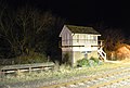 Rye at night, Rye Signal box - geograph.org.uk - 1740285.jpg 640 × 430; 84 KB
-
 Rye at night, Standard Inn, The Mint - geograph.org.uk - 1740364.jpg 640 × 430; 95 KB
-

-
 Rye at night, The Mint - geograph.org.uk - 1740366.jpg 640 × 423; 83 KB
-
 Rye at night, Ypres Tower - geograph.org.uk - 1740294.jpg 640 × 430; 83 KB
-
 Rye churchyard - geograph.org.uk - 3815199.jpg 640 × 425; 168 KB
-
 Saxon Street - geograph.org.uk - 2647463.jpg 640 × 480; 56 KB
-
 Saxon Street - geograph.org.uk - 2647466.jpg 640 × 480; 71 KB
-
 Snow chaos on South Terrace - geograph.org.uk - 2181330.jpg 640 × 480; 75 KB
-
 South St after dark. - geograph.org.uk - 1825853.jpg 640 × 538; 113 KB
-

-
 St Leonard's Warrior Square Station - geograph.org.uk - 2646260.jpg 640 × 480; 96 KB
-
 St Leonards Warrior Square Station - geograph.org.uk - 2647231.jpg 640 × 480; 102 KB
-
 St Leonards Warrior Square Station - geograph.org.uk - 2647404.jpg 640 × 480; 82 KB
-
 St Leonards Warrior Square Station - geograph.org.uk - 2647408.jpg 640 × 480; 75 KB
-
 St Leonards Warrior Square Station - geograph.org.uk - 2893798.jpg 480 × 640; 80 KB
-
 St Leonards Warrior Square Station - geograph.org.uk - 5317913.jpg 640 × 426; 56 KB
-
 St Leonards Warrior Square Station - geograph.org.uk - 5317915.jpg 640 × 426; 83 KB
-
 Terminus Road at night - geograph.org.uk - 1825870.jpg 640 × 436; 91 KB
-

-
 The Bourne at night - geograph.org.uk - 3187216.jpg 640 × 427; 58 KB
-
 The Deluxe - geograph.org.uk - 2818519.jpg 640 × 427; 58 KB
-
 The Deluxe - geograph.org.uk - 2823107.jpg 640 × 427; 61 KB
-
 The Dolphin, Hastings - geograph.org.uk - 2295382.jpg 640 × 480; 77 KB
-
 The Terminus, Terminus Rd - geograph.org.uk - 1825872.jpg 640 × 430; 96 KB
-
 Upper Clarence Road - geograph.org.uk - 2186633.jpg 640 × 480; 52 KB
-
 Wellington Place - geograph.org.uk - 2221222.jpg 640 × 480; 85 KB
-
 Wellington Place - geograph.org.uk - 2823148.jpg 640 × 427; 72 KB
-
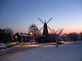 West Blatchington Windmill at Dusk - geograph.org.uk - 1657111.jpg 640 × 480; 72 KB
-
 Ye Olde Pumphouse, Hastings - geograph.org.uk - 2294637.jpg 480 × 640; 111 KB
.jpg)
.jpg)

.jpg)


.jpg)


.jpg)

.jpg)


.jpg)


