Category:Nieuwegracht 199, Utrecht
Jump to navigation
Jump to search
| Object location | | View all coordinates using: OpenStreetMap |
|---|
 | |||||
| Upload media | |||||
| Instance of |
| ||||
|---|---|---|---|---|---|
| Location | Utrecht, Netherlands | ||||
| Street address |
| ||||
| Located on street | |||||
| Heritage designation |
| ||||
 | |||||
|
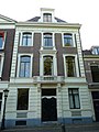
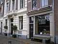
This is a category about rijksmonument number 36441
|
| Address |
|
Media in category "Nieuwegracht 199, Utrecht"
The following 5 files are in this category, out of 5 total.
-
 Nieuwegracht 199.JPG 2,592 × 3,456; 3.92 MB
-
 Nieuwegracht Utrecht Nederland.JPG 2,592 × 1,944; 2.93 MB
-
 Overzicht - Utrecht - 20236221 - RCE.jpg 1,200 × 948; 278 KB
-
 Voorgevel - Utrecht - 20236223 - RCE.jpg 951 × 1,200; 223 KB
-
 Voorgevels - Utrecht - 20236222 - RCE.jpg 804 × 1,200; 171 KB


