Category:Nieuwe Kerksplein 16, Haarlem
Jump to navigation
Jump to search
| Object location | | View all coordinates using: OpenStreetMap |
|---|
 | |||||
| Upload media | |||||
| Instance of |
| ||||
|---|---|---|---|---|---|
| Location | Haarlem, North Holland, Netherlands | ||||
| Street address |
| ||||
| Located on street | |||||
| Heritage designation |
| ||||
 | |||||
|
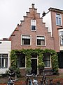
This is a category about rijksmonument number 19612
|
| Address |
|
Media in category "Nieuwe Kerksplein 16, Haarlem"
The following 2 files are in this category, out of 2 total.
-
 WLM-Haarlem 145.JPG 2,736 × 3,648; 2.06 MB
-
 WLM-Haarlem 146.JPG 2,736 × 3,648; 2.12 MB
