Category:Nicolaaskerk (IJhorst)
Jump to navigation
Jump to search
| Object location | | View all coordinates using: OpenStreetMap |
|---|
church building in Staphorst, Netherlands  | |||||
| Upload media | |||||
| Instance of | |||||
|---|---|---|---|---|---|
| Location | IJhorst, Staphorst, Overijssel, Netherlands | ||||
| Street address |
| ||||
| Located on street |
| ||||
| Heritage designation |
| ||||
 | |||||
Nederlands: Nicolaaskerk, IJhorst - anno 1823
|
This is a category about rijksmonument number 34494
|
| Address |
|
Subcategories
This category has the following 2 subcategories, out of 2 total.
B
K
- Klokkenstoel IJhorst (2 F)
Media in category "Nicolaaskerk (IJhorst)"
The following 24 files are in this category, out of 24 total.
-
 De Wijk, Netherlands 19 April 2021 - 21.jpeg 3,024 × 3,024; 519 KB
-
 Exterieur aanzicht - IJhorst - 20119211 - RCE.jpg 1,200 × 807; 251 KB
-
 Exterieur noordzijde - IJhorst - 20119214 - RCE.jpg 1,200 × 964; 276 KB
-
 Exterieur OVERZICHT KLOKKENSTOEL - IJhorst - 20296938 - RCE.jpg 1,200 × 954; 297 KB
-
 Exterieur WESTGEVEL - IJhorst - 20296939 - RCE.jpg 1,200 × 956; 405 KB
-
 Exterieur WESTGEVEL, NOORDGEVEL - IJhorst - 20296940 - RCE.jpg 1,200 × 959; 349 KB
-
 Exterieur zuid-westzijde - IJhorst - 20119212 - RCE.jpg 1,200 × 958; 303 KB
-
 IJhorst - NH Kerk RM34494.JPG 4,461 × 3,276; 3.65 MB
-
 Interieur naar het oosten - IJhorst - 20119213 - RCE.jpg 1,200 × 950; 165 KB
-
 Interieur naar het westen - IJhorst - 20119215 - RCE.jpg 1,200 × 960; 179 KB
-
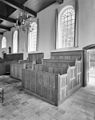
 INTERIEUR, HERENBANK - IJhorst - 20296946 - RCE.jpg 948 × 1,200; 204 KB
-
 INTERIEUR, ORGEL - IJhorst - 20296949 - RCE.jpg 1,200 × 952; 190 KB
-
 INTERIEUR, OVERZICHT HERENBANKEN - IJhorst - 20296947 - RCE.jpg 950 × 1,200; 216 KB
-
 INTERIEUR, OVERZICHT HERENBANKEN - IJhorst - 20296948 - RCE.jpg 947 × 1,200; 198 KB
-
 INTERIEUR, OVERZICHT NAAR HET OOSTEN - IJhorst - 20296944 - RCE.jpg 1,200 × 950; 206 KB
-
 INTERIEUR, OVERZICHT NAAR HET WESTEN - IJhorst - 20296943 - RCE.jpg 1,200 × 943; 225 KB
-
 INTERIEUR, OVERZICHT ORGEL - IJhorst - 20296950 - RCE.jpg 952 × 1,200; 194 KB
-
 INTERIEUR, OVERZICHT ZERKENVLOER - IJhorst - 20296945 - RCE.jpg 1,200 × 951; 256 KB
-
 INTERIEUR, PLATTEGROND TEKENING (1790), GRAFZERKEN - IJhorst - 20296941 - RCE.jpg 1,200 × 1,197; 296 KB
-
 INTERIEUR, PREEKSTOEL - IJhorst - 20296951 - RCE.jpg 954 × 1,200; 180 KB
-
 INTERIEUR, PREEKSTOEL, LEZENAAR (EIKEN), DETAIL - IJhorst - 20296952 - RCE.jpg 1,200 × 1,200; 359 KB
-
 INTERIEUR, TEKENING BANKENPLAN (1790) - IJhorst - 20296942 - RCE.jpg 1,197 × 1,200; 262 KB
-
 Kerk IJhorst.jpg 1,024 × 768; 808 KB
-
 Preekstoel - IJhorst - 20119216 - RCE.jpg 960 × 1,200; 175 KB


,_GRAFZERKEN_-_IJhorst_-_20296941_-_RCE.jpg)

,_DETAIL_-_IJhorst_-_20296952_-_RCE.jpg)
_-_IJhorst_-_20296942_-_RCE.jpg)
