Category:Newton Poppleford and Harpford
Jump to navigation
Jump to search
civil parish in East Devon, Devon, England | |||||
| Upload media | |||||
| Instance of | |||||
|---|---|---|---|---|---|
| Location | East Devon, Devon, South West England, England | ||||
| Population |
| ||||
| Area |
| ||||
 | |||||
Subcategories
This category has the following 4 subcategories, out of 4 total.
H
N
V
Media in category "Newton Poppleford and Harpford"
The following 200 files are in this category, out of 400 total.
(previous page) (next page)-
 A blocked off field entrance off Passaford Lane - geograph.org.uk - 6123510.jpg 1,600 × 1,200; 1.09 MB
-
 A fold in the hills - geograph.org.uk - 6604379.jpg 1,024 × 768; 126 KB
-
 A footpath at Southerton - geograph.org.uk - 2161804.jpg 1,024 × 768; 352 KB
-
 A long time since the last service - geograph.org.uk - 6604395.jpg 1,024 × 768; 163 KB
-
 A quiet East Devon junction - geograph.org.uk - 3329842.jpg 1,024 × 768; 271 KB
-
 A shelter,sheltered - geograph.org.uk - 1518600.jpg 640 × 480; 97 KB
-
 A3052 passing The Cannon Inn - geograph.org.uk - 5253994.jpg 640 × 426; 62 KB
-
 A3052, Four Elms Hill - geograph.org.uk - 5253988.jpg 640 × 426; 99 KB
-
 A3052, Harperford Hill Plantation - geograph.org.uk - 5253999.jpg 640 × 328; 98 KB
-
 A3052, Harperford Hill Plantation - geograph.org.uk - 5254001.jpg 640 × 426; 117 KB
-
 A3052, Newton Poppleford - geograph.org.uk - 5253991.jpg 640 × 426; 70 KB
-
 A3052, westbound - geograph.org.uk - 5254006.jpg 640 × 426; 98 KB
-
 An open field of grain, Metcombe - geograph.org.uk - 4929222.jpg 1,600 × 1,200; 322 KB
-
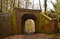 Arch Bridge on Disused Railway near Bowd, Devon - geograph.org.uk - 5734334.jpg 2,400 × 1,590; 3.11 MB
-
 Ashtree Farm - geograph.org.uk - 2435587.jpg 800 × 600; 480 KB
-
 Ashtree Farm - geograph.org.uk - 3045432.jpg 640 × 457; 98 KB
-
 Ashtree Farm - geograph.org.uk - 5977493.jpg 1,024 × 768; 142 KB
-
 Ashtree Farmhouse (2021-08-14) 08.jpg 5,568 × 3,712; 19.97 MB
-
 Ashtree Farmhouse (2021-08-14) 10.jpg 5,568 × 3,712; 16.38 MB
-
 Autumn colour on Goosemoor - geograph.org.uk - 2174778.jpg 640 × 480; 243 KB
-
 Autumn on Littledown Lane - geograph.org.uk - 5975622.jpg 1,024 × 768; 274 KB
-
 Back Brook - geograph.org.uk - 1690060.jpg 640 × 480; 241 KB
-
 Back Brook - geograph.org.uk - 3040221.jpg 480 × 640; 130 KB
-
 Back Lane Cross - geograph.org.uk - 2161748.jpg 1,024 × 768; 264 KB
-
 Badge of Newton Poppleford ^ Harpford Parish Council - geograph.org.uk - 4929293.jpg 1,600 × 1,200; 268 KB
-
 Badgers Hill - geograph.org.uk - 5975505.jpg 1,024 × 768; 193 KB
-
 Barley near Newton Poppleford - geograph.org.uk - 3040467.jpg 640 × 480; 100 KB
-
 Barn at Ashtree Farm (2021-08-14) 09.jpg 5,061 × 3,374; 17.17 MB
-
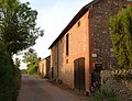 Barn, Pitson Farm - geograph.org.uk - 3045449.jpg 640 × 489; 91 KB
-
 Barton Mews, Venn Ottery - geograph.org.uk - 1867374.jpg 1,024 × 768; 128 KB
-

-
 Blackhill Quarry, Venn Ottery - geograph.org.uk - 3230347.jpg 1,024 × 768; 229 KB
-
 Bracken and trees on Harpford Common - geograph.org.uk - 5282823.jpg 1,600 × 1,200; 854 KB
-
 Bridge End - geograph.org.uk - 1370398.jpg 640 × 455; 91 KB
-
 Bridge End - geograph.org.uk - 3045654.jpg 640 × 480; 93 KB
-
 Bridge End - geograph.org.uk - 5977719.jpg 1,024 × 773; 232 KB
-
 Bridge over former Budleigh Salterton Railway - geograph.org.uk - 5977512.jpg 1,024 × 768; 312 KB
-

-
 Bridge over River Otter - geograph.org.uk - 2174817.jpg 640 × 480; 237 KB
-
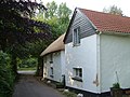
 Bridgend House - geograph.org.uk - 3045669.jpg 640 × 480; 90 KB
-
 Bridle path near Venn Ottery - geograph.org.uk - 3230327.jpg 1,024 × 768; 327 KB
-

-
 Broken gate into a field at Stoneyford - geograph.org.uk - 1596913.jpg 640 × 480; 208 KB
-
 Brooklands Cross - geograph.org.uk - 2163325.jpg 1,024 × 768; 302 KB
-
 Brooklands Cross Nursery - geograph.org.uk - 2163337.jpg 1,024 × 768; 220 KB
-
 Bungalow overlooking River Otter - geograph.org.uk - 2366509.jpg 800 × 600; 473 KB
-
 Burrow Corner - geograph.org.uk - 2161764.jpg 1,024 × 768; 203 KB
-
 Burrow lane - geograph.org.uk - 1690166.jpg 640 × 480; 213 KB
-
 Bus stop and shelter, Newton Poppleford - geograph.org.uk - 3987290.jpg 1,536 × 1,152; 1.36 MB
-

-
 Calm Lane - geograph.org.uk - 3045464.jpg 640 × 480; 152 KB
-
 Centre of Burrow - geograph.org.uk - 1690161.jpg 640 × 480; 241 KB
-
 Change of use - geograph.org.uk - 1519979.jpg 640 × 480; 67 KB
-

-

-
 Cottages on Littledown Lane, near Stoneyford - geograph.org.uk - 5975605.jpg 1,024 × 774; 145 KB
-
 Country road just south of Ashtree Farm - geograph.org.uk - 2435591.jpg 600 × 800; 451 KB
-
 Court Barn and Badgers Hill - geograph.org.uk - 2161796.jpg 640 × 480; 141 KB
-
 Court Place, Harpford - geograph.org.uk - 5977733.jpg 1,024 × 768; 156 KB
-
 Cream Tea - geograph.org.uk - 2465110.jpg 640 × 480; 91 KB
-
-
 Dead oak tree on footpath near Burrow, Devon - geograph.org.uk - 2122950.jpg 681 × 1,024; 194 KB
-
 Disused petrol pump - geograph.org.uk - 1458117.jpg 640 × 480; 74 KB
-

-
 Dog-walking area - geograph.org.uk - 1690068.jpg 640 × 480; 230 KB
-
 East Devon , Ashtree Farm - geograph.org.uk - 5388618.jpg 6,000 × 4,000; 4.89 MB
-
 East Devon , Cattle Grazing - geograph.org.uk - 5388578.jpg 6,000 × 4,000; 7.73 MB
-
 East Devon , Cattle Grazing - geograph.org.uk - 5388579.jpg 6,000 × 4,000; 5.57 MB
-
 East Devon , Country Lane - geograph.org.uk - 5388597.jpg 6,000 × 4,000; 7.72 MB
-
 East Devon , Country Lane - geograph.org.uk - 5388598.jpg 6,000 × 4,000; 6.9 MB
-
 East Devon , Country Lane - geograph.org.uk - 5388600.jpg 6,000 × 4,000; 6.09 MB
-
 East Devon , Country Lane - geograph.org.uk - 5388606.jpg 6,000 × 4,000; 6.19 MB
-
 East Devon , Country Lane - geograph.org.uk - 5388609.jpg 6,000 × 4,000; 6.96 MB
-
 East Devon , Country Lane - geograph.org.uk - 5388613.jpg 6,000 × 4,000; 5.97 MB
-
 East Devon , Country Lane - geograph.org.uk - 5388619.jpg 6,000 × 4,000; 7.43 MB
-
 East Devon , Country lane - geograph.org.uk - 5388629.jpg 6,000 × 4,000; 5.91 MB
-
 East Devon , Countryside Scenery - geograph.org.uk - 5388516.jpg 6,000 × 4,000; 6.15 MB
-
 East Devon , Countryside Scenery - geograph.org.uk - 5388623.jpg 6,000 × 4,000; 6.03 MB
-
 East Devon , Countryside Scenery - geograph.org.uk - 5388625.jpg 6,000 × 4,000; 6.02 MB
-
 East Devon , Countryside Scenery - geograph.org.uk - 5388626.jpg 6,000 × 4,000; 7.54 MB
-
 East Devon , Countryside Scenery - geograph.org.uk - 5388651.jpg 6,000 × 4,000; 7.34 MB
-
 East Devon , Countryside Scenery - geograph.org.uk - 5388654.jpg 6,000 × 4,000; 7.09 MB
-
 East Devon , Farm Track - geograph.org.uk - 5388614.jpg 6,000 × 4,000; 5.64 MB
-
 East Devon , Footbridge - geograph.org.uk - 5388583.jpg 6,000 × 4,000; 6.21 MB
-
 East Devon , Footpath - geograph.org.uk - 5388662.jpg 4,000 × 6,000; 6.97 MB
-
 East Devon , Footpath - geograph.org.uk - 5388663.jpg 6,000 × 4,000; 7 MB
-
 East Devon , Footpath - geograph.org.uk - 5388664.jpg 6,000 × 4,000; 7.55 MB
-
 East Devon , Footpath - geograph.org.uk - 5388666.jpg 4,000 × 6,000; 7.4 MB
-
 East Devon , Footpath - geograph.org.uk - 5388668.jpg 6,000 × 4,000; 6.7 MB
-
 East Devon , Footpath - geograph.org.uk - 5388669.jpg 6,000 × 4,000; 6.19 MB
-
 East Devon , Grassy Field - geograph.org.uk - 5388501.jpg 6,000 × 4,000; 6.39 MB
-
 East Devon , Grassy Field - geograph.org.uk - 5388570.jpg 6,000 × 4,000; 7.69 MB
-
 East Devon , Grassy Field - geograph.org.uk - 5388604.jpg 6,000 × 4,000; 5.45 MB
-
 East Devon , Grassy Field - geograph.org.uk - 5388608.jpg 6,000 × 4,000; 5.43 MB
-
 East Devon , Grassy Field - geograph.org.uk - 5388617.jpg 6,000 × 4,000; 6.02 MB
-
 East Devon , Grassy Field - geograph.org.uk - 5388649.jpg 6,000 × 4,000; 7.33 MB
-
 East Devon , Grassy Field - geograph.org.uk - 5388655.jpg 6,000 × 4,000; 6.61 MB
-
 East Devon , Grassy Field - geograph.org.uk - 5642548.jpg 6,000 × 4,000; 7.64 MB
-
 East Devon , Grassy Field - geograph.org.uk - 5642549.jpg 6,000 × 4,000; 6.93 MB
-
 East Devon , Grassy Field - geograph.org.uk - 5642551.jpg 6,000 × 4,000; 6.55 MB
-
 East Devon , Grassy Field - geograph.org.uk - 5642552.jpg 6,000 × 4,000; 5.72 MB
-
 East Devon , Grassy Path - geograph.org.uk - 5388511.jpg 6,000 × 4,000; 5.06 MB
-
 East Devon , Grassy Path - geograph.org.uk - 5388569.jpg 6,000 × 4,000; 5.49 MB
-
 East Devon , Houghton Lane - geograph.org.uk - 5388622.jpg 6,000 × 4,000; 5.74 MB
-
 East Devon , Otterton Hill Plantation - geograph.org.uk - 5388659.jpg 6,000 × 4,000; 6.39 MB
-
 East Devon , Passaford Lane - geograph.org.uk - 5388631.jpg 6,000 × 4,000; 6.46 MB
-
 East Devon , Passaford Lane - geograph.org.uk - 5388641.jpg 6,000 × 4,000; 6.62 MB
-
 East Devon , Passaford Lane - geograph.org.uk - 5388642.jpg 6,000 × 4,000; 6.46 MB
-
 East Devon , Passaford Lane - geograph.org.uk - 5388645.jpg 6,000 × 4,000; 6.69 MB
-
 East Devon , Passaford Lane - geograph.org.uk - 5388647.jpg 6,000 × 4,000; 6.99 MB
-
 East Devon , Passaford Lane - geograph.org.uk - 5388652.jpg 4,000 × 6,000; 6.28 MB
-
 East Devon , Passaford Lane - geograph.org.uk - 5388657.jpg 6,000 × 4,000; 7.35 MB
-
 East Devon , River Otter - geograph.org.uk - 5388504.jpg 6,000 × 4,000; 5.89 MB
-
 East Devon , River Otter - geograph.org.uk - 5388505.jpg 6,000 × 4,000; 7.34 MB
-
 East Devon , River Otter - geograph.org.uk - 5388512.jpg 6,000 × 4,000; 6.64 MB
-
 East Devon , River Otter - geograph.org.uk - 5388514.jpg 6,000 × 4,000; 7.62 MB
-
 East Devon , River Otter - geograph.org.uk - 5388573.jpg 6,000 × 4,000; 7.33 MB
-
 East Devon , River Otter - geograph.org.uk - 5388574.jpg 6,000 × 4,000; 5.57 MB
-
 East Devon , River Otter - geograph.org.uk - 5388577.jpg 6,000 × 4,000; 6.62 MB
-
 East Devon , River Otter - geograph.org.uk - 5388580.jpg 6,000 × 4,000; 6.47 MB
-
 East Devon , River Otter - geograph.org.uk - 5388582.jpg 6,000 × 4,000; 6.04 MB
-
 East Devon , River Otter - geograph.org.uk - 5388585.jpg 6,000 × 4,000; 6.31 MB
-
 East Devon , Smiths Farmhouse - geograph.org.uk - 5388603.jpg 5,471 × 3,647; 6.66 MB
-
 East Devon , Sog's Lane - geograph.org.uk - 5642550.jpg 6,000 × 4,000; 5.86 MB
-

-
 East Devon Way entering Harpford Wood - geograph.org.uk - 2401677.jpg 800 × 600; 544 KB
-
 East Devon Way in Harpford Wood - geograph.org.uk - 2401688.jpg 800 × 600; 554 KB
-
 East Devon Way on Harpford Common in the rain - geograph.org.uk - 5285886.jpg 1,200 × 1,600; 904 KB
-
 East Devon Way passing under a bridge - geograph.org.uk - 2401685.jpg 600 × 800; 499 KB
-
 East Hill Pride - geograph.org.uk - 2435728.jpg 800 × 600; 458 KB
-
 East Hill Pride Farm Shop - geograph.org.uk - 5978987.jpg 1,024 × 776; 205 KB
-
 Electric sub station - geograph.org.uk - 1463454.jpg 640 × 480; 74 KB
-

-
 Equestrian facility, Harpford Common - geograph.org.uk - 1130228.jpg 640 × 480; 113 KB
-
 Fallen tree across woodland path - geograph.org.uk - 6123497.jpg 1,200 × 1,600; 1.07 MB
-
 Fallen tree by River Otter near Harpford - geograph.org.uk - 4929244.jpg 1,600 × 1,200; 453 KB
-

-
 Farmland above Metcombe - geograph.org.uk - 2613654.jpg 640 × 425; 63 KB
-
 Farmland near Newton Poppleford - geograph.org.uk - 5975616.jpg 1,024 × 768; 136 KB
-
 Field and Gate - geograph.org.uk - 1286018.jpg 640 × 480; 154 KB
-
 Field by the River Otter - geograph.org.uk - 1069906.jpg 640 × 480; 86 KB
-
 Field near Pine Lodge - geograph.org.uk - 2613768.jpg 640 × 457; 72 KB
-
 Field near Stoneyford - geograph.org.uk - 4827461.jpg 2,048 × 1,382; 672 KB
-
-
 First drops of 2010 - geograph.org.uk - 1690137.jpg 640 × 480; 308 KB
-
-
 Football match on Newton Poppleford recreation ground - geograph.org.uk - 4929255.jpg 1,600 × 1,200; 377 KB
-
 Footbridge and ford on Harpford Common - geograph.org.uk - 5282826.jpg 1,600 × 1,200; 843 KB
-
 Footbridge for the East Devon Way - geograph.org.uk - 2366547.jpg 800 × 600; 464 KB
-
 Footbridge over River Otter at Dotton - geograph.org.uk - 5285897.jpg 1,600 × 1,200; 697 KB
-
 Footbridge over the River Otter - geograph.org.uk - 2164986.jpg 1,024 × 768; 319 KB
-
 Footbridge over the River Otter - geograph.org.uk - 2329897.jpg 800 × 600; 426 KB
-
 Footbridge, on Harpford Common - geograph.org.uk - 1130217.jpg 640 × 480; 132 KB
-
-
 Footpath beside the River Otter - geograph.org.uk - 2310193.jpg 800 × 600; 499 KB
-
 Footpath by Back Brook, Newton Poppleford - geograph.org.uk - 4929264.jpg 1,600 × 1,200; 565 KB
-

-
 Footpath from Southerton to Venn Ottery - geograph.org.uk - 2310162.jpg 800 × 600; 526 KB
-

-
 Footpath No.16 at Brooklands - geograph.org.uk - 2164963.jpg 1,024 × 768; 329 KB
-
 Footpath north from Back Lane - geograph.org.uk - 1690104.jpg 640 × 480; 227 KB
-
 Footpath off the A3052 - geograph.org.uk - 3329801.jpg 640 × 480; 120 KB
-
 Footpath on Back Lane - geograph.org.uk - 2161742.jpg 640 × 480; 130 KB
-
 Footpath on the East Devon Way - geograph.org.uk - 2165105.jpg 1,024 × 768; 432 KB
-
 Footpath sign at Joneys Cross - geograph.org.uk - 2046045.jpg 800 × 600; 107 KB
-
 Footpath to Harpford wood and the Bowd. - geograph.org.uk - 2165010.jpg 1,024 × 768; 299 KB
-
 Footpath to Newton Poppleford - geograph.org.uk - 4669994.jpg 1,024 × 768; 204 KB
-
 Ford at Newton Poppleford - geograph.org.uk - 3692131.jpg 3,872 × 2,592; 1.25 MB
-
 Ford, on Harpford Common - geograph.org.uk - 1130208.jpg 640 × 480; 149 KB
-
 Former pump in the main street of Newton Poppleford - geograph.org.uk - 3987288.jpg 1,536 × 1,152; 1.13 MB
-
 Former railway bridge over farm track - geograph.org.uk - 2899986.jpg 600 × 800; 497 KB
-
 Four Elms Hill - geograph.org.uk - 2465137.jpg 640 × 480; 143 KB
-
 Four Elms Hill - geograph.org.uk - 2465142.jpg 640 × 480; 173 KB
-
 Fresh plaster and paint - geograph.org.uk - 3353995.jpg 1,024 × 768; 200 KB
-
 Gate and track near Benchams - geograph.org.uk - 5285883.jpg 1,600 × 1,200; 1,010 KB
-
 Gate on track on Harpford Common - geograph.org.uk - 5282815.jpg 1,600 × 1,200; 833 KB
-

-
 Gateway leading onto Venn Ottery Common - geograph.org.uk - 1618858.jpg 640 × 480; 101 KB
-
 Gateway, Kitts Lane - geograph.org.uk - 5977535.jpg 1,024 × 756; 351 KB
-
 Getting ready to run - geograph.org.uk - 2046059.jpg 800 × 600; 112 KB
-
 Go left for Venn Ottery - geograph.org.uk - 4986403.jpg 640 × 479; 87 KB
-
 Grave slab, Newton Poppleford - geograph.org.uk - 3620023.jpg 480 × 640; 140 KB
-
 Green, Burrow - geograph.org.uk - 3040195.jpg 640 × 458; 80 KB
-
 Harpford , Leat Bridge - geograph.org.uk - 5388594.jpg 6,000 × 4,000; 6.31 MB
-
 Harpford , Lower Way - geograph.org.uk - 5388587.jpg 6,000 × 4,000; 7.54 MB
-
 Harpford , Lower Way - geograph.org.uk - 5388589.jpg 6,000 × 4,000; 7.56 MB
-
 Harpford , Lower Way - geograph.org.uk - 5388590.jpg 6,000 × 4,000; 6.3 MB
-
 Harpford , Lower Way - geograph.org.uk - 5388591.jpg 6,000 × 4,000; 6.2 MB
-
 Harpford , Lower Way - geograph.org.uk - 5388593.jpg 6,000 × 4,000; 6.37 MB
-
 Harpford , The A3052 - geograph.org.uk - 5388595.jpg 6,000 × 4,000; 7.29 MB
-
 Harpford , The A3052 - geograph.org.uk - 5388596.jpg 6,000 × 4,000; 6.91 MB
-
 Harpford Bridge over River Otter - geograph.org.uk - 4929251.jpg 1,600 × 1,200; 406 KB
-
 Harpford Common - geograph.org.uk - 1130287.jpg 640 × 480; 78 KB
-
 Harpford from bank of River Otter - geograph.org.uk - 4929249.jpg 1,600 × 1,200; 500 KB
-
 Harpford Wood - geograph.org.uk - 2465149.jpg 640 × 480; 178 KB
-
 Having seen better days - geograph.org.uk - 1520594.jpg 640 × 480; 59 KB
-
 Hayne Hill - geograph.org.uk - 2665306.jpg 640 × 480; 93 KB
-
 Heathland Track - geograph.org.uk - 972777.jpg 640 × 480; 101 KB
-
 High Street, Newton Poppleford - geograph.org.uk - 3620088.jpg 640 × 458; 67 KB
-
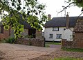
 Houghton Farm - geograph.org.uk - 2435598.jpg 800 × 600; 385 KB


_08.jpg)
_10.jpg)


_09.jpg)


