Category:Newton, Hampton Court
Jump to navigation
Jump to search
settlement and civil parish near Leominster, Herefordshire, England, UK  | |||||
| Upload media | |||||
| Instance of | |||||
|---|---|---|---|---|---|
| Location | Herefordshire, West Midlands, England | ||||
 | |||||
Subcategories
This category has the following 2 subcategories, out of 2 total.
M
- Marlbrook, Herefordshire (5 F)
O
Media in category "Newton, Hampton Court"
The following 50 files are in this category, out of 50 total.
-
 Newton, Hampton Court Herefordshire, OS Map Sheet 198 - Hereford (Hills) 1898.jpg 1,221 × 870; 1.36 MB
-
 A49 bridge over Marl Brook - geograph.org.uk - 4455338.jpg 1,600 × 1,200; 1.46 MB
-
 Approaching the Marlbrook roundabout - geograph.org.uk - 4785485.jpg 1,600 × 901; 610 KB
-
 B4361 Hereford Road - geograph.org.uk - 4785457.jpg 1,600 × 901; 706 KB
-
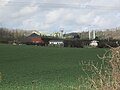
 Cadbury Factory (Marlbrook) - geograph.org.uk - 5742879.jpg 3,648 × 2,432; 4.18 MB
-
 Cadbury Factory (Viewed from Hope-Under-Dinmore ^ Marlbrook) - geograph.org.uk - 5727132.jpg 3,264 × 2,448; 1.99 MB
-

-
 Cadbury Factory - geograph.org.uk - 6215054.jpg 2,931 × 1,511; 1.77 MB
-
 Cadbury's factory at Marlbrook - geograph.org.uk - 3938915.jpg 3,872 × 2,592; 4.08 MB
-
 Cadbury's factory at Marlbrook - geograph.org.uk - 4785479.jpg 1,600 × 901; 636 KB
-
 Cadbury's Factory, Marlbrook - geograph.org.uk - 2334129.jpg 640 × 480; 46 KB
-
 Cadbury's, Marlbrook - geograph.org.uk - 4057935.jpg 800 × 600; 482 KB
-
 Cider to the left - geograph.org.uk - 866067.jpg 640 × 480; 80 KB
-
 Cold Oak Farm, 1 - geograph.org.uk - 4792512.jpg 1,600 × 901; 763 KB
-
 Cold Oak Farm, 2 - geograph.org.uk - 4792515.jpg 1,600 × 901; 604 KB
-
 Cold Oak Farm, 3 - geograph.org.uk - 4792516.jpg 1,600 × 901; 753 KB
-
 Cold Oak Lane - geograph.org.uk - 4792508.jpg 1,600 × 1,200; 960 KB
-
 Cold Oak viewed from the south - geograph.org.uk - 336169.jpg 640 × 426; 158 KB
-
 Derelict buildings at Marlbrook - geograph.org.uk - 3938908.jpg 3,872 × 2,592; 4.62 MB
-
 Entrance to Ford Bridge - geograph.org.uk - 3240530.jpg 640 × 480; 56 KB
-
 Field with haylage bales - geograph.org.uk - 4785444.jpg 1,600 × 901; 677 KB
-
 Footpath and drive to Hill House - geograph.org.uk - 4792510.jpg 1,600 × 1,200; 969 KB
-
 Ford Bridge village boundary signs - geograph.org.uk - 2956692.jpg 640 × 480; 30 KB
-
 Gated Fields near Newton - geograph.org.uk - 6215465.jpg 4,128 × 2,006; 3.28 MB
-

-
 Hereford Road (B4361) - geograph.org.uk - 6313872.jpg 800 × 600; 96 KB
-
 Hilltop pasture - geograph.org.uk - 3274718.jpg 640 × 480; 250 KB
-
 Lane to Newton and Cold Oak - geograph.org.uk - 3938889.jpg 2,592 × 3,872; 4.76 MB
-
 Leominster Golf Course - geograph.org.uk - 3001894.jpg 2,592 × 1,944; 1.76 MB
-
 Mistletoe, Newton - geograph.org.uk - 3274720.jpg 640 × 416; 261 KB
-
 More derelict buildings - geograph.org.uk - 3938911.jpg 3,872 × 2,592; 4.1 MB
-
 Newton - footpath toward Dinmore - geograph.org.uk - 866075.jpg 640 × 480; 122 KB
-
 Newton - Hill House and the lane - geograph.org.uk - 866077.jpg 640 × 480; 95 KB
-
 Newton - Lane to Cold Oak Farm - geograph.org.uk - 168174.jpg 640 × 480; 106 KB
-
 Newton Court Cider Farm Buildings - geograph.org.uk - 6213529.jpg 4,128 × 2,006; 3.59 MB
-
 Oak tree south of Upper Newton - geograph.org.uk - 4792517.jpg 1,600 × 901; 656 KB
-
 Old A49, Marlbrook - geograph.org.uk - 3938918.jpg 3,872 × 2,592; 4.14 MB
-

-
 Pasture land west of Cold Oak, 1 - geograph.org.uk - 4792519.jpg 1,600 × 901; 736 KB
-
 Pasture land west of Cold Oak, 2 - geograph.org.uk - 4792521.jpg 1,600 × 901; 730 KB
-
 Removed hedge, Newton - geograph.org.uk - 3274722.jpg 640 × 480; 277 KB
-
 Rolling countryside near Cold Oak - geograph.org.uk - 866071.jpg 640 × 480; 96 KB
-
 Sheep in pasture near Upper Newton - geograph.org.uk - 4792518.jpg 1,600 × 1,200; 1.46 MB
-
 Sign for cider - geograph.org.uk - 4785448.jpg 1,600 × 901; 718 KB
-
 The Lane from Newton - geograph.org.uk - 6215466.jpg 2,006 × 2,097; 2.27 MB
-
 The lane to Newton - geograph.org.uk - 866062.jpg 640 × 480; 89 KB
-
 Toward Hope under Dinmore - geograph.org.uk - 866072.jpg 640 × 480; 82 KB
-
 Transfer station, Marlbrook - geograph.org.uk - 3273894.jpg 640 × 480; 285 KB
-
 Tree on a Hill - geograph.org.uk - 151316.jpg 640 × 480; 82 KB
-
 Valley of the Marl Brook - geograph.org.uk - 1365553.jpg 640 × 480; 154 KB
_1898.jpg)


_-_geograph.org.uk_-_5742879.jpg)
_-_geograph.org.uk_-_5727132.jpg)
_-_geograph.org.uk_-_5727194.jpg)


_-_geograph.org.uk_-_6313872.jpg)


