Category:Newsholme, Lancashire
Jump to navigation
Jump to search
English: Newsholme is a small village and civil parish in the Ribble Valley, Lancashire, England, and is situated on the A682 road near the boundary with North Yorkshire. Between 1872 and 1957 the village had a railway station on the Ribble Valley Line. (→Newsholme, Lancashire)
Nederlands: Newsholme is een plaats en civil parish in het bestuurlijke gebied Ribble Valley, in het Engelse graafschap Lancashire met 50 inwoners. (→Newsholme)
Polski: Newsholme – wieś w Anglii, w hrabstwie Lancashire, w dystrykcie Ribble Valley. Leży 55 km na północ od miasta Manchester i 307 km na północny zachód od Londynu. W 2001 miejscowość liczyła 50 mieszkańców. (→Newsholme (Lancashire))
village and civil parish in Lancashire, UK  | |||||
| Upload media | |||||
| Instance of | |||||
|---|---|---|---|---|---|
| Location | Ribble Valley, Lancashire, North West England, England | ||||
| Population |
| ||||
 | |||||
Media in category "Newsholme, Lancashire"
The following 49 files are in this category, out of 49 total.
-
 66525 at Newsholme.jpg 1,800 × 2,400; 1.17 MB
-
 A copse - geograph.org.uk - 3564202.jpg 4,592 × 2,706; 5.05 MB
-
 A line of trees - geograph.org.uk - 3564243.jpg 4,592 × 3,056; 6.74 MB
-
 A View over the Ribble Valley - geograph.org.uk - 2656832.jpg 4,320 × 3,240; 5.09 MB
-
 A682 looking north - geograph.org.uk - 3337958.jpg 640 × 480; 48 KB
-
 A682 near Demesne Farm - geograph.org.uk - 5872104.jpg 640 × 480; 83 KB
-
 A682 near Harpers Farm - geograph.org.uk - 3293530.jpg 640 × 480; 149 KB
-
 A682 near Hull's Delf - geograph.org.uk - 3293531.jpg 640 × 480; 163 KB
-
 A682 near Slack - geograph.org.uk - 5872090.jpg 640 × 480; 98 KB
-
 A682 near Slack Farm - geograph.org.uk - 3293535.jpg 640 × 480; 201 KB
-
 A682 towards Burnley - geograph.org.uk - 5872622.jpg 640 × 480; 106 KB
-
 A682, Newsholme - geograph.org.uk - 5872092.jpg 640 × 480; 92 KB
-
 Cereal crop near Slack - geograph.org.uk - 5872089.jpg 640 × 480; 68 KB
-
 Demesne Farm - geograph.org.uk - 5872100.jpg 640 × 480; 71 KB
-
 Demesne Farm Outbuildings (geograph 2657571).jpg 4,320 × 3,240; 3.07 MB
-
 Farm land - geograph.org.uk - 3571424.jpg 4,205 × 2,560; 6.61 MB
-
 Farm track, Castle Haugh Hill - geograph.org.uk - 5872108.jpg 640 × 480; 72 KB
-
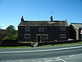 Farmhouse at Newsholme - geograph.org.uk - 164807.jpg 640 × 480; 229 KB
-

-
 Grassland, Newsholme - geograph.org.uk - 5872091.jpg 640 × 480; 103 KB
-

-
 Grazing Middle Breaks Hill - geograph.org.uk - 5872114.jpg 640 × 480; 65 KB
-
 Grazing, Newsholme - geograph.org.uk - 5872095.jpg 640 × 480; 67 KB
-
 Knot Lane - geograph.org.uk - 2657588.jpg 4,320 × 3,240; 5.31 MB
-
 Knot Lane - geograph.org.uk - 3165337.jpg 640 × 480; 218 KB
-
 Knot lane - geograph.org.uk - 4128748.jpg 1,024 × 710; 196 KB
-
 Looking down to the Ribble (geograph 2630492).jpg 640 × 480; 115 KB
-
 Neps Lane at Paythorne Bridge - geograph.org.uk - 3337961.jpg 640 × 480; 87 KB
-
 Pasture west of Painley Farm - geograph.org.uk - 1193273.jpg 640 × 480; 65 KB
-
 Paythorne Bridge - geograph.org.uk - 3141752.jpg 2,048 × 1,536; 728 KB
-
 Paythorne Bridge - geograph.org.uk - 4635121.jpg 4,073 × 2,888; 7.86 MB
-
 Paythorne Bridge - geograph.org.uk - 927834.jpg 640 × 480; 103 KB
-
 Pennine Bridleway approaching Castle Haugh from the north (geograph 3141755).jpg 2,048 × 1,536; 458 KB
-

-
 Railway bridge, Newsholme - geograph.org.uk - 4128753.jpg 800 × 598; 85 KB
-
 Ribble Way near Paythorne Bridge - geograph.org.uk - 2201995.jpg 640 × 481; 112 KB
-
 River Ribble, Paythorne - geograph.org.uk - 2202030.jpg 640 × 480; 88 KB
-
 Rivet benchmark on a milestone north of Gisburn - geograph.org.uk - 3141765.jpg 2,048 × 1,536; 513 KB
-
 Road to Slack Farm - geograph.org.uk - 3293533.jpg 640 × 480; 161 KB
-
 Road to Stankas Hall Farm - geograph.org.uk - 3293529.jpg 640 × 480; 168 KB
-
 Station House and railway bridge at Newsholme (geograph 3165339).jpg 640 × 480; 127 KB
-
 The path to Pit Hill - geograph.org.uk - 4638213.jpg 4,309 × 2,444; 7.65 MB
-
 The track to Low Laithe - geograph.org.uk - 4635055.jpg 4,352 × 2,846; 7.91 MB
-
 Under The Bridge.jpg 3,990 × 2,821; 6.94 MB
-
 Culvert or Bridge - geograph.org.uk - 182479.jpg 640 × 480; 164 KB
-
 Gateway - geograph.org.uk - 164806.jpg 640 × 480; 194 KB
-
 Low Laithe - geograph.org.uk - 182471.jpg 640 × 480; 228 KB
-
 Middle Breaks Hill - geograph.org.uk - 123663.jpg 640 × 480; 88 KB
-
 Newsholme Railway Bridge - geograph.org.uk - 83937.jpg 640 × 480; 95 KB


.jpg)


.jpg)


.jpg)


.jpg)


