Category:Newick
Jump to navigation
Jump to search
village in United Kingdom  | |||||
| Upload media | |||||
| Instance of | |||||
|---|---|---|---|---|---|
| Location | Lewes, East Sussex, South East England, England | ||||
| Population |
| ||||
| Area |
| ||||
| Said to be the same as | Newick (Wikimedia duplicated page, civil parish) | ||||
 | |||||
English: Newick is a village and civil parish in the Lewes District of East Sussex, England. It is located on the A272 road six miles (9.6 km) east of Haywards Heath.
Nederlands: Newick is een plaats en civil parish in het bestuurlijke gebied Lewes, in het Engelse graafschap East Sussex met 2.343 inwoners.
Polski: Newick – wieś w Anglii, w hrabstwie East Sussex, w dystrykcie Lewes. Leży 60 km na południe od Londynu[2]. W 2007 miejscowość liczyła 2343 mieszkańców.
Subcategories
This category has the following 9 subcategories, out of 9 total.
Media in category "Newick"
The following 200 files are in this category, out of 268 total.
(previous page) (next page)-
 A clear flowing River Ouse - geograph.org.uk - 2611453.jpg 4,000 × 3,000; 3.34 MB
-

-

-
 A row of garages, Cricketfield - geograph.org.uk - 1955857.jpg 640 × 422; 76 KB
-
 A272 (High St), Newick - geograph.org.uk - 1953264.jpg 640 × 430; 163 KB
-
 A272 - geograph.org.uk - 5226417.jpg 640 × 356; 63 KB
-
 A272, Newick - geograph.org.uk - 5226407.jpg 640 × 426; 67 KB
-
 A272, Newick - geograph.org.uk - 5226411.jpg 640 × 390; 46 KB
-
 A275 through Sheffield Park - geograph.org.uk - 1982088.jpg 1,024 × 768; 170 KB
-
 Acorns, Newick - geograph.org.uk - 985139.jpg 640 × 480; 74 KB
-
 Alexander Mead off Cricketfield - geograph.org.uk - 1955861.jpg 640 × 430; 114 KB
-
 An entrance to the dairy by the A275 - geograph.org.uk - 1957765.jpg 640 × 430; 143 KB
-
 Ancient Oak on pond edge near Double Barns Farm - geograph.org.uk - 2609918.jpg 4,000 × 3,000; 3.43 MB
-
 Ants' Nest, Rotherfield Wood - geograph.org.uk - 1956017.jpg 640 × 430; 207 KB
-
 Approaching twilight in Newick - geograph.org.uk - 5571448.jpg 4,000 × 3,000; 2.43 MB
-
 Barn by the footpath, Newick - geograph.org.uk - 1955869.jpg 640 × 430; 125 KB
-
 Beechlands, Chailey Lane - geograph.org.uk - 4682931.jpg 640 × 480; 126 KB
-
 Beechlands, Newick.jpg 421 × 301; 38 KB
-
 Bluebells by the Sussex Ouse Valley Way - geograph.org.uk - 1956030.jpg 640 × 430; 204 KB
-
 Bradness Gallery Open Garden.jpg 3,631 × 2,253; 8.57 MB
-
 Bridge, Jackies Lane - geograph.org.uk - 2257919.jpg 640 × 480; 168 KB
-
 Bridleway south to The Warren - geograph.org.uk - 1952971.jpg 640 × 430; 197 KB
-
 Brook Mead - geograph.org.uk - 2284306.jpg 640 × 480; 91 KB
-
 Broomlye Cottages - geograph.org.uk - 2283628.jpg 640 × 481; 89 KB
-
 Cattle by the River Ouse - geograph.org.uk - 1956054.jpg 640 × 430; 157 KB
-
 Chailey Lane - geograph.org.uk - 1982099.jpg 1,024 × 768; 223 KB
-
 Chailey Lane, south of Newick - geograph.org.uk - 2755050.jpg 1,600 × 1,193; 642 KB
-
 Church Road rising from Founthill - geograph.org.uk - 2609679.jpg 4,000 × 3,000; 3.63 MB
-
 Church Road-Allington Road Junction - geograph.org.uk - 1097213.jpg 600 × 450; 64 KB
-
 Climbing Newick Hill - geograph.org.uk - 1953225.jpg 640 × 430; 179 KB
-
 Coney Hall - geograph.org.uk - 2284265.jpg 640 × 480; 62 KB
-
 Coppiced fence, Rotherfield Wood - geograph.org.uk - 1956027.jpg 640 × 430; 201 KB
-

-

-
 Coppiced trees, Newick Hill - geograph.org.uk - 1955899.jpg 640 × 430; 203 KB
-
 Cottage near Newick Park - geograph.org.uk - 5570774.jpg 1,024 × 547; 95 KB
-
 Cottage on The Green (A272) - geograph.org.uk - 1955775.jpg 640 × 430; 137 KB
-
 Cottages on the Village Green, Newick - geograph.org.uk - 1953285.jpg 640 × 430; 146 KB
-
 Cottages, The Green, Newick - geograph.org.uk - 4290900.jpg 1,600 × 872; 233 KB
-
 Cow and calf, Fletching Common - geograph.org.uk - 1953111.jpg 640 × 430; 137 KB
-
 Cricket Field off Newick Hill - geograph.org.uk - 1953235.jpg 640 × 430; 173 KB
-
 Cricket Field, Newick - geograph.org.uk - 1953238.jpg 640 × 430; 130 KB
-
 Daffodils by Schoolhouse Farm - geograph.org.uk - 2284759.jpg 3,648 × 2,432; 5.46 MB
-
 Descending Newick Hill - geograph.org.uk - 1955882.jpg 640 × 430; 162 KB
-
 Double Barns Farm - geograph.org.uk - 5570764.jpg 1,024 × 589; 124 KB
-

-
 East along Chailey Lane - geograph.org.uk - 2609455.jpg 4,000 × 3,000; 3.51 MB
-
 Entering Newick - geograph.org.uk - 1953071.jpg 640 × 430; 165 KB
-
 Entrance to Little Warren Farm - geograph.org.uk - 1953067.jpg 640 × 430; 185 KB
-
 Entrance to New Barn Farm - geograph.org.uk - 2609471.jpg 4,000 × 3,000; 3.19 MB
-

-
 Farmland on the edge of Fletching Common - geograph.org.uk - 1953129.jpg 640 × 430; 123 KB
-
 Field East of Newick - geograph.org.uk - 2624016.jpg 1,600 × 890; 391 KB
-
 Field of Rapeseed near Newick - geograph.org.uk - 4638265.jpg 640 × 480; 108 KB
-
 Fields by Goldbridge Road, Newick - geograph.org.uk - 4899686.jpg 2,048 × 1,536; 1.01 MB
-
 Fields near Broomy Shaw - geograph.org.uk - 2623996.jpg 1,600 × 1,200; 648 KB
-
 Five Acre Field - geograph.org.uk - 2284284.jpg 640 × 480; 85 KB
-
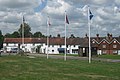 Flags at Newick Green - geograph.org.uk - 1403068.jpg 640 × 427; 75 KB
-
 Footbridge over the River Ouse near Sharpsbridge - geograph.org.uk - 2611447.jpg 4,000 × 3,000; 3.62 MB
-
 Footbridge, Goldbridge wood - geograph.org.uk - 2750614.jpg 3,072 × 2,048; 4.39 MB
-
 Footbridge, River Ouse - geograph.org.uk - 2284300.jpg 480 × 640; 123 KB
-
 Footpath across Fletching Common - geograph.org.uk - 1953147.jpg 640 × 430; 206 KB
-
 Footpath across Fletching Common - geograph.org.uk - 1953158.jpg 640 × 430; 208 KB
-
 Footpath across Fletching Common - geograph.org.uk - 1953169.jpg 640 × 430; 208 KB
-

-
 Footpath junction above Mill Wood - geograph.org.uk - 3467027.jpg 2,800 × 1,867; 2.46 MB
-
 Footpath off Cricketfield - geograph.org.uk - 1955864.jpg 640 × 430; 170 KB
-
 Footpath off Newick Hill - geograph.org.uk - 1953228.jpg 640 × 430; 179 KB
-
 Footpath sign on Jackies Lane - geograph.org.uk - 1953178.jpg 640 × 430; 178 KB
-
 Footpath sign on Sharpsbridge Lane - geograph.org.uk - 2610193.jpg 4,000 × 3,000; 3.36 MB
-
 Footpath signpost, Newick Hill - geograph.org.uk - 1953196.jpg 640 × 430; 201 KB
-
 Footpath to Newick Hill - geograph.org.uk - 1955872.jpg 640 × 430; 148 KB
-
 Footpath to Newick Hill - geograph.org.uk - 1955874.jpg 640 × 430; 181 KB
-
 Forest Lodge, Mill Lane - geograph.org.uk - 1955975.jpg 640 × 430; 171 KB
-
 George VI postbox at lane junction - geograph.org.uk - 2609433.jpg 4,000 × 3,000; 3.46 MB
-
 Glasshouse, Plants4presents - geograph.org.uk - 1953099.jpg 640 × 430; 140 KB
-
 Glasshouses, plants4presents - geograph.org.uk - 1953100.jpg 640 × 430; 142 KB
-
 Going up Newick Hill - geograph.org.uk - 1953216.jpg 640 × 430; 196 KB
-
 Gold Bridge near Newick - geograph.org.uk - 2606943.jpg 4,000 × 3,000; 3.48 MB
-
 Goldbridge Road, Newick - geograph.org.uk - 4899685.jpg 2,048 × 1,536; 1.07 MB
-
 Hilly Field - geograph.org.uk - 2284267.jpg 640 × 480; 74 KB
-
 House on Chailey Lane - geograph.org.uk - 1982114.jpg 1,024 × 683; 235 KB
-
 House on Church Rd - geograph.org.uk - 1955770.jpg 640 × 430; 138 KB
-
 House on High Street, Newick - geograph.org.uk - 4896716.jpg 2,304 × 1,728; 833 KB
-
 Houses and shops by Newick Green - geograph.org.uk - 2624071.jpg 1,600 × 1,200; 440 KB
-
 Houses at Founthill - geograph.org.uk - 2609659.jpg 4,000 × 3,000; 3.47 MB
-
 Houses at Founthill - geograph.org.uk - 5571096.jpg 1,024 × 613; 211 KB
-
 Houses on Alexander Mead - geograph.org.uk - 1955856.jpg 640 × 430; 131 KB
-
 Houses on The Green - geograph.org.uk - 1999992.jpg 1,024 × 768; 190 KB
-
 Jackie's Lane - geograph.org.uk - 1955895.jpg 640 × 430; 137 KB
-
 Jackies Lane - geograph.org.uk - 1747977.jpg 640 × 428; 142 KB
-
 Jackies Lane, southwestwards - geograph.org.uk - 1953173.jpg 640 × 430; 194 KB
-
 Junction between Mill Lane and Newick Hill - geograph.org.uk - 2615812.jpg 4,000 × 3,000; 3.3 MB
-
 Keyhole stile in hedge near Sharpsbridge Farm - geograph.org.uk - 2610210.jpg 4,000 × 3,000; 3.47 MB
-
 Lane across Lane End Common - geograph.org.uk - 1953083.jpg 640 × 430; 180 KB
-
 Lane at Founthill - geograph.org.uk - 5571293.jpg 1,024 × 591; 201 KB
-

-
 Leaving the field - geograph.org.uk - 5571075.jpg 1,024 × 562; 190 KB
-
 Lewes Bonfire, Newick BS banner.jpg 767 × 1,151; 152 KB
-
 Lichen on Tree Stump - geograph.org.uk - 2284801.jpg 3,342 × 2,221; 3.54 MB
-
 Link road from Chailey Lane to Church Road - geograph.org.uk - 2609635.jpg 4,000 × 3,000; 3.33 MB
-
 Little Warren Farm - geograph.org.uk - 2256072.jpg 640 × 480; 114 KB
-
 Lodge house at the entrance to Newick Park Hotel - geograph.org.uk - 2609933.jpg 4,000 × 3,000; 3.54 MB
-
 Lodge Pond on Newick Park estate - geograph.org.uk - 2293352.jpg 4,000 × 3,000; 3.4 MB
-
 Looking westwards in Church Lane - geograph.org.uk - 2885897.jpg 640 × 480; 102 KB
-
 Lower Meadow - geograph.org.uk - 2284294.jpg 640 × 480; 70 KB
-
 Maize near Goldbridge Wood - geograph.org.uk - 2624084.jpg 1,600 × 1,200; 727 KB
-
 Marbles, Newick - geograph.org.uk - 1953271.jpg 640 × 430; 147 KB
-
 Markstakes Lane - geograph.org.uk - 5571300.jpg 1,024 × 539; 128 KB
-
-

-
 Mill Lane - geograph.org.uk - 1955978.jpg 640 × 430; 157 KB
-
 Mill Wood - geograph.org.uk - 3467038.jpg 2,800 × 1,867; 2.11 MB
-
 Near Beechland - geograph.org.uk - 5571302.jpg 1,024 × 536; 168 KB
-
 Near Oxbottom - geograph.org.uk - 1097190.jpg 600 × 400; 145 KB
-
 Newick - The Green - geograph.org.uk - 1750158.jpg 640 × 425; 56 KB
-
 Newick Church nearby barn.JPG 3,160 × 2,302; 1.92 MB
-
 Newick Community Centre - geograph.org.uk - 1955804.jpg 640 × 430; 136 KB
-
 Newick High Street - geograph.org.uk - 4899693.jpg 2,048 × 1,536; 1.24 MB
-
 Newick Hill - geograph.org.uk - 1953231.jpg 640 × 430; 171 KB
-
 Newick Hill - geograph.org.uk - 1955892.jpg 640 × 430; 158 KB
-
 Newick Hill - geograph.org.uk - 1955918.jpg 640 × 430; 188 KB
-
 Newick Hill - geograph.org.uk - 1955932.jpg 640 × 430; 145 KB
-
 Newick Hill nearing the Jackies Lane turnoff - geograph.org.uk - 2614813.jpg 4,000 × 3,000; 3.81 MB
-
 Newick Hill north of Newick - geograph.org.uk - 1955926.jpg 640 × 430; 140 KB
-
 Newick Hill north of Newick - geograph.org.uk - 1955929.jpg 640 × 430; 134 KB
-
 Newick Lodge (geograph 6757318).jpg 1,024 × 684; 194 KB
-
 Newick Park - geograph.org.uk - 5895748.jpg 1,024 × 685; 217 KB
-
 Newick Post Office - geograph.org.uk - 1107627.jpg 600 × 450; 110 KB
-
 Newick Sewage Works - geograph.org.uk - 1107633.jpg 600 × 450; 146 KB
-
 Newick Village Green - geograph.org.uk - 1097599.jpg 600 × 400; 161 KB
-
 Newick Village Green - geograph.org.uk - 1097616.jpg 600 × 450; 178 KB
-
 Newick village green.jpg 4,608 × 3,456; 4.28 MB
-
 Newick village green.JPG 4,608 × 3,456; 4.85 MB
-
 Newick Village Hall - geograph.org.uk - 1107646.jpg 600 × 450; 119 KB
-
 Newick Village Hall - geograph.org.uk - 4899689.jpg 2,048 × 1,536; 1.5 MB
-
 Newick Village Pump - geograph.org.uk - 1072055.jpg 640 × 480; 99 KB
-
 Newick, Alexander Mead - geograph.org.uk - 1106925.jpg 600 × 404; 55 KB
-
 Newick, Alexander Mead - geograph.org.uk - 1106943.jpg 600 × 413; 69 KB
-
 Newick, Cricketfield - geograph.org.uk - 1107635.jpg 600 × 450; 97 KB
-
 Newick, North Lodge - geograph.org.uk - 1107639.jpg 600 × 450; 121 KB
-
 Newick, Reading Room - geograph.org.uk - 1097166.jpg 600 × 400; 143 KB
-
 Newick, St Mary - geograph.org.uk - 6368758.jpg 4,000 × 3,000; 4.76 MB
-
 Newick, The Rough - geograph.org.uk - 1097144.jpg 600 × 400; 133 KB
-
 Nine Acres - geograph.org.uk - 2284288.jpg 640 × 480; 98 KB
-
 North Lodge, Newick - geograph.org.uk - 1095648.jpg 600 × 411; 75 KB
-
 Nursery Fletching Common - geograph.org.uk - 2615823.jpg 4,000 × 3,000; 3.36 MB
-
 Oak Tree Cottage - geograph.org.uk - 5571106.jpg 985 × 1,024; 268 KB
-
 Oast house at Broomlye - geograph.org.uk - 2610152.jpg 4,000 × 3,000; 3.1 MB
-

-

-

-

-

-

-
 Old Direction Sign - Signpost on Spithurst Road - geograph.org.uk - 6072727.jpg 685 × 1,024; 146 KB
-

-
 Path, Lane End Common - geograph.org.uk - 2256000.jpg 480 × 640; 162 KB
-
 Philanias, Cottage Bakery, Newick - geograph.org.uk - 1955751.jpg 640 × 430; 145 KB
-
 Plants 4 presents, Fletching Common - geograph.org.uk - 1953094.jpg 640 × 430; 184 KB
-
 Pond near Double Barns Farm - geograph.org.uk - 5570778.jpg 1,024 × 574; 199 KB
-
 Pylon in Sharps Farm - geograph.org.uk - 2623985.jpg 1,600 × 1,200; 552 KB
-
 Pylon, Rotherfield Wood - geograph.org.uk - 1956012.jpg 430 × 640; 139 KB
-
 Railway Carriage, Oxbottom - geograph.org.uk - 1097179.jpg 600 × 400; 152 KB
-
 Railway Cottages - geograph.org.uk - 1957749.jpg 640 × 430; 148 KB
-

-
 Railway cottages, Sheffield Park - geograph.org.uk - 3399461.jpg 1,024 × 768; 206 KB
-
 Rear of North Lodge, Newick - geograph.org.uk - 1095641.jpg 600 × 400; 60 KB
-
 Ridgeland Bridge on Markskates Lane - geograph.org.uk - 2293376.jpg 4,000 × 3,000; 3.49 MB
-
 Ridgeland Farm - geograph.org.uk - 5894911.jpg 1,024 × 685; 270 KB
-
 Ridgelands Bridge - geograph.org.uk - 2121276.jpg 640 × 480; 107 KB
-
 Ridgelands Lane junction with Chailey Lane - geograph.org.uk - 2609621.jpg 4,000 × 3,000; 3.45 MB
-
 River Ouse (Sussex) - geograph.org.uk - 1957733.jpg 640 × 430; 180 KB
-
 River Ouse - geograph.org.uk - 1956049.jpg 640 × 430; 143 KB
-

-

-
 Road ahead closed - geograph.org.uk - 2997028.jpg 640 × 480; 89 KB
-
 Road Junction beside Rotherfield Wood - geograph.org.uk - 5564102.jpg 1,024 × 628; 145 KB
-
 Road Junction near Founthill - geograph.org.uk - 5571297.jpg 1,024 × 595; 205 KB
-
 Road Junction near Schoolhouse Farm - geograph.org.uk - 2284750.jpg 3,648 × 2,432; 5.35 MB
-
 Road junction south of Newick - geograph.org.uk - 2755056.jpg 1,600 × 1,163; 397 KB
-
 Road junction south of Newick with road sign - geograph.org.uk - 2755061.jpg 1,600 × 1,200; 652 KB
-
 Road sign, Newick - geograph.org.uk - 1955756.jpg 640 × 430; 163 KB
-
 Roadside tree in Newick - geograph.org.uk - 5571449.jpg 3,000 × 4,000; 2.34 MB
-
 Rotherfield Wood - geograph.org.uk - 1955991.jpg 640 × 430; 187 KB
-
 Rotherfield Wood - geograph.org.uk - 1955995.jpg 640 × 430; 186 KB
-
 Rotherfield Wood - geograph.org.uk - 1955999.jpg 640 × 430; 204 KB
-
 Sharp's Farm - geograph.org.uk - 2284272.jpg 640 × 480; 80 KB
-
 Sharpsbridge House (geograph 6757086).jpg 1,024 × 685; 198 KB
-
 Sharpsbridge Lane towards Sharps Bridge - geograph.org.uk - 2610188.jpg 4,000 × 3,000; 3.36 MB
-
 Sharp’s Bridge - geograph.org.uk - 5778927.jpg 1,600 × 1,080; 768 KB
-
 Sheepgate Farm - geograph.org.uk - 3467046.jpg 2,800 × 1,867; 1.08 MB
-
 Sheepgate Fruit Farm - geograph.org.uk - 5571405.jpg 1,024 × 536; 126 KB
-
-
 Silver car on Newick village green - geograph.org.uk - 2516917.jpg 1,600 × 1,200; 313 KB
-
 Spithurst Road NE to Piltdown - geograph.org.uk - 2610170.jpg 4,000 × 3,000; 3.52 MB
-
 Start of footpath to Newick - geograph.org.uk - 1748000.jpg 640 × 428; 150 KB
-

-
 Stream and pond, Newick - geograph.org.uk - 1748004.jpg 640 × 428; 169 KB
-
 Street scene, Newick - geograph.org.uk - 985082.jpg 640 × 480; 79 KB


,_Newick_-_geograph.org.uk_-_1953264.jpg)


_-_geograph.org.uk_-_1955775.jpg)


_-_geograph.org.uk_-_1957748.jpg)


.jpg)


_-_geograph.org.uk_-_1957733.jpg)


.jpg)


