Category:Newhall, Cheshire
Jump to navigation
Jump to search
English: Newhall is a village and a civil parish in Cheshire. The parish includes the village of Aston and the small settlements of Aston Heath, Barnett Brook, Brown's Bank, Dodd's Green, Grandford, Grindley Green, Hollingreen, Kingswood Green, Maiden Estate, Salesbrook, Sheppenhall and part of Sandford. Nearby villages include Audlem and Wrenbury.
village and civil parish in Cheshire, United Kingdom | |||||
| Upload media | |||||
| Instance of | |||||
|---|---|---|---|---|---|
| Location | Cheshire East, Cheshire, North West England, England | ||||
| Population |
| ||||
 | |||||
Subcategories
This category has the following 2 subcategories, out of 2 total.
A
- Aston by Wrenbury (5 F)
B
- Back Coole Lane (3 F)
Media in category "Newhall, Cheshire"
The following 101 files are in this category, out of 101 total.
-
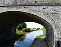
 A525 at Audlem Bridge - geograph.org.uk - 6575486.jpg 1,024 × 741; 196 KB
-
 A530, Whitchurch Road, Aston - geograph.org.uk - 6173250.jpg 800 × 600; 884 KB
-
 Aston Cemetery - geograph.org.uk - 338405.jpg 480 × 640; 163 KB
-
 Audlem, icy canal, north of the village - geograph.org.uk - 2216105.jpg 1,024 × 681; 129 KB
-
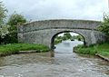
 Bennett's Bridge No 80 - geograph.org.uk - 6458431.jpg 800 × 522; 150 KB
-
 Bennett's Bridge No 80 - geograph.org.uk - 6458456.jpg 800 × 618; 155 KB
-
 Bennett's Bridge north-west of Audlem in Cheshire - geograph.org.uk - 6561668.jpg 1,280 × 960; 1.06 MB
-
 Bennett's Bridge north-west of Audlem in Cheshire - geograph.org.uk - 6561672.jpg 1,280 × 960; 1.11 MB
-
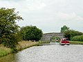
 Bennetts Bridge north of Audlem in Cheshire - geograph.org.uk - 5223423.jpg 1,280 × 890; 827 KB
-
 Brickwall Farm - geograph.org.uk - 3118157.jpg 1,200 × 676; 393 KB
-
 Bridge No 80, Shropshire Union Canal.jpg 640 × 451; 113 KB
-
 Canal and pasture north-west of Audlem, Cheshire - geograph.org.uk - 5222312.jpg 1,280 × 782; 882 KB
-
 Canal and pasture north-west of Audlem, Cheshire - geograph.org.uk - 5223411.jpg 1,280 × 960; 776 KB
-
 Canal and pasture west of Hankelow in Cheshire - geograph.org.uk - 6561693.jpg 1,600 × 900; 1.25 MB
-
 Canal north-west of Audlem in Cheshire - geograph.org.uk - 6561664.jpg 1,440 × 960; 1.15 MB
-
 Canal north-west of Audlem in Cheshire - geograph.org.uk - 6561674.jpg 1,280 × 960; 1.08 MB
-
 Canal north-west of Audlem, Cheshire - geograph.org.uk - 5223414.jpg 1,600 × 839; 733 KB
-
 Cattle by Bennetts Bridge - geograph.org.uk - 5345709.jpg 1,280 × 960; 407 KB
-
 Cattle grazing north-west of Audlem in Cheshire - geograph.org.uk - 6561686.jpg 1,280 × 960; 1.21 MB
-
 Cemetery Gate - geograph.org.uk - 4561635.jpg 1,200 × 900; 414 KB
-
 Cheshire farmland north-west of Audlem - geograph.org.uk - 6561680.jpg 1,440 × 960; 1.38 MB
-
 Cheshire farmland north-west of Audlem - geograph.org.uk - 6561684.jpg 1,280 × 1,280; 1.63 MB
-
 Cheshire farmland north-west of Audlem - geograph.org.uk - 6569728.jpg 1,440 × 960; 1.83 MB
-
 Cheshire pasture land - geograph.org.uk - 3139029.jpg 1,200 × 676; 404 KB
-
 Coole Lane at Brickwall Farm - geograph.org.uk - 2679223.jpg 640 × 457; 112 KB
-
 Coole Lane at Brickwall Farm - geograph.org.uk - 6457785.jpg 800 × 505; 127 KB
-
 Coole Lane at Manor Cottage - geograph.org.uk - 6575478.jpg 1,024 × 768; 195 KB
-
 Coole Lane at Manor Farm - geograph.org.uk - 2679224.jpg 640 × 480; 152 KB
-
 Coole Lane end at Brown's Bank - geograph.org.uk - 6575483.jpg 1,024 × 811; 189 KB
-
 Coole Lane near Pinnacle Farm - geograph.org.uk - 6575476.jpg 1,024 × 741; 204 KB
-

-
 Derelict cottages - geograph.org.uk - 5115537.jpg 640 × 425; 61 KB
-
 Derelict Cottages - geograph.org.uk - 6140370.jpg 1,024 × 768; 228 KB
-
 Derelict Cottages - geograph.org.uk - 6140379.jpg 1,024 × 768; 357 KB
-
 Derelict Cottages - geograph.org.uk - 6140382.jpg 1,024 × 768; 244 KB
-
 Derelict Cottages - geograph.org.uk - 6140384.jpg 1,024 × 768; 246 KB
-
 Derelict Cottages - geograph.org.uk - 6140389.jpg 1,024 × 768; 361 KB
-
 Derelict Cottages - geograph.org.uk - 6140394.jpg 1,024 × 768; 307 KB
-
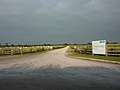
 Entrance to Newhall (geograph 3215747).jpg 640 × 451; 36 KB
-
 Entrance to the OverWater Marina - geograph.org.uk - 6458481.jpg 800 × 507; 115 KB
-

-
 Footpath and field boundary - geograph.org.uk - 795222.jpg 640 × 480; 101 KB
-
 Footpath From Bennett's Bridge - geograph.org.uk - 438272.jpg 640 × 480; 53 KB
-
 Ford on the River Weaver at Aston - geograph.org.uk - 3827297.jpg 3,872 × 2,592; 4.27 MB
-
 Great War memorial plaque - geograph.org.uk - 4564442.jpg 1,200 × 900; 438 KB
-
 Hall o' Coole Corner - geograph.org.uk - 3117038.jpg 1,200 × 676; 375 KB
-
 Headstone - geograph.org.uk - 4564430.jpg 634 × 900; 203 KB
-
 Hollin Green Farm - geograph.org.uk - 3118138.jpg 1,200 × 676; 390 KB
-
 Hollingreen Lane - geograph.org.uk - 3118142.jpg 1,200 × 676; 434 KB
-
 Impassable ford of the River Weaver - geograph.org.uk - 339212.jpg 640 × 471; 156 KB
-
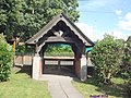
 Inside Lych gate - geograph.org.uk - 4561641.jpg 900 × 1,200; 529 KB
-
 Interior view of a cottage - geograph.org.uk - 5115545.jpg 640 × 480; 83 KB
-
 Interior view of a cottage - geograph.org.uk - 5115554.jpg 640 × 480; 66 KB
-
 Interior view of a cottage - geograph.org.uk - 5115571.jpg 640 × 480; 96 KB
-
 Marina entrance north-west of Audlem in Cheshire - geograph.org.uk - 6581727.jpg 1,280 × 1,280; 1.45 MB
-
 Marina entrance north-west of Audlem in Cheshire - geograph.org.uk - 6581743.jpg 1,280 × 960; 1.16 MB
-

-

-
 Over Water Marina - geograph.org.uk - 5323010.jpg 1,280 × 851; 475 KB
-
 Over Water Marina north of Audlem in Cheshire - geograph.org.uk - 5223437.jpg 1,280 × 858; 721 KB
-
 Over Water Marina north of Audlem in Cheshire - geograph.org.uk - 5223462.jpg 1,280 × 847; 682 KB
-
 OverWater Marina - geograph.org.uk - 5323000.jpg 1,280 × 851; 421 KB
-
 OverWater Marina - geograph.org.uk - 5323006.jpg 1,280 × 851; 361 KB
-
 Overwater Marina - geograph.org.uk - 5345731.jpg 960 × 960; 202 KB
-
 Overwater Marina - geograph.org.uk - 5346263.jpg 1,280 × 960; 173 KB
-
 Overwater Marina - geograph.org.uk - 5346277.jpg 1,280 × 960; 272 KB
-

-
 OverWater Marina entrance near Audlem, Cheshire - geograph.org.uk - 6561058.jpg 1,440 × 960; 1.03 MB
-

-
 OverWater Marina north-west of Audlem in Cheshire - geograph.org.uk - 6561067.jpg 1,440 × 960; 1.16 MB
-
 OverWater Marina north-west of Audlem in Cheshire - geograph.org.uk - 6581723.jpg 1,600 × 900; 1.33 MB
-
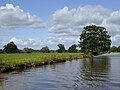
 Pasture land near the Weaver - geograph.org.uk - 3139036.jpg 1,200 × 676; 395 KB
-
 Pasture near Aston - geograph.org.uk - 1220059.jpg 640 × 417; 89 KB
-
 Pasture near Aston - geograph.org.uk - 1220087.jpg 640 × 427; 88 KB
-
 Pasture near Copthorne in Cheshire - geograph.org.uk - 6058407.jpg 1,440 × 960; 1.56 MB
-
 Pasture north-west of Audlem in Cheshire - geograph.org.uk - 5222319.jpg 1,280 × 817; 619 KB
-
 Pasture south of the River Weaver - geograph.org.uk - 1220042.jpg 640 × 406; 103 KB
-
 Pasture with a tree in Cheshire - geograph.org.uk - 6561692.jpg 1,440 × 960; 1.18 MB
-
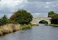
 River Weaver from Audlem Bridge in Cheshire - geograph.org.uk - 6058387.jpg 1,280 × 960; 1.89 MB
-
 River Weaver from Audlem Bridge in Cheshire - geograph.org.uk - 6058389.jpg 960 × 1,280; 1.92 MB
-
-
 Shroppie bridge 80 - geograph.org.uk - 2384810.jpg 640 × 480; 96 KB
-
-
 Shropshire Union Canal near Hankelow in Cheshire - geograph.org.uk - 6561695.jpg 1,280 × 960; 1.12 MB
-
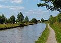
 Shropshire Union Canal north of Audlem, Cheshire - geograph.org.uk - 5223466.jpg 1,600 × 826; 1.18 MB
-

-
 Shropshire Union Canal north of Bennetts Bridge - geograph.org.uk - 5345700.jpg 1,280 × 960; 367 KB
-

-

-
-
 Shropshire Union Canal north-west of Audlem, Cheshire - geograph.org.uk - 5222330.jpg 1,024 × 1,024; 936 KB
-

-
 Shropshire Union Canal, OverWater Marina - geograph.org.uk - 5322994.jpg 1,280 × 851; 368 KB
-
 St Andrew's Lych gate - geograph.org.uk - 4564433.jpg 1,200 × 900; 446 KB
-
 The Weaver valley - geograph.org.uk - 4659582.jpg 800 × 451; 188 KB
-

-
 Very recent cut - geograph.org.uk - 3118144.jpg 1,200 × 676; 431 KB
-
 Walking over Bennetts Bridge - geograph.org.uk - 5345719.jpg 1,280 × 960; 364 KB
-
 Whitchurch Road (A530) near Aston - geograph.org.uk - 6173251.jpg 600 × 800; 885 KB
-
 Whitchurch Road approaching Oldmill Bridge - geograph.org.uk - 5545287.jpg 1,280 × 851; 412 KB
-
 Wrenbury Road, west of Aston - geograph.org.uk - 1220073.jpg 640 × 437; 117 KB


.jpg)


_-_geograph.org.uk_-_4414350.jpg)


_-_geograph.org.uk_-_5016907.jpg)


_near_Aston_-_geograph.org.uk_-_6173251.jpg)

