Category:Newenden
Jump to navigation
Jump to search
English: Newenden is a village and civil parish in the Ashford District of Kent, England. The village is located on the River Rother, four miles (6.4km) south-east of Tenterden. The humpback bridge of 1736 has recently been repaired.
village and civil parish in Kent, United Kingdom  | |||||
| Upload media | |||||
| Instance of | |||||
|---|---|---|---|---|---|
| Location | Ashford, Kent, South East England, England | ||||
| Population |
| ||||
| Area |
| ||||
 | |||||
Subcategories
This category has the following 5 subcategories, out of 5 total.
Media in category "Newenden"
The following 166 files are in this category, out of 166 total.
-
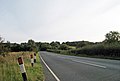
 A28 - geograph.org.uk - 3765098.jpg 640 × 430; 87 KB
-
 A28 - geograph.org.uk - 5368279.jpg 640 × 426; 71 KB
-
 A28 - geograph.org.uk - 6031706.jpg 1,024 × 681; 196 KB
-
 A28 approaching the A286 - geograph.org.uk - 4843275.jpg 640 × 426; 86 KB
-
 A28 Hastings Road - geograph.org.uk - 2449872.jpg 3,072 × 2,304; 1.92 MB
-
 A28 joins the A268 - geograph.org.uk - 2592822.jpg 3,147 × 2,134; 1.25 MB
-
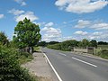
 A28 near Newenden - geograph.org.uk - 2689802.jpg 640 × 424; 86 KB
-
 A28, A268 junction - geograph.org.uk - 3765104.jpg 640 × 456; 104 KB
-
 All clear for the level crossing - geograph.org.uk - 389746.jpg 428 × 640; 376 KB
-
 Approaching the A268 - A28 junction - geograph.org.uk - 4267201.jpg 640 × 547; 104 KB
-
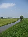
 Boat on the River Rother - geograph.org.uk - 3264910.jpg 640 × 479; 75 KB
-
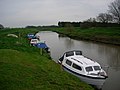
 Boats moored downstream of Newenden Bridge - geograph.org.uk - 3560336.jpg 1,024 × 768; 148 KB
-

-
 Boats on River Rother - geograph.org.uk - 1828329.jpg 1,024 × 768; 221 KB
-
 Boats on River Rother - geograph.org.uk - 1828339.jpg 1,024 × 768; 157 KB
-
 Bridge over Hexden Channel - geograph.org.uk - 451864.jpg 640 × 480; 116 KB
-
 Bridleway gate near New Barn Farm - geograph.org.uk - 1877125.jpg 3,072 × 2,304; 1.77 MB
-
 Bridleway gate on Loosenham Lane - geograph.org.uk - 1876865.jpg 3,072 × 2,304; 2.15 MB
-
 Bridleway to Loosenham Manor - geograph.org.uk - 1876848.jpg 3,072 × 2,304; 2.71 MB
-
 Bungalow on Lossenham Lane - geograph.org.uk - 1911239.jpg 1,024 × 768; 280 KB
-
 Bungalow on Lossenham Lane - geograph.org.uk - 1911241.jpg 1,024 × 768; 218 KB
-
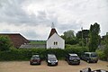
 Church of St Peter - geograph.org.uk - 4843270.jpg 640 × 426; 87 KB
-
 Cricket match at Newenden - geograph.org.uk - 6247262.jpg 4,608 × 3,456; 1.46 MB
-
 Crop Field at Frogs Hill - geograph.org.uk - 2088732.jpg 640 × 320; 45 KB
-
 Dead tree and stubble field - geograph.org.uk - 2583765.jpg 2,256 × 1,496; 900 KB
-
 Digger near Frogs Hill - geograph.org.uk - 5373771.jpg 4,000 × 3,000; 4.82 MB
-
 Drain in Rother Valley, near Newenden - geograph.org.uk - 2583756.jpg 2,256 × 1,496; 925 KB
-
 Dredging The Rother - geograph.org.uk - 2588389.jpg 3,968 × 2,232; 1.59 MB
-
 Dyke at Newenden, Kent - geograph.org.uk - 1051611.jpg 640 × 427; 106 KB
-
 Dyke heading towards the River Rother - geograph.org.uk - 1875256.jpg 3,072 × 2,304; 2.32 MB
-
 Dyke near New Barn Farmhouse - geograph.org.uk - 1877132.jpg 3,072 × 2,304; 1.79 MB
-
 Dyke near Newenden - geograph.org.uk - 1875368.jpg 2,304 × 3,072; 2.62 MB
-
 Entering Kent, A28 - geograph.org.uk - 4843261.jpg 640 × 426; 100 KB
-
 Farm road to Loosenham Farm - geograph.org.uk - 1876875.jpg 3,072 × 2,304; 1.81 MB
-
 Farmland north-west of New Barn Farmhouse - geograph.org.uk - 3559141.jpg 1,024 × 768; 174 KB
-
 Farmland west of Hexden Channel - geograph.org.uk - 3559137.jpg 1,024 × 768; 143 KB
-
 Farmland with drainage ditches, Rother Levels - geograph.org.uk - 3559144.jpg 1,024 × 768; 162 KB
-
 Field gateway on to main road. - geograph.org.uk - 451793.jpg 640 × 480; 159 KB
-
 Field of Oilseed Rape at Newenden - geograph.org.uk - 1828395.jpg 1,024 × 683; 213 KB
-
 Field of Sheep off Hastings Road - geograph.org.uk - 2451629.jpg 640 × 259; 54 KB
-
 Fields by Newenden Bridge - geograph.org.uk - 3931420.jpg 2,298 × 1,658; 1.15 MB
-
 Footbridge near Hexden Channel - geograph.org.uk - 2450933.jpg 3,072 × 2,304; 2.55 MB
-
 Footbridge near Newenden - geograph.org.uk - 1875363.jpg 3,072 × 2,304; 2.43 MB
-
 Footpath and bridleway junction near River Rother - geograph.org.uk - 1876897.jpg 3,072 × 2,304; 1.97 MB
-
 Footpath down to Newenden - geograph.org.uk - 2450950.jpg 3,072 × 2,304; 1.99 MB
-
 Footpath junction near Castle Toll - geograph.org.uk - 1876932.jpg 3,072 × 2,304; 3.03 MB
-
 Footpath on Frog's Hill - geograph.org.uk - 2450948.jpg 3,072 × 2,304; 2.43 MB
-
 Footpath to Newenden - geograph.org.uk - 2583771.jpg 2,256 × 1,496; 898 KB
-
 Footpath to Newenden near Frog's Hill - geograph.org.uk - 2450942.jpg 3,072 × 2,304; 1.67 MB
-
 Footpath towards Castle Toll - geograph.org.uk - 1876911.jpg 3,072 × 2,304; 2.49 MB
-
 Footpath towards Hexden Bridge (2) - geograph.org.uk - 1876839.jpg 3,072 × 2,304; 2.56 MB
-
 Footpath towards Hexden Bridge - geograph.org.uk - 1876837.jpg 3,072 × 2,304; 2.6 MB
-
 Footpath up Frogs Hill - geograph.org.uk - 1876844.jpg 3,072 × 2,304; 2.62 MB
-
 Frenchurst Farm - geograph.org.uk - 5826115.jpg 5,184 × 3,456; 6.85 MB
-
 Hastings Road, near Newenden, Kent - geograph.org.uk - 964016.jpg 640 × 430; 53 KB
-
 Hexden Bridge - geograph.org.uk - 2449864.jpg 3,072 × 2,304; 2.04 MB
-
 Hexden Channel - geograph.org.uk - 2088721.jpg 15,425 × 2,200; 6.9 MB
-
 Hexden Channel - geograph.org.uk - 2449856.jpg 3,072 × 2,304; 2.19 MB
-
 Hexden Channel - geograph.org.uk - 3559134.jpg 1,024 × 768; 132 KB
-
 Hexden Channel - geograph.org.uk - 388875.jpg 640 × 479; 121 KB
-
 Hexden Channel - geograph.org.uk - 4125993.jpg 4,000 × 3,000; 4.07 MB
-
 Hexden channel from Hexden bridge - geograph.org.uk - 2689805.jpg 2,256 × 1,496; 744 KB
-
 Hexden Channel, near Newenden, Kent - geograph.org.uk - 900356.jpg 480 × 640; 65 KB
-
 Hexden Channel, near Newenden, Kent - geograph.org.uk - 900362.jpg 640 × 427; 49 KB
-
 Houses in Newenden - geograph.org.uk - 4125386.jpg 4,000 × 3,000; 4.37 MB
-
 Information board on Loosenham Farm Country Walk - geograph.org.uk - 1876939.jpg 1,954 × 2,613; 1.01 MB
-
 Kent and East Sussex Railway - geograph.org.uk - 388902.jpg 640 × 465; 120 KB
-
 Kent and East Sussex Railway - geograph.org.uk - 5373722.jpg 4,000 × 3,000; 4.08 MB
-
 Kent and East Sussex Railway - geograph.org.uk - 5373728.jpg 4,000 × 3,000; 3.34 MB
-
 Kent and East Sussex Railway heading towards Northiam - geograph.org.uk - 1876996.jpg 3,072 × 2,304; 3.11 MB
-
 Kent and East Sussex Railway heading towards Wittersham Road - geograph.org.uk - 1876984.jpg 3,072 × 2,304; 2.43 MB
-
 Kent and East Sussex Railway in Oil Seed Rape Fields - geograph.org.uk - 1875297.jpg 3,072 × 1,728; 1.75 MB
-
 Knelle Pumping Station - geograph.org.uk - 2583740.jpg 2,256 × 1,496; 805 KB
-
 Knelle Pumping Station on the River Rother - geograph.org.uk - 1877022.jpg 3,072 × 2,304; 1.68 MB
-
 Lane junction - geograph.org.uk - 891909.jpg 640 × 480; 205 KB
-
 Loosenham Farm road - geograph.org.uk - 1876906.jpg 3,072 × 2,304; 2.26 MB
-
 Lossenham Lane - geograph.org.uk - 6031704.jpg 1,024 × 681; 147 KB
-
 Lower Lamberden Cottage - geograph.org.uk - 5826112.jpg 5,184 × 3,456; 3.82 MB
-
 New Barn Farmhouse - geograph.org.uk - 1877128.jpg 3,072 × 2,304; 1.75 MB
-
 1960's Barn - geograph.org.uk - 451770.jpg 640 × 480; 107 KB
-
 Newenden Village Sign (close-up) - geograph.org.uk - 1875392.jpg 2,304 × 3,072; 1.47 MB
-
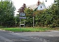
 Newenden Village Sign - geograph.org.uk - 1875375.jpg 3,072 × 2,304; 2.63 MB
-
 Newenden Village sign - geograph.org.uk - 3660184.jpg 1,106 × 1,661; 374 KB
-
 Newenden War Memorial - geograph.org.uk - 4125360.jpg 4,000 × 3,000; 4.16 MB
-
 Newenden War Memorial - geograph.org.uk - 6031705.jpg 1,024 × 681; 199 KB
-
 Newenden, Kent ^ East Sussex Railway - geograph.org.uk - 3226659.jpg 3,648 × 2,736; 1.87 MB
-
 Newenden, Kent ^ East Sussex Railway - geograph.org.uk - 3226660.jpg 3,648 × 2,736; 1.76 MB
-
 Newenden, Kent ^ East Sussex Railway - geograph.org.uk - 3226663.jpg 3,648 × 2,736; 1.34 MB
-
 Newenden, Kent ^ East Sussex Railway - geograph.org.uk - 3226664.jpg 3,648 × 2,736; 1.93 MB
-
 Newenden, Kent ^ East Sussex Railway - geograph.org.uk - 3226665.jpg 3,648 × 2,736; 2.81 MB
-
 Newenden, the A262 to Hawkhurst. - geograph.org.uk - 171253.jpg 640 × 480; 112 KB
-
 Newenden- intersection A268-A28. - geograph.org.uk - 170737.jpg 640 × 480; 158 KB
-
 Newenden-Hill House-horses. - geograph.org.uk - 170735.jpg 640 × 480; 79 KB
-
 Newenden-River Rother. - geograph.org.uk - 170739.jpg 640 × 480; 74 KB
-

-
 Pastures beside Hexden Channel - geograph.org.uk - 451871.jpg 640 × 480; 100 KB
-
 Permissive path near Castle Toll - geograph.org.uk - 1876949.jpg 2,533 × 2,304; 2.49 MB
-
 Pond near Castle Toll - geograph.org.uk - 1082378.jpg 640 × 427; 95 KB
-
 Public Bridleway beside River Rother, Kent - geograph.org.uk - 2518612.jpg 1,600 × 991; 373 KB
-
 River Rother - geograph.org.uk - 1876889.jpg 3,072 × 2,304; 2.02 MB
-
 River Rother - geograph.org.uk - 388920.jpg 640 × 479; 160 KB
-
 River Rother - geograph.org.uk - 5368281.jpg 640 × 425; 74 KB
-
 River Rother - geograph.org.uk - 5373724.jpg 4,000 × 3,000; 3.28 MB
-
 River Rother - geograph.org.uk - 5381430.jpg 640 × 426; 52 KB
-
 River Rother - geograph.org.uk - 6529208.jpg 1,024 × 684; 116 KB
-
 River Rother and Fields near Newenden - geograph.org.uk - 978624.jpg 640 × 427; 77 KB
-
 River Rother at Newenden - geograph.org.uk - 1505147.jpg 640 × 430; 114 KB
-
 River Rother at Newenden - geograph.org.uk - 1828353.jpg 1,024 × 683; 155 KB
-
 River Rother at Newenden - geograph.org.uk - 388942.jpg 640 × 479; 131 KB
-
 River Rother at Newenden Bridge - geograph.org.uk - 4267196.jpg 640 × 430; 35 KB
-

-
 River Rother near Knelle Pumping Station - geograph.org.uk - 2583734.jpg 2,256 × 1,496; 901 KB
-
 River Rother near Loosenham Manor - geograph.org.uk - 1876967.jpg 3,072 × 2,304; 2.1 MB
-
 River Rother near Newenden - geograph.org.uk - 5373715.jpg 4,000 × 3,000; 3.18 MB
-
 River Rother near Newenden - geograph.org.uk - 5373717.jpg 4,000 × 3,000; 3.28 MB
-
 River Rother near Newenden - geograph.org.uk - 5373719.jpg 4,000 × 3,000; 4.16 MB
-
 River Rother near Newenden Bridge - geograph.org.uk - 1875440.jpg 3,072 × 2,304; 2 MB
-
 River Rother towards New Barn Farmhouse - geograph.org.uk - 1877122.jpg 3,072 × 2,304; 1.9 MB
-
 River Rother, county boundary - geograph.org.uk - 3560364.jpg 1,024 × 614; 86 KB
-
 River Rother, Newenden Bridge - geograph.org.uk - 4843260.jpg 640 × 424; 54 KB
-
 Sheep Farming, Maytham Wharf - geograph.org.uk - 388891.jpg 640 × 473; 142 KB
-
 Sheep in the Rother Valley, near Newenden - geograph.org.uk - 2583748.jpg 2,256 × 1,496; 909 KB
-
 Steam Train crosses the river Rother - geograph.org.uk - 2583805.jpg 1,548 × 1,021; 982 KB
-
 Stile beside a dyke near the River Rother - geograph.org.uk - 1875340.jpg 3,072 × 2,304; 2.45 MB
-
 Stile, Gate and Dyke Bridge near Newenden - geograph.org.uk - 1875353.jpg 3,072 × 2,304; 2.5 MB
-
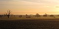 Sunrise near Newenden - geograph.org.uk - 1082381.jpg 640 × 320; 40 KB
-
 The A28 - geograph.org.uk - 3765100.jpg 640 × 430; 86 KB
-
 The Hexden Channel - geograph.org.uk - 5857141.jpg 1,024 × 678; 113 KB
-
 The Oast - geograph.org.uk - 5196558.jpg 640 × 426; 50 KB
-
 The Oast - geograph.org.uk - 5196560.jpg 640 × 398; 51 KB
-
 The Oast - geograph.org.uk - 6529211.jpg 1,024 × 684; 113 KB
-
 The Oast, Newenden - geograph.org.uk - 5381431.jpg 640 × 465; 53 KB
-
 The Old Post Office - geograph.org.uk - 1876831.jpg 3,072 × 2,304; 799 KB
-
 The River Rother, county boundary - geograph.org.uk - 3560834.jpg 1,024 × 614; 140 KB
-
 The Russians Are Coming^ - geograph.org.uk - 388947.jpg 640 × 412; 117 KB
-
 Topiary, Newenden - geograph.org.uk - 3528034.jpg 1,001 × 1,024; 410 KB
-
 Track to Brickhurst Wood - geograph.org.uk - 1877030.jpg 3,072 × 2,304; 1.85 MB
-
 Tree on a pond near Castle Toll - geograph.org.uk - 1876956.jpg 2,304 × 3,072; 2.89 MB
-
 View from Castle Toll mound - geograph.org.uk - 2583795.jpg 2,256 × 1,496; 880 KB
-
 View from Lower Lamberden Cottage - geograph.org.uk - 5826113.jpg 5,184 × 3,456; 6.93 MB
-
 View from the bridleway near Loosenham Manor - geograph.org.uk - 1876853.jpg 3,072 × 1,728; 1.16 MB
-
 View of the Hexden Channel - geograph.org.uk - 2450945.jpg 3,072 × 1,728; 1.37 MB
-
 Waiting to cross Newenden Bridge - geograph.org.uk - 3931419.jpg 2,304 × 1,728; 836 KB
-
 Water treatment works, Newenden - geograph.org.uk - 2516366.jpg 2,256 × 1,496; 891 KB
-
 Weatherboarded cottage, Newenden, Kent (2) - geograph.org.uk - 3528031.jpg 1,600 × 1,034; 547 KB
-
 Weatherboarded cottage, Newenden, Kent - geograph.org.uk - 3528029.jpg 1,600 × 1,169; 526 KB
-
 White house at Lamberden Farm - geograph.org.uk - 2516369.jpg 2,256 × 1,496; 770 KB
-

-
 Barn next to Hexden Channel - geograph.org.uk - 451857.jpg 640 × 480; 124 KB
-
 Brickhurst Wood - geograph.org.uk - 458701.jpg 640 × 480; 86 KB
-
 Bush Wall - geograph.org.uk - 388874.jpg 640 × 479; 161 KB
-
 Castle Toll - geograph.org.uk - 388935.jpg 640 × 479; 167 KB
-
 Converted barn at Heronden - geograph.org.uk - 451758.jpg 640 × 480; 113 KB
-
 Disused farm store - geograph.org.uk - 451753.jpg 640 × 480; 115 KB
-
 Drainage channel with swan - geograph.org.uk - 515751.jpg 640 × 480; 67 KB
-
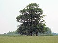 Field oaks on Hexden Farm - geograph.org.uk - 451888.jpg 640 × 480; 76 KB
-
 Footpath to Castle Toll - geograph.org.uk - 388939.jpg 640 × 475; 198 KB
-
 Hexden Channel - geograph.org.uk - 451829.jpg 640 × 480; 148 KB
-
 New Barn Farmhouse - geograph.org.uk - 388909.jpg 640 × 492; 164 KB
-
 Pair of houses, one time sanatorium^ - geograph.org.uk - 451782.jpg 640 × 480; 133 KB
-
 Rape Field Behind the White Hart Inn - geograph.org.uk - 388944.jpg 640 × 479; 252 KB
-

-
 Rother Levels near Newenden - geograph.org.uk - 388917.jpg 640 × 479; 200 KB
-
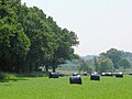 Silage bales - geograph.org.uk - 454326.jpg 640 × 480; 96 KB
-
 Track to Hexden Farm - geograph.org.uk - 451893.jpg 640 × 480; 118 KB
-
 Unnamed Sewer, Rother Levels - geograph.org.uk - 388914.jpg 640 × 479; 175 KB


_-_geograph.org.uk_-_1876839.jpg)


_-_geograph.org.uk_-_1875392.jpg)


_-_geograph.org.uk_-_3528031.jpg)


