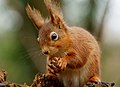
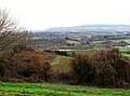
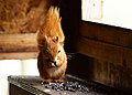
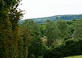
Category:Newchurch, Isle of Wight
Jump to navigation
Jump to search
village and civil parish on the Isle of Wight, in England  | |||||
| Upload media | |||||
| Instance of | |||||
|---|---|---|---|---|---|
| Location | Isle of Wight, South East England, England | ||||
| Area |
| ||||
 | |||||
English: Newchurch is a village and civil parish on the Isle of Wight. It is located between Sandown and Newport in the southeast of the island.
Subcategories
This category has the following 8 subcategories, out of 8 total.
A
- Alverstone Garden Village (8 F)
- Apse Heath Methodist Chapel (11 F)
B
- Borthwood Copse (11 F)
- Branstone, Isle of Wight (1 F)
K
- Knighton, Isle of Wight (7 F)
L
N
- Newchurch War Memorial (1 F)
Media in category "Newchurch, Isle of Wight"
The following 200 files are in this category, out of 401 total.
(previous page) (next page)-
 "And next ... another nut" - geograph.org.uk - 3868530.jpg 4,000 × 2,666; 7.31 MB
-
 "Blimey, what's that" - geograph.org.uk - 2743094.jpg 3,326 × 2,301; 4.58 MB
-
 "Come on, if you think you're hard enough" - geograph.org.uk - 3220137.jpg 4,000 × 2,666; 6.95 MB
-
 "Friends or foes" - geograph.org.uk - 4105704.jpg 5,618 × 3,745; 6.4 MB
-
 "Halt, who goes there" - geograph.org.uk - 3430543.jpg 5,588 × 3,265; 4.38 MB
-
 "Horses" - geograph.org.uk - 3504952.jpg 5,242 × 3,617; 5.69 MB
-
 "I'm not coming down" - geograph.org.uk - 3936315.jpg 4,000 × 2,666; 6.95 MB
-
 "I've picked the best nut" - geograph.org.uk - 2744870.jpg 3,096 × 3,568; 5.78 MB
-
 "Lunch" - geograph.org.uk - 2690483.jpg 3,380 × 2,411; 7.59 MB
-
 "What's down there" - geograph.org.uk - 2850839.jpg 2,699 × 2,713; 2.95 MB
-
 "Which button do I press" - geograph.org.uk - 2999124.jpg 3,333 × 2,926; 3.84 MB
-
 "Who's coming" - geograph.org.uk - 3248718.jpg 6,000 × 4,000; 6.9 MB
-
 'Decisions, decisions ...' - geograph.org.uk - 2446801.jpg 2,440 × 2,000; 3.31 MB
-
 'Grass is good^' - geograph.org.uk - 2446859.jpg 3,214 × 2,139; 7.74 MB
-
 A farm track at Chiddle's Farm - geograph.org.uk - 2652453.jpg 800 × 600; 358 KB
-
 A Favourite Perch - geograph.org.uk - 3964229.jpg 4,000 × 2,666; 6.57 MB
-
 A junction of paths, north of Alverstone - geograph.org.uk - 2652460.jpg 800 × 600; 330 KB
-
 A path off Bullys Hill (road) - geograph.org.uk - 2652482.jpg 800 × 600; 212 KB
-

-
 A Spot of Lunch - geograph.org.uk - 2743075.jpg 4,817 × 3,470; 7.04 MB
-
 A3056, Hale Common - geograph.org.uk - 5149404.jpg 640 × 480; 142 KB
-
 A3056, Newport Road - geograph.org.uk - 3763917.jpg 640 × 480; 314 KB
-
 Airborne at Alverstone - geograph.org.uk - 2726327.jpg 3,600 × 2,400; 3.84 MB
-
 Along the River Yar, Alverstone, Isle of Wight - geograph.org.uk - 2900217.jpg 3,352 × 2,230; 7.72 MB
-
 Alverstone - geograph.org.uk - 3747908.jpg 4,000 × 2,666; 7.22 MB
-
 Alverstone Bridge - geograph.org.uk - 2684311.jpg 3,264 × 2,448; 4.7 MB
-
 Alverstone Bridge, Isle of Wight - geograph.org.uk - 2450138.jpg 3,306 × 2,200; 7.57 MB
-
 Alverstone Crossing - geograph.org.uk - 2684313.jpg 3,264 × 2,448; 4.44 MB
-
 Alverstone in the Autumn - geograph.org.uk - 3747898.jpg 4,000 × 2,666; 7.2 MB
-
 Alverstone Lane, Alverstone, Isle of Wight - geograph.org.uk - 2997382.jpg 2,800 × 4,200; 6.24 MB
-
 Alverstone Lane, Alverstone, Isle of Wight - geograph.org.uk - 2997395.jpg 4,200 × 2,800; 7.13 MB
-
 Alverstone Mead Nature Reserve - geograph.org.uk - 3024487.jpg 800 × 600; 427 KB
-
 Alverstone Mead Nature Reserve - geograph.org.uk - 3868886.jpg 4,000 × 2,666; 7.42 MB
-
 Alverstone Mead Resident - geograph.org.uk - 2707156.jpg 2,088 × 1,296; 742 KB
-
 Alverstone Mead Squirrel - geograph.org.uk - 4404049.jpg 4,000 × 3,000; 7.93 MB
-
 Alverstone Mead Squirrel - geograph.org.uk - 4462658.jpg 4,000 × 2,666; 7.13 MB
-
 Alverstone Mead Squirrel - geograph.org.uk - 4462662.jpg 4,000 × 2,666; 7.72 MB
-
 Alverstone Mead Squirrel - geograph.org.uk - 4661738.jpg 5,271 × 3,514; 6.03 MB
-
 Alverstone Mead Squirrel - geograph.org.uk - 5399685.jpg 4,573 × 3,049; 6.65 MB
-
 Alverstone Mead Squirrel - geograph.org.uk - 5399697.jpg 5,293 × 3,529; 4.73 MB
-
 Alverstone Mead Squirrel - geograph.org.uk - 6130924.jpg 2,967 × 1,977; 7.62 MB
-
 Alverstone Old School Hall - geograph.org.uk - 5509671.jpg 640 × 428; 164 KB
-
 Alverstone Old School Hall, Isle of Wight - geograph.org.uk - 2900254.jpg 2,662 × 4,000; 7.65 MB
-
 Alverstone, Ashey Down - geograph.org.uk - 6302492.jpg 5,847 × 3,898; 4.62 MB
-
 Alverstone, Ashey Down - geograph.org.uk - 6302495.jpg 6,906 × 4,604; 6.7 MB
-
 Alverstone, Isle of Wight - geograph.org.uk - 2900225.jpg 3,214 × 2,139; 7.72 MB
-
 And ..... Pose^ - geograph.org.uk - 2756457.jpg 3,685 × 2,256; 7.62 MB
-
 And ..... pose^ - geograph.org.uk - 3507231.jpg 4,000 × 2,666; 6.27 MB
-
 Apse Heath (Newport Road) - geograph.org.uk - 3763901.jpg 640 × 480; 294 KB
-
 Apse Heath roundabout in the rain - geograph.org.uk - 3024491.jpg 800 × 600; 242 KB
-
 Apse Heath, Isle of Wight - geograph.org.uk - 2993142.jpg 3,900 × 2,600; 5.18 MB
-
 Apse Manor Road, near Shanklin - geograph.org.uk - 5492751.jpg 3,264 × 2,448; 2.67 MB
-
 Arreton Down, Isle of Wight - geograph.org.uk - 3561905.jpg 4,000 × 2,250; 6.66 MB
-
 Arreton, from Mersley Down, IOW - geograph.org.uk - 3311807.jpg 1,600 × 1,197; 436 KB
-
 As Requested - geograph.org.uk - 2934813.jpg 4,624 × 2,975; 3.57 MB
-
 Ashey Down - geograph.org.uk - 5692659.jpg 1,000 × 665; 802 KB
-
 Ashey Down - geograph.org.uk - 5693764.jpg 1,000 × 665; 671 KB
-
 At the top of the Path - geograph.org.uk - 2899014.jpg 2,984 × 1,986; 7.65 MB
-
 Barn at Apse Manor Farm - geograph.org.uk - 3073029.jpg 1,000 × 750; 667 KB
-
 Barn, Alverstone Farm - geograph.org.uk - 5504771.jpg 640 × 480; 116 KB
-
 Beer is Complicated Stuff - geograph.org.uk - 5602552.jpg 640 × 424; 57 KB
-
 Best Foot Forward - geograph.org.uk - 2836200.jpg 2,962 × 2,587; 3.94 MB
-
 Best paw Forwards - geograph.org.uk - 3868509.jpg 4,000 × 2,666; 6.51 MB
-
 Blocked cycle route, IoW - geograph.org.uk - 1967621.jpg 640 × 480; 138 KB
-

-
 Boardwalk, footpath towards Alverstone - geograph.org.uk - 5504757.jpg 640 × 480; 180 KB
-
 Boundary Wall - geograph.org.uk - 2693774.jpg 2,448 × 3,264; 1.63 MB
-
 Boundary Wall - geograph.org.uk - 2694245.jpg 3,264 × 2,448; 1.7 MB
-
 Bridge - geograph.org.uk - 2682930.jpg 3,264 × 2,448; 4.41 MB
-
 Bridge on Sandown-Newport cycleway, IoW - geograph.org.uk - 1967631.jpg 640 × 480; 143 KB
-
 Bridge over River Yar - geograph.org.uk - 3024438.jpg 800 × 600; 306 KB
-

-
 Bridge over River Yar, Langbridge - geograph.org.uk - 2099603.jpg 640 × 480; 260 KB
-
 Bridge over River Yar, Langbridge - geograph.org.uk - 2099615.jpg 640 × 480; 285 KB
-
 Bridleway - geograph.org.uk - 2684330.jpg 3,264 × 2,448; 3.88 MB
-
 Bridleway in Borthwood Copse - geograph.org.uk - 3075817.jpg 750 × 1,000; 772 KB
-
 Bridleway passing Knighton Gorges - geograph.org.uk - 2130957.jpg 640 × 480; 313 KB
-
 Building by River Yar - geograph.org.uk - 5504696.jpg 640 × 428; 201 KB
-
 Buildings, Alverstone Farm - geograph.org.uk - 5509645.jpg 640 × 428; 115 KB
-
 Byway approaching Kern - geograph.org.uk - 3277258.jpg 640 × 427; 225 KB
-
 Byway at Kern, Isle of Wight - geograph.org.uk - 2899888.jpg 3,489 × 2,322; 7.66 MB
-
 Byway to Lessland lane - geograph.org.uk - 1034021.jpg 640 × 480; 53 KB
-

-
 Caravan Club Site Entrance - geograph.org.uk - 2695232.jpg 3,264 × 2,448; 1.54 MB
-
 Cattle grazing off National Cycle Route 23 near Newchurch 2.JPG 4,000 × 3,000; 4.87 MB
-
 Cattle grazing off National Cycle Route 23 near Newchurch 3.JPG 4,000 × 3,000; 4.9 MB
-
 Cattle grazing off National Cycle Route 23 near Newchurch 4.JPG 4,000 × 3,000; 5.05 MB
-
 Cattle grazing off National Cycle Route 23 near Newchurch.JPG 4,000 × 3,000; 5.02 MB
-
 Cattle, Alverstone - geograph.org.uk - 5504749.jpg 640 × 428; 156 KB
-
 Change of Diet - geograph.org.uk - 2850776.jpg 5,613 × 4,000; 7.99 MB
-
 Chapel, Langbridge Shute - geograph.org.uk - 2099598.jpg 480 × 640; 202 KB
-
 Church Room - geograph.org.uk - 2693022.jpg 3,264 × 2,448; 4.18 MB
-
 Common Foxgloves, Apse Heath, Isle of Wight - geograph.org.uk - 2993153.jpg 3,000 × 4,500; 4.71 MB
-
 Conifer plantation - geograph.org.uk - 5504697.jpg 640 × 480; 154 KB
-
 Conifer Plantation on the Isle of Wight - geograph.org.uk - 3748184.jpg 4,000 × 2,666; 7.06 MB
-
 Conifer Plantation on the Isle of Wight - geograph.org.uk - 3748186.jpg 4,000 × 2,666; 6.97 MB
-

-
 Cottage at Whiteley Bank - geograph.org.uk - 4637076.jpg 1,600 × 1,065; 973 KB
-
 Cow and calf, Alverstone - geograph.org.uk - 5509682.jpg 640 × 428; 222 KB
-
 Crinkle Tufts - geograph.org.uk - 2724606.jpg 3,515 × 2,124; 4.69 MB
-
 Crops, Near Apse Heath, Isle of Wight - geograph.org.uk - 2993134.jpg 3,900 × 2,600; 7.35 MB
-
 Crossroads, Mersley Down - geograph.org.uk - 3323139.jpg 640 × 459; 34 KB
-
 Dalverton Garden Centre in Apse Heath - geograph.org.uk - 1934648.jpg 1,500 × 1,000; 141 KB
-
 Driveway - geograph.org.uk - 2693082.jpg 3,264 × 2,448; 4.14 MB
-
 Entrance to Alverstone Mead Nature Reserve - geograph.org.uk - 2450016.jpg 2,723 × 1,812; 4.16 MB
-
 Entrance to Alverstone Mead Nature Reserve - geograph.org.uk - 2450051.jpg 3,122 × 2,078; 7.57 MB
-
 Entrance to Ninham Holiday Park on the A3056 Newport Road - geograph.org.uk - 2263899.jpg 2,371 × 1,563; 1.22 MB
-
 Ever Alert - geograph.org.uk - 2826611.jpg 3,875 × 2,800; 4.6 MB
-
 Fallen Tree - geograph.org.uk - 3748181.jpg 4,000 × 2,666; 7.56 MB
-
 Farms North of Kern - geograph.org.uk - 1455061.jpg 640 × 480; 60 KB
-
 Farmyard, Princelett Farm - geograph.org.uk - 5504590.jpg 640 × 428; 94 KB
-
 Female Squirrel - geograph.org.uk - 3000223.jpg 4,349 × 2,925; 6.03 MB
-
 Finally, a Pause to eat - geograph.org.uk - 4210944.jpg 4,000 × 2,666; 7.96 MB
-
 Fingerpost at Newchurch, Isle of Wight.jpg 640 × 477; 139 KB
-
 Fishing pond - geograph.org.uk - 992036.jpg 640 × 427; 120 KB
-

-
 Footpath Across the Field, Apse Heath, Isle of Wight - geograph.org.uk - 2997854.jpg 4,200 × 2,800; 7.33 MB
-
 Footpath beside road on Ashey Down - geograph.org.uk - 2138536.jpg 480 × 640; 337 KB
-
 Footpath entrance into Borthwood Copse - geograph.org.uk - 3075824.jpg 1,000 × 750; 721 KB
-
 Footpath from Ashey Down to Alverstone - geograph.org.uk - 2138547.jpg 640 × 480; 321 KB
-
 Footpath from Kern to Knighton - geograph.org.uk - 2138554.jpg 640 × 480; 266 KB
-

-

-
 Footpath to Fairway Farm, Alverstone - geograph.org.uk - 2449976.jpg 2,984 × 1,986; 7.45 MB
-
 Foraging Squirrel - geograph.org.uk - 3936295.jpg 4,000 × 2,666; 6.73 MB
-
 Forest Road - geograph.org.uk - 1045097.jpg 640 × 480; 61 KB
-
 Forest Road, Winford - geograph.org.uk - 5149409.jpg 640 × 480; 158 KB
-
 Former Apse Manor airfield, Shanklin - geograph.org.uk - 5495697.jpg 3,752 × 2,814; 2.59 MB
-
 Friendly Face - geograph.org.uk - 4024784.jpg 4,000 × 2,667; 6.27 MB
-
 Friendly Squirrel - geograph.org.uk - 2693278.jpg 5,205 × 3,792; 5.7 MB
-
 From Mersley Down, IOW - geograph.org.uk - 3311809.jpg 1,600 × 1,189; 452 KB
-
 Garden of Rest - geograph.org.uk - 2694289.jpg 3,264 × 2,448; 1.93 MB
-
 The Garlic Farm, near Newchurch - geograph 7189808.jpg 1,024 × 768; 180 KB
-
 Garlic Farm - geograph.org.uk - 1854091.jpg 640 × 480; 84 KB
-
 Garlic Festival, Isle of Wight - geograph.org.uk - 5495743.jpg 4,000 × 3,000; 1.84 MB
-
 Gate on the Bridleway, Apse Heath, Isle of Wight - geograph.org.uk - 2996418.jpg 4,200 × 2,800; 6.23 MB
-
 Gate on the Byway, Kern, Isle of Wight - geograph.org.uk - 2899918.jpg 3,122 × 2,078; 7.78 MB
-
 Geese at Branstone - geograph.org.uk - 2099640.jpg 640 × 480; 254 KB
-
 Getting to Grips - geograph.org.uk - 2826600.jpg 4,896 × 3,319; 7.69 MB
-
 Grave Headstones - geograph.org.uk - 2693785.jpg 3,264 × 2,448; 1.62 MB
-
 Graveyard - geograph.org.uk - 2693742.jpg 3,264 × 2,448; 4.17 MB
-
 Graveyard Path - geograph.org.uk - 2693778.jpg 3,264 × 2,448; 1.73 MB
-
 Half-term fun day at the Garlic Farm - geograph.org.uk - 4352680.jpg 1,600 × 1,064; 435 KB
-
 Happy on his Perch - geograph.org.uk - 2723006.jpg 2,866 × 3,164; 4.07 MB
-
 Hazelnut for Breakfast - geograph.org.uk - 2707166.jpg 3,780 × 2,520; 7.63 MB
-
 Hazelnut Time - geograph.org.uk - 2755583.jpg 4,536 × 2,963; 5.54 MB
-
 Highland Bull, Near Alverstone - geograph.org.uk - 2449949.jpg 3,214 × 2,139; 7.63 MB
-
 Highland Cattle, Alverstone, Isle of Wight - geograph.org.uk - 3936256.jpg 4,000 × 2,666; 7.98 MB
-
 Highland Cattle, Alverstone, Isle of Wight - geograph.org.uk - 3936265.jpg 4,000 × 2,666; 6.6 MB
-
 Highland Cattle, Near Alverstone - geograph.org.uk - 2449959.jpg 2,685 × 1,728; 4.44 MB
-
 House with Victorian postbox, Langbridge - geograph.org.uk - 2099567.jpg 480 × 640; 241 KB
-
 How sheep tracks are made^ - geograph.org.uk - 2130966.jpg 640 × 480; 212 KB
-
 In Prime Position - geograph.org.uk - 3345049.jpg 4,963 × 3,309; 6.26 MB
-
 In the Hide - geograph.org.uk - 2446655.jpg 2,740 × 3,056; 4.2 MB
-
 In the Hide - geograph.org.uk - 2934844.jpg 5,577 × 4,000; 5.05 MB
-
 In the Hide - geograph.org.uk - 3869233.jpg 3,328 × 4,000; 7.13 MB
-
 Incoming Flight - geograph.org.uk - 2997871.jpg 4,275 × 3,000; 5.83 MB
-
 Inside Yates' Brewery - geograph.org.uk - 5602545.jpg 424 × 640; 68 KB
-
 Isle of Wight Airport - geograph.org.uk - 2997857.jpg 4,200 × 2,800; 7.28 MB
-
 Isle of Wight Airport - geograph.org.uk - 2997861.jpg 4,500 × 2,775; 6.33 MB
-
 Isle of Wight Garlic Festival site - geograph.org.uk - 5495732.jpg 4,000 × 3,000; 1.67 MB
-
 Joining the cycleway near Alverstone - geograph.org.uk - 2652362.jpg 800 × 600; 343 KB
-
 Jubilee Garden Centre at Branstone - geograph.org.uk - 2010176.jpg 1,500 × 980; 166 KB
-

-
 Juvenile Female Squirrel - geograph.org.uk - 4105731.jpg 5,037 × 3,358; 5.28 MB
-
 Keeping Mum - geograph.org.uk - 3964046.jpg 4,577 × 3,051; 4.59 MB
-
 Kern, Isle of Wight - geograph.org.uk - 2896709.jpg 3,306 × 2,200; 7.76 MB
-
 Kern, Isle of Wight - geograph.org.uk - 2899874.jpg 3,794 × 2,254; 7.71 MB
-
 Knighton holiday cottage - geograph.org.uk - 2144929.jpg 640 × 480; 219 KB
-
 Knighton Lane - geograph.org.uk - 2099552.jpg 640 × 480; 283 KB
-
 Knowing how to Pose - geograph.org.uk - 3469655.jpg 5,199 × 3,243; 6.59 MB
-
 Knowing What the Photographers Want - geograph.org.uk - 3204733.jpg 2,646 × 3,606; 5.11 MB
-
 Laid gravestones - geograph.org.uk - 2694269.jpg 3,264 × 2,448; 1.67 MB
-
 Land Rover at Cheverton Farm, Apse Heath, Isle of Wight - geograph.org.uk - 2993137.jpg 3,900 × 2,600; 5.85 MB
-
 Langbridge Business Centre - geograph.org.uk - 5602555.jpg 640 × 424; 44 KB
-
 Lay-by - geograph.org.uk - 5692658.jpg 1,000 × 665; 858 KB
-
-
 Looking for Free Lunch - geograph.org.uk - 3547717.jpg 5,096 × 3,397; 5.37 MB
-
 Looking for More - geograph.org.uk - 4024786.jpg 4,000 × 2,666; 6.26 MB
-

-

-
 Looking onto Lime Kiln Shute, Newchurch, IOW - geograph.org.uk - 3311779.jpg 1,600 × 1,135; 258 KB
-

-
 Looking south west from Merlsey Down - geograph.org.uk - 3313796.jpg 1,600 × 1,096; 276 KB
-
 Looking towards Mersley Down, Isle of Wight - geograph.org.uk - 1762964.jpg 1,024 × 768; 212 KB
-
 Lower Knighton Lane - geograph.org.uk - 1045144.jpg 640 × 480; 67 KB
-
 Lunch at the Garlic Farm - geograph.org.uk - 3635938.jpg 3,200 × 4,000; 6.28 MB
-
 Lynch Copse - geograph.org.uk - 2694139.jpg 3,264 × 2,448; 1.61 MB
-
 Male Blackbird - geograph.org.uk - 3000238.jpg 4,358 × 3,312; 6.32 MB
-
 Male Squirrel - geograph.org.uk - 4105798.jpg 4,309 × 2,873; 4.49 MB
-
 Male Squirrel at Alverstone Mead - geograph.org.uk - 4661750.jpg 5,301 × 3,534; 5.53 MB
-
 Mersley Down - geograph.org.uk - 1800064.jpg 1,280 × 857; 165 KB
-
 Mersley Down - geograph.org.uk - 1800065.jpg 1,280 × 856; 347 KB
-
 Mersley Down - geograph.org.uk - 5692254.jpg 1,000 × 665; 800 KB
-
 Mersley Farm near Newchurch - geograph.org.uk - 3055422.jpg 800 × 600; 175 KB
-
 Mersley Lane - geograph.org.uk - 1045132.jpg 640 × 480; 102 KB
-
 Mill Race, Alverstone, IoW - geograph.org.uk - 1967613.jpg 640 × 480; 116 KB
-
 Morning Snack - geograph.org.uk - 3044593.jpg 4,263 × 3,000; 5.59 MB
-
 Munching - geograph.org.uk - 2707169.jpg 3,241 × 2,984; 4.75 MB
-
 My Little 'Friend' - geograph.org.uk - 3248699.jpg 4,000 × 2,895; 7.48 MB


_-_geograph.org.uk_-_2652482.jpg)


_-_geograph.org.uk_-_3763901.jpg)


