Category:Newcastleton
Jump to navigation
Jump to search
village in Scottish Borders, Scotland, UK  | |||||
| Upload media | |||||
| Instance of | |||||
|---|---|---|---|---|---|
| Location |
| ||||
| Population |
| ||||
 | |||||
English: Newcastleton, or Copshaw Holm is a village in the Scottish Borders, only a few miles from the border of Scotland with England.
The village is in Liddesdale and is on the Liddel Water, and is the site of Hermitage Castle.
Subcategories
This category has the following 2 subcategories, out of 2 total.
B
- Blinkbonny Height (2 F)
T
- Telford's (bus company) (2 F)
Media in category "Newcastleton"
The following 148 files are in this category, out of 148 total.
-
 A dismantled railway at Mangerton - geograph.org.uk - 1253571.jpg 640 × 427; 148 KB
-
 A drystane dyke on Kirk Hill - geograph.org.uk - 522020.jpg 640 × 480; 103 KB
-
 A fence on Millstone Edge - geograph.org.uk - 549773.jpg 640 × 480; 104 KB
-
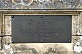 A plaque at Frank Coutts Court - geograph.org.uk - 818242.jpg 639 × 420; 149 KB
-
 A sheepfold by the Stanygill Burn - geograph.org.uk - 809447.jpg 640 × 427; 121 KB
-
 A tree by the track from Blackburn - geograph.org.uk - 880624.jpg 637 × 395; 126 KB
-

-
 Beware of the bull... - geograph.org.uk - 209918.jpg 640 × 480; 99 KB
-
 Boundary fence - geograph.org.uk - 522006.jpg 640 × 480; 113 KB
-
 Callonherd.jpg 225 × 225; 10 KB
-
 Castleton Cross - geograph.org.uk - 795843.jpg 640 × 427; 128 KB
-
 Cattle near Sorbietrees, Newcastleton - geograph.org.uk - 208999.jpg 640 × 480; 88 KB
-
 Disguised petrol pumps at Newcastleton - geograph.org.uk - 886957.jpg 640 × 427; 145 KB
-
 Douglas Square, Newcastleton - geograph.org.uk - 818254.jpg 640 × 427; 135 KB
-
 Ettleton.jpg 2,592 × 1,944; 2.06 MB
-
 Farm cottage - geograph.org.uk - 320845.jpg 640 × 516; 73 KB
-
 Fence across Kershope Burn - geograph.org.uk - 209036.jpg 640 × 480; 104 KB
-
 Forest road near Scotch Kershope - geograph.org.uk - 209050.jpg 640 × 480; 131 KB
-
 Forest track Signs - geograph.org.uk - 330145.jpg 640 × 480; 124 KB
-
 Frank Coutts Court - geograph.org.uk - 818233.jpg 640 × 427; 128 KB
-
 Inscribed stone on a sheepfold - geograph.org.uk - 880653.jpg 640 × 427; 159 KB
-
 Kershope Burn - geograph.org.uk - 209043.jpg 640 × 480; 104 KB
-
 Leysburnfoot (geograph 1896642) (cropped).jpg 2,494 × 1,659; 982 KB
-
 Leysburnfoot (geograph 1896642).jpg 3,888 × 2,592; 2.51 MB
-
 Liddel bridge.jpg 3,008 × 2,000; 2.53 MB
-
 Liddel Water - geograph.org.uk - 1003578.jpg 640 × 480; 61 KB
-

-
 Millholm Cross.jpg 1,944 × 2,592; 1.6 MB
-
 Newcastleton - geograph.org.uk - 909550.jpg 640 × 480; 73 KB
-
 Newcastleton main street. View north. Scottish Borders.jpg 4,896 × 2,752; 2.55 MB
-
 Newcastleton main street. View south-west. Scottish Borders.jpg 4,896 × 2,752; 2.94 MB
-
 Newcastleton Post Office - geograph.org.uk - 818263.jpg 623 × 423; 145 KB
-
 Newcastleton Primary School - geograph.org.uk - 818208.jpg 640 × 427; 143 KB
-
 Newcastleton Square.jpg 640 × 480; 71 KB
-
 Newcastleton Village - geograph.org.uk - 828643.jpg 640 × 480; 86 KB
-
 Newcastleton Village Hall - geograph.org.uk - 818213.jpg 640 × 427; 150 KB
-
 Newcastleton War Memorial - geograph.org.uk - 818144.jpg 427 × 640; 120 KB
-
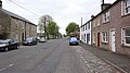
 North Hermitage Street, Newcastleton - geograph.org.uk - 818226.jpg 640 × 427; 121 KB
-
 Old railway arches at Raltonburn Cottage - geograph.org.uk - 209919.jpg 640 × 480; 115 KB
-
 Ordnance Survey One-Inch Sheet 85 Hawick & Eskdale, Published 1925.jpg 12,237 × 9,263; 14.48 MB
-
 Ordnance Survey Sheet NY 48 (35 48) Newcastleton, Published 1950.jpg 7,680 × 8,876; 12.49 MB
-
 Rough grazing near Blinkbonny - geograph.org.uk - 814520.jpg 639 × 411; 163 KB
-
 Sheepfold - geograph.org.uk - 764606.jpg 640 × 427; 94 KB
-
 The bridge over Liddel Water - geograph.org.uk - 1003558.jpg 640 × 480; 72 KB
-
 The Grapes Hotel sign - geograph.org.uk - 818199.jpg 422 × 609; 123 KB
-
 The Pant Well at Newcastleton - geograph.org.uk - 818161.jpg 427 × 640; 131 KB
-
 The remains of Riccarton Tower - geograph.org.uk - 1253516.jpg 640 × 427; 134 KB
-
 The road to Blackburn Farm - geograph.org.uk - 522009.jpg 640 × 480; 111 KB
-
 The summit area of Pike Fell - geograph.org.uk - 328300.jpg 640 × 480; 88 KB
-
 Tweeden Burn - geograph.org.uk - 763995.jpg 640 × 427; 89 KB
-
 Tweeden Burn - geograph.org.uk - 764013.jpg 640 × 427; 91 KB
-
 Tweeden Burn - geograph.org.uk - 764030.jpg 640 × 427; 95 KB
-
 Tweedenhead - geograph.org.uk - 763999.jpg 640 × 412; 101 KB
-
 Two hotels at Newcastleton - geograph.org.uk - 818193.jpg 640 × 399; 135 KB
-
 Whithaugh Burn - geograph.org.uk - 764600.jpg 427 × 640; 100 KB
-
 A fence on Hartsgarth Fell - geograph.org.uk - 320821.jpg 640 × 480; 59 KB
-
 A grass track and gate - geograph.org.uk - 636316.jpg 640 × 480; 120 KB
-
 A lone tree on Hermitage Hill - geograph.org.uk - 379311.jpg 640 × 480; 107 KB
-
 A panorama of Newcastleton - geograph.org.uk - 1003598.jpg 640 × 480; 78 KB
-
 An old tree by the Ralton Burn - geograph.org.uk - 1141563.jpg 427 × 640; 127 KB
-
 An unusual place for a bird's nest - geograph.org.uk - 819395.jpg 600 × 417; 144 KB
-
 Approaching the summit of Din Fell - geograph.org.uk - 320792.jpg 640 × 480; 56 KB
-
 Arnton Fell from Priest Hill - geograph.org.uk - 12637.jpg 640 × 480; 72 KB
-
 B6357 - geograph.org.uk - 84622.jpg 640 × 423; 95 KB
-
 Base of Dawsonburn Viaduct - geograph.org.uk - 1475565.jpg 600 × 450; 146 KB
-
 Bench on Priest Hill - geograph.org.uk - 608624.jpg 640 × 480; 181 KB
-
 Blackburn Farm - geograph.org.uk - 520606.jpg 640 × 480; 108 KB
-
 Boggy ground at Millstone Edge - geograph.org.uk - 548151.jpg 640 × 480; 99 KB
-
 Boulder - geograph.org.uk - 727190.jpg 640 × 480; 92 KB
-

-
 Byre Cleuchs - geograph.org.uk - 636306.jpg 640 × 480; 115 KB
-
 Castle Hill - geograph.org.uk - 763972.jpg 640 × 377; 82 KB
-
 Castle Hill - geograph.org.uk - 763976.jpg 640 × 427; 87 KB
-
 Caulker Grain - geograph.org.uk - 320831.jpg 640 × 480; 80 KB
-
 Clear Fell on Blaemount Rig - geograph.org.uk - 608660.jpg 640 × 480; 219 KB
-
 Cockplay Hill - geograph.org.uk - 320834.jpg 640 × 480; 50 KB
-
 Disused garage in Newcastleton - geograph.org.uk - 595705.jpg 640 × 455; 108 KB
-

-
-
 Dykecrofts - geograph.org.uk - 763969.jpg 640 × 427; 150 KB
-
 Dykecrofts Cottage - geograph.org.uk - 764589.jpg 640 × 329; 66 KB
-
 Fence on Unthank Pikes - geograph.org.uk - 328301.jpg 640 × 480; 81 KB
-
 Field Near Tweeden Burn - geograph.org.uk - 608612.jpg 640 × 480; 184 KB
-
 Footpath Around Priest Hill - geograph.org.uk - 608621.jpg 640 × 480; 171 KB
-
 Ford Across Whithaugh Burn - geograph.org.uk - 608630.jpg 640 × 480; 220 KB
-
 Forest Walk - geograph.org.uk - 84237.jpg 640 × 426; 126 KB
-
 Frog - geograph.org.uk - 728150.jpg 640 × 497; 131 KB
-
 Gall Sike - geograph.org.uk - 764595.jpg 640 × 427; 104 KB
-

-
 Grain Head - geograph.org.uk - 320826.jpg 626 × 476; 71 KB
-
 Grasses on Din Fell - geograph.org.uk - 320807.jpg 640 × 480; 62 KB
-
 Grouse moorland at Blackgate Rig - geograph.org.uk - 548165.jpg 640 × 480; 117 KB
-
 Hawknest Sike from Arkleton Hill - geograph.org.uk - 328303.jpg 640 × 480; 100 KB
-
 Heather moorland at Black Edge - geograph.org.uk - 548131.jpg 640 × 480; 109 KB
-
 Hermitage Hill - geograph.org.uk - 378720.jpg 640 × 480; 125 KB
-
 Hermitage Hill - geograph.org.uk - 379330.jpg 640 × 480; 114 KB
-
 High moorland - geograph.org.uk - 549513.jpg 478 × 589; 108 KB
-
 Hillend, above Kershopefoot - geograph.org.uk - 208995.jpg 640 × 480; 97 KB
-
 Junction of forest tracks - geograph.org.uk - 209040.jpg 640 × 480; 81 KB
-
 Kershope Bridge - geograph.org.uk - 209007.jpg 480 × 640; 113 KB
-
 Kirk Hill triangulation pillar - geograph.org.uk - 521973.jpg 640 × 480; 116 KB
-
 Large Conifers Beside Tweeden Burn - geograph.org.uk - 611610.jpg 640 × 480; 215 KB
-
 Lidalia Caravan Site - Newcastleton - geograph.org.uk - 128280.jpg 640 × 480; 88 KB
-
 Linns View, Harelaw - geograph.org.uk - 334094.jpg 640 × 480; 96 KB
-
 Loch Knowe - geograph.org.uk - 548162.jpg 480 × 640; 121 KB
-

-
 Looking towards Tinnis Hill - geograph.org.uk - 413399.jpg 640 × 423; 39 KB
-
 Moorland bridge - geograph.org.uk - 520611.jpg 637 × 460; 107 KB
-
 Moorland road - geograph.org.uk - 520615.jpg 640 × 480; 115 KB
-
 Newcastleton Forest - geograph.org.uk - 608652.jpg 640 × 480; 209 KB
-
 Newcastleton Forest on Blaemount Rig - geograph.org.uk - 608663.jpg 640 × 480; 175 KB
-
 Newcastleton Health Centre - geograph.org.uk - 595709.jpg 635 × 474; 114 KB
-
 Newcastleton Health Centre entrance - geograph.org.uk - 595716.jpg 480 × 640; 114 KB
-

-
 Old Braidlie - geograph.org.uk - 320851.jpg 640 × 480; 86 KB
-
 Old sheepfold - geograph.org.uk - 634739.jpg 640 × 480; 111 KB
-
 Old Wall and Meadow Near Tweeden Burn - geograph.org.uk - 608645.jpg 640 × 480; 239 KB
-
 Priest Hill - geograph.org.uk - 374854.jpg 640 × 480; 58 KB
-
 Road barrier near Scotch Kershope - geograph.org.uk - 209049.jpg 640 × 480; 119 KB
-
 Roan Fell Flow - geograph.org.uk - 548154.jpg 640 × 480; 102 KB
-
 Rough grazing - geograph.org.uk - 522014.jpg 640 × 480; 109 KB
-
 Rough grazing at Stanygill Rig - geograph.org.uk - 520614.jpg 640 × 480; 98 KB
-
 Rough grazing north of Bedda Hill - geograph.org.uk - 520607.jpg 640 × 480; 108 KB
-
 Rough grazing on Bedda Hill - geograph.org.uk - 520608.jpg 640 × 480; 109 KB
-
 Rough grazing on Cooms Fell - geograph.org.uk - 548169.jpg 637 × 454; 106 KB
-
 Rough grazing on Hermitage Hill - geograph.org.uk - 379369.jpg 640 × 480; 112 KB
-
 Rough grazing on Watch Hill - geograph.org.uk - 548143.jpg 640 × 480; 103 KB
-
 Rough grazing on Yethouse Hill - geograph.org.uk - 549516.jpg 640 × 480; 123 KB
-
 Scrubland by the B6357 - geograph.org.uk - 520860.jpg 640 × 480; 122 KB
-
 Sorbietrees, near Newcastleton - geograph.org.uk - 208996.jpg 640 × 480; 87 KB
-
 Southern approach to Newcastleton - geograph.org.uk - 208994.jpg 640 × 480; 88 KB
-
 Stables near Newcastleton - geograph.org.uk - 208997.jpg 640 × 480; 117 KB
-

-
 The 9th green at Newcastleton Golf Course - geograph.org.uk - 520603.jpg 640 × 480; 105 KB
-
 The flush bracket on Din Fell trig point - geograph.org.uk - 320801.jpg 480 × 640; 130 KB
-
 The grip of winter - geograph.org.uk - 320901.jpg 640 × 480; 87 KB
-

-
 The road to Yethouse - geograph.org.uk - 548173.jpg 640 × 480; 110 KB
-
 The summit of Wetherhorn Hill - geograph.org.uk - 320828.jpg 640 × 480; 57 KB
-
 The Tarras Water - geograph.org.uk - 636309.jpg 480 × 640; 134 KB
-
 The trig point at Millstone Edge - geograph.org.uk - 548148.jpg 640 × 480; 99 KB
-
 The trig point on Cooms Fell - geograph.org.uk - 552854.jpg 640 × 480; 102 KB
-
 Tinnis - geograph.org.uk - 280439.jpg 640 × 480; 133 KB
-
 Tinnis from Whita - geograph.org.uk - 281451.jpg 640 × 480; 46 KB
-
 Twislehope Farm - geograph.org.uk - 320843.jpg 640 × 480; 75 KB
-
 View south from Tinnis - geograph.org.uk - 280438.jpg 640 × 480; 69 KB
-
 Which Way^^ - geograph.org.uk - 394806.jpg 640 × 427; 88 KB
-
 Winter Landscape - geograph.org.uk - 320808.jpg 640 × 480; 58 KB


_(cropped).jpg)
.jpg)


_Newcastleton,_Published_1950.jpg)


