Category:Newborough, Staffordshire
Jump to navigation
Jump to search
village in Staffordshire, United Kingdom  | |||||
| Upload media | |||||
| Instance of | |||||
|---|---|---|---|---|---|
| Location | East Staffordshire, Staffordshire, West Midlands, England | ||||
 | |||||
Subcategories
This category has only the following subcategory.
Media in category "Newborough, Staffordshire"
The following 199 files are in this category, out of 199 total.
-
 123 metre spot height on Thorney Lanes - geograph.org.uk - 5859833.jpg 1,024 × 768; 172 KB
-
 A house for a horse - geograph.org.uk - 5871150.jpg 3,546 × 2,888; 3.16 MB
-
-
 After the cross-country - geograph.org.uk - 5871131.jpg 4,032 × 3,024; 3.2 MB
-
-
 B5234 at Duffield Lane - geograph.org.uk - 2087009.jpg 640 × 480; 84 KB
-
 B5234 heading east - geograph.org.uk - 3421845.jpg 640 × 480; 80 KB
-

-
 Barn, Agardsley Cottage Farm - geograph.org.uk - 5564677.jpg 640 × 480; 56 KB
-
 Bend in the B5234 heading east - geograph.org.uk - 3421887.jpg 640 × 480; 82 KB
-
 Bend in Thorney Lanes, looking south - geograph.org.uk - 5859864.jpg 1,024 × 768; 205 KB
-
 Byrkley Park pond - geograph.org.uk - 400305.jpg 640 × 421; 125 KB
-
 Carrion Rough - geograph.org.uk - 5022352.jpg 4,896 × 3,672; 4.3 MB
-
 Cattle at sunset, Holt Hall Farm - geograph.org.uk - 5859853.jpg 1,024 × 768; 227 KB
-
 Cereal field awaiting the harvest - geograph.org.uk - 6238857.jpg 1,024 × 788; 190 KB
-
 Chantry Wood - geograph.org.uk - 5236073.jpg 1,600 × 1,066; 466 KB
-
 Coffee shop and B^B, Newborough - geograph.org.uk - 3421864.jpg 640 × 480; 68 KB
-
 Cottage near Newborough End - geograph.org.uk - 6238843.jpg 1,024 × 768; 210 KB
-
 Cottage with oil tank, Duffield Lane - geograph.org.uk - 3182439.jpg 1,024 × 768; 168 KB
-
 Crop field beside strip woodland - geograph.org.uk - 5564683.jpg 640 × 480; 64 KB
-
 Cross Roads near to Hadley House - geograph.org.uk - 2665988.jpg 640 × 409; 68 KB
-
 Cross-country control at Eland Lodge Horse Trials - geograph.org.uk - 5351600.jpg 3,788 × 2,746; 2.56 MB
-
 Cross-country course at Eland Lodge Horse Trials - geograph.org.uk - 5351625.jpg 3,193 × 2,567; 2.27 MB
-
 Cross-country course at Eland Lodge Horse Trials - geograph.org.uk - 5872904.jpg 4,032 × 3,024; 3.92 MB
-
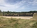
 Cross-country fences at Eland Lodge Horse Trials - geograph.org.uk - 5871012.jpg 4,032 × 3,024; 3.4 MB
-
 Cross-country fences at Eland Lodge Horse Trials - geograph.org.uk - 5871022.jpg 4,032 × 3,024; 2.95 MB
-
 Cross-country fences at Eland Lodge Horse Trials - geograph.org.uk - 5871036.jpg 4,032 × 3,024; 3.59 MB
-
 Cross-country fences at Eland Lodge Horse Trials - geograph.org.uk - 5872855.jpg 4,032 × 3,024; 3.3 MB
-
 Cross-country fences at Eland Lodge Horse Trials - geograph.org.uk - 5872858.jpg 4,032 × 3,024; 2.9 MB
-
 Cross-country fences at Eland Lodge Horse Trials - geograph.org.uk - 5872864.jpg 4,032 × 3,024; 3.44 MB
-
 Cross-country fences at Eland Lodge Horse Trials - geograph.org.uk - 5872874.jpg 4,032 × 3,024; 3.18 MB
-
 Cross-country fences not in use - geograph.org.uk - 5872881.jpg 4,032 × 3,024; 3.37 MB
-
 Cross-country start box at Eland Lodge Horse Trials - geograph.org.uk - 5351662.jpg 4,032 × 3,024; 4.1 MB
-
 Cross-country warm-up area - geograph.org.uk - 5872888.jpg 4,032 × 3,024; 2.9 MB
-
 Cyclist heading east on Duffield Lane - geograph.org.uk - 3182426.jpg 1,024 × 768; 162 KB
-
 Daisy Bank Farm - geograph.org.uk - 2537243.jpg 640 × 428; 68 KB
-
-
 Dolefoot Lane - geograph.org.uk - 5053333.jpg 4,000 × 3,000; 3.78 MB
-
 Dolesfoot Lane - geograph.org.uk - 3931162.jpg 3,717 × 2,561; 4.29 MB
-
 Dressage arenas at Eland Lodge Horse Trials - geograph.org.uk - 5351596.jpg 4,032 × 3,024; 3.69 MB
-
 Dressage arenas at Eland Lodge Horse Trials - geograph.org.uk - 5351707.jpg 3,701 × 2,425; 2.27 MB
-
 Dressage warm-up arena at Eland Lodge Horse Trials - geograph.org.uk - 5351717.jpg 3,662 × 2,693; 3.26 MB
-
 Drive Entrance with Gates - geograph.org.uk - 2665970.jpg 640 × 428; 109 KB
-

-
 Duchy of Lancaster fence at Eland Lodge Horse Trials - geograph.org.uk - 5351641.jpg 4,032 × 3,024; 3.78 MB
-
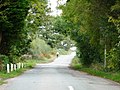
 Duffield Lane, eastern edge of Newborough - geograph.org.uk - 3182443.jpg 1,024 × 768; 124 KB
-
 Duffield Lane, Newborough - geograph.org.uk - 2087023.jpg 640 × 480; 71 KB
-
 Duffield Lane, on Needwood Forest - geograph.org.uk - 402942.jpg 640 × 480; 96 KB
-
 Eland Lodge Equestrian Centre - geograph.org.uk - 4435819.jpg 3,008 × 2,000; 1.1 MB
-
 Eland Lodge Equestrian Centre - geograph.org.uk - 5872894.jpg 4,032 × 3,024; 2.21 MB
-
 Eland Lodge Horse Trials - geograph.org.uk - 5351611.jpg 3,759 × 2,798; 2.88 MB
-

-

-
 Eland Lodge Horse Trials, cross-country course - geograph.org.uk - 4440306.jpg 3,008 × 2,000; 1.89 MB
-
 Eland Lodge Horse Trials, cross-country course - geograph.org.uk - 5022344.jpg 4,896 × 3,672; 4.01 MB
-
 Eland Lodge Horse Trials, cross-country course in wood - geograph.org.uk - 5023946.jpg 2,448 × 3,264; 3.99 MB
-
 Eland Lodge Horse Trials, cross-country obstacles - geograph.org.uk - 4556088.jpg 3,008 × 2,000; 1.67 MB
-
 Eland Lodge Horse Trials, cross-country obstacles - geograph.org.uk - 4556137.jpg 3,008 × 2,000; 1.29 MB
-
 Eland Lodge Horse Trials, cross-country obstacles - geograph.org.uk - 4962189.jpg 3,264 × 2,448; 2.87 MB
-
 Eland Lodge Horse Trials, cross-country obstacles - geograph.org.uk - 5023971.jpg 4,896 × 3,672; 4.38 MB
-
 Eland Lodge Horse Trials, cross-country obstacles in wood - geograph.org.uk - 5023956.jpg 4,896 × 3,672; 5.64 MB
-
 Eland Lodge Horse Trials, cross-country warm-up area - geograph.org.uk - 4556160.jpg 3,008 × 2,000; 1.19 MB
-
-
 Eland Lodge Horse Trials, Hanging Log - geograph.org.uk - 4553816.jpg 3,008 × 2,000; 2.11 MB
-
-
 Eland Lodge Horse Trials, National Forest fence - geograph.org.uk - 4553848.jpg 3,008 × 2,000; 1.94 MB
-
 Eland Lodge Horse Trials, novice fence 20 - geograph.org.uk - 4962195.jpg 3,264 × 2,448; 3.06 MB
-

-
-

-

-
 Eland Lodge Horse Trials, trakehner (detail) - geograph.org.uk - 4553793.jpg 2,000 × 3,008; 1.49 MB
-
 Eland Lodge Horse Trials, trakehner - geograph.org.uk - 4553798.jpg 3,008 × 2,000; 1.89 MB
-
 Eland Lodge Horse Trials, trakehners - geograph.org.uk - 4553780.jpg 3,008 × 2,000; 1.79 MB
-
 Eland Lodge, field corner - geograph.org.uk - 4556217.jpg 3,008 × 2,000; 1.51 MB
-
 Eland Lodge, woodland ride - geograph.org.uk - 4553821.jpg 3,008 × 2,000; 1.77 MB
-
 Electricity poles crossing a wheatfield - geograph.org.uk - 5859869.jpg 1,024 × 768; 199 KB
-
 Elton Covert - geograph.org.uk - 5022339.jpg 4,896 × 3,672; 4.31 MB
-
 Entering Newborough - geograph.org.uk - 3421857.jpg 640 × 480; 88 KB
-
 Entrance to Bagot Park Estate - geograph.org.uk - 2537217.jpg 640 × 428; 79 KB
-
 Entrance to Folly Hall Farm, - geograph.org.uk - 2618665.jpg 640 × 428; 85 KB
-
 Farm track at Eland Lodge - geograph.org.uk - 5872878.jpg 4,032 × 3,024; 4.55 MB
-
 Farmland between Rushton's Hill and Holt Hill - geograph.org.uk - 5859850.jpg 1,024 × 768; 275 KB
-
 Farmland off Duffield Lane - geograph.org.uk - 3421884.jpg 992 × 620; 119 KB
-
 Farmland off the B5234 - geograph.org.uk - 3421842.jpg 1,200 × 900; 292 KB
-
 Farmland, Ivy Bank Farm - geograph.org.uk - 3421893.jpg 640 × 480; 79 KB
-

-
 Field entrance, Rushton's Hill - geograph.org.uk - 5859826.jpg 1,024 × 768; 183 KB
-
 Field near Swilcarlawn Farm - geograph.org.uk - 5564644.jpg 640 × 480; 83 KB
-
 Folly Hall - geograph.org.uk - 402919.jpg 640 × 480; 149 KB
-
 Folly Hall Farm - geograph.org.uk - 3421880.jpg 1,194 × 624; 153 KB
-
 Footpath off the B5234 - geograph.org.uk - 3421855.jpg 640 × 480; 113 KB
-
 Footpath onto Moat Lane - geograph.org.uk - 5236454.jpg 1,600 × 1,066; 692 KB
-
 Footpath to Hoar Cross - geograph.org.uk - 5236442.jpg 1,600 × 1,066; 623 KB
-
 Footpath to Newborough - geograph.org.uk - 5236463.jpg 1,600 × 1,066; 595 KB
-
 Footpath with Two Finger Posts - geograph.org.uk - 2618693.jpg 428 × 640; 118 KB
-

-
-
 From Daisy Bank Farm to Holt Hall - geograph.org.uk - 2537255.jpg 640 × 428; 57 KB
-
 Generating electricity at Thorney Hills - geograph.org.uk - 5859779.jpg 1,024 × 768; 211 KB
-
 Grass field near Noah's Ark Farm - geograph.org.uk - 6238853.jpg 1,024 × 768; 136 KB
-

-
 Grazing, Agardsley Park - geograph.org.uk - 5564672.jpg 640 × 480; 62 KB
-
 Hadley Farm - geograph.org.uk - 5564685.jpg 640 × 480; 53 KB
-
 Harvested cereal field - geograph.org.uk - 6238859.jpg 1,024 × 768; 210 KB
-
 Harvested cereal field near Newborough - geograph.org.uk - 6238846.jpg 1,024 × 768; 259 KB
-
 Hoar Cross Hall grounds - geograph.org.uk - 402894.jpg 640 × 480; 134 KB
-
 Holly Bush Lane - geograph.org.uk - 5564682.jpg 640 × 480; 96 KB
-
 Holt Hall Farm - geograph.org.uk - 2537296.jpg 640 × 428; 73 KB
-
 Holt Hill - geograph.org.uk - 2263416.jpg 1,496 × 1,122; 570 KB
-
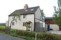
 House in the corner - geograph.org.uk - 3182453.jpg 1,024 × 768; 130 KB
-
 House on the B5234, west of Newborough - geograph.org.uk - 5859875.jpg 1,024 × 768; 177 KB
-
 Junction of Thorney Lanes and the B5234 - geograph.org.uk - 2138776.jpg 586 × 410; 102 KB
-
 Ladysmith Farm - geograph.org.uk - 402753.jpg 640 × 480; 101 KB
-
 Lane towards Agardsley Park - geograph.org.uk - 5564675.jpg 640 × 480; 75 KB
-
 Left for Burton, right for Abbots Bromley - geograph.org.uk - 3182447.jpg 1,024 × 768; 113 KB
-

-
 Looking towards Holt Hall - geograph.org.uk - 2537274.jpg 640 × 428; 58 KB
-
 Lorry park at Eland Lodge Horse Trials - geograph.org.uk - 5351585.jpg 3,803 × 2,808; 3.21 MB
-
 Lorry park at Eland Lodge Horse Trials - geograph.org.uk - 5351680.jpg 4,032 × 3,024; 3.3 MB
-
 Lorry park at Eland Lodge Horse Trials - geograph.org.uk - 5351743.jpg 4,032 × 2,591; 3.14 MB
-
 Maize crop, south of Three Lane Ends Farm - geograph.org.uk - 5859785.jpg 1,024 × 768; 196 KB
-
 Marchington Woodlands - a green landscape - geograph.org.uk - 5859760.jpg 1,024 × 768; 263 KB
-
 Milepost at NGR SK1278925449.jpg 492 × 701; 66 KB
-
 Milepost at NGR SK1430925181.jpg 640 × 480; 238 KB
-
 Minor road near Hadley Cottages - geograph.org.uk - 5564668.jpg 640 × 480; 58 KB
-

-
 Needwood Jubilee Hall, Newchurch - geograph.org.uk - 198856.jpg 640 × 480; 80 KB
-

-

-
 Newborough churchyard - geograph.org.uk - 2119579.jpg 477 × 640; 88 KB
-
 Newborough, All Saints - geograph.org.uk - 6366986.jpg 3,000 × 4,000; 4.27 MB
-
 Ordnance Survey Flush Bracket G3870 - geograph.org.uk - 5053296.jpg 4,000 × 3,000; 4.39 MB
-
-

-
 Public footpath and private road to Bagot's Park - geograph.org.uk - 5859775.jpg 1,024 × 769; 212 KB
-
 Public footpath signpost on Thorney Lanes - geograph.org.uk - 5859793.jpg 1,024 × 768; 321 KB
-
 Public footpath to Park Farm and Bromley Park - geograph.org.uk - 5859796.jpg 1,024 × 768; 223 KB
-
 Quiet lanes - geograph.org.uk - 2119558.jpg 640 × 480; 124 KB
-
 River Swanbourn by Moat Lane - geograph.org.uk - 5236448.jpg 1,600 × 1,066; 542 KB
-
 River Swarbourn - geograph.org.uk - 5236440.jpg 1,600 × 1,066; 586 KB
-
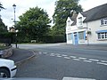
 Road Junction in Newborough - geograph.org.uk - 5053303.jpg 4,000 × 3,000; 3.09 MB
-
 Road junction Newborough - geograph.org.uk - 2138689.jpg 640 × 480; 141 KB
-

-
 Sheep below Poole's Coppice - geograph.org.uk - 5236441.jpg 1,600 × 1,066; 505 KB
-
 Shop at Eland Lodge - geograph.org.uk - 5871138.jpg 4,032 × 3,024; 2.43 MB
-
 Showjumping warm-up arena at Eland Lodge Horse Trials - geograph.org.uk - 5351756.jpg 4,032 × 3,024; 3.5 MB
-
 Sowley House - geograph.org.uk - 5564650.jpg 640 × 480; 58 KB
-
 Squirrel's Corner, Newborough - geograph.org.uk - 402908.jpg 640 × 480; 119 KB
-
 Steep garden on Moat Lane - geograph.org.uk - 5235743.jpg 1,600 × 1,066; 425 KB
-
 Stubble field near Hadley Cottages - geograph.org.uk - 5564663.jpg 640 × 480; 76 KB
-
 Temporary stabling at Eland Lodge Horse Trials - geograph.org.uk - 5351737.jpg 3,978 × 2,711; 3.49 MB
-
 The "Noon Column" Jackson's Bank - geograph.org.uk - 198838.jpg 480 × 640; 94 KB
-

-
 The B5234 - geograph.org.uk - 4030332.jpg 3,538 × 2,717; 3.71 MB
-
 The lane to Agardsley Park - geograph.org.uk - 2666014.jpg 640 × 428; 59 KB
-

-
 The Poplars farm House, Newborough - geograph.org.uk - 2665935.jpg 640 × 428; 105 KB
-
 The Red Lion pub, Newborough - geograph.org.uk - 3421874.jpg 1,024 × 726; 123 KB
-
 The Red Lion, Newborough - geograph.org.uk - 2138697.jpg 640 × 480; 101 KB
-
 The Red Lion, Newborough - geograph.org.uk - 737034.jpg 640 × 427; 216 KB
-
-
 The Woodlands on the hill - geograph.org.uk - 5236465.jpg 1,600 × 1,066; 427 KB
-
 Thorney Lanes - geograph.org.uk - 5859782.jpg 1,024 × 768; 208 KB
-
 Thorney Lanes descending Rushton's Hill - geograph.org.uk - 5859799.jpg 1,024 × 768; 191 KB
-
 Thorney Lanes, heading north - geograph.org.uk - 5859789.jpg 1,024 × 768; 240 KB
-
 Three Lanes End Farm - geograph.org.uk - 2537221.jpg 640 × 428; 83 KB
-
 Through a Gate to Field of Sweetcorn - geograph.org.uk - 2618678.jpg 640 × 428; 74 KB
-
 Tomlinson's Corner Wood - geograph.org.uk - 5564629.jpg 640 × 480; 45 KB
-
 Track in Carrion Rough wood - geograph.org.uk - 5022346.jpg 3,264 × 2,448; 3.64 MB
-

-
 Training mirrors at Eland Lodge Equestrian Centre - geograph.org.uk - 5351775.jpg 4,032 × 3,024; 3.71 MB
-
 Trees round the moat at Moat Hall - geograph.org.uk - 5236451.jpg 1,600 × 1,066; 595 KB
-
 Uncultivated field margin, Rushton's Hill - geograph.org.uk - 5859827.jpg 1,024 × 768; 172 KB
-
 Unused cross-country fences at Eland Lodge Horse Trials - geograph.org.uk - 5871107.jpg 4,032 × 3,024; 4.13 MB
-
 View along the Valley - geograph.org.uk - 2537202.jpg 640 × 428; 63 KB
-
 Village Centre, Newborough - geograph.org.uk - 2486954.jpg 1,496 × 1,122; 645 KB
-
 Watching showjumping at Eland Lodge Horse Trials - geograph.org.uk - 5351558.jpg 4,032 × 3,024; 4.41 MB
-

-
 Wheatfield on Rushton's Hill - geograph.org.uk - 5859800.jpg 1,024 × 768; 181 KB
-

-
 Wooden Bridge - geograph.org.uk - 677662.jpg 640 × 480; 117 KB
-
 Yew Tree Farm, Maker Lane - geograph.org.uk - 402761.jpg 640 × 480; 117 KB
-
 Barn at Agardsley Cottage Farm - geograph.org.uk - 198845.jpg 640 × 480; 70 KB
-
 Bridge over Lin Brook - geograph.org.uk - 308271.jpg 640 × 480; 158 KB
-
 Byrkley Park - geograph.org.uk - 400303.jpg 640 × 427; 95 KB
-

-

-
-
 Ford at Far Hoarcross - geograph.org.uk - 402905.jpg 640 × 480; 208 KB
-
 Hay meadow and hay bales - geograph.org.uk - 198842.jpg 640 × 480; 85 KB
-

-
 Lane to Field House Farm - geograph.org.uk - 419869.jpg 640 × 480; 69 KB
-
 Pound Farm - geograph.org.uk - 198820.jpg 640 × 480; 60 KB
-

-

-
 Tree and Hide Near Yoxall Lodge - geograph.org.uk - 356402.jpg 640 × 480; 80 KB
-
 Woodland at Roost Hill - geograph.org.uk - 198818.jpg 640 × 480; 103 KB
-
 Woodland in the valley of the Lin Brook - geograph.org.uk - 198900.jpg 640 × 480; 109 KB


_course_-_geograph.org.uk_-_4246326.jpg)


_-_geograph.org.uk_-_4553793.jpg)


