Category:Newbigging, Angus
Jump to navigation
Jump to search
English: Newbigging, Angus is a village in Angus, Scotland. The name "Newbigging" originally referred to a "new bigging" or "new cottar town" (hamlet). The village is roughly two miles north of Monifieth and east of Dundee, Scotland's fourth City. Some of the earliest history of the local area is represented approximately four kilometres northwest at the village of Eassie, where the Eassie Stone is displayed in a ruined church; this carved Pictish stone is dated prior to the Early Middle Ages.
village in Angus, Scotland, UK  | |||||
| Upload media | |||||
| Instance of | |||||
|---|---|---|---|---|---|
| Location |
| ||||
 | |||||
Subcategories
This category has only the following subcategory.
N
Media in category "Newbigging, Angus"
The following 21 files are in this category, out of 21 total.
-
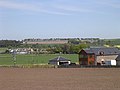
 Across the fields to Newbigging, Angus - geograph-3205002.jpg 640 × 480; 83 KB
-
 Barley Field. - geograph.org.uk - 464091.jpg 480 × 640; 59 KB
-
 Cycle path, Mains of Ardestie. - geograph.org.uk - 464077.jpg 480 × 640; 67 KB
-
 Farmland near Ardestie - geograph.org.uk - 11617.jpg 640 × 480; 94 KB
-
 Newbigging.jpg 640 × 480; 92 KB
-
 Railway path near Newtyle - geograph.org.uk - 177253.jpg 480 × 640; 101 KB
-
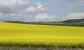 Rape fields north of Mains of Ardestie - geograph.org.uk - 11623.jpg 640 × 382; 97 KB
-
 Recently ploughed field at Ardestie - geograph.org.uk - 556468.jpg 640 × 528; 110 KB
-
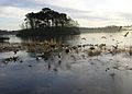
 Seals on a sand bank - geograph.org.uk - 136317.jpg 640 × 480; 48 KB
-

-
 Cotside Quarry - geograph.org.uk - 544168.jpg 640 × 370; 65 KB
-
 Cotside Quarry - geograph.org.uk - 544189.jpg 640 × 480; 109 KB
-
 Groynes, on Monifieth Sands. - geograph.org.uk - 464124.jpg 614 × 640; 54 KB
-
 Harvested fields, close to Woodhill - geograph.org.uk - 546122.jpg 640 × 480; 74 KB
-
 Kirkton of Monikie - geograph.org.uk - 738775.jpg 600 × 378; 106 KB
-

-
 Monikie reservoir - geograph.org.uk - 679988.jpg 600 × 429; 81 KB
-
 Old Downie - geograph.org.uk - 601947.jpg 640 × 480; 111 KB
-
 Remnants of a hedgerow - geograph.org.uk - 544202.jpg 640 × 343; 72 KB
-
 Track beside the Downiemoor Burn - geograph.org.uk - 562399.jpg 640 × 527; 102 KB
-
 Track in a field, beyond Fallaws - geograph.org.uk - 562224.jpg 640 × 480; 134 KB


