Category:New Brancepeth
Jump to navigation
Jump to search
Bosanski: New Brancepeth je selo u mjestu County Durham u Engleskoj. Smješteno je zapadno od Durhama.
English: New Brancepeth is a village in County Durham, in England. It is situated to the west of Durham.
village in United Kingdom | |||||
| Upload media | |||||
| Instance of | |||||
|---|---|---|---|---|---|
| Location | Brandon and Byshottles, County Durham, North East England, England | ||||
 | |||||
Media in category "New Brancepeth"
The following 28 files are in this category, out of 28 total.
-
 "The Loves", Broom Park - geograph.org.uk - 340499.jpg 640 × 480; 66 KB
-

-

-
 Deerness Leisure Centre, Ushaw Moor - geograph.org.uk - 337413.jpg 640 × 480; 89 KB
-
 Deerness Valley Path, Ushaw Moor - geograph.org.uk - 337397.jpg 640 × 480; 106 KB
-
 New Brancepeth - geograph.org.uk - 4395933.jpg 1,500 × 922; 1.13 MB
-
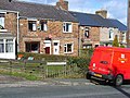 New Brancepeth Post Office - geograph.org.uk - 146448.jpg 640 × 480; 137 KB
-
 New Brancepeth Village Hall - geograph.org.uk - 146449.jpg 640 × 480; 94 KB
-
 North End, Brandon - geograph.org.uk - 124427.jpg 640 × 480; 97 KB
-
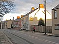
 Road entering New Brancepeth from the west - geograph.org.uk - 3459467.jpg 3,560 × 2,616; 2.64 MB
-

-
 The road from New Brancepeth joining Pit Lane - geograph.org.uk - 3459438.jpg 3,454 × 2,456; 2.34 MB
-
 Eastern end of Ushaw Moor village - geograph.org.uk - 340503.jpg 640 × 480; 77 KB
-
 Field and fence near Broom Park - geograph.org.uk - 340504.jpg 640 × 480; 60 KB
-
 Hareholme Court - geograph.org.uk - 146446.jpg 640 × 480; 46 KB
-
 Hill House Farm, near Esh Winning - geograph.org.uk - 346065.jpg 640 × 480; 66 KB
-
 Keepers Cottages, Pithouse Plantation - geograph.org.uk - 346248.jpg 640 × 480; 85 KB
-
 Morley Farm, Brancepeth - geograph.org.uk - 346258.jpg 640 × 480; 72 KB
-

-
-
 New housing estate at Ushaw Moor - geograph.org.uk - 337400.jpg 640 × 480; 90 KB
-

-
 Pasture land above Esh Wood - geograph.org.uk - 346252.jpg 640 × 480; 65 KB
-
 Pithouse Plantation - geograph.org.uk - 346078.jpg 640 × 480; 71 KB
-
 Stile and wall below Brandon Lane - geograph.org.uk - 346246.jpg 480 × 640; 83 KB
-
 The Deerness Valley Walk - geograph.org.uk - 76490.jpg 427 × 640; 149 KB
-
 Triangulation Pillar off Brandon Lane - geograph.org.uk - 99323.jpg 640 × 480; 130 KB
-
 View from Pit House, Brandon Lane - geograph.org.uk - 124425.jpg 640 × 480; 117 KB


