Category:New Bradwell
Jump to navigation
Jump to search
English: New Bradwell is (mainly) a Victorian era new village, modern district and civil parish that is now part of Milton Keynes (ceremonial Buckinghamshire), on its northern edge. Together with Wolverton (on the other side of the West Coast Main Line), it was built primarily to house the workers on the Wolverton railway works.
Norsk bokmål: New Bradwell er en landsby som har blitt innlemmet i byen Milton Keynes i England. Den ble, i likhet med Wolverton, grunnlagt i viktoriansk tid for som et boligområde for arbeiderne ved jernbanefabrikken i Wolverton. Landsbyen er avgrenset av Great Ouse, Grand Union-kanalen og West Coast Main Line.
village and civil parish in Buckinghamshire, UK  | |||||
| Upload media | |||||
| Instance of | |||||
|---|---|---|---|---|---|
| Location | City of Milton Keynes, Buckinghamshire, South East England, England | ||||
| Located in or next to body of water | |||||
| Population |
| ||||
 | |||||
Subcategories
This category has the following 4 subcategories, out of 4 total.
Media in category "New Bradwell"
The following 77 files are in this category, out of 77 total.
-
 Bradwell Bridge No 72 - geograph.org.uk - 4747369.jpg 800 × 554; 166 KB
-
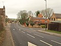 Bradwell Road - geograph.org.uk - 2314517.jpg 640 × 480; 75 KB
-

-
 Bradwell Road in New Bradwell - geograph.org.uk - 4747397.jpg 800 × 559; 125 KB
-
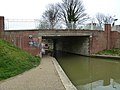
 Bridge 71B, Grand Junction Canal - geograph.org.uk - 2876326.jpg 4,000 × 3,000; 4.74 MB
-
 Bridge 72, Grand Junction Canal - geograph.org.uk - 2876272.jpg 4,000 × 3,000; 5.05 MB
-
 Bridge 73, Grand Junction Canal - geograph.org.uk - 2876287.jpg 4,000 × 3,000; 4.87 MB
-
 Bridge 74 over the Grand Union - geograph.org.uk - 2899578.jpg 640 × 427; 99 KB
-
 Bridge 74, Grand Junction Canal - geograph.org.uk - 2712716.jpg 4,000 × 3,000; 5.08 MB
-
 Bridge over cyclepath, Milton Keynes - geograph.org.uk - 2314089.jpg 640 × 480; 122 KB
-
 Bridge over the canal by the New Inn - geograph.org.uk - 2899437.jpg 640 × 428; 75 KB
-
 Bridgeway (1), New Bradwell - geograph.org.uk - 1542531.jpg 640 × 360; 157 KB
-
 Bridgeway (2), New Bradwell - geograph.org.uk - 1543160.jpg 640 × 360; 186 KB
-
 Bridgeway (3), New Bradwell - geograph.org.uk - 1543172.jpg 640 × 360; 147 KB
-
 Bridgeway (4), New Bradwell - geograph.org.uk - 1543178.jpg 640 × 360; 160 KB
-
 Ex quarry lake - geograph.org.uk - 6010247.jpg 1,600 × 1,066; 272 KB
-
 Fomer Bradwell Halt, July 2009.JPG 2,736 × 3,648; 6.39 MB
-
 Footpath to New Bradwell - geograph.org.uk - 6010250.jpg 1,600 × 1,066; 505 KB
-
 Grafton Street Aqueduct - geograph.org.uk - 2876355.jpg 4,000 × 3,000; 4.66 MB
-
 Grand Union Canal - geograph.org.uk - 4156399.jpg 1,024 × 683; 214 KB
-
 Grand Union canal by Joan's Piece - geograph.org.uk - 2899588.jpg 640 × 427; 58 KB
-
 Grand Union Canal, Bridge Number 72 - geograph.org.uk - 3673960.jpg 640 × 480; 95 KB
-
 Grand Union Canal, Bridge Number 74 - geograph.org.uk - 3674498.jpg 640 × 480; 86 KB
-
 Grand Union Canal, New Bradwell - geograph.org.uk - 531017.jpg 640 × 428; 69 KB
-
 Grand Union Canal, New Bradwell - geograph.org.uk - 6324808.jpg 1,280 × 851; 293 KB
-

-

-

-
 Holding Forth Christian Centre - geograph.org.uk - 1168882.jpg 640 × 480; 85 KB
-

-
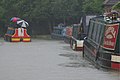
 Narrowboat moored at the New Inn - geograph.org.uk - 4747382.jpg 800 × 517; 111 KB
-
 New Bradwell Clock Tower - geograph.org.uk - 4741801.jpg 658 × 800; 197 KB
-
 New Bradwell Footbridge - geograph.org.uk - 2069930.jpg 640 × 480; 78 KB
-
 New Bradwell Footbridge No 71B - geograph.org.uk - 4747312.jpg 800 × 605; 128 KB
-

-
 New housing by the canal - geograph.org.uk - 2899496.jpg 640 × 427; 57 KB
-
 Newport Road Bridge No 74 - geograph.org.uk - 4747479.jpg 800 × 589; 153 KB
-
 Newport Road, New Bradwell - geograph.org.uk - 3074399.jpg 1,600 × 1,200; 605 KB
-
 Overflow into the River Great Ouse - geograph.org.uk - 4747481.jpg 800 × 584; 113 KB
-
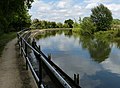
 Path by the Ouse - geograph.org.uk - 2915032.jpg 640 × 427; 98 KB
-
 Path towards Bradville - geograph.org.uk - 2915027.jpg 480 × 640; 137 KB
-
 Playground seen from the Railway Walk - geograph.org.uk - 2899662.jpg 640 × 427; 114 KB
-

-
 Spencer Street, New Bradwell.jpg 5,760 × 3,840; 4.88 MB
-
 St James School & Church Hall.jpg 5,760 × 3,840; 4.78 MB
-
 St James's Church, New Bradwell - geograph.org.uk - 3074401.jpg 1,600 × 1,200; 554 KB
-
 St James, New Bradwell - Chancel - geograph.org.uk - 5116994.jpg 900 × 625; 576 KB
-
 St James, New Bradwell - Chancel - geograph.org.uk - 5117039.jpg 900 × 600; 571 KB
-
 St James, New Bradwell - Doorway - geograph.org.uk - 5117036.jpg 591 × 900; 597 KB
-
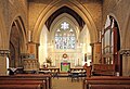
 St James, New Bradwell - East end - geograph.org.uk - 5116825.jpg 900 × 648; 640 KB
-
 St James, New Bradwell - East end - geograph.org.uk - 5116991.jpg 900 × 613; 631 KB
-
 St James, New Bradwell - Font - geograph.org.uk - 5117025.jpg 600 × 900; 516 KB
-
 St James, New Bradwell - geograph.org.uk - 5116821.jpg 900 × 557; 700 KB
-
 St James, New Bradwell - geograph.org.uk - 5116822.jpg 900 × 668; 549 KB
-
 St James, New Bradwell - geograph.org.uk - 5116823.jpg 900 × 659; 540 KB
-
 St James, New Bradwell - North arcade - geograph.org.uk - 5116992.jpg 900 × 600; 620 KB
-
 St James, New Bradwell - Organ - geograph.org.uk - 5117031.jpg 600 × 900; 566 KB
-

-
 St James, New Bradwell - Pulpit - geograph.org.uk - 5117029.jpg 600 × 900; 505 KB
-
 St James, New Bradwell - Sanctuary - geograph.org.uk - 5117019.jpg 576 × 900; 458 KB
-
 St James, New Bradwell - Sanctuary - geograph.org.uk - 5117023.jpg 900 × 606; 576 KB
-

-
-

-

-

-

-

-

-

-
 St James, New Bradwell - West end - geograph.org.uk - 5116997.jpg 900 × 666; 625 KB
-

-
 Swan's Way - geograph.org.uk - 4758830.jpg 640 × 480; 116 KB
-
 The Foresters Arms on Newport Road - geograph.org.uk - 4741755.jpg 800 × 508; 92 KB
-
 The former Cuba public house - geograph.org.uk - 4741789.jpg 800 × 588; 110 KB
-
 The New Inn, New Bradwell - geograph.org.uk - 6324799.jpg 1,280 × 851; 333 KB
-
 The New Inn,New Bradwell.jpg 5,760 × 3,840; 4.93 MB


,_New_Bradwell_-_geograph.org.uk_-_1542531.jpg)
,_New_Bradwell_-_geograph.org.uk_-_1543160.jpg)
,_New_Bradwell_-_geograph.org.uk_-_1543172.jpg)
,_New_Bradwell_-_geograph.org.uk_-_1543178.jpg)


