Category:New Alresford
Jump to navigation
Jump to search
town and civil parish in Hampshire, United Kingdom  | |||||
| Upload media | |||||
| Instance of | |||||
|---|---|---|---|---|---|
| Location | City of Winchester, Hampshire, South East England, England | ||||
| Population |
| ||||
 | |||||
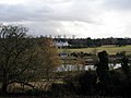
English: New Alresford or simply Alresford (pronounced Allsford) is a small town and civil parish in Hampshire, England. It is situated some 12 km north-east of the city of Winchester, and 20 km south-west of the town of Alton. In the 2001 census the population of Alresford was 5,200.
Subcategories
This category has the following 17 subcategories, out of 17 total.
A
- Alresford Methodist Church (7 F)
B
J
K
N
- New Farm Chapel, Alresford (7 F)
O
- Old Fulling Mill (10 F)
P
R
- River Itchen in New Alresford (12 F)
S
- Swan Hotel, New Alresford (8 F)
T
- Toll House, New Alresford (7 F)
W
Media in category "New Alresford"
The following 200 files are in this category, out of 433 total.
(previous page) (next page)-
 A fine building on Station Road - geograph.org.uk - 6542141.jpg 640 × 480; 116 KB
-
 A peaceful scene at the end of The Dean - geograph.org.uk - 6667199.jpg 640 × 484; 112 KB
-
 Access to the churchyard - geograph.org.uk - 4768403.jpg 1,024 × 734; 269 KB
-
 Alre Valley - geograph.org.uk - 122129.jpg 640 × 479; 272 KB
-
 Alresford (Hampshire) railway station - geograph.org.uk - 4312962.jpg 1,600 × 1,200; 310 KB
-
 Alresford - Broad Street - geograph.org.uk - 6458099.jpg 1,799 × 1,199; 260 KB
-
 Alresford - Cooking Demonstrations - geograph.org.uk - 6606812.jpg 3,864 × 5,152; 6 MB
-
 Alresford - Cottages - geograph.org.uk - 1616034.jpg 640 × 480; 75 KB
-
 Alresford - Fire Station - geograph.org.uk - 1616488.jpg 640 × 480; 69 KB
-
 Alresford - geograph.org.uk - 4302408.jpg 3,909 × 2,605; 7.31 MB
-
 Alresford - geograph.org.uk - 4302413.jpg 6,000 × 4,000; 7.16 MB
-
 Alresford - geograph.org.uk - 4302420.jpg 5,880 × 3,307; 5.44 MB
-
 Alresford - geograph.org.uk - 5641380.jpg 3,339 × 2,227; 7.58 MB
-
 Alresford - geograph.org.uk - 6626529.jpg 4,836 × 2,931; 6.32 MB
-
 Alresford - geograph.org.uk - 6695218.jpg 3,864 × 4,096; 6.17 MB
-
 Alresford - Locomotive 92212 - geograph.org.uk - 6606954.jpg 4,236 × 3,682; 7.2 MB
-
 Alresford - Nat West Bank - geograph.org.uk - 1616077.jpg 640 × 480; 72 KB
-
 Alresford - Old Fire Station - geograph.org.uk - 1616024.jpg 640 × 480; 59 KB
-
 Alresford - Police Station - geograph.org.uk - 1615965.jpg 640 × 480; 114 KB
-
 Alresford - Signal Box - geograph.org.uk - 6606948.jpg 5,152 × 3,864; 6.56 MB
-
 Alresford - Strong Country - geograph.org.uk - 6606938.jpg 5,144 × 2,766; 5.55 MB
-
 Alresford - The Old Sun - geograph.org.uk - 1616376.jpg 640 × 480; 63 KB
-
 Alresford - The Watercress Line - geograph.org.uk - 6626540.jpg 5,152 × 3,864; 6.15 MB
-
 Alresford - Ticket Office - geograph.org.uk - 6695202.jpg 4,844 × 3,058; 5.22 MB
-
 Alresford - Town Houses - geograph.org.uk - 1616058.jpg 640 × 480; 72 KB
-
 Alresford - Town Houses - geograph.org.uk - 1616065.jpg 640 × 480; 95 KB
-
 Alresford - Warehouse Conversion - geograph.org.uk - 1615963.jpg 640 × 480; 61 KB
-
 Alresford - Watercress Line - geograph.org.uk - 6606943.jpg 5,152 × 3,864; 7.77 MB
-
 Alresford Apple Festival 2017 - geograph.org.uk - 6626563.jpg 5,152 × 3,864; 6.73 MB
-
 Alresford Apple Festival 2017 - geograph.org.uk - 6626590.jpg 3,242 × 4,529; 5.91 MB
-
 Alresford Bowling Club - geograph.org.uk - 2456570.jpg 2,560 × 1,920; 2.35 MB
-
 Alresford bridge said to date from the year 1190.jpg 935 × 1,102; 77 KB
-
 Alresford Builders Merchants Ltd - geograph.org.uk - 3965971.jpg 2,048 × 1,536; 563 KB
-
 Alresford Builders Merchants Ltd - geograph.org.uk - 4768343.jpg 1,543 × 1,143; 702 KB
-
 Alresford cascade.jpg 794 × 1,309; 82 KB
-
 Alresford Drove track - geograph.org.uk - 1751670.jpg 2,848 × 2,144; 1.55 MB
-
 Alresford fire station - geograph.org.uk - 279884.jpg 640 × 426; 192 KB
-
 Alresford Golf Course - geograph.org.uk - 869257.jpg 640 × 427; 115 KB
-
 Alresford High Street - geograph.org.uk - 2222107.jpg 640 × 426; 190 KB
-
 Alresford High Street - geograph.org.uk - 2222113.jpg 640 × 426; 228 KB
-
 Alresford Interiors - geograph.org.uk - 4768386.jpg 1,531 × 1,141; 700 KB
-
 Alresford Linen Company - geograph.org.uk - 2456516.jpg 2,560 × 1,920; 2.2 MB
-
 Alresford PO Dec 1992 - Flickr - sludgegulper.jpg 1,127 × 1,733; 102 KB
-
 Alresford SO24 PO Dec 1992 - Flickr - sludgegulper.jpg 1,740 × 1,194; 114 KB
-
 Alresford St John the Baptist.jpg 396 × 463; 15 KB
-
 Alresford Station - Bear Brand - geograph.org.uk - 6695188.jpg 3,463 × 4,772; 5.93 MB
-
 Alresford station - geograph.org.uk - 4466639.jpg 1,296 × 972; 244 KB
-
 Alresford Station - geograph.org.uk - 6626520.jpg 5,152 × 3,864; 7.78 MB
-
 Alresford Station - geograph.org.uk - 6695176.jpg 4,796 × 2,490; 4.8 MB
-
 Alresford Station - geograph.org.uk - 6695206.jpg 4,966 × 3,602; 5.83 MB
-
 Alresford Station - geograph.org.uk - 6695215.jpg 5,152 × 3,864; 6.34 MB
-
 Alresford Station - Post Box - geograph.org.uk - 6695225.jpg 3,146 × 4,486; 5.29 MB
-
 Alresford Station - Roll Out The Barrel - geograph.org.uk - 6695229.jpg 4,630 × 3,643; 5.78 MB
-
 Alresford Station - Southern Railway Poster - geograph.org.uk - 6695212.jpg 5,152 × 3,864; 4.9 MB
-
 Alresford Station - White Star Line - geograph.org.uk - 6695195.jpg 3,125 × 4,846; 5.56 MB
-
 Alresford station buffet - geograph.org.uk - 5584148.jpg 5,202 × 3,465; 2.92 MB
-
 Alresford station platform - geograph.org.uk - 5584157.jpg 5,202 × 3,465; 3.4 MB
-
 Alresford to Winchester Railway - geograph.org.uk - 2118272.jpg 1,704 × 2,272; 2.99 MB
-
 Alresford Watercress Festival - geograph.org.uk - 5256247.jpg 2,560 × 1,920; 2.62 MB
-
 Alresford Watercress Festival - geograph.org.uk - 6606799.jpg 3,864 × 4,117; 6.32 MB
-
 Alresford Watercress Festival - Punch and Judy - geograph.org.uk - 6606826.jpg 5,152 × 3,864; 6.07 MB
-
 Alresford Watercress Festival - Refreshments - geograph.org.uk - 6606819.jpg 5,152 × 3,864; 6.82 MB
-
 Alresford Watercress Festival - Street Performer - geograph.org.uk - 6606823.jpg 5,152 × 3,864; 6.96 MB
-
 Alresford, Buying bread - geograph.org.uk - 4479608.jpg 3,456 × 2,304; 1.88 MB
-
 Alresford, Hampshire ... the old post office (just!) (4923356252).jpg 2,304 × 3,072; 2.62 MB
-
 Alresford, Hampshire ... The post office is in the Co - op. (4923353608).jpg 2,953 × 2,107; 3.52 MB
-
 Alresford, Hampshire, The 'Horse and Groom' - geograph.org.uk - 5028159.jpg 5,184 × 3,456; 6.47 MB
-

-

-
 Approaching Winchester Road, Alresford, Hampshire - geograph.org.uk - 3167999.jpg 4,406 × 2,979; 6.56 MB
-
 Arlebury Park House - geograph.org.uk - 3977292.jpg 1,600 × 1,070; 445 KB
-
 Arlebury Park House, Alresford, Hampshire - geograph.org.uk - 2662968.jpg 2,645 × 1,601; 2.83 MB
-
 Arriving in New Alresford - geograph.org.uk - 3435909.jpg 640 × 427; 93 KB
-
 Astroturf Pitch - Perins School - geograph.org.uk - 6542125.jpg 640 × 480; 126 KB
-
 B3046 passes under the Mid-Hants Railway - geograph.org.uk - 2547805.jpg 3,123 × 2,459; 1.25 MB
-
 Back of a Signal - geograph.org.uk - 3973407.jpg 3,624 × 2,592; 1.28 MB
-
 Barber's Shop, Alresford (caricature) RMG PW4961.jpg 1,280 × 814; 1.56 MB
-
 Barclays Bank. Alresford - geograph.org.uk - 3977327.jpg 1,600 × 1,200; 333 KB
-
 Basingclog Morris - geograph.org.uk - 5256274.jpg 2,560 × 1,920; 2.62 MB
-
 Basingclog Morris - geograph.org.uk - 6606891.jpg 3,991 × 3,864; 6.57 MB
-
 Bay Tree House.jpg 4,000 × 2,672; 4.19 MB
-
 Benenden Green, Arlesford - geograph.org.uk - 872147.jpg 640 × 427; 125 KB
-
 Bow Row - geograph.org.uk - 2456588.jpg 2,560 × 1,920; 2.36 MB
-
 Broad Street, Alresford - geograph.org.uk - 6001476.jpg 1,920 × 1,280; 1.26 MB
-
 Broad Street, Alresford - geograph.org.uk - 6013045.jpg 1,850 × 1,166; 1.49 MB
-
 Broad Street, Alresford, Hampshire - geograph.org.uk - 3113176.jpg 1,024 × 768; 418 KB
-
 Broad Street, Alresford, Hampshire - geograph.org.uk - 3113186.jpg 768 × 1,024; 392 KB
-
 Broad Street, Alresford, Hampshire - geograph.org.uk - 3113209.jpg 1,024 × 768; 473 KB
-
 Broad Street, Alresford, Hampshire - geograph.org.uk - 3113218.jpg 1,024 × 768; 437 KB
-
 Broad Street, Alresford, Hampshire - geograph.org.uk - 3169358.jpg 4,132 × 2,643; 5.87 MB
-
 Broad Street, New Alresford - geograph.org.uk - 1327617.jpg 428 × 640; 98 KB
-
 Broad Street, New Alresford - geograph.org.uk - 97871.jpg 640 × 480; 96 KB
-
 Broad Street, west side, New Alresford - geograph.org.uk - 3785683.jpg 640 × 480; 138 KB
-
 CableArlesford-2.jpg 4,321 × 2,881; 5.62 MB
-
 CableArlesford-3.jpg 3,661 × 2,441; 5.13 MB
-
 Cadbury's Chocolates advertising at Alresford station - geograph.org.uk - 6663324.jpg 2,560 × 1,920; 2.3 MB
-
 Car park at Alresford station - geograph.org.uk - 2433132.jpg 2,560 × 1,920; 1.19 MB
-
 Car park at Alresford station - geograph.org.uk - 2433397.jpg 1,600 × 1,200; 546 KB
-
 Car park at Perins School - geograph.org.uk - 4768332.jpg 1,024 × 762; 229 KB
-
 Car park at Perins School - geograph.org.uk - 6542130.jpg 640 × 480; 136 KB
-
 Car park at Perins School - geograph.org.uk - 6542133.jpg 640 × 480; 133 KB
-
 Cardew House, New Alresford - geograph.org.uk - 3963313.jpg 1,793 × 1,245; 428 KB
-

-
 Cars and houses on New Farm Road - geograph.org.uk - 6330358.jpg 1,024 × 768; 212 KB
-

-
 Centre of Alresford, Hampshire - geograph.org.uk - 3112876.jpg 1,024 × 768; 378 KB
-
 Charters Estate Agents, Alresford - geograph.org.uk - 3977311.jpg 1,600 × 1,200; 364 KB
-
 Christmas Leave - geograph.org.uk - 4302737.jpg 4,545 × 3,409; 4.27 MB
-
 Christmas Lights on West Street - geograph.org.uk - 6703437.jpg 1,600 × 778; 261 KB
-
 Construction of New Alresford Bypass at Tichborne Down - geograph.org.uk - 6449103.jpg 1,798 × 1,198; 502 KB
-
 Corfe Close, Alresford - geograph.org.uk - 5884531.jpg 4,886 × 3,142; 1.67 MB
-
 Cottages in Old Alresford - geograph.org.uk - 110001.jpg 640 × 480; 120 KB
-
 Cottages on East Street - geograph.org.uk - 2456539.jpg 2,560 × 1,920; 1.91 MB
-
 Crocodile Teeth at New Alresford, Hampshire - geograph.org.uk - 2662317.jpg 3,030 × 2,016; 7.8 MB
-

-
 Cutting east of Alresford station - geograph.org.uk - 3547501.jpg 640 × 480; 141 KB
-
 Departure for Ropley - geograph.org.uk - 6161252.jpg 1,024 × 768; 205 KB
-
 Design Realities - West Street - geograph.org.uk - 6543469.jpg 640 × 480; 108 KB
-
 Dichenson Walk, Alresford - geograph.org.uk - 869180.jpg 427 × 640; 183 KB
-
 Disused Railway Bridge crossing Alresford Road (B3047) - geograph.org.uk - 5299998.jpg 4,000 × 3,000; 3.55 MB
-
 Doctors' surgery in Station Road - geograph.org.uk - 2167193.jpg 640 × 480; 51 KB
-
 Does this water taste chalky to you^ - geograph.org.uk - 3159371.jpg 3,320 × 2,016; 2.43 MB
-
 Ducks on River Alre Alresford, Hampshire - geograph.org.uk - 3114395.jpg 1,024 × 768; 580 KB
-
 Ducks, River Alre - geograph.org.uk - 3785600.jpg 640 × 480; 181 KB
-
 Early days at Alresford - Watercress Line - geograph.org.uk - 5248432.jpg 1,800 × 1,162; 178 KB
-
 East Street - geograph.org.uk - 2456237.jpg 2,560 × 1,920; 2.17 MB
-
 East Street - geograph.org.uk - 2456533.jpg 2,560 × 1,920; 1.78 MB
-
 East Street, Alresford - geograph.org.uk - 3973312.jpg 3,500 × 2,412; 2.01 MB
-
 East Street, Alresford - geograph.org.uk - 5584135.jpg 5,202 × 3,465; 2.62 MB
-
 East Street, Alresford, Hampshire - geograph.org.uk - 3169332.jpg 4,091 × 2,700; 4.48 MB
-
 Eel House Notice - geograph.org.uk - 1931429.jpg 3,544 × 2,568; 2.49 MB
-
 Eel House on the Arle - geograph.org.uk - 1931465.jpg 3,392 × 2,648; 3.77 MB
-
 Eliot building - Perins School - geograph.org.uk - 6542117.jpg 640 × 480; 96 KB
-
 Ems Valley Strummers Showband - geograph.org.uk - 6626554.jpg 5,152 × 2,876; 5.66 MB
-
 Entering New Alresford from the east - geograph.org.uk - 1837583.jpg 640 × 480; 154 KB
-
 Exiting Perins school - geograph.org.uk - 4330091.jpg 640 × 504; 69 KB
-
 Farmland near the Itchen - geograph.org.uk - 3563103.jpg 640 × 425; 166 KB
-

-
 Fleur de Lys - geograph.org.uk - 5256267.jpg 2,560 × 1,920; 2.28 MB
-

-
 Former "Peaceful Home" pub - geograph.org.uk - 3969611.jpg 1,578 × 1,185; 345 KB
-
 Former A31 Road, New Alresford, Hampshire - geograph.org.uk - 2662910.jpg 3,076 × 2,047; 7.72 MB
-
 Former A31 Road, New Alresford, Hampshire - geograph.org.uk - 2662923.jpg 2,801 × 1,864; 7.65 MB
-
 Former home to NatWest Bank - geograph.org.uk - 4768384.jpg 1,531 × 1,139; 838 KB
-
 Georgian New Alresford - geograph.org.uk - 2554436.jpg 2,560 × 1,920; 2.02 MB
-
 GFB MST.ED88 (22061216119).jpg 1,365 × 910; 1.09 MB
-
 Part of Alresford Golf Course - geograph.org.uk - 872351.jpg 427 × 640; 122 KB
-

-
 Great Weir, New Alresford - geograph.org.uk - 1327366.jpg 640 × 428; 147 KB
-
 Haig Road - New Alresford - geograph.org.uk - 4904286.jpg 3,264 × 1,840; 3.11 MB
-
 Hair Art - East Street - geograph.org.uk - 4768392.jpg 1,539 × 1,127; 775 KB
-
 Hand washing station - geograph.org.uk - 6682374.jpg 1,024 × 768; 293 KB
-
 Hankins Court - geograph.org.uk - 5596880.jpg 800 × 600; 146 KB
-
 Hankins Court - geograph.org.uk - 6542136.jpg 640 × 480; 105 KB
-
 Headley Close, Alresford - geograph.org.uk - 869275.jpg 539 × 640; 124 KB
-

-
 Here comes another one! - geograph.org.uk - 671304.jpg 640 × 411; 71 KB
-
 Historic East Street - geograph.org.uk - 2456554.jpg 2,560 × 1,920; 2.03 MB
-
 House in Broad Street, Alresford, Hampshire - geograph.org.uk - 3113203.jpg 768 × 1,024; 412 KB
-
 Houses along East Street - geograph.org.uk - 4768389.jpg 1,529 × 1,146; 780 KB
-
 Houses along East Street - geograph.org.uk - 4768394.jpg 1,540 × 1,138; 1,004 KB
-
 Houses along East Street - geograph.org.uk - 4768397.jpg 1,521 × 1,122; 700 KB
-
 Houses and cars in Jacklyns Close - geograph.org.uk - 6330346.jpg 1,024 × 768; 242 KB
-
 Houses in New Farm Road.jpg 640 × 427; 95 KB
-
 Houses on Jacklyns Lane - geograph.org.uk - 6542138.jpg 640 × 480; 107 KB
-
 Houses on Pound Hill - geograph.org.uk - 5495829.jpg 640 × 480; 93 KB
-
 Houses on Tichborne Down - geograph.org.uk - 5582239.jpg 640 × 427; 89 KB
-

-
 How many people read the small print^ - geograph.org.uk - 6675536.jpg 1,024 × 768; 127 KB
-
 Itchen for a Pint - geograph.org.uk - 6606791.jpg 5,105 × 3,003; 7.11 MB
-
 Jacklyns Close joining Jacklyns Lane - geograph.org.uk - 6330347.jpg 1,024 × 768; 256 KB
-
 Jacklyns Lane - geograph.org.uk - 6542084.jpg 640 × 480; 130 KB
-
 Jacklyns Lane Railway Bridge - geograph.org.uk - 2986585.jpg 4,288 × 3,216; 3.39 MB
-
 Junction of Broad Street, East Street and West Street - geograph.org.uk - 2432878.jpg 1,600 × 1,200; 575 KB
-
 Keep Your Distance - geograph.org.uk - 6675535.jpg 1,024 × 768; 321 KB
-
 Ladywell Cottage, New Alresford - geograph.org.uk - 3785937.jpg 640 × 480; 141 KB
-

-
 Lavender at the Long Barn - geograph.org.uk - 5883655.jpg 5,184 × 3,456; 5.29 MB
-
 Leaving New Alresford - geograph.org.uk - 1837582.jpg 640 × 480; 158 KB
-
 Local Colour, New Alresford - geograph.org.uk - 2456247.jpg 2,560 × 1,920; 2.19 MB
-
 Long Barn, Alresford - geograph.org.uk - 5883654.jpg 5,175 × 3,075; 3.1 MB
-
 Long Load! - geograph.org.uk - 697478.jpg 640 × 509; 79 KB
-

-
 Looking along Tichborne Down, Alresford - geograph.org.uk - 869276.jpg 427 × 640; 130 KB
-
 Looking along Tichborne Down, Alresford - geograph.org.uk - 869644.jpg 640 × 427; 110 KB
-
 Looking down Pound Hill - geograph.org.uk - 4768335.jpg 1,515 × 1,132; 788 KB
-
 Looking down Sun Hill, Alresford - geograph.org.uk - 869220.jpg 640 × 427; 144 KB
-

-
 Looking north-west along New Farm Road - geograph.org.uk - 6330351.jpg 1,024 × 768; 228 KB
-
 Looking up Broad Street - geograph.org.uk - 4768383.jpg 1,531 × 1,093; 795 KB
-
 Looking up Broad Street - geograph.org.uk - 6542152.jpg 640 × 480; 135 KB
-
 Lord Nelson ready to leave from Alresford - geograph.org.uk - 4655383.jpg 4,000 × 3,000; 3.95 MB
-
 Lord Nelson, No 850 - geograph.org.uk - 5256282.jpg 2,560 × 1,920; 2.72 MB
-
 Lower end of Broad Street - geograph.org.uk - 6542149.jpg 640 × 480; 109 KB
-
 Maple Close, Alresford - geograph.org.uk - 869676.jpg 640 × 427; 117 KB
-
 Memorial Garden, Alresford, Hampshire - geograph.org.uk - 3114340.jpg 768 × 1,024; 497 KB
-
 Mid-Hants Railway - geograph.org.uk - 5641453.jpg 3,657 × 2,439; 7.57 MB
-
 Mid-Hants Railway - geograph.org.uk - 5641456.jpg 3,339 × 2,227; 7.61 MB
-
 Mid-Hants Railway - geograph.org.uk - 5641459.jpg 3,498 × 2,333; 7.67 MB
-
 Mid-Hants Railway - geograph.org.uk - 5641461.jpg 3,578 × 2,386; 7.58 MB


_railway_station_-_geograph.org.uk_-_4312962.jpg)


_(4923356252).jpg)
.jpg)


_RMG_PW4961.jpg)


_-_geograph.org.uk_-_2158262.jpg)


_-_geograph.org.uk_-_5299998.jpg)


.jpg)

_-_geograph.org.uk_-_2166882.jpg)


