Category:Neville Park Loop
Jump to navigation
Jump to search
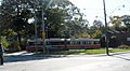
Neville Park Loop the end of the line for the Queen line, was once at Neville Park Boulevard, but has been moved one block east to Nursewood Road.
Terminus of Toronto 501 streetcar line  | |||||
| Upload media | |||||
| Instance of | |||||
|---|---|---|---|---|---|
| Location |
| ||||
| Owned by | |||||
| Inception |
| ||||
 | |||||
Media in category "Neville Park Loop"
The following 18 files are in this category, out of 18 total.
-
 Neville Park Blvd tracks looking north.jpg 2,400 × 1,600; 637 KB
-
 Neville Park Blvd tracks looking south.JPG 2,400 × 1,600; 917 KB
-
 Neville Park Loop 2709163072.jpg 1,600 × 1,200; 326 KB
-
 Neville Park Loop 4032486051.jpg 2,304 × 1,271; 389 KB
-
 Neville Park Loop 4803913136.jpg 2,592 × 3,872; 5.25 MB
-
 Neville Park Loop 4803915550.jpg 3,872 × 2,592; 4.61 MB
-
 Neville Park Loop ALRV 4223.JPG 2,400 × 1,600; 943 KB
-
 Neville Park Loop CLRV 4185.JPG 2,400 × 1,600; 896 KB
-
 Neville Park Loop Keep Out.JPG 2,400 × 1,600; 755 KB
-
 Neville Park Loop s0071 it2128.jpg 1,050 × 811; 158 KB
-
 Neville Park Loop s0071 it4341.jpg 1,050 × 775; 192 KB
-
 Neville Park Loop s0071 it4342.jpg 1,050 × 753; 197 KB
-
 Neville Park Loop stop opposite.JPG 2,400 × 1,600; 736 KB
-
 Neville Park Loop view of location.JPG 2,400 × 1,600; 861 KB
-
 Neville Park Loop view widescreen.JPG 2,400 × 1,350; 770 KB
-
Philodromidae.webm 11 min 29 s, 640 × 360; 19.83 MB
-
 Queen Street at Neville Park 8086038856.jpg 1,800 × 1,117; 342 KB
-
 UTDC streetcar 4222 leaving the Neville Park loop.jpg 2,384 × 1,536; 903 KB


