Category:Neuwerk radar tower
Jump to navigation
Jump to search
| Object location | | View all coordinates using: OpenStreetMap |
|---|
 | |||||
| Upload media | |||||
| Instance of | |||||
|---|---|---|---|---|---|
| Made from material | |||||
| Location |
| ||||
| Inception |
| ||||
| Height |
| ||||
 | |||||
Media in category "Neuwerk radar tower"
The following 15 files are in this category, out of 15 total.
-
 11-09-04-fotoflug-nordsee-by-RalfR-028.jpg 4,288 × 2,848; 5.84 MB
-
 2012-02-22-Fotoflugkurs Cuxhaven-Einsamer Schütze 197.JPG 2,304 × 3,456; 5.95 MB
-
 2012-02-22-Fotoflugkurs Cuxhaven-Einsamer Schütze 219.JPG 2,304 × 3,456; 5.66 MB
-
 2012-02-22-Fotoflugkurs Cuxhaven-Einsamer Schütze 220.JPG 3,456 × 2,304; 5.7 MB
-
 2017-09-07 HS-Reise Inseln Neuwerk und Scharhörn (2559).jpg 4,752 × 3,168; 9.46 MB
-
 Insel Neuwerk (Hamburg) - geo.hlipp.de - 9823.jpg 640 × 427; 47 KB
-
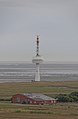
 Neuwerk 2018 by-RaBoe 159.jpg 3,666 × 2,415; 571 KB
-
 Neuwerk 2018 by-RaBoe 160.jpg 3,666 × 2,425; 548 KB
-
 Neuwerk 2018 by-RaBoe 205.jpg 2,399 × 3,666; 482 KB
-
 Neuwerk 2018 by-RaBoe 206.jpg 2,400 × 3,666; 531 KB
-
 Neuwerk 3887.jpg 1,750 × 1,313; 313 KB
-
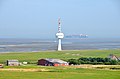 Radarturm auf der Insel Neuwerk, Nationalpark Hamburgisches Wattenmeer.jpg 4,928 × 3,264; 9.75 MB
-
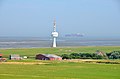 Radarturm, Insel Neuwerk (Nationalpark Hamburgisches Wattenmeer).jpg 4,928 × 3,264; 8.88 MB
-
 Sturmflut Neuwerk Radarturm.jpg 4,906 × 2,820; 1.62 MB
-
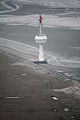
 The red door (cc) (4960755644).jpg 2,136 × 2,848; 426 KB


.jpg)
_-_geo.hlipp.de_-_9823.jpg)


.jpg)

_(4960755644).jpg)