Category:Nettleton, Lincolnshire
Jump to navigation
Jump to search
English: Nettleton is a village and civil parish in the West Lindsey district of Lincolnshire, England close to the town of Caistor. According to the 2001 census it had a population of 579.
village and civil parish in Lincolnshire, UK  | |||||
| Upload media | |||||
| Instance of | |||||
|---|---|---|---|---|---|
| Location | West Lindsey, Lincolnshire, East Midlands, England | ||||
| Population |
| ||||
| Said to be the same as | Nettleton (Wikimedia duplicated page, civil parish) | ||||
 | |||||
Subcategories
This category has the following 11 subcategories, out of 11 total.
A
B
F
G
H
N
R
S
Media in category "Nettleton, Lincolnshire"
The following 200 files are in this category, out of 281 total.
(previous page) (next page)-
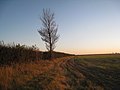
 A bridleway to Nettleton - geograph.org.uk - 2743188.jpg 800 × 600; 119 KB
-
 A bridleway towards Rothwell Top Farm - geograph.org.uk - 2743180.jpg 800 × 600; 116 KB
-
 A permissive path near Nettleton Top - geograph.org.uk - 2742852.jpg 800 × 600; 89 KB
-

-

-
 A46 alongside Nettleton wood - geograph.org.uk - 4573224.jpg 640 × 277; 101 KB
-
 A46 at Nettleton Hill - geograph.org.uk - 3008320.jpg 640 × 430; 51 KB
-
 A46 entering Nettleton - geograph.org.uk - 4573204.jpg 640 × 355; 118 KB
-
 A46 Holton Road - geograph.org.uk - 4751858.jpg 1,024 × 666; 118 KB
-
 A46 Holton Road - geograph.org.uk - 4765502.jpg 1,024 × 691; 178 KB
-
 A46 junction ahead in Nettleton - geograph.org.uk - 4152404.jpg 1,024 × 768; 94 KB
-
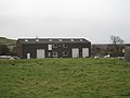
 Acre House Farm - geograph.org.uk - 2925159.jpg 1,024 × 768; 269 KB
-
 Acre House on Viking Way - geograph.org.uk - 5744039.jpg 5,376 × 3,024; 4.04 MB
-

-

-
 After the shower - geograph.org.uk - 2925190.jpg 1,024 × 768; 175 KB
-

-
 At Nettleton Grange - geograph.org.uk - 3257614.jpg 4,453 × 2,969; 2.73 MB
-
 B1225 at Mount Pleasant - geograph.org.uk - 3523697.jpg 640 × 367; 76 KB
-

-
 B1225 near Chalk Quarry entrance - geograph.org.uk - 3523685.jpg 640 × 378; 42 KB
-
 B1225 south from footpath - geograph.org.uk - 4573496.jpg 640 × 355; 121 KB
-

-
 Bend ahead (one of many) on the A46 - geograph.org.uk - 4787539.jpg 1,024 × 715; 129 KB
-
 Beware electric cables - geograph.org.uk - 2925136.jpg 768 × 1,024; 224 KB
-
 Beware of cows - geograph.org.uk - 2742856.jpg 800 × 600; 139 KB
-
 Bikers on Mansgate Hill - geograph.org.uk - 3399315.jpg 640 × 427; 64 KB
-
 Boardwalk and gate near Suddell House - geograph.org.uk - 2219764.jpg 1,024 × 768; 253 KB
-
 Breedon Aggregates at Mansgate Quarry - geograph.org.uk - 2745414.jpg 800 × 600; 216 KB
-

-
 Bridge by Nettleton Beck - geograph.org.uk - 3031187.jpg 640 × 427; 100 KB
-
 Bridleway to Nettleton - geograph.org.uk - 2992886.jpg 1,024 × 768; 169 KB
-
 Bridleway to Pelham Road - geograph.org.uk - 4175558.jpg 640 × 427; 52 KB
-

-

-

-

-
 Caistor Road looking towards Nettleton Hill - geograph.org.uk - 6192781.jpg 1,804 × 1,070; 1.04 MB
-

-
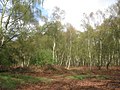
 Change in Long Wood - geograph.org.uk - 2925029.jpg 1,024 × 768; 201 KB
-
 Chiaroscuro - Chalk quarry pond - geograph.org.uk - 3031098.jpg 640 × 427; 92 KB
-
 Church Street, Nettleton - geograph.org.uk - 3928946.jpg 640 × 480; 78 KB
-
 Clear felled land in Long Wood - geograph.org.uk - 2925021.jpg 1,024 × 768; 237 KB
-

-
 Conservation water feature - geograph.org.uk - 3027889.jpg 640 × 427; 113 KB
-
 Cooks Lane at the junction of Grimsby Road - geograph.org.uk - 6192714.jpg 1,866 × 1,192; 1.25 MB
-
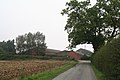
 Cottage on Moortown Road - geograph.org.uk - 3490574.jpg 640 × 427; 65 KB
-
 Country road junction - geograph.org.uk - 3928970.jpg 640 × 480; 42 KB
-
 Crop field off High Street - geograph.org.uk - 3928972.jpg 640 × 480; 46 KB
-
 Crop field towards Nettleton Hill - geograph.org.uk - 3928935.jpg 640 × 480; 57 KB
-

-
 Descending Nettleton Hill - geograph.org.uk - 4864427.jpg 2,000 × 1,333; 1.29 MB
-
 Disused pit opposite Acre House - geograph.org.uk - 4175302.jpg 640 × 427; 94 KB
-
 Disused track on Nettleton Hill - geograph.org.uk - 2911489.jpg 1,024 × 768; 207 KB
-

-
 Duck boards on the Viking Way - geograph.org.uk - 4864557.jpg 2,000 × 1,333; 1.14 MB
-
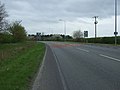
 Entering Caistor, Lincolnshire - geograph.org.uk - 2579369.jpg 800 × 600; 187 KB
-
 Entering Long Wood - geograph.org.uk - 2911419.jpg 1,024 × 768; 277 KB
-
 Entering Nettleton - geograph.org.uk - 4058608.jpg 640 × 480; 90 KB
-
 Entering Nettleton on the Viking Way - geograph.org.uk - 2219863.jpg 1,024 × 768; 166 KB
-
 Entrance ahead off B1205 to Nettleton Park - geograph.org.uk - 4152395.jpg 1,024 × 768; 179 KB
-
 Entrance to Nettleton Road - geograph.org.uk - 5774874.jpg 1,600 × 1,108; 526 KB
-
 Entrance to Oxgangs House - geograph.org.uk - 4185834.jpg 1,600 × 1,067; 616 KB
-
 Evening view by the High Street - geograph.org.uk - 2659962.jpg 1,024 × 768; 146 KB
-
 Farm building, Nettleton Top - geograph.org.uk - 4058594.jpg 640 × 480; 73 KB
-
 Farm buildings at Acre House - geograph.org.uk - 6300795.jpg 1,024 × 768; 132 KB
-

-
-

-
 Farming on the wold above Nettleton - geograph.org.uk - 6300811.jpg 1,024 × 768; 138 KB
-
 Farmland north of Moortown Road - geograph.org.uk - 3928682.jpg 640 × 480; 39 KB
-
 Farmland north of Moortown Road - geograph.org.uk - 3928689.jpg 640 × 480; 48 KB
-
 Farmland towards Nettleton Hill - geograph.org.uk - 3928702.jpg 640 × 480; 81 KB
-
 Farmland west of Normanby Road - geograph.org.uk - 4058590.jpg 640 × 480; 67 KB
-
 Field and bales off the B1225 - geograph.org.uk - 3279815.jpg 2,256 × 1,504; 1.26 MB
-
 Field beside Holton Road (A46) - geograph.org.uk - 3928929.jpg 640 × 480; 64 KB
-
 Field boundary east of Nettleton Lodge - geograph.org.uk - 3257600.jpg 4,608 × 3,072; 3.48 MB
-
 Field by Long Wood - geograph.org.uk - 2925007.jpg 1,024 × 768; 210 KB
-
 Field gates and farm track - geograph.org.uk - 430529.jpg 640 × 480; 124 KB
-
 Field margin towards Nettleton Hill - geograph.org.uk - 3928938.jpg 640 × 480; 65 KB
-
 Fields off Normanby Road - geograph.org.uk - 4184335.jpg 4,172 × 2,781; 5.22 MB
-

-
 Footbridge on Viking Way - geograph.org.uk - 4864530.jpg 2,000 × 1,333; 1.3 MB
-
 Footbridge over Nettleton Beck - geograph.org.uk - 3257603.jpg 4,608 × 3,072; 3.44 MB
-
 Footpath from Moortown Road - geograph.org.uk - 3490564.jpg 640 × 427; 74 KB
-
 Footpath to Acre House - geograph.org.uk - 2216050.jpg 1,024 × 768; 153 KB
-

-
 From the Bridlepath - geograph.org.uk - 373267.jpg 640 × 480; 135 KB
-
 Gate on the Viking Way - geograph.org.uk - 2216193.jpg 1,024 × 768; 238 KB
-
 Hawthorn berries in December - geograph.org.uk - 3257645.jpg 4,188 × 2,992; 2.38 MB
-
 Hawthorn Cottage, Nettleton - geograph.org.uk - 3257613.jpg 4,378 × 2,627; 2.57 MB
-
 Heading towards Nettleton on the Viking Way - geograph.org.uk - 2216201.jpg 1,024 × 768; 152 KB
-
 Hemlock in December - Nettleton Wold - geograph.org.uk - 3257647.jpg 3,708 × 2,967; 1.76 MB
-
 High Street (B1225) - geograph.org.uk - 3928976.jpg 640 × 480; 51 KB
-
 High Street (B1225) - geograph.org.uk - 4058037.jpg 640 × 480; 61 KB
-
 Hillside grazing, Nettleton - geograph.org.uk - 3928956.jpg 640 × 480; 65 KB
-
 Holton Road (A46) - geograph.org.uk - 3928915.jpg 640 × 480; 61 KB
-
 Holton Road (A46) - geograph.org.uk - 3928922.jpg 640 × 480; 91 KB
-
 Holton Road (A46) - geograph.org.uk - 3928930.jpg 640 × 480; 103 KB
-
 Holton Road leaving Nettleton - geograph.org.uk - 6192783.jpg 1,824 × 1,114; 1.01 MB
-
 Horsetails near Nettleton Top - geograph.org.uk - 2925262.jpg 1,024 × 768; 361 KB
-
 House and stables on Caistor Road, Nettleton - geograph.org.uk - 6192782.jpg 1,920 × 1,280; 1.52 MB
-
 House at Nettleton - geograph.org.uk - 2911470.jpg 1,024 × 768; 149 KB
-
 Ironstone haulage route - geograph.org.uk - 2911525.jpg 1,024 × 768; 219 KB
-
 Ironstone haulage route - geograph.org.uk - 2911542.jpg 1,024 × 768; 191 KB
-
 Ironstone route - geograph.org.uk - 2925200.jpg 1,024 × 768; 274 KB
-
 Junction at the top of Mansgate Hill - geograph.org.uk - 3399344.jpg 640 × 427; 54 KB
-

-

-

-

-

-
 Leaving Nettleton - geograph.org.uk - 3928913.jpg 640 × 480; 52 KB
-
 Lincolnshire Wolds - view to Nettleton - geograph.org.uk - 3257617.jpg 4,354 × 2,613; 2.22 MB
-

-
 Looking towards Tugdale Wood - geograph.org.uk - 5744033.jpg 5,376 × 3,024; 2.93 MB
-
 Macrolepiota procera - geograph.org.uk - 6303194.jpg 1,024 × 768; 287 KB
-
 Manor Wood - geograph.org.uk - 3928695.jpg 478 × 640; 125 KB
-
 Mansgate Chalk Quarry (2) - geograph.org.uk - 2216211.jpg 1,024 × 768; 160 KB
-
 Mansgate Chalk Quarry - geograph.org.uk - 2216207.jpg 1,024 × 768; 165 KB
-
 Mansgate chalk quarry - geograph.org.uk - 3399340.jpg 640 × 427; 69 KB
-
 Mansgate Quarry - geograph.org.uk - 3928963.jpg 640 × 480; 75 KB
-
 Mansgate Quarry - geograph.org.uk - 3928966.jpg 640 × 480; 64 KB
-
 Memorial Cottage on Moortown Road, Nettleton - geograph.org.uk - 5774858.jpg 1,600 × 1,065; 818 KB
-

-
 Monkey Puzzle Tree, Moortown Lane - geograph.org.uk - 3376905.jpg 1,504 × 2,256; 1.7 MB
-
 Moortown Road (B1205) - geograph.org.uk - 3928686.jpg 640 × 480; 51 KB
-
 Moortown Road (B1205) - geograph.org.uk - 3928692.jpg 640 × 480; 76 KB
-
 Moortown Road (B1205) - geograph.org.uk - 3928698.jpg 640 × 480; 88 KB
-
 Moortown Road Nettleton - geograph.org.uk - 4152400.jpg 1,024 × 768; 81 KB
-
 Mud on the Viking Way - geograph.org.uk - 4864510.jpg 2,000 × 1,333; 1.44 MB
-
 Nettleton Bleak House seen from the Viking Way - geograph.org.uk - 2219770.jpg 1,024 × 768; 186 KB
-
 Nettleton from Nettleton Hill - geograph.org.uk - 4180857.jpg 640 × 427; 63 KB
-
 Nettleton from Nettleton Hill - geograph.org.uk - 4864437.jpg 2,000 × 1,333; 1.39 MB
-
 Nettleton Grange Farm from the Viking Way - geograph.org.uk - 4864490.jpg 2,000 × 1,333; 1.31 MB
-
 Nettleton Grange Farm from the Viking Way - geograph.org.uk - 4864497.jpg 2,000 × 1,333; 1.11 MB
-
 Nettleton Hill - geograph.org.uk - 3031174.jpg 640 × 427; 84 KB
-
 Nettleton Hill - geograph.org.uk - 4180843.jpg 640 × 427; 51 KB
-
 Nettleton Hill - geograph.org.uk - 4864411.jpg 2,000 × 1,333; 1.29 MB
-
 Nettleton Ironstone Mine - geograph.org.uk - 4864588.jpg 2,000 × 1,333; 1.38 MB
-
 Nettleton Manor - geograph.org.uk - 3490587.jpg 640 × 427; 89 KB
-
 Nettleton panorama - geograph.org.uk - 4864460.jpg 5,000 × 1,712; 4.47 MB
-
 Nettleton Park, cottage - geograph.org.uk - 3490582.jpg 640 × 427; 73 KB
-
 Nettleton Top - geograph.org.uk - 740016.jpg 640 × 480; 57 KB
-

-
 Nettleton Top, aerial 2019 - geograph.org.uk - 6197285.jpg 1,024 × 683; 150 KB
-
 Nettleton village - geograph.org.uk - 4152412.jpg 1,024 × 610; 153 KB
-
 Nettleton Village - geograph.org.uk - 4573213.jpg 640 × 291; 97 KB
-
 Nettleton Wood - geograph.org.uk - 2925062.jpg 1,024 × 768; 288 KB
-
 New Farm - all things are relative^ - geograph.org.uk - 3027922.jpg 640 × 427; 87 KB
-
 Nissen Hut on the edge of Big Wood - geograph.org.uk - 2911430.jpg 1,024 × 768; 305 KB
-
 Normanby Road - geograph.org.uk - 4058592.jpg 640 × 480; 47 KB
-
 Normanby Road - geograph.org.uk - 4058600.jpg 640 × 480; 59 KB
-
 Normanby Road at Acre House Farm - geograph.org.uk - 2742874.jpg 800 × 600; 187 KB
-
 Normanby Road at Nettleton Top Farm - geograph.org.uk - 2742835.jpg 800 × 600; 148 KB
-
 Normanby Road at Nettleton Top Farm - geograph.org.uk - 2742840.jpg 800 × 600; 133 KB
-
 Normanby Road runs downhill towards Nettleton - geograph.org.uk - 4184330.jpg 4,272 × 2,848; 7.64 MB
-
 Normanby Road, Nettleton - geograph.org.uk - 3928960.jpg 640 × 480; 72 KB
-
 Normanby Road, Nettleton - geograph.org.uk - 5737922.jpg 5,297 × 2,979; 2.7 MB
-
 Normandby Road descends into Nettleton - geograph.org.uk - 4864700.jpg 2,000 × 1,333; 1.35 MB
-
 North from Nettleton Top - geograph.org.uk - 3031217.jpg 640 × 427; 53 KB
-
 Old and new at Whitegate Hill, Caistor - geograph.org.uk - 2579432.jpg 800 × 600; 280 KB
-
 Old buildings at Nettleton Manor - geograph.org.uk - 4152398.jpg 1,024 × 768; 108 KB
-

-

-
 Old mill - Whitegate Hill, Caistor - geograph.org.uk - 3257634.jpg 4,451 × 2,671; 2.5 MB
-
 Old mine workings at Nettleton Ironstone Mine - geograph.org.uk - 4864604.jpg 2,000 × 1,333; 1.47 MB
-
 Old mine workings at Nettleton Ironstone Mine - geograph.org.uk - 4864610.jpg 2,000 × 1,333; 1.6 MB
-

-

-
 Old railway embankment - geograph.org.uk - 4864596.jpg 2,000 × 1,333; 1.42 MB
-
 Old road revealed - geograph.org.uk - 5719008.jpg 5,376 × 3,024; 7.43 MB
-

-
 On Church Street, Nettleton - geograph.org.uk - 3257612.jpg 4,411 × 2,941; 2.76 MB
-
 Ordnance Survey Cut Mark - geograph.org.uk - 2971060.jpg 640 × 480; 118 KB
-

-
 Path by Nettleton Beck - geograph.org.uk - 6300800.jpg 1,024 × 768; 157 KB
-

-
 Permissive Path near Nettleton - geograph.org.uk - 4864364.jpg 2,000 × 1,333; 1.27 MB
-
 Pond on Nettleton Beck at Nettleton Grange - geograph.org.uk - 5723707.jpg 5,376 × 3,024; 5.5 MB
-
 Pool near Nettleton Grange - geograph.org.uk - 3257616.jpg 4,298 × 3,070; 3.12 MB
-
 Poolside Leisure - geograph.org.uk - 2219868.jpg 1,024 × 768; 137 KB
-
 Rails to Lincoln - geograph.org.uk - 454656.jpg 640 × 480; 137 KB
-
 Rainy view from the Wolds - geograph.org.uk - 3027915.jpg 640 × 427; 96 KB
-

-
 Riding horses on Nettleton Wold - geograph.org.uk - 3257620.jpg 4,298 × 3,070; 3.08 MB
-
 Rising ground towards Nettleton Top - geograph.org.uk - 6300805.jpg 1,024 × 768; 106 KB
-
 Road to Nettleton - geograph.org.uk - 4864679.jpg 2,000 × 1,298; 1.38 MB
-
 Road to Nettleton Bleak House - geograph.org.uk - 4180840.jpg 640 × 427; 81 KB
-

-

-
 Service station on Holton Road (A46) - geograph.org.uk - 3928916.jpg 640 × 480; 53 KB
-
 Shadowy pond by Nettleton Beck - geograph.org.uk - 3031201.jpg 640 × 427; 131 KB
-
 Sign for Blacksmith's Arms Rothwell - geograph.org.uk - 4152424.jpg 1,024 × 768; 111 KB
-
 Small wood on the Viking Way - geograph.org.uk - 4864567.jpg 2,000 × 1,333; 1.53 MB
-
 St John the Baptist Church, Nettleton - geograph.org.uk - 5777339.jpg 1,600 × 1,065; 668 KB
-
 St John the Baptist parish church Nettleton - geograph.org.uk - 5718838.jpg 5,376 × 3,024; 2.74 MB
-
 The beginning of Mansgate Hill - geograph.org.uk - 2219874.jpg 1,024 × 768; 165 KB
-
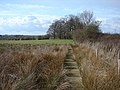 The Boardwalk - geograph.org.uk - 753308.jpg 640 × 480; 100 KB
-


_on_the_A46_-_geograph.org.uk_-_4787539.jpg)


_-_geograph.org.uk_-_4058036.jpg)


_off_High_Street_-_geograph.org.uk_-_3928975.jpg)


_-_geograph.org.uk_-_3928929.jpg)


_-_geograph.org.uk_-_3928976.jpg)
_-_geograph.org.uk_-_4058037.jpg)

_-_geograph.org.uk_-_3928915.jpg)
_-_geograph.org.uk_-_3928922.jpg)
_-_geograph.org.uk_-_3928930.jpg)


_-_geograph.org.uk_-_2216211.jpg)


_-_geograph.org.uk_-_3928686.jpg)
_-_geograph.org.uk_-_3928692.jpg)
_-_geograph.org.uk_-_3928698.jpg)


_-_geograph.org.uk_-_3116872.jpg)
_-_geograph.org.uk_-_3116913.jpg)


_-_geograph.org.uk_-_3928916.jpg)


