Category:Nettlecombe, Dorset
Jump to navigation
Jump to search
Subcategories
This category has the following 2 subcategories, out of 2 total.
M
- Mappercombe Manor (16 F)
T
Media in category "Nettlecombe, Dorset"
The following 32 files are in this category, out of 32 total.
-
 Cottages on King's Farm - geograph.org.uk - 1032516.jpg 640 × 426; 121 KB
-
 Marsh Farm - geograph.org.uk - 1032726.jpg 640 × 426; 73 KB
-
 Beautiful Footpath Entrance - geograph.org.uk - 1425693.jpg 640 × 480; 110 KB
-
 Bed of Dismantled Railway - geograph.org.uk - 1425707.jpg 640 × 480; 104 KB
-
 Byway from Nettlecombe - geograph.org.uk - 2906128.jpg 640 × 430; 58 KB
-
 Cottages in Nettlecombe - geograph.org.uk - 2909360.jpg 640 × 430; 67 KB
-
 Field with Eggardon Hill Beyond - geograph.org.uk - 1427083.jpg 640 × 480; 118 KB
-
 House at Mappercombe Farm (geograph 2415392).jpg 640 × 480; 100 KB
-
 Ivy covered building, Nettlecombe - geograph.org.uk - 1030189.jpg 640 × 426; 90 KB
-
 King's House - geograph.org.uk - 1032507.jpg 640 × 426; 111 KB
-
 Knowle Hill, Nettlecombe, Dorset - geograph.org.uk - 622447.jpg 640 × 253; 38 KB
-
 Lane in Nettlecombe - geograph.org.uk - 2909338.jpg 640 × 430; 48 KB
-
 Lane past Mappercombe Farm (geograph 5318681).jpg 3,072 × 2,048; 1.41 MB
-
 Lane, Nettlecombe - geograph.org.uk - 2909341.jpg 640 × 430; 47 KB
-
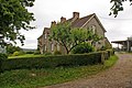
 Mappercombe Farm - geograph.org.uk - 1030165.jpg 640 × 426; 101 KB
-
 Marquis of Lorne Cottages - geograph.org.uk - 2909346.jpg 640 × 430; 90 KB
-
 Nettlecombe - geograph.org.uk - 2909382.jpg 640 × 430; 53 KB
-
 Nettlecombe - geograph.org.uk - 2909405.jpg 640 × 430; 62 KB
-
 Nettlecombe thatched houses.jpg 5,742 × 3,828; 14.59 MB
-
 North from near Mappercombe Farm - geograph.org.uk - 1030149.jpg 640 × 426; 99 KB
-
 North from near Mapperton Farm - geograph.org.uk - 1030169.jpg 640 × 426; 111 KB
-

-
 Old Staddles - geograph.org.uk - 2909394.jpg 640 × 430; 48 KB
-
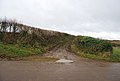
 Path junction - geograph.org.uk - 1032734.jpg 640 × 426; 116 KB
-
 Powerstock Cricket.jpg 1,600 × 1,147; 165 KB
-
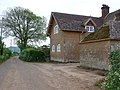
 Southmead Farmhouse - geograph.org.uk - 2909354.jpg 640 × 430; 55 KB
-
 Thatched Cottage - geograph.org.uk - 2909400.jpg 640 × 430; 65 KB
-
 The Square, Nettlecombe - geograph.org.uk - 1030188.jpg 640 × 426; 92 KB
-
 The Village of Powerstock - geograph.org.uk - 33563.jpg 640 × 480; 93 KB
-
 Towards Knowle Hill - geograph.org.uk - 1032678.jpg 640 × 426; 103 KB
-
 Towards Rampisham Down - geograph.org.uk - 1032614.jpg 640 × 426; 81 KB
-
 Who has priority^ - geograph.org.uk - 1022627.jpg 640 × 426; 130 KB


.jpg)


.jpg)


