Category:Netherton, Worcestershire
Jump to navigation
Jump to search
hamlet and civil parish in Worcestershire, United Kingdom  | |||||
| Upload media | |||||
| Instance of | |||||
|---|---|---|---|---|---|
| Location | Wychavon, Worcestershire, West Midlands, England | ||||
| Population |
| ||||
 | |||||
Media in category "Netherton, Worcestershire"
The following 46 files are in this category, out of 46 total.
-
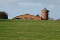
 Brick silos, Chapel Farm - geograph.org.uk - 6008038.jpg 768 × 1,024; 203 KB
-
 Bridleway between Netherton ^ Cropthorne - geograph.org.uk - 2620222.jpg 640 × 480; 126 KB
-
 Bridleway near Netherton - geograph.org.uk - 6008728.jpg 1,024 × 768; 304 KB
-
 Building foundations - geograph.org.uk - 6008740.jpg 1,024 × 768; 247 KB
-
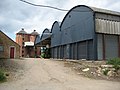
 Chapel Farm, Netherton - geograph.org.uk - 6008046.jpg 1,024 × 768; 209 KB
-
 Construction site at Netherton - geograph.org.uk - 6008738.jpg 1,024 × 768; 361 KB
-
 Dead-end lane to Netherton - geograph.org.uk - 3799766.jpg 800 × 451; 174 KB
-
 Fallow deer - geograph.org.uk - 6006205.jpg 1,024 × 683; 190 KB
-
 Fallow deer - geograph.org.uk - 6006218.jpg 1,024 × 683; 246 KB
-
 Fallow deer jumping a fence - geograph.org.uk - 6006213.jpg 1,024 × 683; 270 KB
-
 Farm buildings being converted - geograph.org.uk - 6008742.jpg 1,024 × 768; 258 KB
-
 Farm buildings being converted - geograph.org.uk - 6008746.jpg 1,024 × 768; 275 KB
-
 Farm buildings near Netherton - geograph.org.uk - 851558.jpg 640 × 480; 105 KB
-
 Farm track near Netherton - geograph.org.uk - 851409.jpg 640 × 480; 81 KB
-
 Farmland below Haselor Hill - geograph.org.uk - 6006234.jpg 1,024 × 683; 244 KB
-
 Farmland near Netherton - geograph.org.uk - 1975642.jpg 3,008 × 2,000; 1.51 MB
-
 Field by Netherton Lane - geograph.org.uk - 6251104.jpg 1,920 × 1,280; 1.15 MB
-
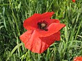
 Field of poppies at Netherton - geograph.org.uk - 850215.jpg 640 × 480; 130 KB
-
 Footpath to Cropthorne - geograph.org.uk - 3528995.jpg 800 × 451; 186 KB
-
 Gates in farmland - geograph.org.uk - 6006208.jpg 1,024 × 683; 270 KB
-
 Harrifare Barn - geograph.org.uk - 6006249.jpg 1,024 × 683; 210 KB
-
 Herrifare Barn - geograph.org.uk - 6006247.jpg 1,024 × 683; 186 KB
-
 Herrifare Barn - geograph.org.uk - 6008049.jpg 1,024 × 768; 271 KB
-
 Herrifare Barn, Netherton - geograph.org.uk - 1975461.jpg 3,008 × 2,000; 1.46 MB
-
 Houses at Netherton - geograph.org.uk - 6008048.jpg 1,024 × 683; 254 KB
-
 Netherton Farm - geograph.org.uk - 851398.jpg 640 × 480; 70 KB
-
 Netherton Lane - geograph.org.uk - 6246532.jpg 1,862 × 1,188; 1.74 MB
-
 Netherton Lane near Upper Haselor - geograph.org.uk - 6246533.jpg 1,848 × 1,162; 1.32 MB
-
 Netherton Lane near Upper Haselor - geograph.org.uk - 6251103.jpg 1,920 × 1,280; 1.8 MB
-
 Piles of earth and sand - geograph.org.uk - 6008748.jpg 1,024 × 768; 249 KB
-
 Poppy in a field near Elmley Castle - geograph.org.uk - 850225.jpg 640 × 480; 73 KB
-
 Salt Way at Netherton - geograph.org.uk - 6008735.jpg 1,024 × 768; 270 KB
-
 Sheep below Haselor Hill - geograph.org.uk - 1945368.jpg 640 × 426; 78 KB
-
 Silage bales at Chapel Farm - geograph.org.uk - 6007536.jpg 1,024 × 768; 183 KB
-
 Site of a Romano-British settlement - geograph.org.uk - 6008734.jpg 1,024 × 768; 250 KB
-
 Standing on 2 degrees west - geograph.org.uk - 6006273.jpg 1,024 × 683; 245 KB
-
 Suffolk Rams - geograph.org.uk - 1975465.jpg 640 × 426; 117 KB
-
 Timber-framed house in Netherton - geograph.org.uk - 851397.jpg 640 × 480; 110 KB
-
 Track passing trees - geograph.org.uk - 6006298.jpg 1,024 × 768; 230 KB
-
 Tree-lined track - geograph.org.uk - 6006279.jpg 683 × 1,024; 353 KB
-
 Trees beside a bridleway - geograph.org.uk - 6006276.jpg 1,024 × 683; 220 KB
-
 Varieties of brassica - geograph.org.uk - 6008579.jpg 1,024 × 683; 321 KB
-
 View from the junction of Haselor Lane - geograph.org.uk - 5506654.jpg 5,184 × 3,456; 6.45 MB
-
 View over farmland at Netherton - geograph.org.uk - 6006227.jpg 1,024 × 683; 174 KB
-
 View to Haselor Hill - geograph.org.uk - 852208.jpg 480 × 640; 125 KB
-
 Willow tree - geograph.org.uk - 6006278.jpg 1,024 × 683; 249 KB


