Category:Nether Langwith
Jump to navigation
Jump to search
English: Nether Langwith is a village and civil parish in Nottinghamshire bordering Langwith in Derbyshire, England. Lying on the banks of the River Poulter. It is located 2 miles north of Shirebrook. According to the 2001 census it had a population of 493.
village in the United Kingdom  | |||||
| Upload media | |||||
| Instance of | |||||
|---|---|---|---|---|---|
| Location | Bassetlaw, Nottinghamshire, East Midlands, England | ||||
| Population |
| ||||
 | |||||
Subcategories
This category has the following 3 subcategories, out of 3 total.
J
- Jug and Glass, Nether Langwith (11 F)
N
- Nether Langwith War Memorial (7 F)
Media in category "Nether Langwith"
The following 114 files are in this category, out of 114 total.
-
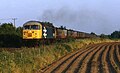 56101 Nether Langwith.jpg 2,048 × 1,251; 437 KB
-
 A632 at entrance to Langwith Lodge - geograph.org.uk - 3530074.jpg 539 × 376; 77 KB
-
 A632 at Nether Langwith - geograph.org.uk - 3013102.jpg 640 × 438; 49 KB
-
 A632 heading east - geograph.org.uk - 3893528.jpg 640 × 480; 47 KB
-
 A632 heading west - geograph.org.uk - 3893520.jpg 640 × 480; 51 KB
-
 A632 in Nether Langwith - geograph.org.uk - 2044036.jpg 640 × 480; 46 KB
-
 A632 near Cuckney Hay Wood - geograph.org.uk - 2044032.jpg 640 × 480; 40 KB
-
 A632 near Park House Farm - geograph.org.uk - 3817704.jpg 3,974 × 2,200; 5.77 MB
-
 Access road to a disused quarry - geograph.org.uk - 3817048.jpg 800 × 533; 186 KB
-
 Access road to Nether Langwith Quarry - geograph.org.uk - 3817701.jpg 4,000 × 2,248; 5.08 MB
-
 Across the field to Langwith - geograph.org.uk - 3817684.jpg 4,000 × 2,248; 4.81 MB
-
 Barn at Top Farm - geograph.org.uk - 3817186.jpg 800 × 533; 107 KB
-

-
 Bend near Langwith Mill House - geograph.org.uk - 3013098.jpg 640 × 447; 47 KB
-
 Bend on A632 west of Wood Lane - geograph.org.uk - 3530070.jpg 640 × 418; 100 KB
-
 Big sky, big field at Woodend Farm - geograph.org.uk - 3819100.jpg 800 × 533; 63 KB
-
 Blue Barn Farm - geograph.org.uk - 4937910.jpg 5,079 × 3,809; 2.88 MB
-
 Blue Barn Farm - geograph.org.uk - 5792252.jpg 1,024 × 768; 231 KB
-
 Blue Barn Farm - geograph.org.uk - 6460303.jpg 3,648 × 2,736; 1.5 MB
-
 Bluebells in Graves Wood - geograph.org.uk - 4937912.jpg 5,184 × 3,888; 7.63 MB
-
 Brook House Farmhouse, Langwith.jpg 4,032 × 3,024; 2.86 MB
-
 Cattle near the mill - geograph.org.uk - 4820861.jpg 5,500 × 3,667; 5.84 MB
-
 Cemetery, Whaley Thorns - geograph.org.uk - 4301046.jpg 640 × 480; 103 KB
-
 Clouds over Whaley Thorns - geograph.org.uk - 3819099.jpg 800 × 533; 77 KB
-
 Cockshut Lane - geograph.org.uk - 4301050.jpg 640 × 480; 60 KB
-
 Crop field east of Cockshut Lane - geograph.org.uk - 4301043.jpg 640 × 480; 88 KB
-
 Cuckney Hay Wood - geograph.org.uk - 6359705.jpg 1,024 × 768; 253 KB
-
 Curious landscaping of old quarry spoil at Nether Langwith - geograph.org.uk - 3817687.jpg 3,823 × 1,649; 3.95 MB
-
 Derbyshire border in Nether Langwith - geograph.org.uk - 2044039.jpg 640 × 480; 46 KB
-
 Disappearing paths - geograph.org.uk - 5792359.jpg 1,024 × 768; 296 KB
-
 Distant roofs - geograph.org.uk - 4820936.jpg 5,000 × 3,333; 6.85 MB
-
 Entering Nether Langwith - geograph.org.uk - 2044034.jpg 640 × 480; 49 KB
-
 Entering Nether Langwith from the east - geograph.org.uk - 2224301.jpg 900 × 589; 293 KB
-
 Entering Nether Langwith on A632 - geograph.org.uk - 3530079.jpg 640 × 299; 41 KB
-
 Entrance to disused quarry at Nether Langwith - geograph.org.uk - 3817700.jpg 4,000 × 2,248; 5.35 MB
-
 Farmland, Langwith Mill House - geograph.org.uk - 3893516.jpg 640 × 480; 72 KB
-
 Female Occupations 2011.jpg 360 × 217; 18 KB
-
 Field - geograph.org.uk - 4820905.jpg 5,000 × 3,333; 7.29 MB
-
 Field and woodland edge - geograph.org.uk - 2224273.jpg 900 × 656; 408 KB
-
 Field Entrance - geograph.org.uk - 4820908.jpg 5,000 × 3,333; 7.21 MB
-
 Field full of rubbish - geograph.org.uk - 4820901.jpg 5,000 × 3,333; 7.15 MB
-
 Fields north of Whaley Thorns - geograph.org.uk - 2824512.jpg 1,024 × 608; 129 KB
-
 Footpath crossing in Cuckney Hay Wood - geograph.org.uk - 3817051.jpg 800 × 533; 177 KB
-
 Footpath near Top Farm - geograph.org.uk - 6359694.jpg 1,024 × 768; 265 KB
-
 Footpath passing Whaley Thorns Cemetery - geograph.org.uk - 4102035.jpg 4,000 × 3,000; 1.93 MB
-
 Footpath to Graves Wood - geograph.org.uk - 5787963.jpg 1,024 × 768; 215 KB
-
 Footpath to Langwith - geograph.org.uk - 2224221.jpg 900 × 672; 362 KB
-
 Footpath to the A616 - geograph.org.uk - 5792245.jpg 1,024 × 768; 276 KB
-
 Footpath west of Blue Barn Farm - geograph.org.uk - 4940378.jpg 1,600 × 1,200; 780 KB
-
 Footpath west through Cuckney Hay Wood - geograph.org.uk - 2224267.jpg 900 × 648; 448 KB
-
 Gorse Covert seen from Graves Wood - geograph.org.uk - 5792272.jpg 1,024 × 768; 228 KB
-
 Graves Wood - the bluebells - geograph.org.uk - 4937916.jpg 5,184 × 3,888; 7.48 MB
-
 House and Barn - geograph.org.uk - 4820884.jpg 5,000 × 3,333; 7.7 MB
-
 House east of Wood Lane on A632 - geograph.org.uk - 3530065.jpg 640 × 406; 70 KB
-
 House near Blue Barn Farm - geograph.org.uk - 5792268.jpg 1,024 × 768; 217 KB
-
 Houses on Portland Road, Nether Langwith - geograph.org.uk - 4334564.jpg 1,600 × 1,062; 610 KB
-
 Houses on Portland Road, Nether Langwith - geograph.org.uk - 4334565.jpg 1,600 × 1,062; 664 KB
-
 In Cuckney Hay Wood - geograph.org.uk - 3893512.jpg 478 × 640; 140 KB
-
 Jug ^ Glass Cottage, Nether Langwith - geograph.org.uk - 4334669.jpg 1,600 × 1,577; 1.09 MB
-
 Junction of Wood Lane with the A632 - geograph.org.uk - 3893519.jpg 640 × 480; 50 KB
-
 Junction on the A632 - geograph.org.uk - 2044031.jpg 640 × 480; 42 KB
-
 Lane North of Pasture Hill farm - geograph.org.uk - 6460294.jpg 3,648 × 2,736; 2.57 MB
-
 Lane north of Whaley Thorns - geograph.org.uk - 2824505.jpg 1,500 × 1,065; 669 KB
-
 Lane towards Whaley Thorns - geograph.org.uk - 2824520.jpg 1,024 × 616; 130 KB
-
 Langwith house and mill - geograph.org.uk - 4820878.jpg 5,500 × 3,667; 7.05 MB
-
 Langwith Lodge, Nether Langwith - geograph.org.uk - 3410586.jpg 640 × 377; 182 KB
-
 Langwith Lodge, Notts.jpg 2,090 × 1,486; 891 KB
-
 Langwith Mill - geograph.org.uk - 3819108.jpg 800 × 533; 128 KB
-
 Langwith Mill - geograph.org.uk - 3893518.jpg 640 × 480; 66 KB
-
 Langwith Mill - geograph.org.uk - 4820845.jpg 5,500 × 3,667; 7.1 MB
-
 Langwith Mill - geograph.org.uk - 4820849.jpg 5,500 × 3,667; 7.4 MB
-
 Langwith Mill House - geograph.org.uk - 3817709.jpg 3,916 × 2,086; 5.72 MB
-
 Langwith Mill House - geograph.org.uk - 3819105.jpg 800 × 533; 114 KB
-
 Langwith Mill House - geograph.org.uk - 4820872.jpg 5,000 × 3,333; 7.15 MB
-
 Lime Avenue - geograph.org.uk - 2812201.jpg 640 × 439; 75 KB
-
 Lone tree in farmland - geograph.org.uk - 3893525.jpg 640 × 480; 45 KB
-
 Looking toward Woodend - geograph.org.uk - 4820933.jpg 5,500 × 3,667; 5.34 MB
-
 Male Occupations, 2011.jpg 360 × 217; 17 KB
-
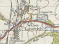 Map image of Nether Langwith.PNG 276 × 205; 128 KB
-
 Modern sculpture^ - geograph.org.uk - 487966.jpg 640 × 480; 193 KB
-
 Nether Langwith - Brook House Farm - geograph.org.uk - 1811650.jpg 1,600 × 1,200; 558 KB
-
 Newly planted trees in Cuckney Hay Wood - geograph.org.uk - 6359701.jpg 1,024 × 768; 266 KB
-
 Occupation chart.jpg 360 × 216; 21 KB
-
 Occupation for Males and Females in 2011.jpg 361 × 217; 20 KB
-
 On the A632 near Langwith Mill House - geograph.org.uk - 2044029.jpg 640 × 480; 40 KB
-
 Over the Wall - geograph.org.uk - 2812199.jpg 640 × 442; 60 KB
-
 Path by quarry workings - geograph.org.uk - 2224244.jpg 900 × 675; 293 KB
-
 Path towards Cuckney Hay Wood - geograph.org.uk - 2224252.jpg 900 × 675; 413 KB
-
 Quarry spoil alongside footpath - geograph.org.uk - 211622.jpg 600 × 148; 77 KB
-
 River Poulter at Nether Langwith - geograph.org.uk - 4334630.jpg 1,600 × 1,062; 730 KB
-
 River Poulter enters the Robin Hood County - geograph.org.uk - 3817679.jpg 4,000 × 2,248; 7.71 MB
-
 Road to Cuckney - geograph.org.uk - 4820913.jpg 5,000 × 3,333; 7.18 MB
-
 Small woodland stream by the A632 - geograph.org.uk - 2224285.jpg 675 × 900; 491 KB
-

-
 Terraced housing on Portland Road - geograph.org.uk - 4301061.jpg 640 × 480; 64 KB
-
 The Farmhouse - geograph.org.uk - 4820922.jpg 5,500 × 3,667; 7.01 MB
-
 The Farmhouse, Cotton Mill, Langwith.jpg 4,032 × 3,024; 3.8 MB
-
 The track to Nether Langwith - geograph.org.uk - 4937905.jpg 3,733 × 4,977; 4.35 MB
-
 Top Farm - geograph.org.uk - 3816883.jpg 3,934 × 1,879; 4.76 MB
-
 Top Farm near Langwith - geograph.org.uk - 4940382.jpg 1,600 × 1,200; 613 KB
-
 Track by Boon Hills Wood - geograph.org.uk - 2224237.jpg 675 × 900; 442 KB
-
 Track to Blue Barn Farm - geograph.org.uk - 3817711.jpg 4,000 × 2,248; 6.04 MB
-

-
 Track to the mill - geograph.org.uk - 4820891.jpg 5,500 × 3,667; 7.35 MB
-
 Trees by the A632 - geograph.org.uk - 2224293.jpg 675 × 900; 379 KB
-
 View of Nether Langwith - geograph.org.uk - 2044038.jpg 640 × 480; 51 KB
-
 View over field towards Shireoaks Hill Farm - geograph.org.uk - 6460300.jpg 3,648 × 2,736; 1.89 MB
-
 Whaley Thorns - Children's Centre - geograph.org.uk - 1820421.jpg 1,600 × 1,200; 360 KB
-
 Whaley Thorns Village Hall - geograph.org.uk - 4334571.jpg 1,600 × 1,062; 995 KB
-
 Whaley Thorns village sign - geograph.org.uk - 4937908.jpg 3,817 × 5,089; 4.08 MB
-
 What the plough turned up - geograph.org.uk - 5792263.jpg 1,024 × 768; 358 KB
-
 Willow Trees near Cuckney Dam - geograph.org.uk - 6455994.jpg 3,648 × 2,736; 2.49 MB
-
 Works - geograph.org.uk - 4820895.jpg 5,000 × 3,333; 7.27 MB
-
 Poulter Country Park - geograph.org.uk - 99314.jpg 640 × 423; 70 KB


