Category:Nesserlander Schleuse
Jump to navigation
Jump to search
| Object location | | View all coordinates using: OpenStreetMap |
|---|
| Upload media | |||||
| Instance of | |||||
|---|---|---|---|---|---|
| Location | Emden, Lower Saxony, Germany | ||||
| Located in or next to body of water | |||||
 | |||||
Media in category "Nesserlander Schleuse"
The following 15 files are in this category, out of 15 total.
-
 Emden - Nesserlander Brücke und Schleuse (2024).jpg 4,200 × 3,150; 6.73 MB
-
 Emden - Nesserlander Brücke, Pumpwerk & Wasserschutzpolizei (2024).jpg 5,000 × 2,500; 6.69 MB
-
 Emden nessellanderschleuse 2013.jpg 3,658 × 1,988; 724 KB
-
 GUSTAV MEYER 7490.jpg 5,472 × 3,648; 2.97 MB
-
 J38 401 Emden Außenhafen, Nesserlander Schleuse.jpg 5,886 × 3,924; 5.55 MB
-
 J38 402 Nesserlander Schleuse.jpg 5,886 × 3,924; 5.84 MB
-
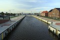
 Nesselander Br 20190922.jpg 1,920 × 1,079; 822 KB
-
 Nesserlander Brücke Emden.jpg 5,334 × 3,561; 9.31 MB
-

-
 Nesserlander Schleuse 1438.jpg 5,472 × 3,648; 2.61 MB
-
 Nesserlander Schleuse 1439.jpg 5,472 × 3,648; 2.77 MB
-
 Nesserlander Schleuse 1440.jpg 5,105 × 3,402; 2.66 MB
-
 Nesserlander Schleuse 1443.jpg 3,972 × 2,647; 1.62 MB
-
 PRESTO 7483.jpg 5,175 × 3,450; 2.82 MB
-
 Schlepper "Leda" (ENI 02335709) im Emder Aussenhafen (2024).jpg 4,800 × 3,600; 8.74 MB
.jpg)
.jpg)


_im_Emder_Aussenhafen_(2024).jpg)


_im_Emder_Aussenhafen_(2024).jpg)