Category:Nessa (Stazzona)
Jump to navigation
Jump to search
|
Nessa (Stazzona) has an entry on OpenStreetMap (show). |
human settlement in the Italian municipality of Stazzona (Italy) _,_along_VML4.jpg) _along_VML4.jpg)   | |||||
| Upload media | |||||
| Instance of |
| ||||
|---|---|---|---|---|---|
| Location | Stazzona, Province of Como, Lombardy, Italy | ||||
| Elevation above sea level |
| ||||
 | |||||
Media in category "Nessa (Stazzona)"
The following 11 files are in this category, out of 11 total.
-
 Arrival at Nessa, along VML4.jpg 6,942 × 2,767; 9.69 MB
-
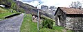
 Crossing at Nessa (Stazzona), along VML4.jpg 4,608 × 3,456; 7.54 MB
-
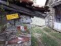
 Information board on VML in Nessa (Stazzona).jpg 1,099 × 1,308; 554 KB
-
 Nessa, VML turns right.jpg 6,057 × 2,334; 7.14 MB
-
 Photosphere at a junction on th road to Nessa, along VML4.jpg 5,322 × 2,661; 5.84 MB
-
 Photosphere in Nessa (Stazzona) along VML4.jpg 5,322 × 2,661; 6.02 MB
-
 Place name sign Nessa.jpg 4,608 × 3,456; 6.43 MB
-
 Route marker on a fence in Nessa (Stazzona).jpg 4,083 × 2,895; 5.76 MB
-
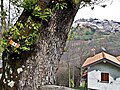 Route marker on a tree in Nessa (Stazzona).jpg 4,608 × 3,456; 8.44 MB
-
 Route marker VML in Nessa (Stazzona).jpg 4,608 × 3,456; 12.43 MB
-
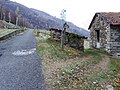
 Track in Nessa (Stazzona) , along VML4.jpg 4,608 × 3,456; 8.19 MB
,_along_VML4.jpg)
.jpg)

_along_VML4.jpg)
.jpg)
.jpg)
.jpg)