Category:Nepal photographs taken on 2013-10-21
Appearance
| ← | Monday 21 October 2013 | → | ||
| ← | October 2013 | → | ||
Nepal photographs taken on 21 October 2013.
Image files should be categorized here automatically using {{taken on}} template. Direct categorisation is also possible, if automatic is impossible.
Media in category "Nepal photographs taken on 2013-10-21"
The following 36 files are in this category, out of 36 total.
-
Annapurna Base Camp (2).jpg 5,353 × 3,422; 6.79 MB
-
Annapurna III and Gangapurna - Annapurna Circuit, Nepal - panoramio (1).jpg 2,500 × 1,530; 1.08 MB
-
Annapurna III and Gangapurna - Annapurna Circuit, Nepal - panoramio.jpg 2,500 × 1,573; 1.06 MB
-
Annapurna massif - Nepal - panoramio.jpg 2,500 × 1,450; 1.33 MB
-
Bridge over a creek in the Arun valley. - panoramio.jpg 1,936 × 1,296; 1.02 MB
-
CERCA DEL CAMPO BASE DEL ANNAPURNA - panoramio.jpg 4,288 × 2,848; 6.22 MB
-
Damodar Himal - Annapurna Circuit, Nepal - panoramio.jpg 2,500 × 1,242; 1.32 MB
-
ESCALERAS EN CHOMRONG - panoramio.jpg 4,288 × 2,848; 9.5 MB
-
High Camp - Annapurna Circuit, Nepal - panoramio (1).jpg 2,500 × 1,686; 2.18 MB
-
High Camp - Annapurna Circuit, Nepal - panoramio.jpg 2,500 × 1,642; 1.76 MB
-
High Camp entrance - Annapurna Circuit, Nepal - panoramio.jpg 2,500 × 1,700; 1.75 MB
-
High Camp hill - Annapurna Circuit, Nepal - panoramio.jpg 2,500 × 1,638; 1.33 MB
-
High Camp overview - Annapurna Circuit, Nepal - panoramio.jpg 2,500 × 1,722; 2.21 MB
-
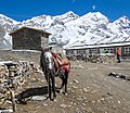
Horse in High Camp - Annapurna Circuit, Nepal - panoramio (1).jpg 2,500 × 1,705; 1.89 MB
-
Horse in High Camp - Annapurna Circuit, Nepal - panoramio.jpg 2,309 × 2,000; 1.92 MB
-
House near the road in the valley of the Arun river. - panoramio.jpg 1,936 × 1,296; 1.14 MB
-
Humble home near the road. - panoramio.jpg 1,936 × 1,296; 1.03 MB
-
In this place located several houses. - panoramio.jpg 1,936 × 1,296; 1.09 MB
-
LODGE EN EL TREKKING AL CAMPO BASE DEL ANNAPURNA - panoramio.jpg 4,288 × 2,848; 5.61 MB
-
MACHHAPUCHHARE. ARISTA IMPOSIBLE - panoramio.jpg 4,288 × 2,848; 5.96 MB
-
MACHHAPUCHHARE. PIRAMIDE DE HIELO Y ROCA - panoramio.jpg 4,288 × 2,848; 6.23 MB
-
Morning Walk in the mountains.jpg 4,928 × 2,772; 1.12 MB
-
NEW BRIDGE. RIO MHODI - panoramio.jpg 4,288 × 2,848; 9.35 MB
-
Sunrise from Thorung la.jpg 4,928 × 3,264; 915 KB
-
The road along the shore Arun River. - panoramio.jpg 1,936 × 1,296; 1.18 MB
-
The road to Num along the valley Arun river. - panoramio.jpg 1,936 × 1,296; 1.07 MB
-
This is Arun river valley. View towards Hatiya. - panoramio.jpg 1,936 × 1,296; 993 KB
-
Thorong High Camp.jpg 2,500 × 1,686; 2.18 MB
-
Thorung La pass.jpg 4,112 × 2,474; 2.15 MB
-
Towards Thorong La - Annapurna Circuit, Nepal - panoramio.jpg 2,500 × 1,286; 1.3 MB
-
Tribhuvan University,Arts Faculty.JPG 6,016 × 4,000; 9.16 MB
-
VERTICALIDAD DE HIELO Y ROCA - panoramio.jpg 4,288 × 2,848; 6.32 MB
-
View of the village GOLA. - panoramio.jpg 1,936 × 1,296; 983 KB
-
Way to Thorong Phedi - Annapurna Circuit, Nepal - panoramio.jpg 2,500 × 1,662; 1.42 MB
-
Yakawa Kang - Annapurna Circuit, Nepal - panoramio.jpg 2,500 × 1,683; 1.4 MB


