Category:Nepal maps by U.S. Army Map Service
Jump to navigation
Jump to search
Media in category "Nepal maps by U.S. Army Map Service"
The following 16 files are in this category, out of 16 total.
-
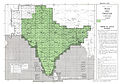 India and Pakistan AMS index.jpg 1,964 × 1,378; 3.78 MB
-

-

-

-
 Map China 1-250,000 Tile NH 45-14 Tingri Dzong.jpg 5,000 × 3,802; 4.75 MB
-
 Map India and Pakistan 1-250,000 Tile NF 44-14 Philibhit.jpg 5,000 × 3,765; 3.51 MB
-
 Map India and Pakistan 1-250,000 Tile NG 45-1 Katmandu.jpg 5,000 × 3,921; 4.67 MB
-
 Map India and Pakistan 1-250,000 Tile NG 45-2 Mount Everest.jpg 5,000 × 3,831; 5.91 MB
-
 Map India and Pakistan 1-250,000 Tile NG 45-3 Kanchenjunga.jpg 5,000 × 3,805; 6.51 MB
-
 Map India and Pakistan 1-250,000 Tile NG 45-7 Kishanganj.jpg 5,000 × 3,799; 6.02 MB
-
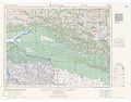
 Map India and Pakistan 1-250,000 Tile NH 44-15 Nepalganj.jpg 5,000 × 3,781; 3.9 MB
-
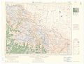
 Map India and Pakistan 1-250,000 Tile NH 44-16 Pokhara.jpg 5,000 × 3,846; 4.17 MB
-
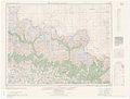
 Map India and Pakistan 1-250,000 Tile NH 44-6 Nanda Devi.jpg 5,000 × 3,799; 4.02 MB
-
 Map India and Pakistan 1-250,000 Tile NH 45-13 Jongkha Dzong.jpg 5,000 × 3,774; 4.21 MB
-

-
 Tingri Dzong map sheet name in 1955 (cropped).jpg 758 × 148; 19 KB

-_Map_China_1-250,000_Tile_NH_45-14_Tingri_Dzong_(cropped).jpg)
.jpg)
.jpg)


.jpg)
.jpg)