Category:Nelson, Caerphilly
Jump to navigation
Jump to search
village and community in the county borough of Caerphilly, Wales   | |||||
| Upload media | |||||
| Instance of | |||||
|---|---|---|---|---|---|
| Location | Caerphilly County Borough, Wales | ||||
| Population |
| ||||
| Area |
| ||||
 | |||||
Català: Nelson és una població del sud de Gal·les, pertanyent al comtat de Sir Caerffili, que a causa de la proximitat amb Cardiff està creixent ràpidament. El seu nom gal·lès original (Ffos-y-Gerddinen, Fossat del "cerddinen", una rosàcia del gènere Sorbus) cedí el lloc al nom d'un "pub" local a causa de la dificultat de pronunciació [1].
Cymraeg: Pentref ym Mwrdeisdref Sirol Caerffili yw Nelson (Cyfeirnod OS: ST1195). Saif bum milltir i'r gogledd o dref Pontypridd. Dywedir i'r pentref gael ei alw ar ôl tafarn o'r enw 'The Nelson's Arms' ac i'r dafarn gael ei alw ar ôl ymweliad gan yr Arglwydd Nelson yn 1803 - dwy flynedd cyn Brwydr Trafalgr.
English: Nelson is an expanding village in the county borough of Caerphilly, in Wales. It is situated 5 miles north of Pontypridd which remains the main town for shopping.
Media in category "Nelson, Caerphilly"
The following 200 files are in this category, out of 527 total.
(previous page) (next page)-

-
 2010 Wales Caerphilly Community Nelson map.svg 512 × 725; 375 KB
-
 2024 Wales Caerphilly Community Nelson map.svg 512 × 725; 345 KB
-
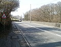
 A472 at Maes-y-dderwen - geograph.org.uk - 5755631.jpg 640 × 480; 59 KB
-
 A472 from Nelson towards Quakers Yard - geograph.org.uk - 6007003.jpg 1,024 × 879; 221 KB
-
 A472 heads east from Nelson - geograph.org.uk - 2313638.jpg 640 × 624; 109 KB
-
 A472 in Nelson - geograph.org.uk - 6029634.jpg 1,024 × 895; 223 KB
-
 A472 NE from Heol Fawr, Nelson - geograph.org.uk - 2318450.jpg 640 × 480; 57 KB
-
 A472 SW from Heol Fawr, Nelson - geograph.org.uk - 2318448.jpg 640 × 550; 83 KB
-
 Abernant electricity substation, Nelson - geograph.org.uk - 6006970.jpg 1,024 × 640; 158 KB
-
 All Dolled Up in Nelson - geograph.org.uk - 6004711.jpg 858 × 1,024; 151 KB
-
 Allotments, Nelson - geograph.org.uk - 4624761.jpg 3,264 × 2,448; 2.01 MB
-
 Allotments, Nelson - geograph.org.uk - 4679475.jpg 3,264 × 2,448; 1.89 MB
-
 Along Llancaiach View, Nelson - geograph.org.uk - 6018943.jpg 1,024 × 852; 185 KB
-
 Ashgrove Terrace houses, Nelson - geograph.org.uk - 6005009.jpg 1,024 × 847; 162 KB
-
 Ashgrove Terrace, Nelson - geograph.org.uk - 2335085.jpg 640 × 356; 45 KB
-
 Astra Plant, Nelson - geograph.org.uk - 2321970.jpg 640 × 480; 59 KB
-
 B4255 towards Nelson and Bedlinog - geograph.org.uk - 6029644.jpg 1,024 × 862; 208 KB
-
 Barclays Bank, Nelson - geograph.org.uk - 2323980.jpg 486 × 640; 62 KB
-
 Bend in Heol Islwyn, Nelson - geograph.org.uk - 6006147.jpg 1,024 × 689; 150 KB
-
 Bend in the B4255 in Nelson - geograph.org.uk - 6008116.jpg 1,024 × 799; 147 KB
-
 Bend in the road at a Nelson junction - geograph.org.uk - 6018963.jpg 1,024 × 549; 100 KB
-
 Bends ahead on the road to Nelson - geograph.org.uk - 2313394.jpg 640 × 492; 87 KB
-
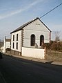
 Bethel Evangelical Church, Nelson - geograph.org.uk - 2318456.jpg 480 × 640; 65 KB
-
-

-
 Bilingual warning sign on a Nelson corner - geograph.org.uk - 6008135.jpg 1,024 × 901; 164 KB
-
 Boarded-up premises, Commercial Street, Nelson - geograph.org.uk - 6008222.jpg 1,024 × 1,004; 213 KB
-

-
 Bogflower.jpg 2,134 × 2,848; 1.21 MB
-
 Brooklands in the north of Nelson - geograph.org.uk - 6002454.jpg 1,024 × 663; 135 KB
-
 Brooklands, Nelson - geograph.org.uk - 3159702.jpg 640 × 445; 66 KB
-
 Bryncelyn Community Centre, Nelson - geograph.org.uk - 2362074.jpg 640 × 357; 44 KB
-
 Bryncelyn houses, Nelson - geograph.org.uk - 2361936.jpg 640 × 410; 55 KB
-
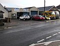 BT Motors garage in Nelson - geograph.org.uk - 6002464.jpg 1,024 × 773; 163 KB
-
 Bull at Pentraethlon Farm - geograph.org.uk - 5736382.jpg 5,179 × 3,451; 4 MB
-

-

-

-
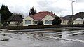 Bungalows at the western edge of Nelson - geograph.org.uk - 6005051.jpg 1,024 × 573; 118 KB
-
 Bus stop and shelter, Bryncelyn, Nelson - geograph.org.uk - 6003304.jpg 1,024 × 679; 158 KB
-
 Bwl Road, Nelson - geograph.org.uk - 2363483.jpg 640 × 582; 104 KB
-
 Bwrlyn, Pentwyn Road, near Nelson - geograph.org.uk - 2363564.jpg 640 × 565; 120 KB
-
 Byway alongside Senghenydd Dyke - geograph.org.uk - 3360106.jpg 640 × 480; 59 KB
-
 Byway on Mynydd Eglwysilan - geograph.org.uk - 3360112.jpg 640 × 480; 56 KB
-
 Cae Llwyndu speed bumps, Nelson - geograph.org.uk - 6017776.jpg 1,024 × 952; 162 KB
-
 Cae Llwyndu, Nelson - geograph.org.uk - 6017502.jpg 1,024 × 654; 145 KB
-
 Cae'r Gelynnen, Nelson - geograph.org.uk - 6017769.jpg 1,024 × 703; 121 KB
-
 Caerphilly Road houses, Nelson - geograph.org.uk - 2318444.jpg 640 × 599; 91 KB
-
 Caerphilly UK community map (Nelson).svg 894 × 1,266; 474 KB
-
 Café Nelson, 12 Commercial Street, Nelson - geograph.org.uk - 6004722.jpg 1,024 × 910; 221 KB
-

-

-
 Calfaria Baptist Church, Nelson (geograph 4679422).jpg 3,264 × 2,448; 1.91 MB
-
 Calfaria Baptist Church, Nelson - geograph.org.uk - 2324012.jpg 640 × 480; 70 KB
-
 Car Park, Parc Penallta Country Park - geograph.org.uk - 5714044.jpg 5,184 × 3,456; 6.46 MB
-
 Car-lined High Street, Nelson - geograph.org.uk - 6002982.jpg 986 × 1,024; 180 KB
-
 Carneddi Llwydion - geograph.org.uk - 3360116.jpg 640 × 480; 91 KB
-
 Carneddi Llwydion B - geograph.org.uk - 6162887.jpg 1,024 × 576; 180 KB
-
 Carneddi Llwydion C - geograph.org.uk - 6162884.jpg 1,024 × 576; 180 KB
-
 Caution - Walters site entrance, Nelson - geograph.org.uk - 6029658.jpg 1,024 × 768; 147 KB
-
 Centre of Nelson, Caerphilly from Commercial Street.jpg 2,848 × 2,134; 380 KB
-
 Change of house type, Shingrig Road, Nelson - geograph.org.uk - 6002477.jpg 1,024 × 838; 157 KB
-
 Chapel House, Heol Fawr, Nelson - geograph.org.uk - 2318460.jpg 640 × 498; 65 KB
-
 Church of St John the Baptist, Nelson - geograph.org.uk - 2361903.jpg 640 × 491; 101 KB
-
 Church of St John the Baptist, Nelson - geograph.org.uk - 4679449.jpg 3,264 × 2,448; 1.95 MB
-
 Classy Canines in Nelson - geograph.org.uk - 6003829.jpg 1,024 × 840; 161 KB
-
 Co-op on a Nelson corner (geograph 6005284).jpg 1,024 × 901; 176 KB
-
 Co-operative Food store, Mafon Road, Nelson (geograph 6006220).jpg 1,024 × 826; 173 KB
-
 Commercial Street, Nelson - geograph.org.uk - 5755632.jpg 640 × 480; 70 KB
-
 Commercial Vans premises, Nelson - geograph.org.uk - 6029572.jpg 1,024 × 696; 133 KB
-

-
 Copy of Picture 014.jpg 2,848 × 2,134; 1.12 MB
-
 Corner house, Llwyn-yr-eos, Nelson - geograph.org.uk - 2356588.jpg 640 × 431; 62 KB
-

-

-

-
 Cosy Corner Nursery, Nelson - geograph.org.uk - 2356573.jpg 542 × 640; 68 KB
-
 Cottage Garden Florist in Nelson - geograph.org.uk - 6005221.jpg 1,024 × 806; 173 KB
-
 Countryside at Pen-yr-heol-fawr near Nelson - geograph.org.uk - 2070686.jpg 1,600 × 1,200; 223 KB
-
 Cwmheldeg Farm - geograph.org.uk - 5721752.jpg 5,184 × 3,456; 7.09 MB
-
 Cycle route next to Penallta Country Park - geograph.org.uk - 5720282.jpg 5,179 × 3,451; 5.77 MB
-
 Cycletrack.jpg 2,134 × 2,848; 1.17 MB
-
 Dark green cabinets, Llwyncelyn Terrace, Nelson - geograph.org.uk - 6005917.jpg 1,024 × 991; 393 KB
-
-

-
 Detached house, Commercial Street, Nelson - geograph.org.uk - 6008209.jpg 1,024 × 733; 140 KB
-
 Devonia, Nelson - geograph.org.uk - 2361752.jpg 640 × 461; 62 KB
-
 Distinctively painted house, Heol Fawr, Nelson - geograph.org.uk - 6004671.jpg 1,024 × 795; 143 KB
-
 Domino's Pizza in Nelson - geograph.org.uk - 6017457.jpg 1,024 × 840; 171 KB
-
 Domino's Pizza, Dynevor Terrace, Nelson - geograph.org.uk - 6017473.jpg 1,024 × 883; 182 KB
-
 Donald Street, Nelson - geograph.org.uk - 6002508.jpg 1,024 × 768; 141 KB
-
 Dormer bungalows, Tawelfan, Nelson - geograph.org.uk - 6018790.jpg 1,024 × 675; 131 KB
-
 Downtown Nelson - geograph.org.uk - 447181.jpg 640 × 480; 84 KB
-
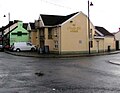 Dynevor Arms in Nelson - geograph.org.uk - 6005298.jpg 1,024 × 794; 150 KB
-
 Dynevor Arms, Nelson - geograph.org.uk - 2323999.jpg 640 × 431; 60 KB
-
 Dynevor Terrace directions sign, Nelson - geograph.org.uk - 6029578.jpg 1,024 × 921; 249 KB
-
 Dynevor Terrace houses in Nelson - geograph.org.uk - 6005364.jpg 1,024 × 695; 157 KB
-
 Dynevor Terrace, Nelson - geograph.org.uk - 4679535.jpg 3,264 × 2,448; 1.74 MB
-
 East along the A472, Nelson - geograph.org.uk - 6006200.jpg 1,024 × 950; 234 KB
-
 Eastern edge of Nelson - geograph.org.uk - 2318441.jpg 640 × 481; 87 KB
-

-

-
 End of dry stone wall in the hills above Nelson - geograph.org.uk - 2070670.jpg 1,600 × 1,200; 369 KB
-
 End of the 30 zone in Llanfabon - geograph.org.uk - 6007161.jpg 1,024 × 841; 282 KB
-
 End of the 40 zone west of Nelson - geograph.org.uk - 6006981.jpg 1,024 × 826; 199 KB
-

-
 Entrance to allotments, Nelson - geograph.org.uk - 4624758.jpg 3,264 × 2,448; 1.74 MB
-
 Entrance to Brynllefrith, Llanfabon - geograph.org.uk - 6007139.jpg 1,024 × 768; 323 KB
-
 Entrance to Llanfabon House, Llanfabon - geograph.org.uk - 6007113.jpg 1,024 × 815; 257 KB
-

-
 Entrance to Nelson Exchange, South Wales - geograph.org.uk - 6029598.jpg 1,024 × 768; 243 KB
-
 Fairfield, Nelson - geograph.org.uk - 6003690.jpg 1,024 × 799; 155 KB
-
 Fallen trig on Mynydd Eglwysilan - geograph.org.uk - 3352704.jpg 640 × 480; 80 KB
-
 Fallen trig point on Mynydd Eglwysilan - geograph.org.uk - 4498835.jpg 4,000 × 3,000; 5.02 MB
-
 Fallen trig point on Mynydd Eglwysilan - geograph.org.uk - 4498842.jpg 3,856 × 2,891; 4.91 MB
-
 Farm buildings, Ty-du Farm - geograph.org.uk - 5720708.jpg 5,184 × 3,456; 7.17 MB
-
 Farm lane behind Hawthorne Avenue, Nelson - geograph.org.uk - 5720470.jpg 5,179 × 3,451; 3.94 MB
-
 Farm near Parc Penallta Country Park - geograph.org.uk - 5714047.jpg 5,184 × 3,456; 7.14 MB
-
 Fast food stall in Nelson - geograph.org.uk - 6007186.jpg 800 × 673; 101 KB
-
 Ffos Close, Nelson - geograph.org.uk - 6018728.jpg 1,024 × 827; 135 KB
-
 Ffos y Cerridden, Nelson - geograph.org.uk - 6006137.jpg 1,024 × 757; 135 KB
-
 Fidygelyn Farm - geograph.org.uk - 5721483.jpg 5,179 × 3,451; 4.45 MB
-
 Field footpath from Llanfabon Road - geograph.org.uk - 5736661.jpg 5,179 × 3,451; 4.31 MB
-
 Field gate, Llanfabon Road, Llanfabon - geograph.org.uk - 6007076.jpg 1,024 × 768; 287 KB
-
 Field north east of Llanfabon - geograph.org.uk - 4380910.jpg 640 × 480; 86 KB
-

-
 Fields Above Tirmynydd - geograph.org.uk - 5391075.jpg 1,600 × 1,200; 429 KB
-
 Fields, Cwmheldeg-isaf - geograph.org.uk - 5721738.jpg 5,179 × 3,451; 6.13 MB
-

-
 Foot crossing near Nelson - geograph.org.uk - 2327247.jpg 2,816 × 2,112; 2.51 MB
-
 Foot crossing near Nelson - geograph.org.uk - 2327261.jpg 2,816 × 2,112; 2.28 MB
-
 Footpath near Parc Penallta - geograph.org.uk - 4498804.jpg 4,000 × 3,000; 4.31 MB
-

-

-
 Former Police Station, Nelson - geograph.org.uk - 4624779.jpg 3,264 × 2,448; 1.71 MB
-
 Former police station, Station Terrace, Nelson - geograph.org.uk - 6018748.jpg 1,024 × 718; 167 KB
-
 From 40 to 30 on Cae Llwyndu, Nelson - geograph.org.uk - 6017524.jpg 1,024 × 741; 153 KB
-
 G.Bridges Welding ^ Plating premises in Nelson - geograph.org.uk - 6005410.jpg 1,022 × 1,024; 162 KB
-
 Gas Valve Compound near Nelson - geograph.org.uk - 2313439.jpg 640 × 458; 99 KB
-

-
 Gates on field footpath to Pen Beili - geograph.org.uk - 5720955.jpg 5,179 × 3,451; 4.22 MB
-
 Gates to field at Gilwern - geograph.org.uk - 5720943.jpg 5,179 × 3,451; 6.06 MB
-
 Ger Bryntaldwyn - Near Bryntaldwyn - geograph.org.uk - 5073867.jpg 640 × 480; 76 KB
-

-
 Ger Wern Ganol - Near Wern Ganol - geograph.org.uk - 5073834.jpg 640 × 480; 134 KB
-

-

-
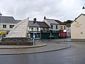
 Grade II listed Nelson War Memorial - geograph.org.uk - 6005016.jpg 3,239 × 2,659; 1.58 MB
-
 Green house, Dynevor Terrace, Nelson - geograph.org.uk - 6006048.jpg 1,024 × 830; 198 KB
-
-
 Gwaun Llwyfen houses, Nelson - geograph.org.uk - 6017512.jpg 1,024 × 839; 155 KB
-

-
 Handball Court in Nelson - geograph.org.uk - 88546.jpg 640 × 480; 133 KB
-
 Handball Court, Nelson - geograph.org.uk - 2737582.jpg 1,944 × 2,592; 896 KB
-
 Head Over Heels in Nelson - geograph.org.uk - 6005187.jpg 868 × 1,024; 161 KB
-

-
 Heol Fawr - geograph.org.uk - 5073855.jpg 640 × 480; 69 KB
-
 Heol Fawr houses, Nelson - geograph.org.uk - 2321981.jpg 640 × 489; 60 KB
-
 Heol Isaf bungalows, Nelson - geograph.org.uk - 2318469.jpg 640 × 480; 56 KB
-
 Heol Islwyn bungalows, Nelson - geograph.org.uk - 6006149.jpg 1,024 × 839; 196 KB
-
 Heol Islwyn semis, Nelson - geograph.org.uk - 6006152.jpg 1,024 × 754; 161 KB
-
 Heol Morien, Nelson - geograph.org.uk - 6005867.jpg 1,024 × 688; 128 KB
-
 Heol Tasker, Nelson - geograph.org.uk - 2361954.jpg 640 × 472; 62 KB
-
 High Close, Nelson - geograph.org.uk - 2361739.jpg 640 × 367; 51 KB
-
 High Close, Nelson - geograph.org.uk - 6002984.jpg 1,024 × 787; 142 KB
-
 High St, Nelson - geograph.org.uk - 4624787.jpg 3,264 × 2,448; 1.78 MB
-
 High Street bungalows, Nelson - geograph.org.uk - 2362099.jpg 640 × 556; 75 KB
-
 High Street bungalows, Nelson - geograph.org.uk - 6003801.jpg 1,024 × 669; 122 KB
-
 High Street houses in Nelson - geograph.org.uk - 6003823.jpg 1,024 × 938; 208 KB
-

-
 Highstreetnelson.jpg 2,848 × 2,134; 1.27 MB
-
 Hillside field above Gilwern - geograph.org.uk - 5720986.jpg 5,179 × 3,451; 4.28 MB
-
 Hollybush pub name sign, Nelson - geograph.org.uk - 6006006.jpg 786 × 1,024; 160 KB
-
 Hollybush, Llwyncelyn Terrace, Nelson (geograph 6006001).jpg 1,024 × 693; 165 KB
-
 House, Tai'r-heol - geograph.org.uk - 4679530.jpg 3,264 × 1,779; 1.63 MB
-

-

-
 Houses at the northwest end of Tawelfan, Nelson - geograph.org.uk - 6018954.jpg 1,024 × 723; 112 KB
-
 Houses at the southern end of Heol Fawr, Nelson - geograph.org.uk - 6007780.jpg 1,024 × 876; 173 KB
-

-
 Houses at the western end of High Street, Nelson - geograph.org.uk - 6005055.jpg 1,024 × 788; 159 KB
-
 Housing variety in Nelson - geograph.org.uk - 6003693.jpg 1,024 × 670; 135 KB
-
 Housing variety, Cae Llwyndu, Nelson - geograph.org.uk - 6017534.jpg 1,024 × 763; 175 KB
-

-
 Inconvenient in Nelson - geograph.org.uk - 6006059.jpg 1,024 × 925; 215 KB
-

-

-
 Into allotments, Nelson - geograph.org.uk - 6005983.jpg 1,024 × 577; 130 KB
-
 Inverness to Kyle Nelson&L37893220691 (16926386861).jpg 3,490 × 1,719; 4.35 MB
-
 Inverness to Kyle Nelson37892220691 (16926375851).jpg 3,047 × 1,969; 3.61 MB
-
 Inverness to Kyle Nelson37892220691 (2) (16741166659).jpg 3,141 × 1,910; 4.34 MB
-
 Inverness to Kyle Nelson37892893220691 (16304970584).jpg 3,114 × 1,927; 4.29 MB
-
 Inverness to Kyle Nelson37893220691 (16307321953).jpg 3,329 × 1,802; 3.85 MB
-
 Jacabbs Club, 17 Wern Crescent, Nelson - geograph.org.uk - 6005028.jpg 1,024 × 863; 150 KB
-
 Jacabbs Club, Nelson (geograph 2324031).jpg 640 × 501; 62 KB
-
 JNP Legal office in Nelson - geograph.org.uk - 6002980.jpg 1,024 × 764; 137 KB
-

-
 Junction of Bwl Road and Shingrig Road, Nelson - geograph.org.uk - 6002473.jpg 1,024 × 936; 239 KB
-


.svg)


.jpg)


.jpg)
.jpg)


.jpg)


.jpg)
.jpg)
_(16741166659).jpg)
.jpg)
.jpg)

.jpg)


