Category:Neen Sollars
Jump to navigation
Jump to search
English: Neen Sollars is a village and civil parish on River Rea, formerly called the River Neen, in south Shropshire. The village is about 2.5 miles south-southwest of Cleobury Mortimer.
village and civil parish in Shropshire United Kingdom  | |||||
| Upload media | |||||
| Instance of | |||||
|---|---|---|---|---|---|
| Location | Shropshire, West Midlands, England | ||||
 | |||||
Subcategories
This category has the following 2 subcategories, out of 2 total.
A
R
- Rea Aqueduct (4 F)
Media in category "Neen Sollars"
The following 89 files are in this category, out of 89 total.
-
 All Saints' church, Neen Sollars - geograph.org.uk - 5431417.jpg 768 × 1,024; 239 KB
-
 All Saints, Neen Sollars - geograph.org.uk - 4975195.jpg 3,252 × 2,162; 2.14 MB
-
 All Saints, Neen Sollars - geograph.org.uk - 4978444.jpg 3,251 × 2,161; 1.62 MB
-
 All Saints, Neen Sollars - geograph.org.uk - 4978445.jpg 3,248 × 2,160; 1.82 MB
-
 All Saints, Neen Sollars - geograph.org.uk - 4980885.jpg 2,201 × 1,731; 2.33 MB
-
 All Saints, Neen Sollars - geograph.org.uk - 4990713.jpg 2,414 × 3,478; 1.74 MB
-
 All Saints, Neen Sollars - geograph.org.uk - 4990734.jpg 3,260 × 2,168; 1.81 MB
-
 All Saints, Neen Sollars - geograph.org.uk - 4990738.jpg 3,173 × 2,177; 1.15 MB
-
 All Saints, Neen Sollars - geograph.org.uk - 4990747.jpg 3,248 × 2,160; 1.7 MB
-
 All Saints, Neen Sollars - geograph.org.uk - 4990755.jpg 2,160 × 3,248; 1.48 MB
-
 All Saints, Neen Sollars - geograph.org.uk - 4990774.jpg 3,301 × 2,194; 1.75 MB
-
 All Saints, Neen Sollars - geograph.org.uk - 4990803.jpg 2,318 × 3,487; 2.15 MB
-
 All Saints, Neen Sollars - geograph.org.uk - 4992741.jpg 2,310 × 3,276; 2.06 MB
-
 Bear and pond near Neen Sollars - geograph.org.uk - 5662607.jpg 1,024 × 683; 466 KB
-
 Bewdley and Tenbury Railway - geograph.org.uk - 5662571.jpg 1,024 × 683; 500 KB
-
 Birch Hill - geograph.org.uk - 3158700.jpg 640 × 360; 206 KB
-
 Bridge over Mill Brook - geograph.org.uk - 3158667.jpg 640 × 360; 260 KB
-
 Bridge over the Bewdley to Woofferton railway - geograph.org.uk - 5662590.jpg 1,024 × 683; 607 KB
-
 Church Cottage, Neen Sollars - geograph.org.uk - 4992290.jpg 3,465 × 2,211; 1.8 MB
-
 Church Farm in Neen Sollars - geograph.org.uk - 2964435.jpg 3,178 × 1,943; 2.78 MB
-
 Church Farm, Neen Sollars - geograph.org.uk - 4026211.jpg 4,048 × 3,040; 5.03 MB
-
 East window, Neen Sollars church - geograph.org.uk - 5431421.jpg 768 × 1,024; 223 KB
-
 Faith, Hope and Charity, All Saints, Neen Sollars - geograph.org.uk - 4990788.jpg 3,252 × 2,162; 1.49 MB
-
 Farmland north of Neen Sollars - geograph.org.uk - 2964387.jpg 1,663 × 1,586; 1.2 MB
-
 Farmland west of Mamble - geograph.org.uk - 2972091.jpg 1,707 × 1,183; 800 KB
-
 Farmland west of Mamble - geograph.org.uk - 2972097.jpg 1,628 × 1,273; 875 KB
-
 Field on Birch Hill - geograph.org.uk - 5431429.jpg 1,024 × 768; 313 KB
-
 Field, Neen Sollars - geograph.org.uk - 3158690.jpg 640 × 360; 242 KB
-
 Field, Neen Sollars - geograph.org.uk - 5661866.jpg 1,024 × 683; 371 KB
-
 Field, Sturts - geograph.org.uk - 5662596.jpg 1,024 × 683; 396 KB
-
 Former field, Sturts - geograph.org.uk - 5661870.jpg 1,024 × 683; 343 KB
-
 Gate and path to Neen Sollars church - geograph.org.uk - 5431399.jpg 1,024 × 768; 324 KB
-
 Gaudywood Park - geograph.org.uk - 4423211.jpg 800 × 533; 467 KB
-
 Green lane near Neen Sollars - geograph.org.uk - 5662502.jpg 1,024 × 683; 529 KB
-
 GWR Bridge abutments, Neen Sollars - geograph.org.uk - 4992425.jpg 3,489 × 2,320; 2.93 MB
-
 High House, Neen Sollars.jpg 3,489 × 2,320; 2.69 MB
-
 Inn sign of Live and Let Live Inn inn sign - geograph.org.uk - 5430087.jpg 768 × 1,024; 296 KB
-
 Lane descending into Neen Sollars - geograph.org.uk - 2972063.jpg 1,016 × 979; 467 KB
-
 Lane enters Neen Sollars - geograph.org.uk - 2972084.jpg 1,860 × 1,372; 917 KB
-
 Lane through Neen Sollars - geograph.org.uk - 2964394.jpg 2,392 × 1,851; 1.68 MB
-
 Live and Let Live Inn - geograph.org.uk - 5430084.jpg 1,024 × 768; 268 KB
-
 Looking along the disused railway line - geograph.org.uk - 244598.jpg 640 × 480; 127 KB
-
 Mill Brook - geograph.org.uk - 3158677.jpg 640 × 360; 272 KB
-
 Mill Brook, Neen Sollars - geograph.org.uk - 5662616.jpg 1,024 × 683; 554 KB
-
 Neen Sollars - geograph.org.uk - 258449.jpg 640 × 480; 100 KB
-
 Neen Sollars - geograph.org.uk - 53107.jpg 640 × 480; 62 KB
-
 Neen Sollars All Saints Church - geograph.org.uk - 4026192.jpg 4,048 × 3,040; 4.96 MB
-
 Neen Sollars and Milson Victory Hall - geograph.org.uk - 5661861.jpg 1,024 × 683; 277 KB
-
 Neen Sollars Bridge - geograph.org.uk - 2964455.jpg 3,264 × 2,448; 2.99 MB
-
 Neen Sollars Defibrillator Station - geograph.org.uk - 4973436.jpg 3,248 × 2,160; 2.48 MB
-
 Neen Sollars from the churchyard - geograph.org.uk - 4981134.jpg 3,301 × 2,195; 1.81 MB
-
 Neen Sollars House - geograph.org.uk - 259162.jpg 640 × 480; 135 KB
-
 Neen Sollars Railway Station - geograph.org.uk - 6550448.jpg 2,560 × 1,440; 1.76 MB
-
 Neens Hill - geograph.org.uk - 4423233.jpg 800 × 533; 307 KB
-
 Newly laid hedge - geograph.org.uk - 5661868.jpg 1,024 × 683; 447 KB
-

-
 Old Forge Cottage in Neen Sollars - geograph.org.uk - 2972023.jpg 2,646 × 2,170; 2.44 MB
-
 Old Smithy Cottage, Neen Sollars.jpg 2,276 × 2,037; 2.2 MB
-
 Old Toll House, Neen Sollars (geograph 6114514).jpg 800 × 600; 95 KB
-
 Old water pump, Neen Sollars - geograph.org.uk - 258450.jpg 480 × 640; 170 KB
-
 Path in Sturts Coppice - geograph.org.uk - 5662593.jpg 1,024 × 683; 623 KB
-
 Pond, Sturts - geograph.org.uk - 5661869.jpg 1,024 × 683; 524 KB
-
 Rea Bridge, Neen Sollars.jpg 3,465 × 2,211; 2.82 MB
-
 Ridgetop field - geograph.org.uk - 5662601.jpg 1,024 × 683; 416 KB
-
 River Rea in Neen Sollars - geograph.org.uk - 2964450.jpg 3,264 × 2,448; 2.96 MB
-
 Road near Neen Sollars - geograph.org.uk - 3158704.jpg 640 × 360; 209 KB
-
 Road through Neen Sollars - geograph.org.uk - 2964415.jpg 3,248 × 2,448; 3.58 MB
-
 Rose Hill in Neen Sollars - geograph.org.uk - 2972080.jpg 2,280 × 1,893; 1.62 MB
-
 Sign on the approach to Neen Sollars - geograph.org.uk - 2964381.jpg 1,677 × 1,333; 937 KB
-
 Sir Humphrey Conyngesby, died 1624 - geograph.org.uk - 4990762.jpg 3,248 × 2,160; 1.41 MB
-
 Soldier by Neen Sollars War Memorial - geograph.org.uk - 6550450.jpg 3,648 × 2,736; 4.84 MB
-
 Soldier by Neen Sollars War Memorial - geograph.org.uk - 6550451.jpg 3,648 × 2,736; 4.95 MB
-
 Specimen trees, Neen Sollars - geograph.org.uk - 4980840.jpg 3,188 × 2,120; 2.3 MB
-
 Steep ground near Neen Sollars - geograph.org.uk - 2964479.jpg 1,801 × 1,328; 1.02 MB
-

-
 The Live and Let Live - geograph.org.uk - 4423221.jpg 800 × 533; 474 KB
-
 The Live and Let Live - geograph.org.uk - 4423229.jpg 800 × 533; 371 KB
-
 The Live ^ Let Live Inn - geograph.org.uk - 2972032.jpg 2,656 × 1,975; 2.32 MB
-
 The Live ^ Let Live Inn - geograph.org.uk - 2972037.jpg 2,652 × 2,303; 2.62 MB
-
 The refurbished bridge in Neen Sollars - geograph.org.uk - 3225312.jpg 640 × 480; 107 KB
-
 The Village of Neen Sollars - geograph.org.uk - 6533191.jpg 3,648 × 2,736; 3.54 MB
-
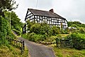
 Timber -framed house in Neen Sollars - geograph.org.uk - 3225326.jpg 640 × 480; 118 KB
-
 Unsealed road, Neen Sollars - geograph.org.uk - 5661864.jpg 1,024 × 683; 502 KB
-
 View across Neen Sollars - geograph.org.uk - 2964487.jpg 2,314 × 2,019; 1.97 MB
-
 Woodland path - geograph.org.uk - 5662600.jpg 1,024 × 683; 613 KB
-
 Farm building at Tetshill - geograph.org.uk - 259160.jpg 640 × 480; 104 KB
-
 Farmland to the northeast of Marlbrook - geograph.org.uk - 258454.jpg 640 × 480; 134 KB
-
 Farmland to the south of Neen Sollars - geograph.org.uk - 258452.jpg 640 × 480; 134 KB
-
 The Rea valley at Tetshill - geograph.org.uk - 259161.jpg 640 × 480; 117 KB


.jpg)


