Category:Nederlands Hervormde Kerk, Spijk (Lingewaal)
Jump to navigation
Jump to search
| Object location | | View all coordinates using: OpenStreetMap |
|---|
 | |||||
| Upload media | |||||
| Instance of |
| ||||
|---|---|---|---|---|---|
| Location | Spijk, West Betuwe, Gelderland, Netherlands | ||||
| Street address |
| ||||
| Heritage designation |
| ||||
 | |||||
Kerk:
|
This is a category about rijksmonument number 22001
|
Toren:
|
This is a category about rijksmonument number 22002
|
| Address |
|
Subcategories
This category has the following 2 subcategories, out of 2 total.
Media in category "Nederlands Hervormde Kerk, Spijk (Lingewaal)"
The following 18 files are in this category, out of 18 total.
-
 Detail toren - Spijk - 20203288 - RCE.jpg 945 × 1,200; 255 KB
-
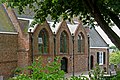 Hervormde kerk, Spijk.jpg 3,888 × 2,592; 6.52 MB
-
 Kruis, van het dak - Spijk - 20203289 - RCE.jpg 938 × 1,200; 220 KB
-
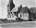
 Overzicht - Spijk - 20203261 - RCE.jpg 1,200 × 939; 226 KB
-
 Overzicht - Spijk - 20203293 - RCE.jpg 1,200 × 953; 154 KB
-
 Overzicht oostgevel - Spijk - 20203274 - RCE.jpg 806 × 1,200; 195 KB
-
 Overzicht van de noordoostgevel - Spijk - 20384526 - RCE.jpg 927 × 1,200; 1.05 MB
-
 Overzicht van een gedeelte van de noordgevel - Spijk - 20203264 - RCE.jpg 954 × 1,200; 320 KB
-
 Overzicht zuidoostgevel - Spijk - 20203262 - RCE.jpg 1,200 × 939; 304 KB
-
 Overzicht zuidoostgevel - Spijk - 20203273 - RCE.jpg 1,200 × 808; 249 KB
-
 Overzicht zuidoostgevel met kerktoren - Spijk - 20203263 - RCE.jpg 958 × 1,200; 255 KB
-
 Overzicht zuidwestgevel met kerktoren - Spijk - 20203260 - RCE.jpg 949 × 1,200; 253 KB
-
 Raam in koor - Spijk - 20203286 - RCE.jpg 968 × 1,200; 246 KB
-
 Spijk aan de Dijk..jpg 4,770 × 3,177; 4.63 MB
-
 Spijk bij de Hervormde kerk..jpg 4,770 × 3,177; 5.67 MB
-
 Spijk RM Hervormde Kerk.jpg 4,255 × 3,349; 4.57 MB
-
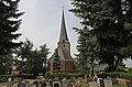 Toren hervormde kerk, Spijk.jpg 3,853 × 2,550; 4.03 MB
-


