Category:Nederlands Hervormde Kerk, Noordeloos
Jump to navigation
Jump to search
| Object location | | View all coordinates using: OpenStreetMap |
|---|
church building in Giessenlanden, Netherlands  | |||||
| Upload media | |||||
| Instance of | |||||
|---|---|---|---|---|---|
| Location | Noordeloos, Molenlanden, South Holland, Netherlands | ||||
| Street address |
| ||||
| Located on street |
| ||||
| Heritage designation |
| ||||
 | |||||
Nederlands: Bonifatiuskerk / Hervormde kerk, Noordeloos - anno 15e eeuw
|
This is a category about rijksmonument number 30642
|
| Address |
|
Subcategories
This category has the following 2 subcategories, out of 2 total.
Media in category "Nederlands Hervormde Kerk, Noordeloos"
The following 47 files are in this category, out of 47 total.
-
 Doopvont - Noordeloos - 20168860 - RCE.jpg 1,200 × 980; 229 KB
-
 Doopvont - Noordeloos - 20168871 - RCE.jpg 937 × 1,200; 218 KB
-
 Exterieur aanzicht - Noordeloos - 20168846 - RCE.jpg 1,200 × 800; 140 KB
-
 Exterieur koor - Noordeloos - 20168847 - RCE.jpg 802 × 1,200; 211 KB
-
 Exterieur naar het noord-oosten - Noordeloos - 20168853 - RCE.jpg 1,200 × 958; 245 KB
-
 Exterieur noord-zijde - Noordeloos - 20168852 - RCE.jpg 960 × 1,200; 244 KB
-
 Exterieur van het koor - Noordeloos - 20168849 - RCE.jpg 962 × 1,200; 302 KB
-
 Herenbank - Noordeloos - 20168868 - RCE.jpg 1,200 × 957; 158 KB
-
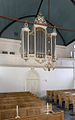 Intenieur, aanzicht orgel, orgelnummer 1089 - Noordeloos - 20417179 - RCE.jpg 750 × 1,200; 133 KB
-
 Interieur naar het noord-oosten - Noordeloos - 20168851 - RCE.jpg 1,200 × 958; 156 KB
-
 Interieur naar het noorden - Noordeloos - 20168854 - RCE.jpg 981 × 1,200; 132 KB
-
 Interieur naar het oosten - Noordeloos - 20168850 - RCE.jpg 1,200 × 954; 156 KB
-
 Interieur naar het oosten - Noordeloos - 20168866 - RCE.jpg 1,200 × 962; 170 KB
-
 Interieur naar het westen - Noordeloos - 20168864 - RCE.jpg 1,200 × 963; 175 KB
-
 INTERIEUR, GEVANGENISHOK IN TOREN - Noordeloos - 20266941 - RCE.jpg 1,195 × 1,200; 301 KB
-
 INTERIEUR, KANDELAAR OP BANK - Noordeloos - 20273742 - RCE.jpg 1,195 × 1,200; 217 KB
-
 INTERIEUR, KANDELAAR OP BANK - Noordeloos - 20273743 - RCE.jpg 1,195 × 1,200; 201 KB
-
 INTERIEUR, KANDELAAR OP BANK - Noordeloos - 20273744 - RCE.jpg 1,195 × 1,200; 222 KB
-
 INTERIEUR, KAP EERSTE SCHIPTRAVEE - Noordeloos - 20266942 - RCE.jpg 1,192 × 1,200; 367 KB
-
 INTERIEUR, KAP EERSTE SCHIPTRAVEE - Noordeloos - 20266943 - RCE.jpg 1,197 × 1,200; 355 KB
-
 INTERIEUR, KROON (1681) - Noordeloos - 20273739 - RCE.jpg 1,192 × 1,200; 206 KB
-
 INTERIEUR, LEZENAAR (VOORZANGER) - Noordeloos - 20273740 - RCE.jpg 1,197 × 1,200; 194 KB
-
 INTERIEUR, LEZENAAR VAN PREEKSTOEL - Noordeloos - 20273741 - RCE.jpg 1,200 × 1,200; 306 KB
-

-
 INTERIEUR, ZILVEREN AVONDMAALSBEKERS (17DE EEUW) - Noordeloos - 20276808 - RCE.jpg 1,185 × 1,200; 233 KB
-
 Kap - Noordeloos - 20168861 - RCE.jpg 1,200 × 956; 255 KB
-
 Noord-transept, steunbeer - Noordeloos - 20168855 - RCE.jpg 1,200 × 1,166; 348 KB
-
 Noord-transept, steunbeer - Noordeloos - 20168856 - RCE.jpg 1,197 × 1,200; 264 KB
-
 Noord-transept, steunbeer - Noordeloos - 20168857 - RCE.jpg 1,197 × 1,200; 409 KB
-
 Noord-transept, steunbeer - Noordeloos - 20168858 - RCE.jpg 1,181 × 1,200; 359 KB
-
 Noordeloos - panoramio - Rokus Cornelis (5).jpg 2,707 × 1,800; 575 KB
-
 Noordeloos - panoramio - Rokus Cornelis (6).jpg 1,800 × 2,707; 544 KB
-
 Noordeloos - panoramio - Rokus Cornelis (7).jpg 1,800 × 2,707; 554 KB
-
 Noordeloos - panoramio - Rokus Cornelis (8).jpg 1,800 × 2,707; 661 KB
-
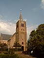
 Noordeloos NH Kerk.jpg 3,644 × 3,306; 3.52 MB
-
 Noordeloos, kerk 2007-06-02.JPG 1,704 × 2,272; 1.1 MB
-
 Orgel - Noordeloos - 20168865 - RCE.jpg 965 × 1,200; 156 KB
-
 Preekstoel - Noordeloos - 20168869 - RCE.jpg 1,200 × 1,200; 202 KB
-
 Preekstoel - Noordeloos - 20168872 - RCE.jpg 960 × 1,200; 167 KB
-
 Preekstoel, voet - Noordeloos - 20168870 - RCE.jpg 1,200 × 1,200; 260 KB
-
 Raam in koor - Noordeloos - 20168859 - RCE.jpg 959 × 1,200; 300 KB
-
 Rouwbord - Noordeloos - 20168878 - RCE.jpg 944 × 1,200; 184 KB
-
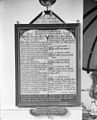
 Tekstbord - Noordeloos - 20168879 - RCE.jpg 1,200 × 925; 186 KB
-
 Tiengebodenbord - Noordeloos - 20168877 - RCE.jpg 972 × 1,200; 232 KB
-
 Voorgevel van kerk - Noordeloos - 20403322 - RCE.jpg 1,200 × 968; 294 KB
-
 Zuid-gevel naar het oosten - Noordeloos - 20168863 - RCE.jpg 1,200 × 953; 248 KB
-
 Zuid-zijde met toren - Noordeloos - 20168862 - RCE.jpg 955 × 1,200; 256 KB


_-_Noordeloos_-_20273739_-_RCE.jpg)
_-_Noordeloos_-_20273740_-_RCE.jpg)

_-_Noordeloos_-_20276809_-_RCE.jpg)
_-_Noordeloos_-_20276808_-_RCE.jpg)

.jpg)
.jpg)
.jpg)
.jpg)


