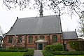
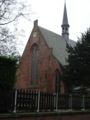
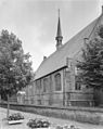
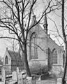
Category:Nederlands Hervormde Kerk, Leiderdorp
Jump to navigation
Jump to search
| Object location | | View all coordinates using: OpenStreetMap |
|---|
church in Leiderdorp, Netherlands  | |||||
| Upload media | |||||
| Instance of | |||||
|---|---|---|---|---|---|
| Location | Leiderdorp, South Holland, Netherlands | ||||
| Street address |
| ||||
| Located on street |
| ||||
| Heritage designation |
| ||||
 | |||||
|
This is a category about rijksmonument number 25693
|
| Address |
|
Media in category "Nederlands Hervormde Kerk, Leiderdorp"
The following 40 files are in this category, out of 40 total.
-
 Avondmaalsbeker - Leiderdorp - 20137740 - RCE.jpg 943 × 1,200; 161 KB
-
 Doopbekkenhouder - Leiderdorp - 20137739 - RCE.jpg 874 × 1,200; 132 KB
-
 Grafzerk - Leiderdorp - 20137767 - RCE.jpg 953 × 1,200; 253 KB
-
 Grafzerk - Leiderdorp - 20137768 - RCE.jpg 1,200 × 959; 306 KB
-

-
 Grafzerk van Mr.Corn.Bicker v.Swieten en vrouw - Leiderdorp - 20137742 - RCE.jpg 959 × 1,200; 310 KB
-
 Herenbank - Leiderdorp - 20137738 - RCE.jpg 1,200 × 879; 147 KB
-
 Herenbank - Leiderdorp - 20137765 - RCE.jpg 963 × 1,200; 163 KB
-
 Ingang - Leiderdorp - 20137749 - RCE.jpg 954 × 1,200; 366 KB
-
 Interieur - Leiderdorp - 20137733 - RCE.jpg 1,200 × 886; 136 KB
-
 Interieur naar het oosten - Leiderdorp - 20137746 - RCE.jpg 1,200 × 951; 167 KB
-
 Interieur naar het oosten - Leiderdorp - 20137761 - RCE.jpg 1,200 × 961; 210 KB
-
 Interieur naar het westen - Leiderdorp - 20137744 - RCE.jpg 1,200 × 955; 201 KB
-
 Interieur naar het westen - Leiderdorp - 20137745 - RCE.jpg 1,200 × 958; 183 KB
-
 Interieur naar het westen - Leiderdorp - 20137762 - RCE.jpg 955 × 1,200; 218 KB
-
 Interieur noordbeuk - Leiderdorp - 20137763 - RCE.jpg 1,200 × 957; 192 KB
-
 Interieur, aanzicht orgel, orgelnummer 863 - Leiderdorp - 20384908 - RCE.jpg 801 × 1,200; 220 KB
-
 Kerk naar het noord-westen - Leiderdorp - 20137732 - RCE.jpg 1,200 × 885; 239 KB
-
 Kerk vanuit het zuid-westen - Leiderdorp - 20137731 - RCE.jpg 892 × 1,200; 196 KB
-
 Leiderdorp - Hoofdstraat 19.jpg 3,072 × 2,048; 2.72 MB
-
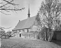
 Leiderdorpkerk.jpg 300 × 400; 84 KB
-
 Noord-gevel - Leiderdorp - 20137750 - RCE.jpg 1,200 × 955; 241 KB
-
 Noord-gevel - Leiderdorp - 20137751 - RCE.jpg 1,200 × 954; 260 KB
-
 Noord-west zijde - Leiderdorp - 20137752 - RCE.jpg 1,200 × 946; 256 KB
-
 Noordgevel - Leiderdorp - 20137755 - RCE.jpg 955 × 1,200; 284 KB
-
 Oostgevel - Leiderdorp - 20137759 - RCE.jpg 962 × 1,200; 402 KB
-
 Oostgevel - Leiderdorp - 20137760 - RCE.jpg 962 × 1,200; 345 KB
-
 Orgel - Leiderdorp - 20137734 - RCE.jpg 874 × 1,200; 177 KB
-
 Orgel - Leiderdorp - 20137743 - RCE.jpg 957 × 1,200; 196 KB
-
 Orgel - Leiderdorp - 20137766 - RCE.jpg 968 × 1,200; 220 KB
-
 Orgel naar het zuid-westen - Leiderdorp - 20137735 - RCE.jpg 881 × 1,200; 158 KB
-
 Orgel naar het zuid-westen - Leiderdorp - 20137736 - RCE.jpg 890 × 1,200; 190 KB
-
 Overzicht zuidgevel - Leiderdorp - 20137756 - RCE.jpg 1,200 × 956; 331 KB
-
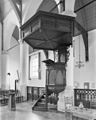 Preekstoel - Leiderdorp - 20137764 - RCE.jpg 963 × 1,200; 175 KB
-
 Regeringsbank - Leiderdorp - 20137737 - RCE.jpg 836 × 1,200; 143 KB
-
 West-gevel - Leiderdorp - 20137753 - RCE.jpg 951 × 1,200; 211 KB
-
 Zuid-west zijde - Leiderdorp - 20137747 - RCE.jpg 1,200 × 950; 211 KB
-
 Zuid-west zijde - Leiderdorp - 20137748 - RCE.jpg 1,200 × 947; 247 KB
-
 Zuidgevel - Leiderdorp - 20137757 - RCE.jpg 1,200 × 952; 331 KB
-
 Zuidgevel - Leiderdorp - 20137758 - RCE.jpg 1,200 × 955; 246 KB


