Category:Nederlands Hervormde Kerk, Hoog-Keppel
Jump to navigation
Jump to search
| Object location | | View all coordinates using: OpenStreetMap |
|---|
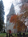
church building in Bronckhorst, Netherlands .jpg) | |||||
| Upload media | |||||
| Instance of | |||||
|---|---|---|---|---|---|
| Location | Hoog-Keppel, Bronckhorst, Gelderland, Netherlands | ||||
| Street address |
| ||||
| Located on street |
| ||||
| Heritage designation |
| ||||
| Inception |
| ||||
 | |||||
|
This is a category about rijksmonument number 22826
|
| Address |
|
Media in category "Nederlands Hervormde Kerk, Hoog-Keppel"
The following 29 files are in this category, out of 29 total.
-
 Deel van koor projectieopname - Hoog-Keppel - 20115136 - RCE.jpg 1,002 × 1,200; 425 KB
-
 Deel van koorsluiting - Hoog-Keppel - 20115128 - RCE.jpg 971 × 1,200; 320 KB
-
 Deel van koorsluiting - Hoog-Keppel - 20115133 - RCE.jpg 951 × 1,200; 344 KB
-
 Deel van noord-gevel - Hoog-Keppel - 20115130 - RCE.jpg 1,200 × 959; 407 KB
-
 Deel van noord-gevel projectieopname - Hoog-Keppel - 20115129 - RCE.jpg 1,200 × 959; 393 KB
-
 Deel zuid-gevel projectieopname - Hoog-Keppel - 20115127 - RCE.jpg 1,200 × 971; 435 KB
-
 Deel zuid-gevel projectieopname - Hoog-Keppel - 20115131 - RCE.jpg 961 × 1,200; 433 KB
-
 Deel zuid-gevel projectieopname - Hoog-Keppel - 20115132 - RCE.jpg 968 × 1,200; 426 KB
-
 Detail noord-gevel - Hoog-Keppel - 20115137 - RCE.jpg 979 × 1,200; 420 KB
-
 Entree naar de kerk vanuit het westen - Hoog-Keppel - 20115119 - RCE.jpg 1,200 × 1,200; 395 KB
-
 Exterieur detail - Hoog-Keppel - 20115124 - RCE.jpg 798 × 1,200; 328 KB
-
 Exterieur uit 't zuiden - Hoog-Keppel - 20115112 - RCE.jpg 2,654 × 2,101; 2.24 MB
-
 Exterieur van het koor - Hoog-Keppel - 20115135 - RCE.jpg 962 × 1,200; 356 KB
-
 Exterieur vanuit het zuiden - Hoog-Keppel - 20115115 - RCE.jpg 1,200 × 948; 379 KB
-
 Honeymoon in Doesburg 13-15nov 2010 (62).jpg 2,112 × 2,816; 1.25 MB
-
 Interieur naar het oosten - Hoog-Keppel - 20115121 - RCE.jpg 953 × 1,200; 162 KB
-
 Interieur naar het westen - Hoog-Keppel - 20115122 - RCE.jpg 953 × 1,200; 168 KB
-
 Interieur, aanzicht orgel, orgelnummer 713 - Hoog-Keppel - 20359285 - RCE.jpg 956 × 1,200; 139 KB
-
 Kerk en huis nr 25 vanuit het zuid-westen - Hoog-Keppel - 20115120 - RCE.jpg 1,200 × 1,200; 388 KB
-
 Kerk vanuit het noord-westen - Hoog-Keppel - 20115117 - RCE.jpg 1,200 × 1,200; 384 KB
-
 Kerk vanuit het noord-westen - Hoog-Keppel - 20115118 - RCE.jpg 1,200 × 1,200; 318 KB
-
 Met N.H.Kerk, voorgevel - Hoog-Keppel - 20115144 - RCE.jpg 1,200 × 806; 166 KB
-
 Noord gevel van de toren - Hoog-Keppel - 20115126 - RCE.jpg 961 × 1,200; 282 KB
-
 Noord-oost zijde - Hoog-Keppel - 20115134 - RCE.jpg 966 × 1,200; 369 KB
-
 Orgel - Hoog-Keppel - 20115116 - RCE.jpg 940 × 1,200; 216 KB
-
 Preekstoel - Hoog-Keppel - 20115123 - RCE.jpg 946 × 1,200; 163 KB
-
 Toren ingangspartij - Hoog-Keppel - 20115114 - RCE.jpg 955 × 1,200; 392 KB
-
 Toren uit het zuid-westen - Hoog-Keppel - 20115113 - RCE.jpg 958 × 1,200; 322 KB
-
 Zijingang - Hoog-Keppel - 20115125 - RCE.jpg 798 × 1,200; 267 KB


