Category:Nebraska Spur 18C
Jump to navigation
Jump to search
secondary state highway spur in Clay County, Nebraska, United States   | |||||
| Upload media | |||||
| Instance of | |||||
|---|---|---|---|---|---|
| Location | Clay County, Nebraska | ||||
| Transport network |
| ||||
| Owned by | |||||
| Maintained by | |||||
| Inception |
| ||||
| Length |
| ||||
| Terminus | |||||
| |||||
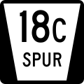
English: Media related to Nebraska Spur 18C, a 5.03-mile (8.10 km) secondary state highway spur in Clay County, Nebraska, United States, that connects South Railroad Street in Deweese with Nebraska Highway 14 (west of Edgar).
Subcategories
This category has only the following subcategory.
Media in category "Nebraska Spur 18C"
The following 3 files are in this category, out of 3 total.
-
 Deweese, Nebraska from E.JPG 2,326 × 1,002; 757 KB
-
 N SPUR 18C.svg 600 × 600; 11 KB
-
 Nebraska State Spur 314.svg 501 × 401; 12 KB
