Category:Nebraska Highway 70
Jump to navigation
Jump to search
state highway in Nebraska, United States   | |||||
| Upload media | |||||
| Instance of | |||||
|---|---|---|---|---|---|
| Location |
| ||||
| Transport network | |||||
| Connects with |
| ||||
| Owned by | |||||
| Maintained by | |||||
| Inception |
| ||||
| Length |
| ||||
| Terminus | |||||
| Partially coincident with | |||||
 | |||||
English: Media related to Nebraska Highway 70, a 230.36-mile (370.73 km) state highway in Nebraska, United States, that connects Nebraska Highway 2 and Nebraska Highway 92 in Broken Bow (in Custer County) with Nebraska Highway 14 in Elgin (in Antelope County).
Subcategories
This category has only the following subcategory.
Media in category "Nebraska Highway 70"
The following 4 files are in this category, out of 4 total.
-
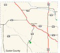 Custer County Map.png 1,653 × 1,468; 130 KB
-
 N-70 1950.svg 1,485 × 1,485; 112 KB
-
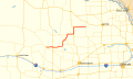 N-70 map.svg 1,027 × 609; 994 KB
-
 N-70.svg 600 × 600; 125 KB

