Category:Nearctic SVG maps of WWF ecoregions
Jump to navigation
Jump to search
Media in category "Nearctic SVG maps of WWF ecoregions"
The following 121 files are in this category, out of 121 total.
-
 Alaska Peninsula Montane Taiga map.svg 1,712 × 1,992; 338 KB
-
 Alaska-St. Elias Range tundra map.svg 1,712 × 1,992; 340 KB
-
 Alberta Mountain forests map.svg 1,712 × 1,992; 337 KB
-
 Alberta-British Columbia foothills forests map.svg 1,712 × 1,992; 341 KB
-
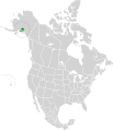
 Aleutian Islands tundra map.svg 1,712 × 1,992; 337 KB
-
 Allegheny Highlands forests map.svg 1,712 × 1,992; 337 KB
-
 Appalachian mixed mesophytic forests map.svg 1,712 × 1,992; 342 KB
-
 Appalachian-Blue Ridge forests map.svg 1,712 × 1,992; 343 KB
-
 Arctic coastal tundra map.svg 1,712 × 1,992; 341 KB
-
 Arctic foothills tundra map.svg 1,712 × 1,992; 337 KB
-
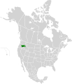
 Arizona Mountains Forests map.svg 1,712 × 1,992; 342 KB
-
 Aspen-Parkland.svg 1,304 × 1,263; 120 KB
-
 Atlantic coastal pine barrens map.svg 1,712 × 1,992; 338 KB
-
 Baffin coastal tundra map.svg 1,712 × 1,992; 337 KB
-
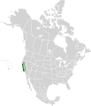
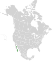
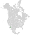
 Baja California Desert map.svg 1,712 × 1,992; 344 KB
-
 Beringia lowland tundra map.svg 1,712 × 1,992; 344 KB
-
 Beringia upland tundra map.svg 1,712 × 1,992; 339 KB
-
 Blue Mountains Forests map.svg 1,712 × 1,992; 338 KB
-
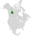
 British Columbia mainland coastal forests map.svg 1,712 × 1,992; 338 KB
-
 Brooks-British Range tundra map.svg 1,712 × 1,992; 340 KB
-
 California Central Valley Grasslands map.svg 1,712 × 1,992; 338 KB
-
 California Coastal Sage and Chaparral map.svg 1,712 × 1,992; 341 KB
-
 California Interior Chaparral and Woodlands map.svg 1,712 × 1,992; 339 KB
-
 California Montane Chaparral and Woodlands map.svg 1,712 × 1,992; 339 KB
-
 Cascade Mountains leeward forests map.svg 1,712 × 1,992; 338 KB
-
 Central and Southern Cascades Forests map.svg 1,712 × 1,992; 336 KB
-
 Central and Southern Mixed Grasslands map.svg 1,712 × 1,992; 344 KB
-
 Central British Columbia Mountain forests map.svg 1,712 × 1,992; 337 KB
-
 Central Canadian Shield forests map.svg 1,712 × 1,992; 338 KB
-
 Central Forests-Grassland Transition Zone map.svg 1,712 × 1,992; 346 KB
-
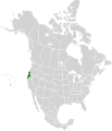
 Central Pacific coastal forests map.svg 1,712 × 1,992; 337 KB
-
 Central Tall Grasslands map.svg 1,712 × 1,992; 343 KB
-
 Central U.S. Hardwood Forests map.svg 1,712 × 1,992; 345 KB
-
 Chihuahuan Desert map.svg 1,712 × 1,992; 369 KB
-
 Colorado Plateau Shrublands map.svg 1,712 × 1,992; 348 KB
-
 Colorado Rockies Forests map.svg 1,712 × 1,992; 341 KB
-
 Cook Inlet taiga map.svg 1,712 × 1,992; 337 KB
-
 Copper Plateau taiga map.svg 1,712 × 1,992; 336 KB
-
 Davis Highlands tundra map.svg 1,712 × 1,992; 338 KB
-
 East Central Texas Forests map.svg 1,712 × 1,992; 336 KB
-
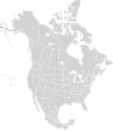
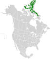
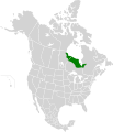
 Eastern Canadian Forests map.svg 1,712 × 1,992; 347 KB
-
 Eastern Canadian Shield taiga map.svg 1,712 × 1,992; 344 KB
-
 Eastern Cascades Forests map.svg 1,712 × 1,992; 338 KB
-
 Eastern forest-boreal transition map.svg 1,712 × 1,992; 339 KB
-
 Eastern Great Lakes Lowland Forests.svg 1,712 × 1,992; 339 KB
-
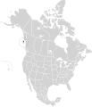
 Ecoregions quebec map.svg 1,630 × 2,000; 844 KB
-
 Edwards Plateau Savannas map.svg 1,712 × 1,992; 338 KB
-
 Flint Hills tall grasslands map 2.svg 1,712 × 1,992; 274 KB
-
 Flint Hills tall grasslands map.svg 1,712 × 1,992; 337 KB
-
 Florida Sand Pine Scrub map.svg 1,712 × 1,992; 339 KB
-
 Fraser Plateau and Basin complex map.svg 1,712 × 1,992; 336 KB
-
 Great Basin Montane Forests map.svg 1,712 × 1,992; 181 KB
-
 Great Basin Shrub Steppe map.svg 1,712 × 1,992; 337 KB
-
 Gulf of California Xeric Scrub map.svg 1,712 × 1,992; 347 KB
-
 Gulf of St. Lawrence lowland forests map.svg 1,712 × 1,992; 338 KB
-
 High Arctic tundra map.svg 1,712 × 1,992; 364 KB
-
 Interior Alaska-Yukon lowland taiga map.svg 1,712 × 1,992; 347 KB
-
 Interior Yukon-Alaska alpine tundra map.svg 1,712 × 1,992; 345 KB
-
 Kalaallit Nunaat high arctic tundra map.svg 300 × 500; 43 KB
-
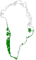 Kalaallit Nunaat low arctic tundra map.svg 300 × 500; 107 KB
-
 Klamath-Siskiyou Forests map.svg 1,712 × 1,992; 336 KB
-
 Low Arctic tundra map.svg 1,712 × 1,992; 349 KB
-
 Madrean Sky Islands Montane Forests map.svg 1,712 × 1,992; 345 KB
-
 Meseta Central Matorral map.svg 1,712 × 1,992; 349 KB
-
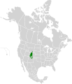
 Mid-Continental Canadian forests map.svg 1,712 × 1,992; 346 KB
-
 Middle Arctic tundra map.svg 1,712 × 1,992; 364 KB
-
 Middle Atlantic coastal forests map.svg 1,712 × 1,992; 341 KB
-
 Midwestern Canadian Shield forests map.svg 1,712 × 1,992; 340 KB
-
 Mississippi Lowland Forests map.svg 1,712 × 1,992; 341 KB
-
 Mojave Desert map.svg 1,712 × 1,992; 342 KB
-
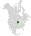
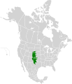
 Montana Valley and Foothill grasslands map.svg 1,712 × 1,992; 343 KB
-
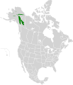
 Muskwa-Slave Lake forests map.svg 1,712 × 1,992; 339 KB
-
 Nebraska Sand Hills Mixed Grasslands map.svg 1,712 × 1,992; 339 KB
-
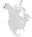
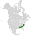
 New England-Acadian forests map.svg 1,712 × 1,992; 346 KB
-
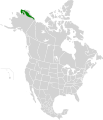
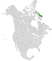
 Newfoundland Highland forests map.svg 1,712 × 1,992; 338 KB
-
 North Central Rockies forests map.svg 1,712 × 1,992; 341 KB
-
 Northeastern coastal forests map.svg 1,712 × 1,992; 343 KB
-
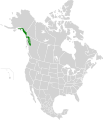
 Northern California Coastal Forests map.svg 1,712 × 1,992; 337 KB
-
 Northern Canadian Shield taiga map.svg 1,712 × 1,992; 341 KB
-
 Northern Cordillera forests map.svg 1,712 × 1,992; 342 KB
-
 Northern Mixed Grasslands.svg 1,712 × 1,992; 341 KB
-
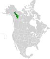
 Northern Pacific coastal forests map.svg 1,712 × 1,992; 340 KB
-
 Northern short grasslands map.svg 1,712 × 1,992; 346 KB
-
 Northern tall grasslands map.svg 1,712 × 1,992; 338 KB
-
 Northern transitional alpine forests map.svg 1,712 × 1,992; 336 KB
-
 Northwest Territories taiga map.svg 1,712 × 1,992; 343 KB
-
 Ogilvie-MacKenzie alpine tundra map.svg 1,712 × 1,992; 340 KB
-
 Okanagan dry forests map.svg 1,712 × 1,992; 337 KB
-
 Ozark Mountain Forests map.svg 1,712 × 1,992; 336 KB
-
 Pacific Coastal Mountain icefields and tundra map.svg 1,712 × 1,992; 343 KB
-
 Palouse grasslands map.svg 1,712 × 1,992; 339 KB
-
 Piney Woods Forests map.svg 1,712 × 1,992; 337 KB
-
 Puget lowland forests map.svg 1,712 × 1,992; 337 KB
-
 Queen Charlotte Islands map.svg 1,712 × 1,992; 335 KB
-
 San Lucan Xeric Scrub map.svg 1,712 × 1,992; 343 KB
-
 Sierra de la Laguna Pine-Oak Forests map.svg 1,712 × 1,992; 339 KB
-
 Sierra Juarez and San Pedro Martir Pine-Oak Forests map.svg 1,712 × 1,992; 339 KB
-
 Sierra Madre Occidental Pine-Oak Forests map.svg 1,712 × 1,992; 369 KB
-
 Sierra Nevada Forests map.svg 1,712 × 1,992; 336 KB
-
 Snake-Columbia Shrub Steppe map.svg 1,712 × 1,992; 347 KB
-
 Sonoran Desert map.svg 1,712 × 1,992; 345 KB
-
 Sonoran-Sinaloan transition subtropical dry forest map.svg 1,712 × 1,992; 342 KB
-
 South Avalon-Burin oceanic barrens map.svg 1,712 × 1,992; 337 KB
-
 South Central Rockies Forests map.svg 1,712 × 1,992; 348 KB
-
 Southeastern Conifer Forests map.svg 1,712 × 1,992; 340 KB
-
 Southeastern mixed forests map.svg 1,712 × 1,992; 343 KB
-
 Southern Great Lakes forests map.svg 1,712 × 1,992; 343 KB
-
 Southern Hudson Bay Taiga map.svg 1,712 × 1,992; 339 KB
-
 Tamaulipan Mezquital map.svg 1,712 × 1,992; 346 KB
-
 Terrestrial ecoregions USA CAN MEX.svg 1,712 × 1,992; 696 KB
-
 Texas Blackland Prairies map.svg 1,712 × 1,992; 339 KB
-
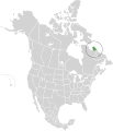 Torngat Mountain tundra map.svg 1,712 × 1,992; 340 KB
-
 Upper Midwest Forest-Savanna Transition Zone map.svg 1,712 × 1,992; 340 KB
-
 Wasatch and Uinta Montane Forests map.svg 1,712 × 1,992; 338 KB
-
 Western Great Lakes forests map.svg 1,712 × 1,992; 342 KB
-
 Western Gulf Coastal Grasslands map.svg 1,712 × 1,992; 340 KB
-
 Western Short Grasslands map.svg 1,712 × 1,992; 348 KB
-
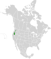
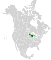
 Willamette Valley forests map.svg 1,712 × 1,992; 336 KB
-
 Wyoming Basin Shrub Steppe map.svg 1,712 × 1,992; 343 KB
-
 Yukon Interior dry forests map.svg 1,712 × 1,992; 338 KB
-
 Zoomed in map of Southern Great Lakes forests.png 497 × 340; 662 KB


