Category:Naturschutzgebiet Bornriethmoor
Jump to navigation
Jump to search
| Diese Kategorie repräsentiert ein Schutzgebiet nach Naturschutzrecht in Deutschland. |
|---|
| Diese Kategorie wurde nach einem klaren Schema angelegt, sie sollte nicht verschoben, gelöscht oder umkategorisiert werden. Sie ist unter anderem in dieser Uploadkarte hinterlegt. Beschreibung und Hintergründe auf der Seite des Wikiprojekts |
| Foto zu Wiki Loves Earth hochladen! - Seite von Wiki Loves Earth Deutschland |
Deutsch: Naturschutzgebiet „Bornriethmoor“, NSG LÜ 170 in der Gemeinde Südheide (Ortsteil Hermannsburg), Landkreis Celle, Niedersachsen
nature reserve in Lower Saxony, Germany  | |||||
| Upload media | |||||
| Instance of |
| ||||
|---|---|---|---|---|---|
| Location | Südheide, Celle, Lower Saxony, Germany | ||||
| IUCN protected areas category | |||||
| Inception |
| ||||
| Area |
| ||||
 | |||||
Media in category "Naturschutzgebiet Bornriethmoor"
The following 18 files are in this category, out of 18 total.
-
 BirkenbruchwaldBornriethmoor.JPG 3,648 × 2,736; 6.44 MB
-
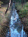 Bornriethmoor Abzugsgraben.jpg 2,448 × 3,264; 5.99 MB
-
 Bornriethmoor Entwässerungsgraben 20210508.jpg 4,624 × 3,468; 13.99 MB
-
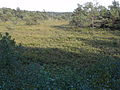
 Bornriethmoor renaturiert.jpg 1,500 × 1,125; 2 MB
-
 Bornriethmoor Vernässung.JPG 3,648 × 2,736; 4.32 MB
-
 Bornriethmoor-20240306-10.JPG 4,608 × 3,456; 6.88 MB
-
 BornriethmoorWeg.JPG 3,264 × 2,448; 2.39 MB
-
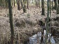
 Gagelstrauch2.JPG 2,744 × 2,058; 3.53 MB
-
 GagelstrauchbestandBornriethmoor.JPG 3,648 × 2,736; 4.18 MB
-
 GagelstrauchBornriethmoor.JPG 3,648 × 2,736; 4.14 MB
-
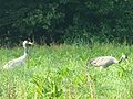 Kranich (4).jpg 1,302 × 976; 582 KB
-
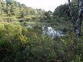
 Moor mit Gagelstrauch.jpg 3,264 × 2,448; 2.55 MB
-
 Moor mit Schilfrohr.jpg 3,264 × 2,448; 6.4 MB
-
 NSG Bornriethmoor Hinweisschild.JPG 3,456 × 4,608; 13 MB
-
 Salinenleitung Holzroehre.jpg 2,974 × 1,982; 2.13 MB
-
 SülzeSalineRöhrenltg.JPG 2,730 × 2,012; 3 MB
-
 Torfkanal Bornriethmoor 01.JPG 3,264 × 2,448; 3.3 MB
-
 Torfstich.jpg 1,944 × 1,458; 3.73 MB


.jpg)


