Category:Nature of Utah
Jump to navigation
Jump to search
States of the United States: Alabama · Alaska · Arizona · Arkansas · California · Colorado · Connecticut · Delaware · Florida · Georgia · Hawaii · Idaho · Illinois · Indiana · Iowa · Kansas · Kentucky · Louisiana · Maine · Maryland · Massachusetts · Michigan · Minnesota · Mississippi · Missouri · Montana · Nebraska · Nevada · New Hampshire · New Jersey · New Mexico · New York · North Carolina · North Dakota · Ohio · Oklahoma · Oregon · Pennsylvania · Rhode Island · South Carolina · South Dakota · Tennessee · Texas · Utah · Vermont · Virginia · Washington · West Virginia · Wisconsin · Wyoming – Washington, D.C.
American Samoa · Guam · Northern Mariana Islands · Puerto Rico · United States Virgin Islands – Baker Island · Howland Island · Jarvis Island · Kingman Reef · Midway Atoll · Palmyra Atoll · Wake Island
American Samoa · Guam · Northern Mariana Islands · Puerto Rico · United States Virgin Islands – Baker Island · Howland Island · Jarvis Island · Kingman Reef · Midway Atoll · Palmyra Atoll · Wake Island
Subcategories
This category has the following 35 subcategories, out of 35 total.
Media in category "Nature of Utah"
The following 24 files are in this category, out of 24 total.
-

-
 2015.06.09 19.28.43 IMG 2732 - Flickr - andrey zharkikh.jpg 4,752 × 3,168; 2.23 MB
-
 2016.07.30 12.45.58 DSC05453 - Flickr - andrey zharkikh.jpg 4,896 × 3,672; 3.48 MB
-
 Aquatic habitat inventory in the Hot Desert EIS area, Utah (IA aquatichabitatin01wing).pdf 631 × 831, 131 pages; 29.23 MB
-
 Bigwater-lowres.jpg 400 × 263; 85 KB
-
 Birch trees in Utah high country LCCN2011633134.tif 6,857 × 5,360; 210.34 MB
-

-
 Bountiful.jpg 320 × 240; 70 KB
-
 Bush (4187212000).jpg 2,828 × 4,256; 5.58 MB
-
-
 Riparian community type classification of northern Utah and adjacent Idaho (IA CAT31365373).pdf 1,275 × 1,650, 110 pages; 19.15 MB
-
 CloudOverUtah.jpg 1,600 × 1,200; 763 KB
-
 Comb Ridge near Bluff, Utah.jpg 1,600 × 1,200; 373 KB
-
 Forestsnowbird.jpg 1,091 × 637; 770 KB
-
 Great Basin Montane Forests map.svg 1,712 × 1,992; 181 KB
-
 Great Basin Shrub Steppe map.svg 1,712 × 1,992; 337 KB
-
 MississippianMarbleUT.JPG 1,500 × 1,125; 994 KB
-
 Rain Soaked Earth Landscape II, Circleville, UT.jpg 960 × 720; 77 KB
-
 Rain Soaked Earth Landscape, Circleville, UT.jpg 960 × 720; 71 KB
-
 Sunset Pass.jpg 4,000 × 2,000; 4.01 MB
-
 Twitchell Canyon Fire.JPG 6,048 × 4,029; 2.98 MB
-
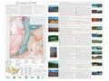 Utah Level IV ecoregions.pdf 7,200 × 5,400; 6.32 MB
-
 Utah Wildlife Management Units.svg 4,488 × 5,598; 406 KB
-
 Yellow fall leaves.jpg 1,836 × 3,264; 3.03 MB


.jpg)

.jpg)


