Category:Nature of Peisey-Nancroix
Jump to navigation
Jump to search
Subcategories
This category has the following 16 subcategories, out of 16 total.
A
- Aiguille du Saint-Esprit (12 F)
- Aiguille Grive (55 F)
- Aiguille Rousse (16 F)
- Aliet (27 F)
C
- Col de l'Aliet (2 F)
- Col de la Croix des Frêtes (4 F)
- Col de la Grande Casse (9 F)
- Col de la Tourne (Vanoise) (3 F)
G
L
- Lac de la Plagne (33 F)
- Lac du Grattaleu (8 F)
M
- Mont Blanc de Peisey (12 F)
N
- Nant Benin (1 F)
P
- Plan de la Grassaz (36 F)
R
- Roc du Grand Renard (20 F)
Media in category "Nature of Peisey-Nancroix"
The following 108 files are in this category, out of 108 total.
-
 0509 Peisey-Nancroix.JPG 2,288 × 1,712; 763 KB
-
 0509 Pesey-Nancroix alpages.JPG 2,288 × 1,712; 799 KB
-
 Aiguille de Bacque depuis Plan de la Grassaz (août 2023).JPG 3,264 × 2,448; 4.23 MB
-
 Aiguille Rousse in sea of clouds, 2018.jpg 6,016 × 4,000; 6.29 MB
-
 Benne Vanoise Express entre Peisey et Montchavin (août 2024).JPG 3,128 × 2,348; 5.99 MB
-
 Camping Les Lanchettes - panoramio.jpg 2,592 × 1,944; 2.41 MB
-
 Cascade du Nant Cruet au-dessus de Rosuel (août 2022).JPG 3,264 × 2,448; 5.78 MB
-
 Cascade du Ponturin au Plan de la Plagne (août 2023) 1.JPG 3,212 × 2,384; 4.99 MB
-
 Cascade du Ponturin au Plan de la Plagne (août 2023) 2.JPG 3,264 × 2,448; 4.42 MB
-
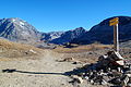
 Cattle and hiking sign.jpg 4,650 × 3,648; 4.49 MB
-
 Cattle in Peisey-Nancroix.jpg 1,682 × 2,472; 1.24 MB
-
 Cattle walking.jpg 3,259 × 1,053; 1.35 MB
-
 Col D'entreport 2390m - panoramio.jpg 700 × 394; 60 KB
-
 Col du plan de Séry DSC 2663.JPG 3,008 × 2,000; 3.49 MB
-
 Crête des Lanchettes depuis Plan de la Plagne au sud (août 2023).JPG 3,264 × 2,448; 3.84 MB
-
 Crête des Lanchettes depuis Rosuel (août 2022).JPG 3,264 × 2,448; 5.54 MB
-
 Dernière borne de la RD 87 à Rosuel en été (août 2022).JPG 3,204 × 2,384; 4.57 MB
-
 Donkey in France 2.jpg 5,294 × 3,535; 5.14 MB
-
 Donkey in France.jpg 3,131 × 2,163; 2.7 MB
-
 Dos de la Charmette et Aiguille Rousse depuis Rosuel (août 2022).JPG 3,264 × 2,448; 3.83 MB
-
 Dôme et glacier des Pichères au matin (août 2023).JPG 3,264 × 2,448; 4.75 MB
-
 Face Nord-Est Bellecôte et Vallon de Rosuel en hiver (février 2024).JPG 4,000 × 3,000; 6.01 MB
-
 Flanc Est Vallée Rosuel et Cascade de la Gurraz (août 2023).JPG 3,264 × 2,448; 3.25 MB
-
 France - plant.jpg 3,039 × 3,125; 3.6 MB
-
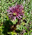
 Gentiana Purpurea près du lac de la Plagne en Vanoise (août 2023).JPG 3,220 × 2,408; 5.71 MB
-
 Gentianella campestris près du Lac de la Plagne en Vanoise (août 2023).JPG 2,668 × 2,060; 2.64 MB
-
 Glacier des Platières sous Dôme de la Sache (août 2022).JPG 3,264 × 2,448; 4.33 MB
-
 GR 5 et Cascade de la Gurraz sur les hauteurs de Rosuel (août 2023).JPG 3,264 × 2,448; 6.65 MB
-
 Hameau des Lanches à Peisey-Nancroix (août 2022).JPG 1,983 × 1,464; 2.3 MB
-
 Hauteurs de Vallandry et Tarentaise en été (août 2022).JPG 3,200 × 2,396; 3.54 MB
-
 Hiking trail signs.jpg 5,472 × 3,648; 6.61 MB
-
 Horse in Vanoise National Park 2.jpg 3,752 × 2,814; 4.61 MB
-
 Houseleek in France.jpg 1,264 × 1,420; 608 KB
-
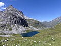
 Lac de Grattaleu depuis Col de la Croix-des-Frêtes (août 2023).JPG 3,264 × 2,448; 3.61 MB
-
 Lac de la Plagne en direction de Rosuel en été (août 2023).JPG 4,000 × 3,000; 5.56 MB
-
 Lac de la Plagne sous l'Aliet à Peisey-Nancroix (août 2023).JPG 4,000 × 3,000; 7.9 MB
-
 Lac de Rosuel et Crête des Lanchettes (août 2022).JPG 3,264 × 2,448; 5.3 MB
-
 Le Ponturin au Plan de la Plagne en direction de Tignes (août 2023).JPG 3,899 × 2,877; 5.87 MB
-
 Le Ponturin calme au Plan de la Plagne côté sud (août 2023).JPG 3,176 × 2,352; 5.2 MB
-
 Le Ponturin descendant Plan de la Plagne direction Rosuel (août 2023).JPG 3,264 × 2,448; 4.19 MB
-
 Le Ponturin quelques mètres sous le Lac de la Plagne (août 2023) 1.JPG 3,212 × 2,388; 4.93 MB
-
 Le Ponturin quelques mètres sous le Lac de la Plagne (août 2023) 2.JPG 3,224 × 2,416; 6.5 MB
-
 Lying cattle.jpg 4,037 × 1,537; 2.45 MB
-
 Lying marmot.jpg 4,064 × 2,382; 3.24 MB
-
 Marmot in France 4.jpg 1,239 × 855; 473 KB
-
 Mont Pourri - St-Esprit - Aiguille Rouge depuis Bellecôte (hiver 2024).JPG 3,264 × 2,448; 4.77 MB
-
 Mont Pourri et Dôme de la Sache depuis Lac de la Plagne (été 2023).JPG 3,200 × 2,380; 3.9 MB
-
 Mont Pourri et Dôme des Platières depuis Rosuel (août 2022).JPG 3,140 × 2,340; 5.57 MB
-
 Mont Pourri et Dôme des Platières vus de Rosuel (août 2022).JPG 3,933 × 2,926; 7.88 MB
-
 Mont Pourri massif from La Plagne, 2018.jpg 5,126 × 2,024; 5.36 MB
-
 Mont Pourri massif from Malatray slope, La Plagne, 2018.jpg 6,016 × 4,000; 11.26 MB
-
 Mont Pourri surplombant Rosuel depuis Bellecôte en hiver (février 2024).JPG 3,264 × 2,448; 4.61 MB
-
 Montagne d'automne en Tarentaise.jpg 1,944 × 1,944; 1.12 MB
-
 Mountain pond 5.jpg 3,569 × 1,909; 2.98 MB
-
 Mountains in Peisey-Nancroix 2.jpg 5,290 × 3,433; 4.73 MB
-
 Panorama de Rosuel en direction du nord en été (août 2022).JPG 7,888 × 1,920; 10.06 MB
-
 Panorama Rosuel depuis Bellecôte en hiver (février 2024).JPG 7,960 × 1,864; 9.52 MB
-
 Panoramique Ouest depuis Col du Palet au matin (août 2023).JPG 7,936 × 1,920; 10.09 MB
-
 Peisey - Valandry - vue de montchavin - Janvier 2015.jpg 2,304 × 1,728; 691 KB
-
 Peisey-Nancroix vallée du Ponthurin Grande Motte.jpg 3,264 × 2,448; 2.88 MB
-
 Pesey Vallandry.jpg 4,954 × 3,302; 12.1 MB
-
 Pesey-Vallandry.JPG 3,456 × 5,184; 10.83 MB
-
 Pichères.jpg 4,058 × 1,808; 1.45 MB
-
 Plan de la Plagne en direction de Rosuel (août 2023).JPG 3,264 × 2,448; 5.8 MB
-
 Plaque Parc National de la Vanoise le long du Ponturin (août 2023).JPG 3,176 × 2,352; 4.51 MB
-
 Plaque Parc National de la Vanoise sous Lac de la Plagne (août 2023).JPG 3,264 × 2,448; 3.56 MB
-
 Pointe de la Vallaisonnay.jpg 5,409 × 3,521; 4.28 MB
-
 Polyommatus icarus près du Lac de la Plagne en Vanoise (août 2023).JPG 2,640 × 1,972; 3.37 MB
-
 Ponturin au nord du Lac de la Plagne (août 2023).JPG 3,204 × 2,400; 5.44 MB
-
 Ponturin au Plan de la Plagne en direction de Rosuel (août 2023).JPG 3,264 × 2,448; 5.37 MB
-
 Ponturin descendant du Plan de la Plagne direction Rosuel (août 2023).JPG 3,264 × 2,448; 4.45 MB
-
 Ponturin en amont du Lac de la Plagne (août 2023).JPG 3,264 × 2,448; 4.21 MB
-
 Ponturin et Lac de la Plagne en Vanoise (août 2023).JPG 3,212 × 2,392; 4.47 MB
-
 Ponturin et sa cascade au Plan de la Plagne (août 2023).JPG 3,204 × 2,380; 4.41 MB
-
 Premiers mètres du Ponturin au nord du Lac de la Plagne (août 2023).JPG 3,204 × 2,412; 5.36 MB
-
 Refuge du Mont Pourri.jpg 1,024 × 768; 776 KB
-
 Refuge sous le Col du Palet au matin (août 2023).JPG 3,236 × 2,404; 4.05 MB
-
 Rochers Rouges depuis Lac du Grattaleu (août 2023).JPG 3,264 × 2,448; 3.99 MB
-
 Rochers Rouges depuis Plan de la Grassaz (août 2023).JPG 3,264 × 2,448; 3.93 MB
-
 Rock formation in Vanoise National Park.jpg 5,472 × 3,098; 4.97 MB
-
 Rosuel au pied du Mont Pourri en Vanoise (août 2022).JPG 3,264 × 2,448; 5.27 MB
-
 Rosuel en direction de la Tarentaise en été (août 2022) 1.JPG 3,160 × 2,328; 4.98 MB
-
 Rosuel en direction de la Tarentaise en été (août 2022) 2.JPG 3,208 × 2,392; 5.09 MB
-
 Rosuel en direction du Mont Pourri et la Vanoise (août 2022).JPG 4,000 × 3,000; 7.51 MB
-
 Rosuel enneigé depuis la montagne de Bellecôte (février 2024).JPG 4,000 × 3,000; 6.37 MB
-
 Rosuel et l'Aiguille Rousse en été (août 2022).JPG 3,264 × 2,448; 5.61 MB
-
 Saxifraga Aizoides près du Lac de la Plagne en Vanoise (août 2023).JPG 2,944 × 2,220; 3.11 MB
-
 Sentier des hauts de Vallandry en été (août 2022).JPG 3,264 × 2,448; 3.85 MB
-
 Sentier du GR5 arrivant au refuge de Rosuel (août 2022).JPG 3,264 × 2,448; 5.32 MB
-
 Sentier GR au Plan de la Plagne en direction de Tignes (août 2023).JPG 3,264 × 2,448; 4.3 MB
-
 Sommet de l'Aiguille Rouge côté sud-ouest en hiver (mars 2023).JPG 3,264 × 2,448; 3.24 MB
-
 Sommets et glaciers de Bellecôte et Pichères au matin (août 2023).JPG 4,000 × 3,000; 4.7 MB
-
 Sous le Col du Palet et son refuge au matin (août 2023).JPG 3,264 × 2,448; 4.83 MB
-
 Test de vue importee.jpg 3,264 × 2,448; 1.58 MB
-
 Torrent du Ponturin entre Rosuel et Nancroix (août 2022).JPG 3,264 × 2,448; 4.74 MB
-
 Trail in Peisey-Nancroix.jpg 5,472 × 3,648; 5.29 MB
-
 Trail to Col de la Tourne.jpg 5,472 × 3,648; 7.15 MB
-
 Traversée d'une benne Vanoise Express (août 2024).JPG 3,264 × 2,448; 5.95 MB
-
 Vallon de Rosuel enneigé depuis Bellecôte (février 2024).JPG 4,000 × 3,000; 6.94 MB
-
 Vallon de Rosuel enneigé depuis la montagne de Bellecôte (février 2024).JPG 4,000 × 3,000; 7.04 MB
-
 Vallon du Ponturin Direction Rosuel (août 2022).JPG 2,048 × 1,536; 2.3 MB
-
 Vallon du Ponturin en direction de Rosuel (août 2022).JPG 1,935 × 1,437; 2.2 MB
-
 Vallon sud de Peisey-Nancroix depuis la limite de Champagny (août 2023).JPG 3,264 × 2,448; 3.74 MB
-
 Vallée du Ponturin et La Plagne depuis Aiguille Rouge (août 2024).JPG 4,000 × 3,000; 6.46 MB
-
 Vanoise National Park - trail 2.jpg 5,472 × 3,648; 6.57 MB
-
 Vanoise National Park 6.jpg 15,222 × 2,964; 12.34 MB
-
 Zygaena exulans 151393342.jpg 921 × 2,048; 1.13 MB
-
 Zygène sur Épervière sous le col du Palet (août 2023).JPG 3,060 × 2,352; 2.94 MB


.JPG)

.JPG)

.JPG)
_1.JPG)
_2.JPG)


.JPG)
.JPG)
.JPG)


.JPG)
.JPG)
.JPG)
.JPG)

.JPG)
.JPG)
.JPG)
.JPG)
.JPG)
.JPG)


.JPG)
.JPG)
.JPG)
.JPG)
.JPG)
.JPG)
.JPG)
_1.JPG)
_2.JPG)


.JPG)
.JPG)
.JPG)
.JPG)

.JPG)


.JPG)
.JPG)
.JPG)

.JPG)
.JPG)
.JPG)
.JPG)
.JPG)
.JPG)
.JPG)
.JPG)

.JPG)
.JPG)
.JPG)

.JPG)
_1.JPG)
_2.JPG)
.JPG)
.JPG)
.JPG)
.JPG)
.JPG)
.JPG)
.JPG)
.JPG)
.JPG)
.JPG)

.JPG)


.JPG)
.JPG)
.JPG)
.JPG)
.JPG)
.JPG)
.JPG)


.JPG)
.JPG)
.JPG)
.JPG)