Category:Nature of Luzarches
Jump to navigation
Jump to search
Subcategories
This category has only the following subcategory.
F
- Forêt de Coye in Luzarches (36 F)
Media in category "Nature of Luzarches"
The following 71 files are in this category, out of 71 total.
-

-

-
 Luzarches (95), ancien jardin public, rue de Meaux.JPG 2,736 × 3,648; 2.43 MB
-
 Luzarches (95), chemin du Compant, vue vers l'ouest en direction de Gascourt.jpg 5,184 × 3,456; 3.18 MB
-

-
 Luzarches (95), croix Saint-Côme.jpg 2,748 × 3,664; 2.64 MB
-
 Luzarches (95), croix Sainte-Élisabeth près de la Grange-aux-Bois, 25.01.2016 1.JPG 2,736 × 3,648; 4.23 MB
-
 Luzarches (95), croix Sainte-Élisabeth près de la Grange-aux-Bois, 25.01.2016 2.JPG 2,736 × 3,648; 4.2 MB
-

-

-
 Luzarches (95), le GR 1 au lieu-dit La Ménagerie 1.jpg 5,184 × 3,456; 4.3 MB
-
 Luzarches (95), le GR 1 au lieu-dit La Ménagerie 2.jpg 5,184 × 3,456; 4.26 MB
-
 Luzarches (95), le GR 1 au lieu-dit La Ménagerie 3.jpg 5,184 × 3,456; 4.37 MB
-
 Luzarches (95), le GR 1 au lieu-dit La Ménagerie 4.jpg 3,456 × 5,184; 5.08 MB
-
 Luzarches (95), le GR 1 à la lisière avec la forêt de Coye.jpg 3,456 × 5,184; 5.04 MB
-
 Luzarches (95), le GR 655 entre Pont-de-Brassay et Thimécourt 1.jpg 5,184 × 3,456; 4.4 MB
-
 Luzarches (95), le GR 655 entre Pont-de-Brassay et Thimécourt 2.jpg 5,184 × 3,456; 3.95 MB
-
 Luzarches (95), le GR 655 entre Pont-de-Brassay et Thimécourt 3.jpg 5,184 × 3,456; 4.93 MB
-
 Luzarches (95), le GR 655 entre Pont-de-Brassay et Thimécourt 4.jpg 5,184 × 3,456; 5.02 MB
-
 Luzarches (95), le GR 655 entre Pont-de-Brassay et Thimécourt 5.jpg 5,184 × 3,456; 5.15 MB
-
 Luzarches (95), lieu-dit Derrière le moulin de Luzarches, vue vers Chaumontel 1.jpg 5,184 × 3,456; 2.01 MB
-
 Luzarches (95), lieu-dit Derrière le moulin de Luzarches, vue vers Chaumontel 2.jpg 5,184 × 3,456; 2.35 MB
-
 Luzarches (95), lieu-dit La Petite Prairie, près de Chaumontel-les-Nonnains 1.jpg 5,184 × 3,456; 2.71 MB
-
 Luzarches (95), lieu-dit La Petite Prairie, près de Chaumontel-les-Nonnains 2.jpg 5,184 × 3,456; 2.82 MB
-
 Luzarches (95), lieu-dit Prairie de Thimécourt 1.jpg 5,184 × 3,456; 3.02 MB
-
 Luzarches (95), lieu-dit Prairie de Thimécourt 2.jpg 5,184 × 3,456; 4.15 MB
-
 Luzarches (95), lieu-dit Prairie de Thimécourt 3.jpg 5,184 × 3,456; 3.1 MB
-
 Luzarches (95), lieu-dit Prairie de Thimécourt 4.jpg 5,184 × 3,456; 2.29 MB
-
 Luzarches (95), lieu-dit Prairie de Thimécourt 5.jpg 5,184 × 3,456; 2.21 MB
-
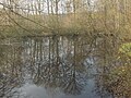
 Luzarches (95), mare des Nonnains.jpg 3,664 × 2,748; 3.11 MB
-
 Luzarches (95), moulin de Luzarches.jpg 2,748 × 3,664; 2.32 MB
-
 Luzarches (95), petit pont sur le ru du Poncel de 1769.jpg 2,748 × 3,664; 1.61 MB
-
 Luzarches (95), plaine du rû Popelin, à l'est du château de Chauvigny 1.jpg 5,184 × 3,456; 3.08 MB
-
 Luzarches (95), plaine du rû Popelin, à l'est du château de Chauvigny 2.jpg 5,184 × 3,456; 3.1 MB
-
 Luzarches (95), poteau des Brûlis en forêt de Coye 1.jpg 3,456 × 5,184; 4.28 MB
-
 Luzarches (95), route d'Hérivaux 3.jpg 5,184 × 3,456; 2.84 MB
-
 Luzarches (95), route de la Domesse en forêt de Coye 1.jpg 5,184 × 3,456; 5.11 MB
-
 Luzarches (95), route de la Domesse en forêt de Coye 2.jpg 3,456 × 5,184; 5.17 MB
-
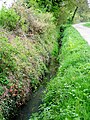 Luzarches (95), ru du Pontcel le long du chemin de la Paroisse.jpg 2,748 × 3,664; 3.55 MB
-
 Luzarches (95), source de Rocquemont.jpg 3,664 × 2,748; 2.59 MB
-
 Luzarches (95), vue vers le hameau de La Prairie 1.jpg 5,184 × 3,456; 3.65 MB
-
 Luzarches (95), vue vers le hameau de La Prairie 2.jpg 5,184 × 3,456; 2.57 MB
-
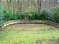 Luzarches, abreuvoir chemin Vieux de Paris.jpg 3,664 × 2,748; 2.74 MB
-
 Luzarches, France - panoramio (1).jpg 1,728 × 3,072; 856 KB
-
 Luzarches, France - panoramio (10).jpg 1,728 × 3,072; 2.08 MB
-
 Luzarches, France - panoramio (11).jpg 1,728 × 3,072; 2.56 MB
-
 Luzarches, France - panoramio (12).jpg 3,072 × 1,728; 2.69 MB
-
 Luzarches, France - panoramio (13).jpg 1,728 × 3,072; 1.97 MB
-
 Luzarches, France - panoramio (14).jpg 1,728 × 3,072; 1.85 MB
-
 Luzarches, France - panoramio (15).jpg 1,728 × 3,072; 1.78 MB
-
 Luzarches, France - panoramio (16).jpg 3,072 × 1,728; 2.67 MB
-
 Luzarches, France - panoramio (17).jpg 3,072 × 1,728; 2.46 MB
-
 Luzarches, France - panoramio (18).jpg 3,072 × 1,728; 2.51 MB
-
 Luzarches, France - panoramio (19).jpg 1,728 × 3,072; 2.25 MB
-
 Luzarches, France - panoramio (20).jpg 3,072 × 1,728; 2.58 MB
-
 Luzarches, France - panoramio (21).jpg 1,728 × 3,072; 2.22 MB
-
 Luzarches, France - panoramio (22).jpg 1,728 × 3,072; 2.48 MB
-
 Luzarches, France - panoramio (23).jpg 3,072 × 1,728; 2.65 MB
-
 Luzarches, France - panoramio (24).jpg 3,072 × 1,728; 2.55 MB
-
 Luzarches, France - panoramio (25).jpg 3,072 × 1,728; 2.58 MB
-
 Luzarches, France - panoramio (26).jpg 3,072 × 1,728; 1.62 MB
-
 Luzarches, France - panoramio (27).jpg 3,072 × 1,728; 1.87 MB
-
 Luzarches, France - panoramio (28).jpg 1,728 × 3,072; 2.32 MB
-
 Luzarches, France - panoramio (29).jpg 3,072 × 1,728; 2.72 MB
-
 Luzarches, France - panoramio (31).jpg 3,072 × 1,728; 2.12 MB
-
 Luzarches, France - panoramio (8).jpg 3,072 × 1,728; 2.39 MB
-
 Luzarches, France - panoramio (9).jpg 1,728 × 3,072; 2.71 MB
-
 Luzarches, panorama quartier St-Damien.jpg 962 × 647; 153 KB
-
 Mare 14 arpents.jpg 712 × 536; 548 KB
-
 Place de la république à Luzarches.jpg 995 × 637; 200 KB
-
 Prairie et pompe à eau.jpg 995 × 625; 188 KB
,_vue_sur_le_ch%C3%A2teau_de_Chauvigny_et_l%27%C3%A9glise_de_Luzarches_depuis_le_nord_de_la_commune.jpg)
_-_La_Chapelle_(60)_-_Orry-la-Ville_(60),_Poteau_Nibert_dans_la_For%C3%AAt_de_Coye.jpg)
,_ancien_jardin_public,_rue_de_Meaux.JPG)
,_chemin_du_Compant,_vue_vers_l%27ouest_en_direction_de_Gascourt.jpg)
,_chemin_le_long_du_r%C3%BB_Popelin_(%C3%A0_droite),_dans_le_bois_au_sud_du_ch%C3%A2teau_de_Chauvigny.jpg)
,_croix_Saint-C%C3%B4me.jpg)
,_croix_Sainte-%C3%89lisabeth_pr%C3%A8s_de_la_Grange-aux-Bois,_25.01.2016_1.JPG)
,_croix_Sainte-%C3%89lisabeth_pr%C3%A8s_de_la_Grange-aux-Bois,_25.01.2016_2.JPG)
,_d%C3%A9but_de_la_route_de_la_Domesse_vers_la_for%C3%AAt_de_Coye_-_le_GR_1_au_lieu-dit_La_Petite_Prairie,_pr%C3%A8s_de_Chaumontel_1.jpg)
,_d%C3%A9but_de_la_route_de_la_Domesse_vers_la_for%C3%AAt_de_Coye_-_le_GR_1_au_lieu-dit_La_Petite_Prairie,_pr%C3%A8s_de_Chaumontel_2.jpg)
,_le_GR_1_au_lieu-dit_La_M%C3%A9nagerie_1.jpg)
,_le_GR_1_au_lieu-dit_La_M%C3%A9nagerie_2.jpg)
,_le_GR_1_au_lieu-dit_La_M%C3%A9nagerie_3.jpg)
,_le_GR_1_au_lieu-dit_La_M%C3%A9nagerie_4.jpg)
,_le_GR_1_%C3%A0_la_lisi%C3%A8re_avec_la_for%C3%AAt_de_Coye.jpg)
,_le_GR_655_entre_Pont-de-Brassay_et_Thim%C3%A9court_1.jpg)
,_le_GR_655_entre_Pont-de-Brassay_et_Thim%C3%A9court_2.jpg)
,_le_GR_655_entre_Pont-de-Brassay_et_Thim%C3%A9court_3.jpg)
,_le_GR_655_entre_Pont-de-Brassay_et_Thim%C3%A9court_4.jpg)
,_le_GR_655_entre_Pont-de-Brassay_et_Thim%C3%A9court_5.jpg)
,_lieu-dit_Derri%C3%A8re_le_moulin_de_Luzarches,_vue_vers_Chaumontel_1.jpg)
,_lieu-dit_Derri%C3%A8re_le_moulin_de_Luzarches,_vue_vers_Chaumontel_2.jpg)
,_lieu-dit_La_Petite_Prairie,_pr%C3%A8s_de_Chaumontel-les-Nonnains_1.jpg)
,_lieu-dit_La_Petite_Prairie,_pr%C3%A8s_de_Chaumontel-les-Nonnains_2.jpg)
,_lieu-dit_Prairie_de_Thim%C3%A9court_1.jpg)
,_lieu-dit_Prairie_de_Thim%C3%A9court_2.jpg)
,_lieu-dit_Prairie_de_Thim%C3%A9court_3.jpg)
,_lieu-dit_Prairie_de_Thim%C3%A9court_4.jpg)
,_lieu-dit_Prairie_de_Thim%C3%A9court_5.jpg)
,_mare_des_Nonnains.jpg)
,_moulin_de_Luzarches.jpg)
,_petit_pont_sur_le_ru_du_Poncel_de_1769.jpg)
,_plaine_du_r%C3%BB_Popelin,_%C3%A0_l%27est_du_ch%C3%A2teau_de_Chauvigny_1.jpg)
,_plaine_du_r%C3%BB_Popelin,_%C3%A0_l%27est_du_ch%C3%A2teau_de_Chauvigny_2.jpg)
,_poteau_des_Br%C3%BBlis_en_for%C3%AAt_de_Coye_1.jpg)
,_route_d%27H%C3%A9rivaux_3.jpg)
,_route_de_la_Domesse_en_for%C3%AAt_de_Coye_1.jpg)
,_route_de_la_Domesse_en_for%C3%AAt_de_Coye_2.jpg)
,_ru_du_Pontcel_le_long_du_chemin_de_la_Paroisse.jpg)
,_source_de_Rocquemont.jpg)
,_vue_vers_le_hameau_de_La_Prairie_1.jpg)
,_vue_vers_le_hameau_de_La_Prairie_2.jpg)

.jpg)
.jpg)
.jpg)
.jpg)
.jpg)
.jpg)
.jpg)
.jpg)
.jpg)
.jpg)
.jpg)
.jpg)
.jpg)
.jpg)
.jpg)
.jpg)
.jpg)
.jpg)
.jpg)
.jpg)
.jpg)
.jpg)
.jpg)
.jpg)


