Category:Nature of Kingswear
Jump to navigation
Jump to search
Subcategories
This category has only the following subcategory.
G
- Gardens of Coleton Fishacre (191 F)
Media in category "Nature of Kingswear"
The following 77 files are in this category, out of 77 total.
-

-
 Adders basking - geograph.org.uk - 1508218.jpg 640 × 412; 64 KB
-
 Ash tree on the coast path - geograph.org.uk - 812159.jpg 640 × 480; 141 KB
-
 Badger hole on the coast path - geograph.org.uk - 1352583.jpg 480 × 640; 142 KB
-
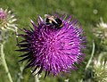 Bee on thistle - geograph.org.uk - 850808.jpg 640 × 490; 79 KB
-
 Beetle near Coleton Barton Farm - geograph.org.uk - 812730.jpg 576 × 640; 62 KB
-
 Cormorants nesting above Old Mill Bay - geograph.org.uk - 1365214.jpg 640 × 457; 106 KB
-
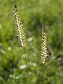 Crested Dog's-tail - geograph.org.uk - 858887.jpg 480 × 640; 51 KB
-
 Cyclamen on the edge of Warren Woods - geograph.org.uk - 1011547.jpg 640 × 480; 115 KB
-
 Dandelion by the coast path - geograph.org.uk - 1168909.jpg 640 × 480; 115 KB
-
 Dart Valley Trail, Long Wood - geograph.org.uk - 1508238.jpg 456 × 640; 135 KB
-
 Devonian coast - geograph.org.uk - 1337570.jpg 640 × 480; 235 KB
-
 Devonian coast 2 - geograph.org.uk - 1337587.jpg 640 × 480; 232 KB
-
 Dipsacus fullonum by Combe Lane - geograph.org.uk - 1188332.jpg 480 × 640; 90 KB
-
 Elderflower near Brownstone Battery - geograph.org.uk - 1353323.jpg 640 × 430; 56 KB
-
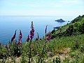
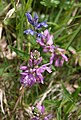
 Foxglove on the coast path - geograph.org.uk - 812055.jpg 480 × 640; 68 KB
-
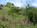 Foxgloves on the coast path - geograph.org.uk - 811585.jpg 640 × 480; 137 KB
-

-
 Fungi, Kennels Road, Torbay - geograph.org.uk - 864625.jpg 640 × 480; 127 KB
-
 Fungus near Brownstone - geograph.org.uk - 1168211.jpg 640 × 481; 102 KB
-
 Gorse alongside the coast path - geograph.org.uk - 811843.jpg 640 × 480; 133 KB
-
-
 Ground Ivy above Scabbacombe Sands - geograph.org.uk - 1267321.jpg 480 × 640; 153 KB
-
 Hollow tree near Coleton Barton - geograph.org.uk - 1337601.jpg 640 × 480; 237 KB
-
 Honeysuckle by the coast path - geograph.org.uk - 1353064.jpg 640 × 459; 71 KB
-
 Iris by the coast path - geograph.org.uk - 1267866.jpg 497 × 640; 140 KB
-
 Kingswear, on The Warren - geograph.org.uk - 750167.jpg 640 × 427; 235 KB
-

-

-

-
 Lichens near Kelly's Cove - geograph.org.uk - 1169093.jpg 640 × 479; 126 KB
-
 Long Wood - geograph.org.uk - 1188613.jpg 506 × 640; 139 KB
-
 Long Wood, Kingswear.jpg 4,096 × 2,848; 5.72 MB
-
 Mossy pavement - geograph.org.uk - 1051930.jpg 640 × 480; 159 KB
-
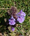
 Motley Milkwort - geograph.org.uk - 811905.jpg 431 × 640; 58 KB
-
 Oak Tree - geograph.org.uk - 1051871.jpg 640 × 480; 120 KB
-
 Oak tree, Greenway Road, Hook Bottom - geograph.org.uk - 369518.jpg 640 × 480; 128 KB
-
 Old Man's Beard in the hedgerow - geograph.org.uk - 1011494.jpg 640 × 480; 152 KB
-
 Pea by the coast path - geograph.org.uk - 1365223.jpg 543 × 640; 51 KB
-
 Pine trees, Hoodown - geograph.org.uk - 1367545.jpg 553 × 640; 125 KB
-
 Pines on The Warren - geograph.org.uk - 812406.jpg 480 × 640; 97 KB
-
 Pines on The Warren - geograph.org.uk - 819064.jpg 480 × 640; 139 KB
-
 Plantlife on rocks near Kelly's Cove - geograph.org.uk - 1169095.jpg 640 × 329; 101 KB
-
 Pony on the coast path - geograph.org.uk - 1390975.jpg 640 × 448; 57 KB
-
 Rock face by the coast path - geograph.org.uk - 819007.jpg 480 × 640; 151 KB
-
 Rock formation, below Brownstone Battery - geograph.org.uk - 1544469.jpg 640 × 480; 152 KB
-
-
 Sheep's-bit, Jasione montana - geograph.org.uk - 1337653.jpg 640 × 640; 425 KB
-
 Sheepsbit above Kelly's Cove - geograph.org.uk - 1352788.jpg 514 × 640; 59 KB
-
 Shelducks on River Dart.jpg 3,368 × 2,364; 1.29 MB
-

-
 Snowdrops, Brownstone - geograph.org.uk - 1168155.jpg 640 × 480; 100 KB
-
 Snowdrops, Brownstone - geograph.org.uk - 1168173.jpg 474 × 640; 85 KB
-
 Speyeria aglaja - geograph.org.uk - 1365143.jpg 640 × 510; 78 KB
-

-
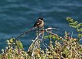 Stonechat by the coast path - geograph.org.uk - 1353072.jpg 640 × 461; 68 KB
-
 Stonecrop by the coast path (2) - geograph.org.uk - 1353107.jpg 640 × 480; 136 KB
-
 Stonecrop by the coast path - geograph.org.uk - 1353090.jpg 640 × 362; 102 KB
-
 Sunlight in woodland, Hoodown - geograph.org.uk - 1367629.jpg 640 × 480; 133 KB
-
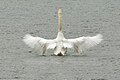 Swan on Waterhead Creek.jpg 1,124 × 749; 279 KB
-
 Thistle above Scabbacombe - geograph.org.uk - 1181663.jpg 640 × 480; 100 KB
-

-
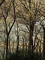
 Trees above the coast path - geograph.org.uk - 818271.jpg 640 × 480; 137 KB
-
 Trees in Long Wood - geograph.org.uk - 1188590.jpg 480 × 640; 149 KB
-
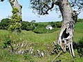
 Trees near Coleton Farm - geograph.org.uk - 1169756.jpg 480 × 640; 91 KB
-
 Trees near Froward Cove - geograph.org.uk - 1353149.jpg 480 × 640; 131 KB
-
 Trefoil, Brownstone Battery - geograph.org.uk - 818157.jpg 640 × 554; 81 KB
-
 Vanessa cardui - geograph.org.uk - 1353338.jpg 476 × 640; 69 KB
-
 Vanessa cardui - geograph.org.uk - 1353344.jpg 640 × 493; 121 KB
-

-
 Viewpoint by the pine - geograph.org.uk - 819118.jpg 480 × 640; 138 KB
-
 Violet, Brownstone - geograph.org.uk - 1168193.jpg 544 × 640; 76 KB
-
 Violet, Castle Road - geograph.org.uk - 1168460.jpg 640 × 492; 84 KB
-
 Violets by the coast path - geograph.org.uk - 1267169.jpg 640 × 472; 163 KB
-
 Weld by the South West Coast Path - geograph.org.uk - 850846.jpg 404 × 640; 114 KB
-
 Wild legume, Mill Bay Cove - geograph.org.uk - 1011472.jpg 640 × 480; 132 KB
-

,_and_Black_Bryony_near_Hillhead_South_Devon_-_geograph.org.uk_-_1535293.jpg)


_-_geograph.org.uk_-_1267348.jpg)


_-_geograph.org.uk_-_1353107.jpg)


