Category:National Cycle Network route 67
Jump to navigation
Jump to search

A long distance cycle route running north-south through Yorkshire to the East Midlands.   | |||||
| Upload media | |||||
| Instance of | |||||
|---|---|---|---|---|---|
| Part of | |||||
| Location |
| ||||
| Connects with | |||||
| Length |
| ||||
| official website | |||||
| |||||
Subcategories
This category has the following 2 subcategories, out of 2 total.
B
N
- Nutbrook trail (40 F)
Media in category "National Cycle Network route 67"
The following 46 files are in this category, out of 46 total.
-
 Barnsley boundary walk - geograph.org.uk - 405412.jpg 480 × 640; 145 KB
-
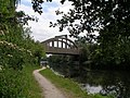 Canal Bridge 7b Concrete Bridge - geograph.org.uk - 2972100.jpg 2,048 × 1,536; 744 KB
-
 Clay Royd Bridge. - geograph.org.uk - 87056.jpg 640 × 480; 150 KB
-
 Controlling access - geograph.org.uk - 2014555.jpg 1,024 × 768; 264 KB
-
 Controlling access - geograph.org.uk - 2014558.jpg 1,024 × 768; 173 KB
-
 Cycle Routes - geograph.org.uk - 144615.jpg 640 × 479; 123 KB
-

-
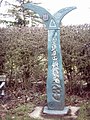 Cycleway Marker - geograph.org.uk - 298221.jpg 480 × 640; 109 KB
-

-

-
 Guarding the Trail - geograph.org.uk - 2013503.jpg 1,024 × 768; 230 KB
-
 Harland Way route sign.jpg 2,169 × 3,056; 2.89 MB
-
 Junction on footpath and cycleway - geograph.org.uk - 2014548.jpg 1,024 × 768; 219 KB
-
 Looking south at Nidd junction.jpg 1,800 × 1,200; 1.12 MB
-
 Milepost on the Trans Pennine Trail - geograph.org.uk - 245332.jpg 480 × 640; 147 KB
-
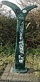 National cycle network milepost TPT67 - geograph.org.uk - 1128432.jpg 313 × 640; 309 KB
-
 National Cycle Network signpost, Methly Lanes (geograph 6668506).jpg 551 × 755; 282 KB
-
 National Cycle Route 67 - geograph.org.uk - 4983634.jpg 640 × 426; 91 KB
-
 National Cycle Route 67 - geograph.org.uk - 4983642.jpg 640 × 426; 92 KB
-
 National Cycle Route 67 - geograph.org.uk - 4983647.jpg 640 × 426; 91 KB
-
 National Cycle Route 67 - geograph.org.uk - 4983667.jpg 640 × 426; 60 KB
-
 National Cycle Route 67 West of Ilkeston - geograph.org.uk - 1005852.jpg 640 × 480; 128 KB
-

-
 NCN Millennium Milepost MP1146 Bilton North Yorkshire.jpg 2,727 × 3,624; 1.15 MB
-
 Nidderdale Greenway signs.jpg 1,800 × 1,200; 1.51 MB
-
 Path from old railway line to the canal towpath - geograph.org.uk - 2714519.jpg 1,024 × 768; 181 KB
-

-
 Ramsden's Bridge and cottage - geograph.org.uk - 1321314.jpg 640 × 477; 367 KB
-
 Ramsdens Bridge - geograph.org.uk - 1277807.jpg 640 × 480; 311 KB
-
 Ramsdens Bridge - geograph.org.uk - 1277816.jpg 640 × 427; 302 KB
-

-
 Refreshments for cyclists available here^ - geograph.org.uk - 6790592.jpg 1,024 × 683; 179 KB
-
 Silver birch tree alongside the towpath - geograph.org.uk - 2714492.jpg 1,024 × 768; 141 KB
-
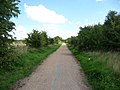
 Start of the Harland Way - geograph.org.uk - 490057.jpg 640 × 478; 180 KB
-
 Sustrans 67 and Railway - geograph.org.uk - 302939.jpg 640 × 479; 119 KB
-
 The Erewash Canal nr Stanton, Derbyshire - geograph.org.uk - 16507.jpg 640 × 480; 155 KB
-
 The former Methley Joint railway - geograph.org.uk - 2015400.jpg 1,024 × 768; 205 KB
-
 The former Methley Joint railway line - geograph.org.uk - 2015367.jpg 1,024 × 768; 146 KB
-
 TPT Route 67 footbridge - geograph.org.uk - 960004.jpg 640 × 480; 105 KB
-
 Trans Pennine Trail 67 (1) - geograph.org.uk - 2478165.jpg 1,024 × 768; 723 KB
-
 Trans Pennine Trail 67 (2) - geograph.org.uk - 2478175.jpg 768 × 1,024; 793 KB
-
 Trans Pennine Trail 67 (3) - geograph.org.uk - 2478189.jpg 768 × 1,024; 758 KB
-
 Trans Pennine Trail 67 - geograph.org.uk - 1856587.jpg 480 × 640; 320 KB
-
 Tree alongside the former railway line - geograph.org.uk - 2015043.jpg 1,024 × 768; 170 KB
-
 Tree alongside the Trans Pennine Trail - geograph.org.uk - 2015059.jpg 1,024 × 768; 164 KB
-
 Western Edge of Ilkeston - geograph.org.uk - 1005862.jpg 640 × 480; 94 KB


.jpg)


_-_geograph.org.uk_-_2478165.jpg)
_-_geograph.org.uk_-_2478175.jpg)
_-_geograph.org.uk_-_2478189.jpg)