Category:National Cycle Network route 167
Jump to navigation
Jump to search

Cycle route in the United Kingdom   | |||||
| Upload media | |||||
| Instance of | |||||
|---|---|---|---|---|---|
| Part of | |||||
| Location |
| ||||
| Connects with | |||||
| Length |
| ||||
| Highest point |
| ||||
| |||||
Media in category "National Cycle Network route 167"
The following 13 files are in this category, out of 13 total.
-
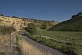 A section of Waterdale - geograph.org.uk - 94014.jpg 640 × 427; 59 KB
-
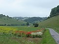 A Splash of Colour - geograph.org.uk - 1374588.jpg 640 × 480; 57 KB
-
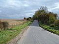
 A Wet and Winding Road - geograph.org.uk - 1226950.jpg 640 × 480; 74 KB
-
 Huggate Wold In Winter - geograph.org.uk - 1264810.jpg 640 × 480; 143 KB
-
 Minor Road Towards Huggate - geograph.org.uk - 1541475.jpg 640 × 480; 65 KB
-
 NCN Route Sign 167.svg 512 × 212; 7 KB
-
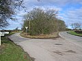 Road Junction at SE832551 - geograph.org.uk - 125374.jpg 640 × 480; 110 KB
-
 Road To Thixendale - geograph.org.uk - 389587.jpg 640 × 480; 97 KB
-
 The Roman Road, The Bence - geograph.org.uk - 1319178.jpg 640 × 427; 305 KB
-
 Thixendale from the Wolds Way - geograph.org.uk - 1226960.jpg 640 × 480; 70 KB
-
 Trees in Aldro Plantation - geograph.org.uk - 94308.jpg 640 × 427; 79 KB
-
 Waterman Hole - geograph.org.uk - 591087.jpg 640 × 469; 58 KB
-
 Wolds' Road - geograph.org.uk - 269946.jpg 640 × 480; 79 KB


