Category:Narin, County Donegal
Jump to navigation
Jump to search
village in Ulster, Ireland  | |||||
| Upload media | |||||
| Instance of | |||||
|---|---|---|---|---|---|
| Location | County Donegal, Ulster, Ireland | ||||
 | |||||
English: Narin is a small village on Gweebara Bay on the west coast of County Donegal in Ireland. The topography is rough rolling bogland and craggy low hills. Narin Strand is a sand beach approximately two kilometers long. Inishkeel island is located approximately 250 meters from the mainland in Gweebara Bay and can be reached on foot at low tide by crossing a tidal sand bank. The population of Narin is spread sparsely around the countryside in mostly modern housing. There is a large tourist trade serviced by several B&Bs and caravan parks. The local amenities consist of two pubs, The Cope convenience store and beach front and caravan park shops. There is also an 18 hole golf course with club house. Narin lies at an altitude of 12 metres (42 feet) and lies 8km north of Ardara, 11km northwest of Glenties and 13km south of Dungloe.
Media in category "Narin, County Donegal"
The following 36 files are in this category, out of 36 total.
-

-

-
 Delta Lima 21 - Glenties Fire Station - geograph.org.uk - 3226457.jpg 1,024 × 958; 142 KB
-

-

-

-
 Gleann An Caisil, Glenties, Co. Donegal - geograph.org.uk - 3227674.jpg 1,024 × 656; 105 KB
-
 Gleann An Caisil, Glenties, Co. Donegal - geograph.org.uk - 3227678.jpg 1,024 × 768; 127 KB
-
 Gleann An Caisil, Glenties, Co. Donegal - geograph.org.uk - 3227681.jpg 1,024 × 743; 160 KB
-
 Glenties Fire Station - Call Sign Delta-Lima 21 - geograph.org.uk - 3227239.jpg 1,024 × 553; 119 KB
-

-
 Glenties' The Limelight Nite Club - geograph.org.uk - 3227474.jpg 1,024 × 768; 144 KB
-
 Gweebarra Bay geograph-3185296-by-Ben-Brooksbank.jpg 2,383 × 1,486; 2.7 MB
-

-

-
 Houses on the southern outskirts of Glenties - geograph.org.uk - 3227326.jpg 1,024 × 579; 121 KB
-
 Kelvon House, Glenties - geograph.org.uk - 3227538.jpg 1,024 × 768; 171 KB
-

-

-
 Mountain Rescue Base, Glenties - geograph.org.uk - 2419143.jpg 640 × 480; 71 KB
-
 Mullinard - geograph.org.uk - 1032587.jpg 640 × 480; 79 KB
-
 Naran - Beach sign regarding low tide - geograph.org.uk - 1176542.jpg 639 × 426; 211 KB
-
 Narin Strand.jpg 3,200 × 1,800; 1.43 MB
-
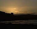 Port Noo Sunset.jpg 1,280 × 1,024; 582 KB
-
 Public toilets, Glenties - geograph.org.uk - 2419146.jpg 640 × 480; 100 KB
-

-
 Sharp bend in Main Street, Glenties - geograph.org.uk - 3227424.jpg 1,024 × 616; 144 KB
-
 St Conal (Connell) Catholic Church, Glenties - geograph.org.uk - 3227372.jpg 1,024 × 669; 230 KB
-

-
 The Marian Grotto, Glenties - geograph.org.uk - 3227526.jpg 885 × 1,024; 287 KB
-
-
 The northern section of Main Street, Glenties - geograph.org.uk - 3227435.jpg 1,024 × 605; 131 KB
-
 The southern end of Main Street, Glenties - geograph.org.uk - 3227392.jpg 1,024 × 573; 158 KB
-
 View north along Glenties' Main Street - geograph.org.uk - 3227427.jpg 1,024 × 569; 160 KB
-

-


_Catholic_Church,_Glenties_-_geograph.org.uk_-_3227372.jpg)


