Category:Nankai Trough megathrust earthquakes
Jump to navigation
Jump to search
English: Nankai megathrust earthquakes
日本語: 南海トラフ巨大地震
class of earthquakes in Japan   | |||||
| Upload media | |||||
| Instance of |
| ||||
|---|---|---|---|---|---|
| Subclass of |
| ||||
| Location |
| ||||
| |||||
Subcategories
This category has the following 7 subcategories, out of 7 total.
1
- 1361 Shōhei earthquake (2 F)
- 1498 Meiō earthquake (3 F)
T
- Tōkai earthquakes (8 F)
Media in category "Nankai Trough megathrust earthquakes"
The following 17 files are in this category, out of 17 total.
-
 Fault models of 1854 Ansei-Nankai-earthquake.png 640 × 480; 33 KB
-
 Fault models of 1854 Ansei-Tokai-earthquake.png 640 × 480; 30 KB
-
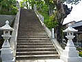 Haitaka jinja shrine steps.jpg 2,592 × 1,944; 1.93 MB
-
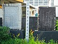
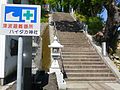 Haitaka jinja tsunami monument.JPG 2,592 × 1,944; 2.17 MB
-
 Kanigaike pond.jpg 2,592 × 1,944; 1.92 MB
-
 Kure Kumano Hoei-Ansei.JPG 2,592 × 1,944; 1.99 MB
-
 Mugi-ansei-showa.jpg 2,592 × 1,944; 1.95 MB
-
 Murotsu port, muroto, Koch.jpg 3,094 × 2,246; 1.65 MB
-
 Nankai Trouph earthquake occurrence by BPT distribution.png 840 × 450; 17 KB
-
 Nankai-Tonankai-Tokai earthquake history.png 500 × 1,660; 442 KB
-
 RuptureAreasNankaiMegathrust 2013.png 1,336 × 774; 408 KB
-
 RuptureAreasNankaiMegathrust.png 2,103 × 1,439; 373 KB
-
 Time predictable model of Nankai Trouph earthquake.png 840 × 600; 19 KB
-
 Tomoura-Oiwa-keicho-hoei.jpg 2,592 × 1,944; 1.97 MB
-
 南海トラフ沿いの地震に関する評価検討会.png 600 × 364; 394 KB
-
 室津港の南海地震時の隆起量を基にした予測モデル.png 1,208 × 1,000; 50 KB
-
 過去に発生した南海トラフ地震の震源域の時空間分布.png 963 × 1,171; 600 KB


