Category:Nadap
Jump to navigation
Jump to search
| Object location | | View all coordinates using: OpenStreetMap |
|---|
village in Hungary   | |||||
| Upload media | |||||
| Instance of |
| ||||
|---|---|---|---|---|---|
| Location | Gárdony District, Fejér County, Hungary | ||||
| Head of government |
| ||||
| Population |
| ||||
| Area |
| ||||
| official website | |||||
 | |||||
Subcategories
This category has only the following subcategory.
S
Media in category "Nadap"
The following 20 files are in this category, out of 20 total.
-
 HUN Nadap COA.jpg 2,000 × 2,120; 216 KB
-
 HUN Nadap címer.svg 600 × 636; 58 KB
-
 Nadap légifotó.jpg 347 × 480; 33 KB
-
 Nadap Osjegy.jpg 800 × 600; 221 KB
-
 Nadap rovastabla.png 81 × 40; 5 KB
-
 Nadap, első világháborús emlékmű 2022 01.jpg 1,600 × 2,400; 1.11 MB
-
 Nadap, Huszár tanya - panoramio (1).jpg 1,598 × 1,790; 711 KB
-
 Nadap, Huszár tanya - panoramio.jpg 1,571 × 1,332; 634 KB
-
 Nadap, második világháborús emlékmű 2022 01.jpg 2,400 × 1,600; 1.46 MB
-
 Nadap, Templom - panoramio.jpg 2,088 × 1,538; 2.32 MB
-
 Nadap, templomkerti kőfeszület 2022 01.jpg 1,600 × 2,400; 830 KB
-
 Nadap, templomkerti kőfeszület 2022 02.jpg 1,600 × 2,400; 1.21 MB
-
 Nadap, templomkerti kőfeszület 2022 03.jpg 1,600 × 2,400; 1,012 KB
-
 Nadap, templomkerti kőfeszület 2022 04.jpg 1,600 × 2,400; 1.11 MB
-
 Nadap, templomkerti kőfeszület 2022 05.jpg 1,600 × 2,400; 1.25 MB
-
 Nadap-első-katonai-felmérés-térképe.jpg 838 × 681; 266 KB
-
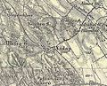 Nadap-harmadik-katonai-felmérés-térképe.jpg 841 × 679; 278 KB
-
 Nadap-második-katonai-felmérés-térképe.jpg 863 × 706; 311 KB
-
 Szintezési ősjegy, Nadap - panoramio.jpg 3,872 × 2,592; 4.03 MB
-
 View from Bence-hegy 2018-03-22-5.jpg 5,312 × 2,988; 8.04 MB


.jpg)


